displaying 220 results
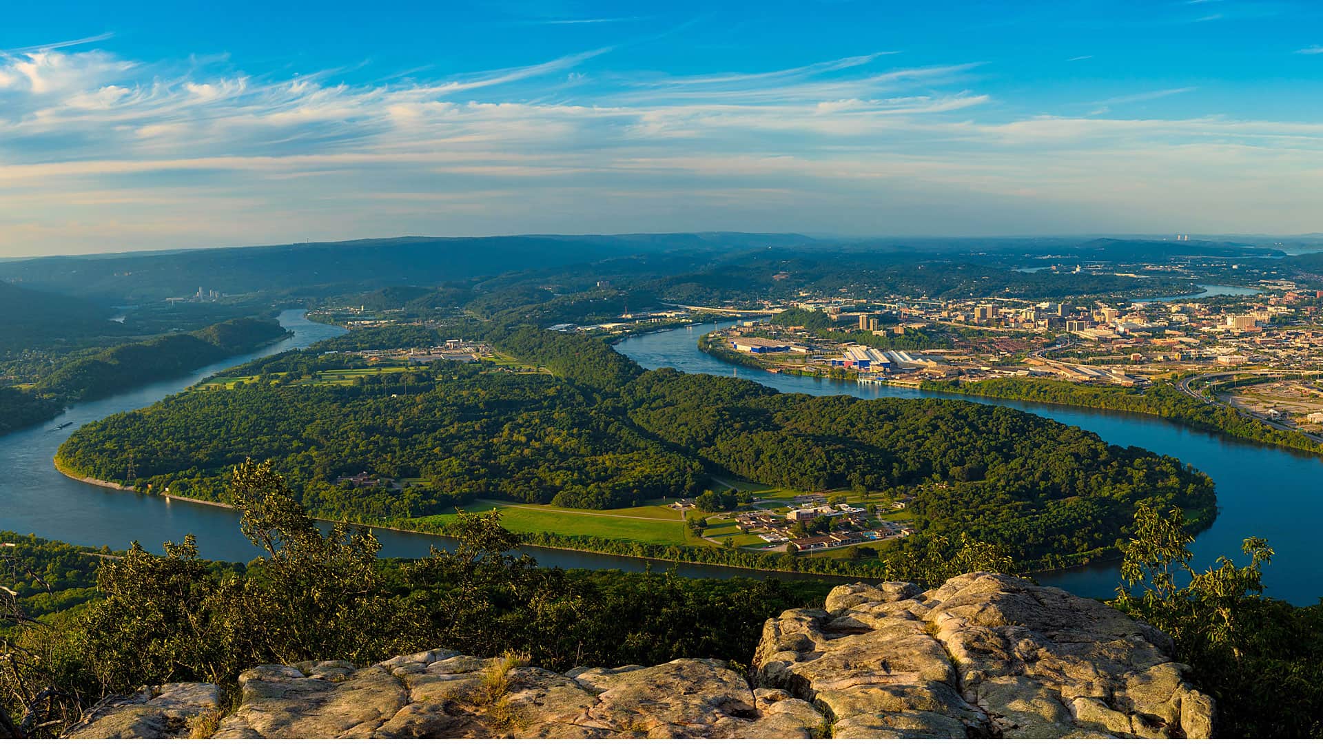
Thrive Regional Partnership is using geodesign technology and methodology to plan smartly and sustainably.
Where and how should a community grow? Where should a city build sidewalks and trails to lower the risk of accidents and encourage walking?
This summit will focus on how geodesign can play a pivotal role in making European communities smarter, safer, and more resilient.
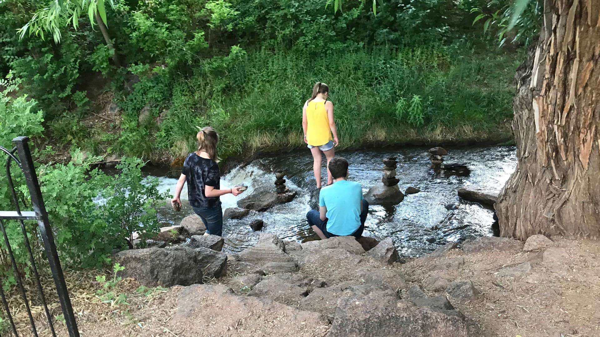
Manitou Springs, Colorado, is employing ArcGIS technology to create walking, biking, shopping, and running routes along a picturesque creek.
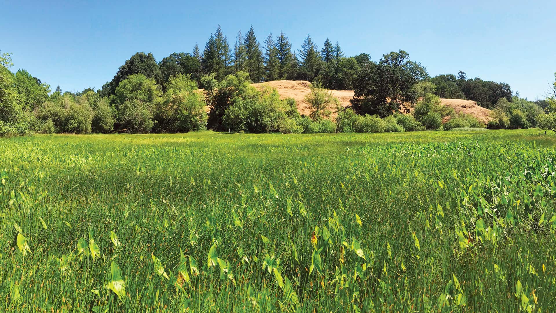
Employing geodesign and translational ecology, Plas Newydd Farm is restoring 876 acres of farmland to its native Pacific Northwest habitat.

More time to read now that you telecommute? Pick up a copy of Python Scripting for ArcGIS Pro, or one of seven other new books from Esri Press.
The next Geodesign Summit in the United States is scheduled for January 29–30, 2014, in Redlands, California.
Geodesign is about holistic design and communication.
Esri president Jack Dangermond challenges GIS professionals to use geodesign to extend their work in meeting the world's challenges.
Geodesign methods and GIS technology can offer insights on pressing global issues. Find out how at the 2020 Geodesign Summit.
Find out how GIS is being used in the geodesign sphere during the Geodesign Summit, which will be held online April 11–12, 2022.