displaying 1360 results

Ordnance Survey Ireland transformed from a traditional map production model to providing geospatial data for improved decisions.

The power of GIS rises from the unique way it connects seemingly unrelated information through location.

GIS helped two companies—Quiet Professionals and Janes—connect people who want to leave Afghanistan with those who can help them.

For the fiftieth anniversary of Earth Day, Earth Challenge 2020 aims to collect location-specific data to inform public policy.

Since the start of the COVID-19 pandemic, AAG has offered more than 100 varied events online. Here’s what the organization has learned.

A recent ICA conference on atlases, toponymy, and map design energized attendees, and several other events this year aim to do the same.
In the United States, it is rare to take more than one year of geography. This needs to change so students learn complex ways of thinking.
The International Cartographic Conference—held in Florence, Italy, in December—brought together cartographers from all over the world.
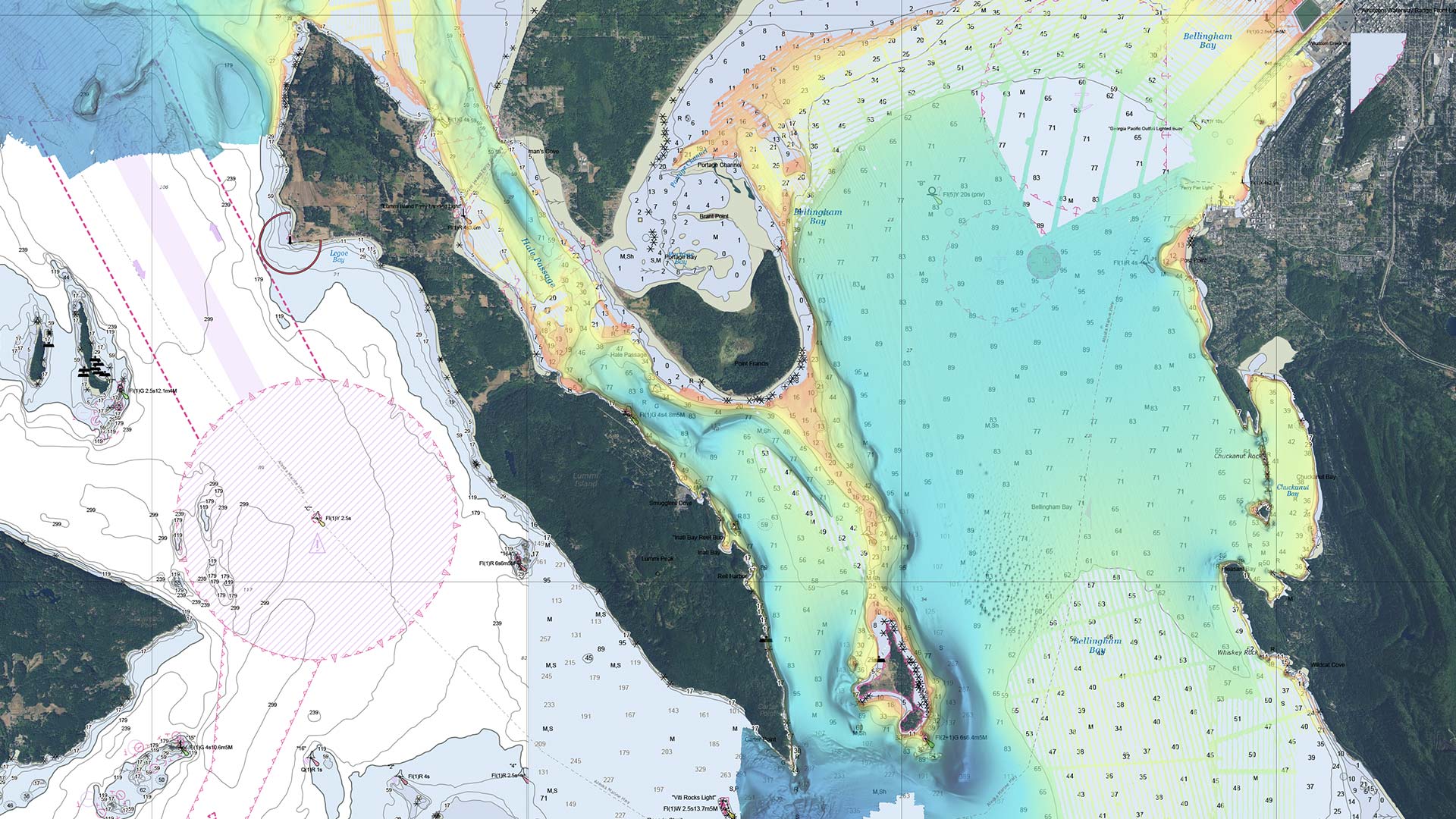
Hydrographic offices are starting to move away from making traditional paper charts and more toward producing charts on demand.
Geography sits at the confluence of people, place, and the environment and is essential to understanding and exploring the world.
Anita Palmer is a pioneer in GIS education. And when it comes to teaching novices, she has a knack for bringing the technology to life.

Acquisition of Airbus' WorldDEM4Ortho Means Esri Provides Most Accurate Global Satellite-Based Elevation Data Available