displaying 1009 results

3D artist Romain Janil uses Esri CityEngine to make helicopter flight simulation programs that are as realistic as possible.
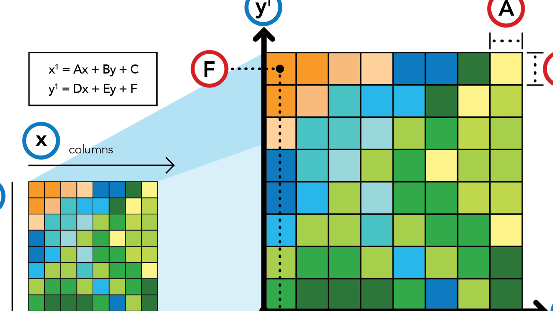
An overview of the #georeferencing process in ArcGISPro.
The Global Ecological Land Units map provides data on landform, climate, rock, and land cover at an unprecedented level of detail for the entire
Following Hurricane Sandy in 2012, the City of Philadelphia, Pennsylvania, began developing its first comprehensive debris management plan...
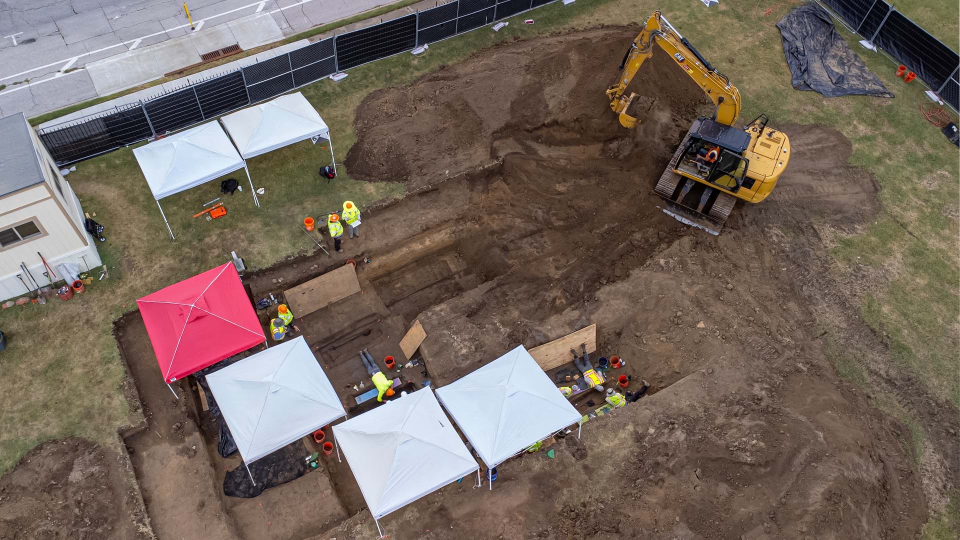
Esri senior writer Karen Sullivan discusses the legacy of forgotten black burial grounds and the initiative to document them.

Dr. Susan Wolfinbarger from the US Department of State discusses the distribution of humanitarian resources in global conflicts.

Mattias Wallin, geospatial data scientist at John Deere, discusses the value of data science in solving business problems.
Check out this National Wetlands Inventory that provides a comprehensive map of the wetlands of the United States.
In this story created with ArcGIS StoryMaps, learn about the rise of seabed maps and why seafloor mapping is critical to saving our planet.
Robert D. Sharp, director of the NGA, speaks about his agency's roles, goals, and challenges with Esri' president Jack Dangermond.
In this one-minute map hack, John Nelson from Esri teaches you how to add elevation hillshade to your map without washing the colors out.