displaying 17 results
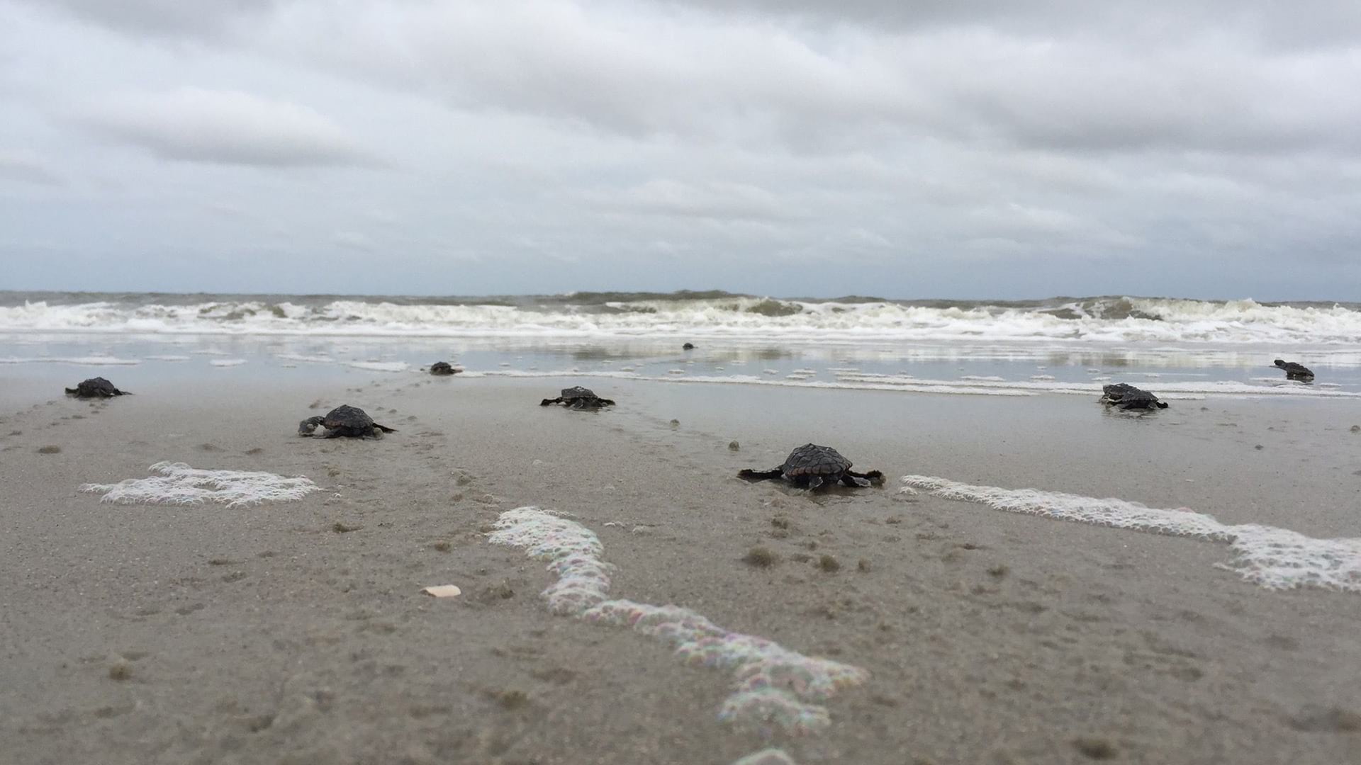
Sea Turtle Patrol Hilton Head Island is on a mission to save sea turtle nests and hatchlings. The group uses GIS and GNSS technology to do this.
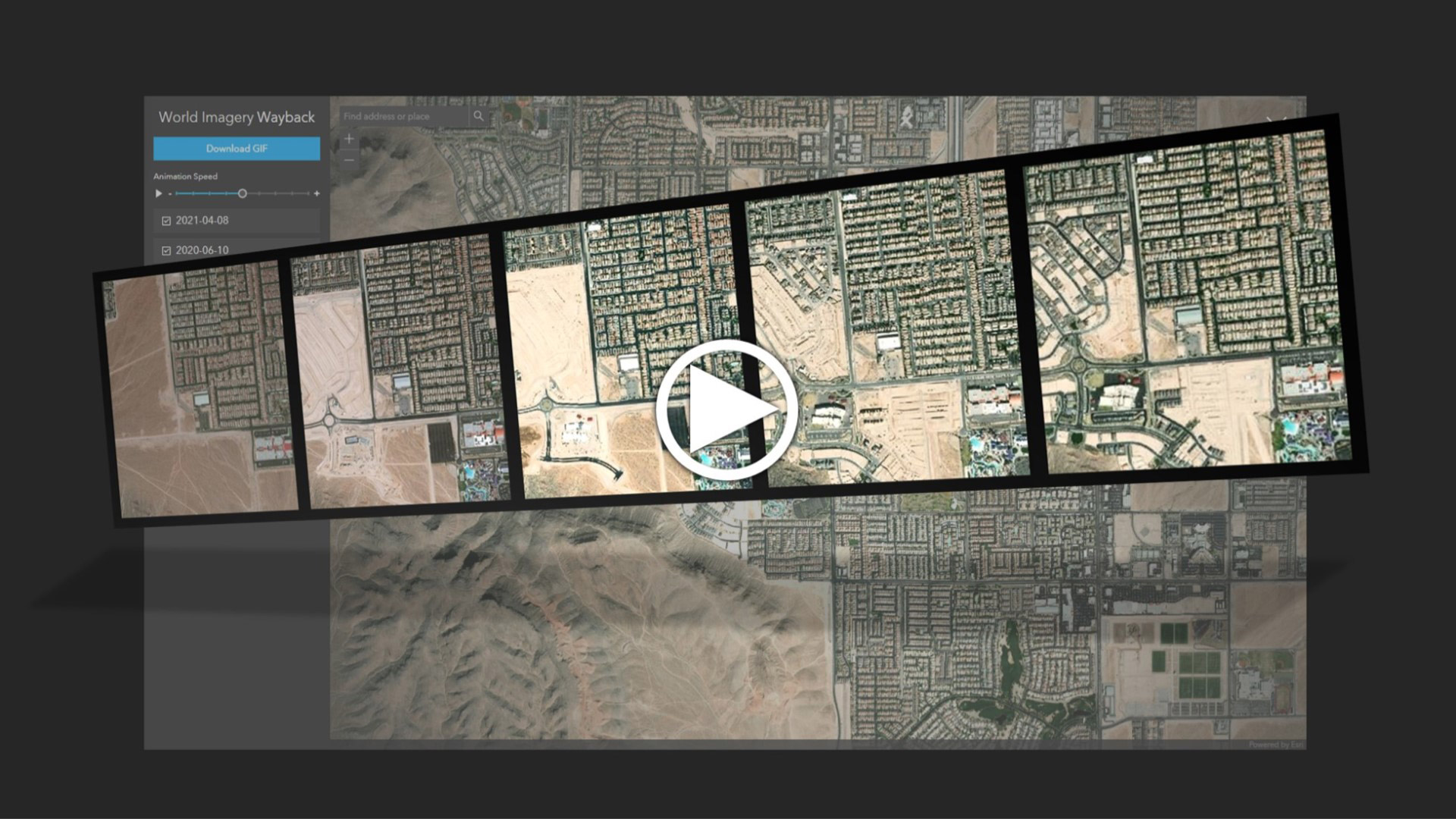
Learn to create and share animations of your images of interest using the World Imagery Wayback app.
Learning GIS is an important skill set, but the goal is to understand an issue or problem in a deeper, more holistic way and then taking action.
Scott Sambell,of Ethos Environmental talks about the use of ArcGIS technology to eradicate invasive species in New Zealand.
Learn how spatial statistics in ArcGIS helps you answer questions confidently and make decisions that use more than simple visual analysis.
How can the use of technology reduce heat and create resilient infrastructure in one of the hottest cities in the United States?
What are the advantages of sharing imagery and raster data within ArcGIS using map tile cache, tiled imagery, and dynamic imagery?
This story visually explains the goals of the 30x30 movement to protect and preserve 30 percent of the Earth’s land and water by 2030.
Learn the process of customizing an Esri basemap to meet your branding needs.
Learn to create a feature layer for your ArcGIS QuickCapture project using either ArcGIS Online or ArcGIS Pro.
Esri instructor Jack Horton demonstrates how to use ArcGIS Pro to edit a boundary line to accurately maintain land records data.
In this course, you will learn to use ArcGIS to streamline operations, gain deeper insight from data, and collaborate more effectively.