I think I can speak for all members of the ArcGIS Pro team when I say, one of the most common questions we get is “What is so special about ArcGIS Pro?” In the moment, it is pretty easy to rattle off the top few things that come to mind, but this really doesn’t do Pro due justice. There are so many things that are already special and the list is only growing.
We wanted to compile a list of some things we think are advancements in ArcGIS Pro. We know the list isn’t exhaustive by any means, but that’s where you come in! Please leave a comment below letting us know what you think is an advancement in Pro.
We asked the Desktop development team to contribute their ideas. Here is the list!
.
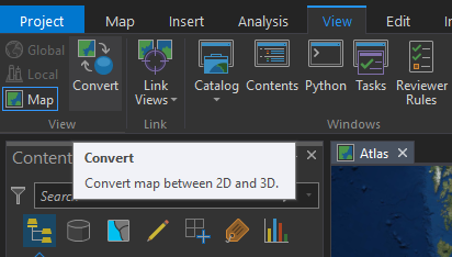
3D
One of the biggest strengths of ArcGIS Pro is its 3D integration. 3D is a great way to analyze and visualize data and Pro makes it much easier to do. 3D capabilities in Pro include
– Convert between 2D and 3D in the click of a button
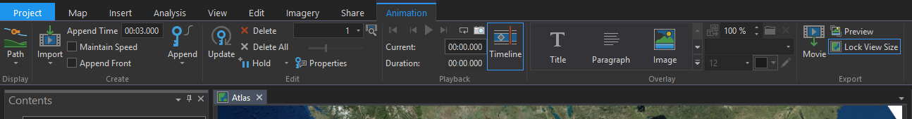
Animations
Another great way to visualize data is through animations. Animations are user-created simulations that walk-through camera keyframes of your maps. This functionality is available in ArcScene, but it is just better and more powerful in ArcGIS Pro, not to mention really easy to use.
I wanted to explore animations before I posted this blog because I had never done it before and after about an hour of messing around I came up with this video…
It’s not very pretty, but it’s pretty good for just an hour of trying something new! It just goes to show how easy it is.
For a more ‘aesthetic’ example click here.
Charts
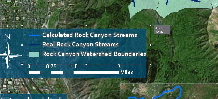
Charts are another feature that were available in ArcMap but are more powerful in ArcGIS Pro. Charting capabilities are enhanced with multi-series support, filtering by map extent and selection as well as time and range sliders. Line charts also support advanced time aggregation. In Pro you can create many kinds of charts and insert them on your layouts. The charts remain live and update as your data updates.
Developer
Pro makes it easier than ever to download and install additional Python libraries using Conda and the Python Package Manager. This takes the guess work out of finding libraries that are compatible with your version of Python. Due to the new organization of ArcGIS Pro (projects, maps, etc.) ArcPy has changed a little bit, but it is easier and once again more powerful in ArcGIS Pro. Pro also provides improved database schema creating tools.
Editing
There are some major advancements within editing in ArcGIS Pro. Here are some that we came up with
– No need to start/stop editing
– On-the-map interactive annotation editing
– The extents from elements on the page can act as natural snapping positions allowing you to easily set up a well-organized layout
– CAD-like editing feedback
– Edit in 2D and see results in 3D or vice versa.
Geoprocessing
ModelBuilder in ArcGIS Pro has a plethora of enhancements including search and filtering to find specific model elements, grouping which allows you to select multiple elements and collapse them into one label-able item, and improved selection and connection tools.
Along with the new and improved ModelBuilder functionality, there are a lot of new geoprocessing tools that are specific to ArcGIS Pro and other old tools that have been ‘beefed up’ in Pro.
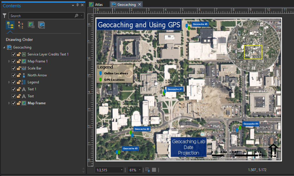
Layouts
Being able to have multiple layouts in one project in Pro really optimizes workflows and improves data organization. Enhanced features within layouts in ArcGIS Pro are listed below.
– Layouts have their own table of contents – North Arrow, legend, etc. are all objects in the table of contents.
– Feedback when resizing elements – When you add a new element, or resize an existing element you get a feedback box telling you the exact x,y size of the element.
– Map extents are uncoupled from layout map frames – In ArcMap when you change the extent of your map, you can inadvertently change the extent of the map in the layout. This can be bad if the map you want to print has a specific extent that needs to be kept. To change the extent of a map frame in Pro, you must intentionally Activate that map. Then you can reposition it, and Close Activation to maintain the extent.
– Printer page sizes decoupled from the page – In ArcMap your page size is coupled to the page sizes in your installed printers. If you send a map to a friend who doesn’t have the same page sizes on their printer it can inadvertently change the size of your page. In Pro, we have decoupled this so you won’t accidentally cause your page size to change.
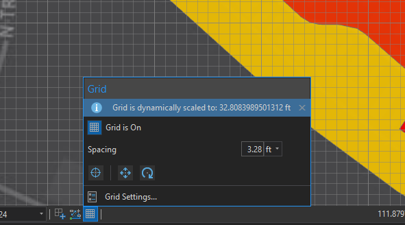
– Improved gird and graticules user experience – There are many enhancements to the grid and graticule experience in ArcGIS Pro, including the ability to format grid labels in many ways.
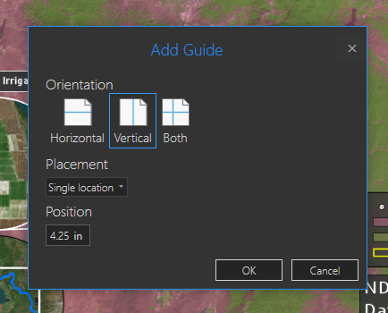
– Insert Multiple Guides – You can add more than one layout guide to the page at a time. You can add them horizontally, vertically, or in both directions and add them in the center, offset from the edges, or evenly spaced to create a grid.
Organization
ArcGIS Pro has a project based structure. This makes it much easier to organize work as you can have multiple maps and layouts in a single project. Project templates also make it easier to repeat projects with new data. With the 2.0 release of Pro, ‘Project favorites‘ allow for easy access of frequently-used folder, database, and server connections to any project.
Performance
It’s a 64 bit, multi-threaded application.
Symbology
These are some of the symbology advancements in ArcGIS Pro
– Smart mapping UI for authoring symbology
– Apply Transparency to Graphics and Text – Any color in ArcGIS pro can be transparent. You can use this to make any graphic or piece of text in your layout transparent.
– More symbology types and richer symbology options
– Unclassed colors symbology – no more spending time trying to figure out the best classification system.
Tools
Many system tools in ArcGIS Pro are enhanced to support interactive feature input. Only custom-built tools could leverage similar capabilities in ArcMap.
Also, analysis capabilities from ArcGIS Enterprise (Standard Feature Analysis tools, GeoAnalytics tools, and Raster Analysis tools) are only available in ArcGIS Pro.
UI
ArcGIS Pro’s user interface is definitely an advancement. Here are some things about the UI that make it advanced
– No more remembering which toolbar to enable to get to a tool
– No more giant pick lists of layers to change simple things like transparency.
– On-screen navigation control (for 2D and 3D)
Other Unique Features
Like I mentioned above, this list is not exhaustive, but some other unique features of ArcGIS Pro include
– Export of PDF – now supports native transparency (no more jaggies)
– New ‘range slider’ for interactive and dynamic filtering across multiple layers
– Integration with ArcGIS Online in terms of both adding data from the Living Atlas and other sources and sharing maps with AGOL.
– New advances in space time pattern mining are only available in ArcGIS Pro
– ArcGIS Pro has geo-enrichment capabilities through the Enrich Layer geoprocessing tool.
– Tasks
– R-bridge
.
Did we capture everything? What do you think is better in Pro? Leave a comment below and add to our list!
.
– Tylor the ArcGIS Pro Intern
.
Article Discussion: