Last week we updated GeoPlanner to version 2.4. For this update, we wanted to help you be more productive and better assess the impact of your plans.
Improving productivity involved making the app easier to use by adding tools so you can do more. To help you better understand the impact of your plans, we added dashboard and reporting tools. Let’s look at each.
Improved Productivity
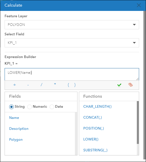
Calculate fields
You can now use a Calculate tool to update attributes of multiple features. You can do this against all or selected features in a scenario or all features across all scenarios. You can build expressions from functions, attributes, and use mathematic and grouping operators. Calculate will help you maintain data integrity and generate values for Key Performance Indicators (KPIs).
Do more with design layers
We sketch, paint and update attributes in design layers. These layers participate in scenarios and drive KPIs. At this update, you can rename and reorder them in the contents pane. You can also add new or delete existing design types (symbols) within the layers.
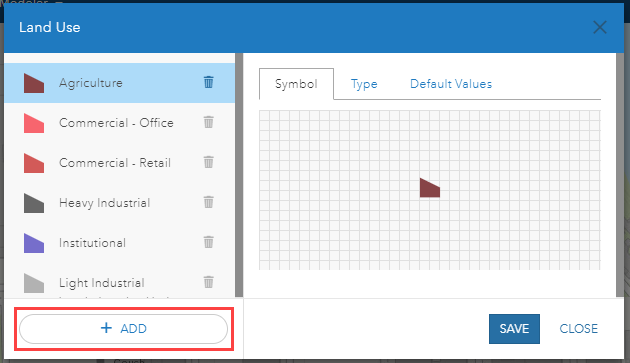
This means that you can now start a GeoPlanner project from any template and add, delete and change the symbols available in that project. At this update, most of you will not need ArcGIS Pro or Desktop to create a template. You can do it by yourself, in the app.
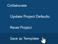
Save as Template
Now that you can fully customize your design types or symbols in a project, you’ll create amazing GeoPlanner templates that match the needs of your planning industry or domain. Want to save your project as a template so you don’t have to repeat your customizations in future projects? Now you can with the Save as Template tool in the new Collaborate menu in GeoPlanner’s backstage.
The new Update Project Defaults tool in the Collaborate menu also allows you to share the current state of your web map with your project team. This means that all layers, transparencies and indicators can be standardized for everyone working in the same project. Your project team uses the Reset Project tool, also in the Collaborate menu, to pick up the changes shared by Update Project Defaults.
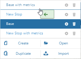
Reorder your scenarios
We heard from many of you that you need to reorder the list of scenarios in a project. Now you can. This will help you reduce clicks and simplify finding your scenarios.
Assess Impact
GeoPlanner has powerful impact assessment functionality in its dashboard and reports. These tools are the core of the app’s decision support capabilities. You can almost instantly understand the consequences of a design, action, or change.
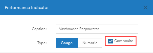
Composite KPI
We’ve created a new type of indicator, the Composite KPI. These are built from other KPIs and allow you to link different indicators to reveal unseen impacts or create ISO standard metrics. For example, to create the Urban Park Space Per Capita Indicator (ISO 37120, 19.1), you could create one KPI for park area and one KPI for estimated population. You would then create a composite KPI that combines them: park area/estimated population.
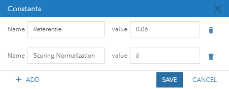
Create a constant
Say you have a single value that is used in many different KPIs. You might call these values constants. Until recently, if you wanted to change that constant, you would have to modify each KPI equation that uses it. Now, however, you can define constants within GeoPlanner’s dashboard and then refer to them as a variable in any KPI. Need to update a constant? You change it in one dialog and all KPIs that reference it will update. Not only will this augment the power of your KPIs, but it will make you more productive! It addresses both themes of this blog!
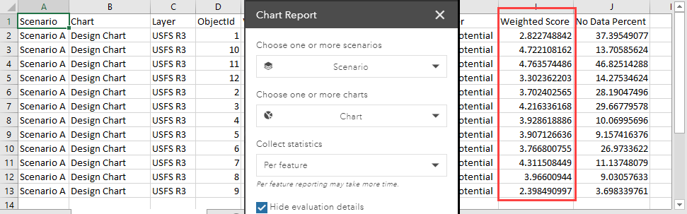
What’s the score?
But wait, there’s more! Earlier in 2017, we introduced a chart report that generates a .csv for planning elements, environmental screening reports, and other information products. You can now streamline this report by hiding its evaluation details. This will show a suitability score per type or feature and allow you to answer the question What are the suitability scores for my features?
Don’t have GeoPlanner? Don’t worry! You can try it for free. Follow these instructions on how to access a free trial. Click on the Don’t have an ArcGIS Online subscription link.

Article Discussion: