CHALLENGE
Over half of a million Americans have died in the past two decades due to opioid overdose. A major challenge contributing to this epidemic is opioid diversion, which is the illegal distribution of prescription drugs. To combat this challenge, auditors need a way to identify fraudulent healthcare workers or persons exploiting the healthcare system. This starts with looking at data associated to the patients, physicians who prescribe opioids, and pharmacies’ distribution of them. Auditors need to visualize the relationships between them to uncover patterns and insights that are not easily observed at first glance.
Combining data regarding patients, physicians, treatment centers, and opioid prescriptions can be overwhelmingly vast and difficult to track without the right software. With limited resources to tackle this issue, auditors need to know where to best focus their efforts. They need narrowed data, a straightforward way to view it, and the ability to combine different layers of data to allow for comparison, aggregation, and analysis. A geographic lens is needed to examine the networks between physicians, treatment centers, pharmacy, and patient.
SOLUTION
Using ArcGIS AllSource, auditors can create multiple views of the data, including maps, timelines, link charts, and other charts regarding healthcare providers, pharmacies, and patients. This allows auditors to view locations of the beneficiary homes in geographic relation to the physician and pharmacy. By interrogating the data with ArcGIS AllSource they can answer questions like: How far are beneficiaries traveling for certain doctors or pharmacies? How many other pharmacies are closer to the beneficiary than the one they are driving to? Having these answers helps them to focus their efforts on physicians, treatment centers and pharmacies which need to be investigated further for illegal activities.
In this example the auditor began by mapping a physician in Western New York and each of his opioid prescribed patients. They examined the distance between patients’ homes and the physician’s office. Through this they found a few outliers: patients driving abnormally long distances to see the doctor for a prescription.
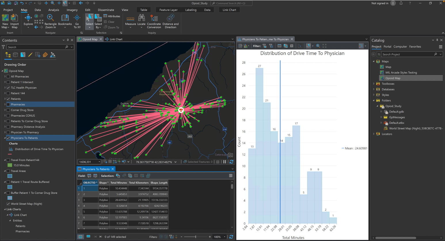
The auditor also looked at the pharmacies at which opioid prescriptions were redeemed. Utilizing geographic networks, they could see where the opioid prescriptions were most often picked up. This revealed one pharmacy that was being used much more frequently than the rest.
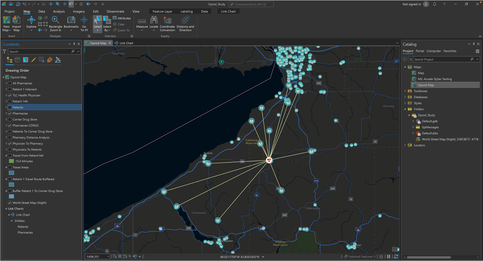
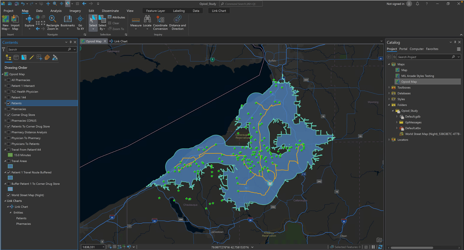
Another distance analysis was performed connecting pharmacies to prescription holders, ultimately revealing how far patients drove for this specific pharmacy and how many other pharmacies they passed on their way that would have been a more convenient stop. This presented a pharmacy with a remarkably high drive time and driving distance from many of the beneficiaries. A buffer and drive time analysis was utilized to see other pharmacy options patients could pick up from. With a higher drive time and distance than other pharmacy options, it was revealed that many beneficiaries were going out of their way to retrieve opioids from a single treatment center. An average of eight other options were bypassed on the way to this treatment center.
BENEFIT
The auditors were able to reveal potential bad actors using ArcGIS AllSource for intelligence analysis and location intelligence for decision support. It made it easier to identify outliers and facilitate investigative search in a timely manner. Identifying those potentially corrupt physicians and pharmacies gives law enforcement solid leads to act on for safer communities. Additionally, ArcGIS AllSource enables users to capture their workflow so it can be automated and shared with other agencies, cities and states who are also working to combat this crisis. ArcGIS AllSource is a powerful application enabling investigations professionals to act on data making searches seamless, straightforward, and organized.


Article Discussion: