By John F. Berry, Learn ArcGIS Content team
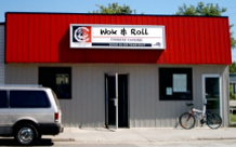
 A new project on the Learn ArcGIS website could help unsnarl your traffic and delivery management issues! In Let’s Get the Chow Mein on the Road, you assume the role of the Wok & Roll Chinese food delivery manager dealing with congested Broward County roads in South Florida. But the lessons from the project could be applied to any professional business struggling to deliver products and services in the most economical means possible.
Project workflow: In this three-lesson project, you start with plotting the location of Wok & Roll and finish with discovering marketing data about your customers. In the first lesson, you create driving zones for free and surcharge deliveries. In the second lesson, you interact with the Directions tool and generate routes for single and multiple deliveries (as well as print the directions and save those routes for analysis). In the final lesson, you extract customer data and, with the use of the Esri Tapestry Segmentation layer, discover lifestyle considerations that could drive future business and advertising decisions.


Article Discussion: