If you can think it, you can build it
Esri sponsored an internal hackathon with the goal to use the ArcGIS platform to create a solution in GIS that solves a problem targeting one of three audiences: enterprise users, civic governments or constituents, or consumers. This was an opportunity to take a step back from the daily work routine and have our own developers and product support teams use the SDKs and APIs to build the app of their dreams.
Hack the Map II was held over two days in January. A total of 68 people registered and organized into 14 teams. Teams were asked to show off their ArcGIS knowledge and app building acumen. They each demonstrated ArcGIS solutions that exhibit best practices and the features that make Esri technology stand out.
After the hacking period concluded, each team prepared a 5-minute presentation to demonstrate their app and solution to our 4 judges. This year’s judging panel included Scott Morehouse, Larry Boden, Steven Nelson, and Greg Pleiss. We awarded a trophy to the overall winning team and lots of Esri swag to the category winners.
Here we present a summary of the hackathon project submissions. Each project is highlighted in our gallery where you can learn more. Each gallery entry has a link to the source code on github.
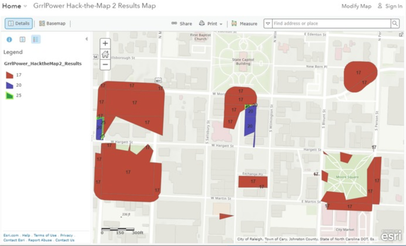
Super Approach

Best overall app
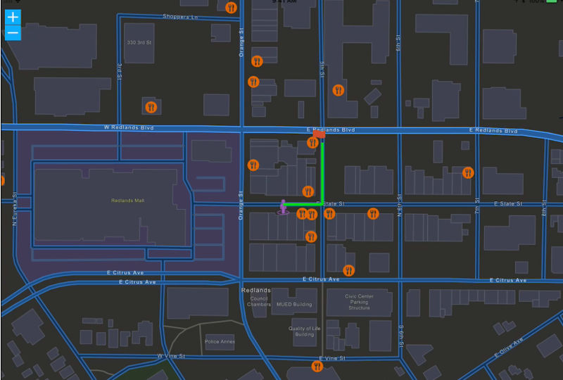
Targeting all major smartphone operating systems to provide a fast and convenient way for citizens to report their urgent concerned issues related to their day-to-day life. Apart from 3D map-view reporting mechanism, it also builds a location-based reporting system which do a smart filter of nearby issues recommended to save time on submitting long forms and reducing duplicated reports: a new crowd-source and VGI-based platform.
The tech: ArcGIS API for JavaScript, ArcGIS Pro, ArcGIS Online, React.
The team: Zihan Song, Kevin (Yuan) Gao, Claudia Wang, Yuting Tao, Max Zeng, Qun Hui
GeoTrivia

First prize Consumer
Play geographic trivia on desktop, tablet or Xbox! Buffers display users’ proximity to correct answers – the closer you are, the more points you earn! Three different basemaps determine the level of difficulty, meaning that even the most seasoned geo geeks can challenge themselves.
The tech: ArcGIS Runtime SDK for .NET, ArcGIS Pro, ArcGIS Online
The team: Mara Stoica, Allison Davis, Nate Bedortha, Chris Warner
Gov Projects
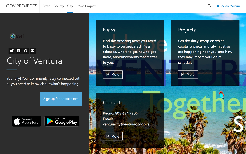
First prize Civic
For Public Information Officers and their staff, this provides a drag and drop, point and click experience for disseminating incoming, real-time community information to citizens on an hourly, daily basis. This information comes in to the government organization through many different formats and channels. This must be collated/organized and send to citizens, voters and the public at large. This is a daily challenge. The agency is doing what they can to remain accountable to city officials and the citizens, but the challenge is, getting the citizen to “come to the fountain”. Citizens seem to only care about the info channels when a disaster or road closure interrupts their life, then logs complaints that their government isn’t communicating with them. There is a disconnect there today.
For citizens, this provides a channel of information from their government, through the information channels that are already an integral part of their daily lives: Notifications to their devices, emails to their inboxes, facebook pages they collaborate in, twitter accounts they follow.
The tech: ArcGIS API for JavaScript, ArcGIS Online
The team: David Martinez, Eric Bader, Nicholas Furness, Allan Lafromboise, Andy Gup
Center Pivot Irrigation Monitor
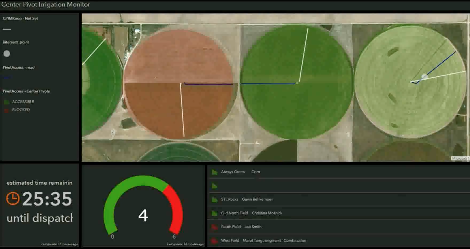
First prize Enterprise
Using an API provided by the center pivot irrigation boom and turn that into a Feature Service (using Esri Koop) that can be consumed in the platform. As part of our application we’ll utilize the ArcGIS Platform (Operations Dashboard, Web AppBuilder, Portal) to visualize the information in ways that will allow customers to see the data in an easy-to-consume way. We will use ArcGIS GeoEvent Server to send alerts to the employees when the booms block or unblock a service road.
The tech: ArcGIS Online, Web AppBuilder, Operations Dashboard, Esri Koop, ArcGIS GeoEvent Server
The team: Gavin Rehkemper, Christina Mosnick, Marut Tangtrongwanit, Matt Harman, Kevin Rich, Candice L’Ecuyer
Sky-insight
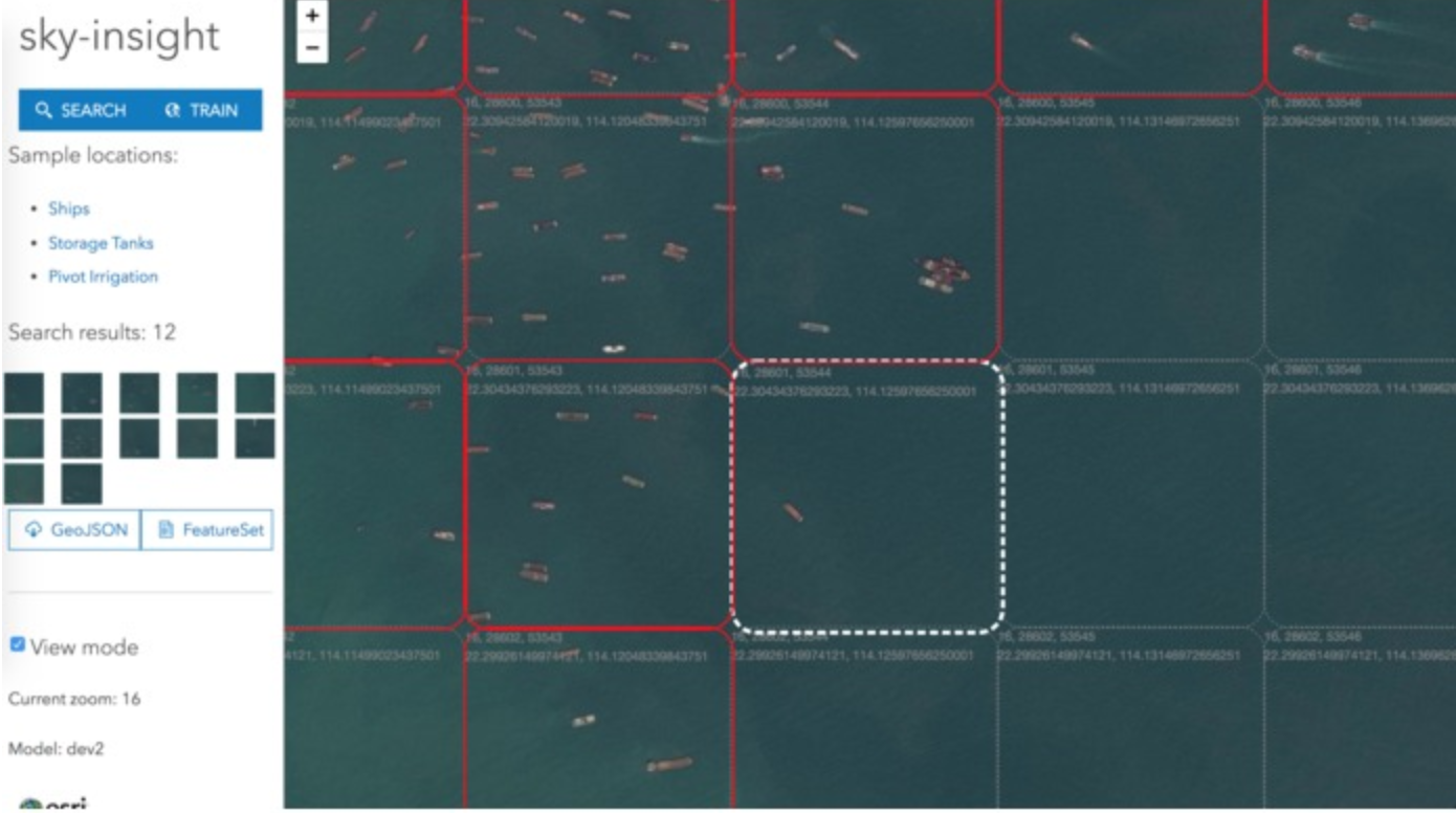
2nd Place Enterprise
Easily train machine learning models using satellite/aerial imagery & ArcGIS. Enrich your existing GIS data with real world planetary data in near realtime ML models. Monitor the physical world with ease using automation & image classification. Count cars, airplanes. Monitor ship traffic. Develop financial indices. Discover new insights.
The tech: ArcGIS API for JavaScript, ArcGIS Online
The team: Noah Mulfinger, Aysar Khalid
GeoQuest
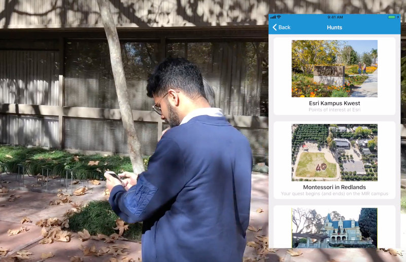
2nd Place Consumer
Custom scavenger hunts for the 21st century.
A creator can build a quest by using a desktop app. The creator uses the map to define a boundary in which the quest takes place and a set of challenges to complete. Challenges might be as simple as going to a certain location, answering a question about something they find at a location, or more complicated things like aligning team members along a specified heading or doing some GIS analysis (overlay, for example) to answer a question. The creator can create new challenges for the quest and also include existing (previously created) challenges. After choosing the teams (and players) to participate in the quest, setting a start location and start/end times, the quest is ready!
To participate in the quest, players assemble at the start location at the specified time. Teams use their mobile devices (iOS) to complete the quest. They can view challenge descriptions and choose any challenge they want to try. Challenges are completed successfully by either submitting geometry at the correct location or by answering a question. Each challenge has a different point value (based on difficulty), and teams can always back out and start a new one if they have problems completing it. As challenges are completed, the points are recorded and a leader board is updated that the teams can check. When the quest is over (everyone completes it or time expires), a winner is declared.
The tech: ArcGIS Runtime SDK for .NET, Xamarin, ArcGIS Online
The team: Thad Tilton, Tony Wakim, Aditya Togani, Gagandeep Singh
Sustainable projects
2nd Place Civic
Find a suitable location for the next sustainable project.
We want to make it easier for city employees to find the optimal spot for sustainable projects in the hope that cities become more green and sustainable. Sustainable projects are things like the addition of solar-powered trash compactors for public use and vegetation rooftop installations.
The tech: ArcGIS Runtime SDK for .NET, ArcGIS Pro, ArcMap, ArcGIS for Server/gp
The team: Mara Dolan, Melanie Whalen, Rachel Applebaum, Nagma Yasmin, Qing Shi
ARthur’s Seat
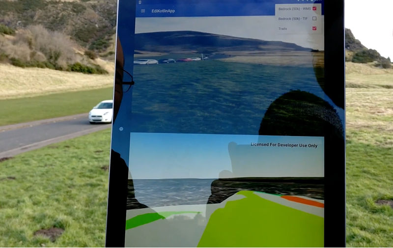
Consumer
Display geographical information in Virtual/Augmented reality on Edinburgh’s Arthur’s Seat.
As humans, we don’t interact with the world around us from the top down 2D perspective of a map–we view the world in 3D from approximately 1.5 meters from the ground. So, when we endeavor to use data on a map, we translate that data from a 2D map onto the 3D landscape around us, a process which can be done more quickly and accurately, with the aid of modern computing (on a smartphone!).
The tech: ArcGIS Runtime SDK for Android
The team: Alan Lucas, Trevor Draeseke
Street Art Hunter
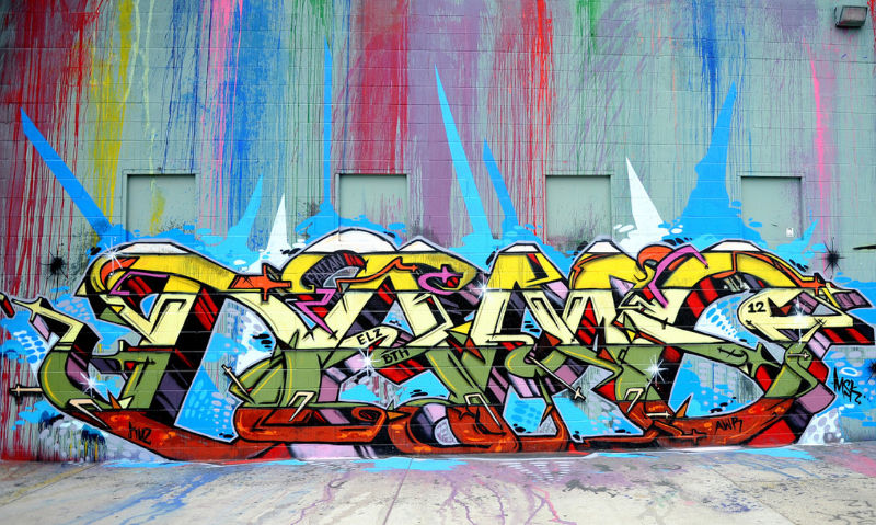
Consumer
Geo-locate street art from photos.
There must be a time when you see a nice picture that evokes your desire to find out the photograph location, so you can visit it in person and get your own picture. However, a lot of pictures online may have lost their GPS information, and you don’t even know the place name to google it. This inspires us to develop an app that can geo-locate any photo, based on picture content, using deep learning.
The tech: ArcGIS API for JavaScript, TensorFlow
The team: Fang Yao, Han Hu, Wei Ying, Jibin Liu
Accessible Map
Consumer
Mapping for vision impaired users.
A map is, by design, a very visual medium. Paper maps can be augmented for use by vision-impaired individuals but what about interactive digital maps on a mobile device?
The app runs on an iPhone or iPad with Apple’s VoiceOver technology enabled. VoiceOver speaks the name of user interface elements as the user taps on them, providing audible guidance on the app’s functionality. The “Accessible Map” app extends this feature to provide more mapping-centric information to the user. This functionality allows the user to hear:
• the address of their current location
• the number of points of interest near their location
• the name of a tapped-on point of interest
• audible directions to a tapped on location
The tech: ArcGIS Runtime SDK for iOS, ArcGIS Online, Apple SDK VoiceOver
The team: Mark Dostal, Garima Dhakal
Kai-o-tee
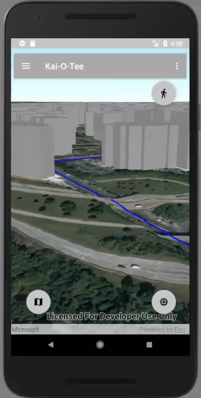
Consumer
Viewing the world around you and sharing your experiences with the world has never been easier.
This project shows the power of the ArcGIS platform as used in creating a consumer application. It uses the ArcGIS Runtime Android SDK in combination with the arcgisonline.com platform to demonstrate key applications of principles in GIS such as 3D visualization, line of sight analyses, geolocation, routing etc. in a way that makes it easily usable to the ordinary person. The application also shows the strengths of the ArcGIS platform and the potential to make GIS a household concept.
The tech: ArcGIS Runtime SDK for Android, ArcGIS Online
The team: Stewart Rouse, Kwasi Asant
Quench PCT
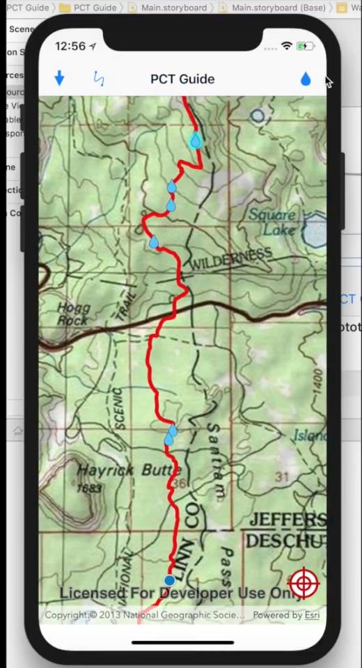
Consumer
Pacific Crest Trail trail guide showing nearest water sites based on direction.
As a former section hiker, planning for where you will next be able to fill up water is of the utmost importance. Stretches of up to 30 miles often exist between reliable water stores! Knowing where the next water source is and the latest reports of that water source will help inform PCT hikers on the most precious resource of all – water!
The tech: ArcGIS Runtime SDK for iOS, ArcGIS Pro, ArcMap
The team: Eli Gregory, Sandie Peters, Mike Wilburn
GIS Talk Bot
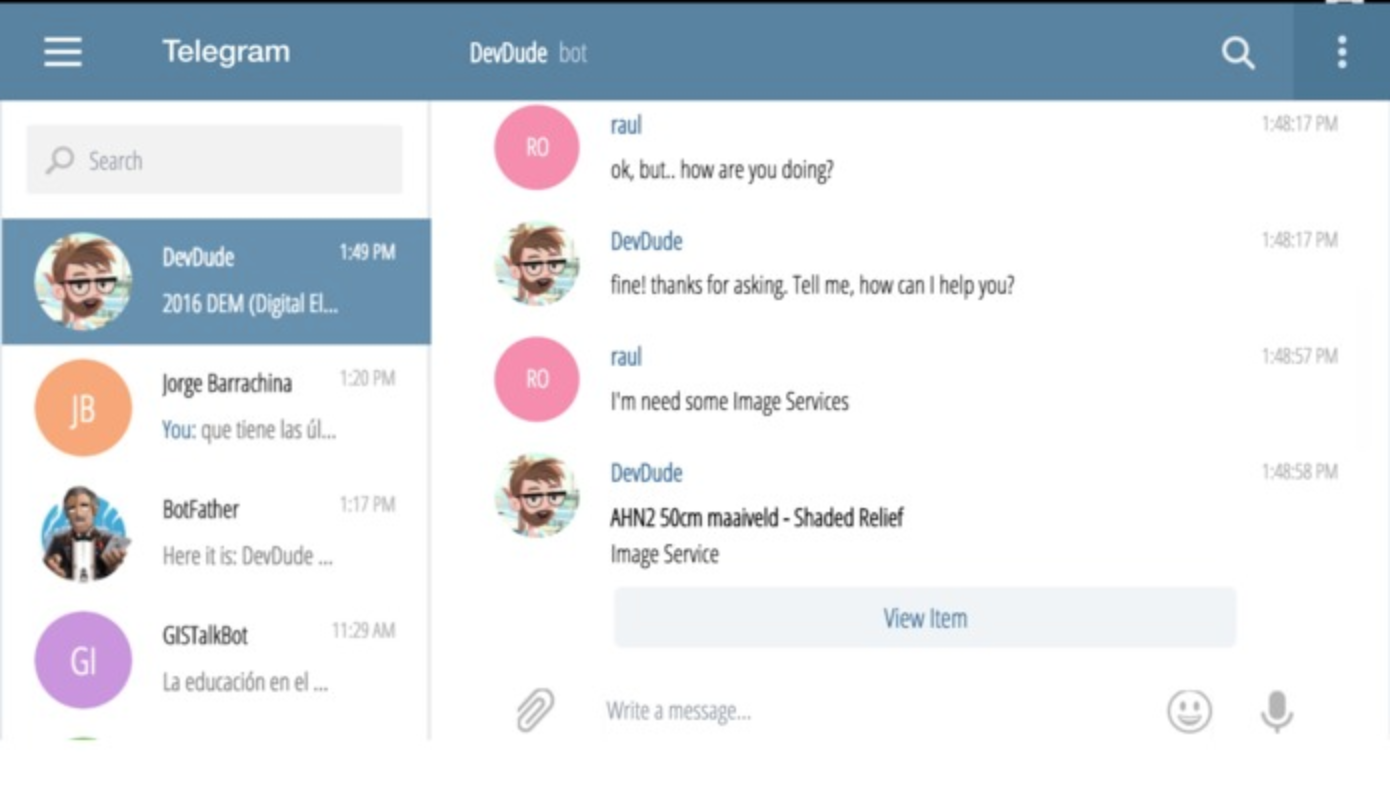
Consumer
Ask him about published items on AGOL and get awesome curated responses. We heard about Sonar last year at Andrew Turner’s presentation and we though that we could build a bot that could be setup to work within an ArcGIS organization, allowing any Esri Customer could launch their own bot easily. GIS Talk Bot queries information from public items within an ArcGIS Organization.
The tech: ArcGIS REST API, JavaScript, DialogFlow, Telegram, Now
The team: Raul Jimenez Ortega, Aitor Calero, Isaac Medel Calvo, Jorge Barrachina, Yansa Tejada Mengibar
Spawn
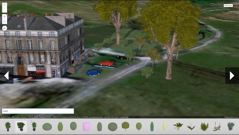
Enterprise
3D just got easier! Bring your web scenes to life like never before.
When you’ve got an urban development or BIM model that you want to bring to life, Web Style Symbols are the perfect solution! However, until now, it’s been a little bit tricky to add items into your scene.
But now, with Spawn, it’s a simple two-step process:
• Firstly, use our carousel with its natural language search, to choose the street furniture you want to add. There are over 300 items to choose from, so you’re sure to find the perfect one.
• And then, when you’ve selected it, just add it into your scene with a simple click.
It only takes a few seconds to add vibrancy and realism to a lifeless scene and take your project to the next level!
The tech: ArcGIS API for JavaScript
The team: Richard Mumford, Sean McGee, Richard Stevens, Jonathan Whiting
We were truly energized to see the application of the ArcGIS platform, the varied technology integrations, and the diversity of teams and ideas. These unique projects will inspire others to leverage the ArcGIS platform in new ways. We wish to thank all our teams for their participation and their commitment to doing great work, and our esteemed judges for their time and expertise.


Commenting is not enabled for this article.