What is ArcGIS GeoPlanner?
GeoPlanner for ArcGIS is a web-based planning and design tool that empowers you to iteratively analyze, design, and evaluate multi-scale scenarios in a collaborative environment.
- Design by understanding how dependent systems and environmental concerns interact within your project.
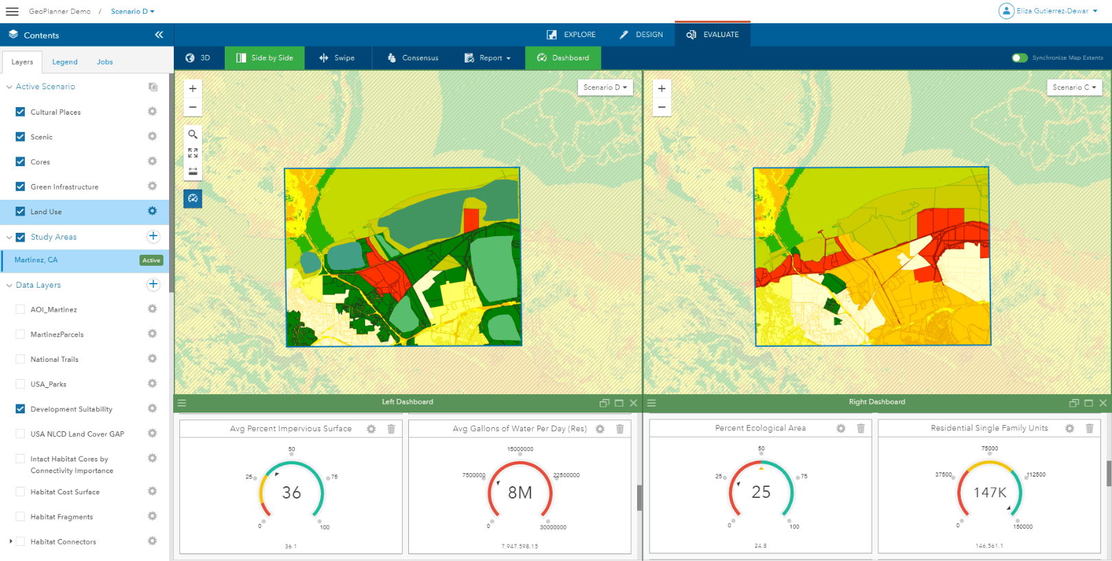
- Configure charts, graphs, and gauges to interpret and compare the success of your designs.
- Communicate project suitability, performance, and impact by sharing your data-informed plans.
- Use striking metrics and visuals show the relationship between design and impact to tell your compelling story.
- Take full advantage of its larger web-GIS environment to engage experts, collaborators, and stakeholders across a wide variety of topical domains.
The Road Ahead…
ArcGIS GeoPlanner’s Strategic Pivot to Support Landscape and Natural Systems Planning:
At its heart, ArcGIS GeoPlanner is a scenario-based planning and design tool. While GeoPlanner will continue to be an applicable tool for supporting urban and land use planning, the application will be making a strategic pivot to focus on landscape and natural systems planning.
GeoPlanner will evolve into the go-to application for users engaged in scenario planning related to:
- Conservation Planning
- Environmental Planning
- Forestry Management
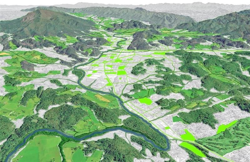
- Green Infrastructure Planning
- Natural Resources Management
- Protected Areas Planning and Management
- Stormwater Management
- Watershed Planning

New Capabilities to Support Environmental Workflows:
With this shift to support landscape and natural systems planning, new capabilities are envisioned to better support environmentally focused workflows including:
- Advanced Key Performance Indicator capabilities and Baseline Modifiers intelligently linked to on-the-ground conditions, reflect the performance and impact of each design.
- Environmental Conflict Screening and Reporting allows you to quickly identify opportunities and constraints within existing conditions and your proposed design.
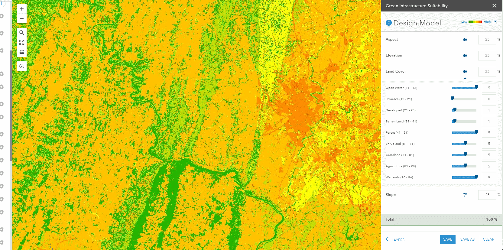
- Modernized Weighted Raster Overly (WRO) Model takes full advantage of ArcGIS Online and its latest Imagery Service, streamlining the configuration process and enhancing the ease by which users can publish and host their own models.
- New analysis capabilities using Zonal Statistics allow you to enrich boundary data; prioritize parcels, watersheds, management districts with valuable information to support desired functions.
Stay tuned for additional updates and other exciting new capabilities coming soon!


Article Discussion: