Spring has come to this part of the map and we have fresh updates to share for ArcGIS Hub. New features and capabilities can be seeds for ideas and sprouts of potential to help your site thrive. Look around to see what’s new: in this blog, your Hub site, and on the ground.
Privacy consent notices
P is for privacy and peonies coming up carefully. We have expanded settings for privacy consent notices on Hub sites. Here are the basics:
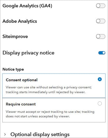
- Site visitor is required to provide consent before viewing the site (no tracking loaded onto visitor browser or enabled in the application until the user consents).
- Site visitor can accept none, some, or all configured types of tracking (if visitor changes their consent during the session, all tracking via the site domain will be deleted).
- When the Esri User Experience Improvement program is disabled for a member’s organization, their browsing is not tracked.
See details in this Esri Community post.
Web analytics
A is for Analytics and apple trees in soft bloom. Hub site editors have three options for collecting web analytics on their site usage. You can utilize Google Analytics 4, Siteimprove, and Adobe Analytics for tracking site activity. Note, that we removed support for Google Analytics 3; learn more in this Community post. Refer to the web help for more on web analytics in Hub.
New search view
S is for sage, that stayed green all winter, and S is for search! The new search view is now generally available by default (out of beta). In the catalog, users can view items as a list or as a grid (includes the item thumbnail).
With the new location filter, users can search by geography and then filter results based on that location. Filters on the left sidebar of the search catalog are sorted by frequency (number of items that match each filter value). That number now appears next to each filter.
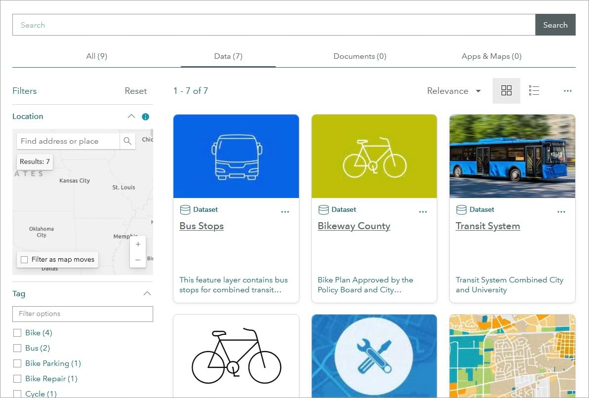
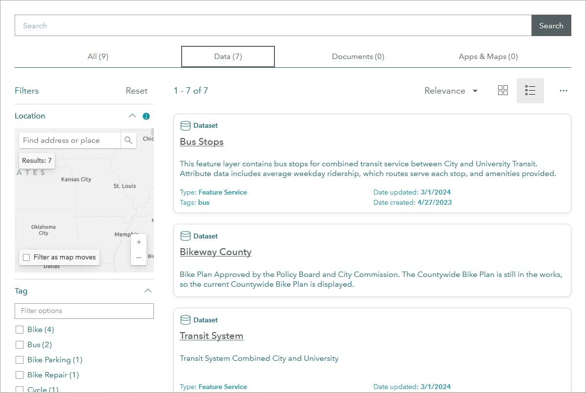
Items with many layers will only appear as one item (keeping layers together within an item). So, the number of items on search will match the site catalog (and not be increased by separated sublayers).
Finally, for public Hub sites, users can export public items from the site catalog to a CSV file. Find details in this Esri Community post.
Find more search information in this detailed blog.
Hosted downloads
H is for hyacinth and Hosted downloads, now generally available. All hosted feature service items with extract enabled will use the upgraded experience.
Benefits include additional formats, a progress indicator, faster downloads for certain items, fewer errors and generic messages, and filtering support for public and private content. To enable hosted downloads, be sure to allow Extract Capabilities (see screenshot below). Learn more in this Esri Community post.

DCAT AP feed version
Forsythia is under F along with the feed editor. The DCAT AP version in Hub feeds changed from 2.0.1 to 2.1.1. Use Hub feeds to stay aware of new content added to a site catalog. See the web help for details on configuring and managing feeds.
Projects and metrics and more
Plum trees with lacy blossoms will later be laden with fruit. P is also for Hub projects, emerging from beta, as a built-in tool to organize, share, and steadily bring your work to fruition.
Use this Premium feature to manage structured efforts towards defined goals. And now you can add up to two call-to-action links to appear in the project header. Find details in the web help and this Community post.
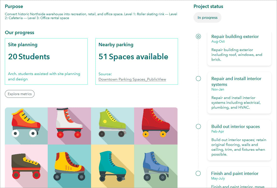
Add it up with metrics and let the data speak! Add metrics to your projects to track and highlight progress towards milestones. Like the Summary statistics card, you can use a dynamic or static source to populate a metric.
Metrics can be hidden and used internally or made visible to site visitors on the main overview pane of project view. See the web help to learn more.
Discussion boards
D is for daffodil and discussion boards. Released earlier this year, this Premium feature can facilitate engagement with and within your communities.
Use discussion boards to gather feedback and ideas on important issues: from a board for guiding local art walks to gathering input on solar energy sites to swiftly responding to a natural disaster.
Discussion boards are easy to set up, customize, and manage. Participants can range from a small private group to a public-facing board. You can set up board participation through channels, which define who can create, read, and moderate posts.
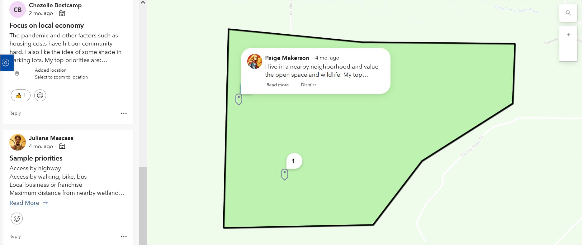
Boards can be map-based and set up to ensure all comments are placed within a specific geographic area. It’s easy to add comments, locations, and reactions. Take a look at discussion boards today and start collaborating with stakeholders! Learn more in the web help and this overview blog.
A sunny summary
Many organizations, from governments to non-profits to open data portals, have shared their Hub sites with the Hub Gallery. You can browse and filter sites by sector, focus area, and other categories to see an abundance of Hub Sites. Nominate your hard-working site and share it with the world.
Sign up for the ArcGIS Hub e-newsletter for regular updates. Post questions or comments, and let us know how your Hub site is going (and growing!) on the ArcGIS Hub Community page.


Article Discussion: