The 2026 Esri Infrastructure Management & GIS (IMGIS) Conference brings together infrastructure professionals to learn how geographic information system (GIS) technology supports planning, operations, and asset management across the infrastructure lifecycle. Taking place October 27-29 in Palm Springs, California, this year’s event includes several opportunities to learn how organizations are using Indoor GIS, a capability of ArcGIS, to improve facility operations, emergency preparedness, space management, and digital twin initiatives.

Building an Operational Foundation with Indoor GIS
Infrastructure organizations create and maintain vast amounts of information about facilities, assets, and operations. Yet much of that information remains distributed across CAD drawings, BIM models, PDFs, lidar scans, enterprise systems, spreadsheets, and documents, making it difficult to access and apply in day-to-day operations.
Indoor GIS enables organizations to make infrastructure management and operations more intelligent by bringing this information together through location, creating a connected view of the people, places, and assets inside facilities. With Indoor GIS, organizations can improve operational awareness, support maintenance and inspections, strengthen emergency preparedness, optimize space utilization, and establish a foundation for operational digital twins.
At the center of Indoor GIS is ArcGIS Indoors for indoor mapping. Organizations can also add indoor positioning, now natively included in ArcGIS, for live location awareness, location sharing, and wayfinding. Indoor GIS also extends throughout the ArcGIS platform, connecting field operations, real-time data, imagery, 3D, reality capture, and digital twin workflows to create a more complete operational picture of facilities.
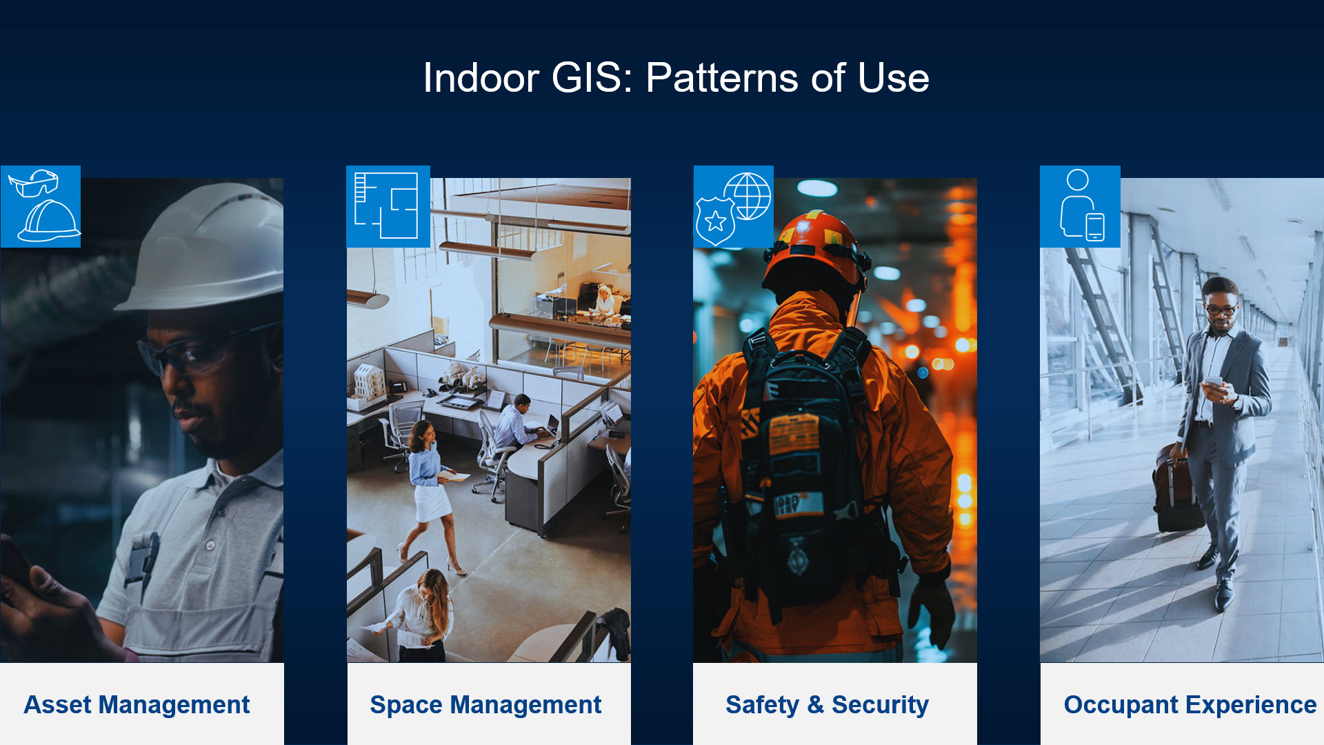
Indoor GIS Supports Four Key Patterns of Use:
Asset Management
Indoor GIS empowers teams with the ability to map, locate, navigate to, and inspect assets inside buildings and facilities, as well as visualize local conditions of assets and work orders with 360° imagery, and service indoor assets in a floor-aware context.
Recording the accurate location of each asset allows organizations to also tie these locations back to asset and work order management systems.
Space Management
Indoor GIS helps organizations better understand how space is being used across buildings, campuses, and facilities. Organizations can use the same floor plans and turn them into space intelligence for planning, reservations, assignments, space consolidation, and office moves, and other what if scenarios.
By analyzing occupancy and utilization patterns, facility managers can optimize space allocation, support moves and renovations, and make more informed decisions about facility planning and operations.
Safety and Security
Indoor GIS supports emergency planning and response by providing a floor-aware view of facilities, assets, and critical infrastructure. With up-to-date indoor maps, first responders and facility staff can quickly locate safety equipment, evacuation routes, ingress and egress points, and exits when incidents occur. Additionally, organizations can use these maps for response planning, create and maintain pre-incident plans that improve preparedness and coordination across teams.
Occupant and Visitor Experience
Indoor GIS improves the way occupants and visitors interact with facilities, helping them orient themselves within a building, wayfinding, navigation, and workspace reservations. It allows employees, facility crews, and visitors to easily locate workspaces, meeting rooms, assets, services, and places of interest.
Now that we’ve reviewed what Indoor GIS and the key patterns of use, let’s take a look at the multiple opportunities that IMGIS offers to organizations to learn how to apply Indoor GIS to their everyday workflows.
Esri Presentations
Hear from Esri leadership, industry experts, and your peers as they share their vision, real-world insights, and practical examples that connect strategy with day-to-day operations.
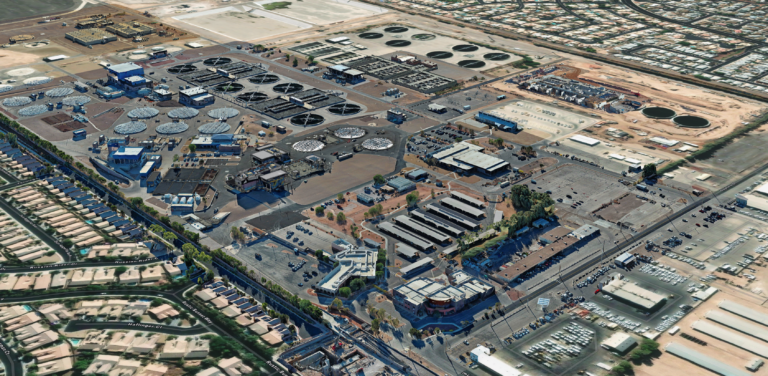
Jason Hall from Clark County Water Reclamation District will showcase how they are using Indoor GIS to provide indoor mapping and floor-aware navigation across its wastewater treatment facilities, improving safety, operational efficiency, and collaboration while serving as the foundation for a facility-wide digital twin.
Indoor GIS experts will also be hosting and presenting the following sessions:
Indoor GIS SIG: Unleashing the Power of GIS Indoors
Date: October 27th | 4:00 PM – 5:00 PM PDT | Mesquite GH | PSCC
The Indoor GIS SIG offers a platform to actively engage in discussions and to participate in face-to-face interactions, fostering high-quality discussions with like-minded peers. This SIG presents a valuable opportunity to network, exchange ideas, and collaborate with experts in the Indoor GIS domain.
Representatives from Clark County Water Reclamation District, Denver International Airport, Langan Engineering, and Map I.T. will showcase how they leverage Indoor GIS to improve operational efficiency.
Read some of the success stories:
- Clark County Water Reclamation District Transforms Wastewater Operations with ArcGIS Indoors and Digital Twin Technology
- Denver Airport Digitally Transforms with Indoor GIS for the Vision 100 Plan
- Wake County Public School System Implements ArcGIS Indoors District-Wide – A Success Story
- Three Legs of the Stool: Embracing ArcGIS as Anchor Technology for Facility Operations
Indoor GIS: A Foundation for Operational Digital Twins of Facilities
Date: October 28th | 1:30 PM – 2:30 PDT | Primrose C | PSCC
As facilities become more complex, organizations need a trusted digital foundation for managing people, assets, and operations indoors. This session demonstrates how Indoor GIS creates operational digital twins for buildings, campuses, treatment plants, transportation hubs, and critical infrastructure. Learn how to transform CAD, BIM, LiDAR, and 360-degree imagery into actionable geospatial intelligence that improves space utilization, operational awareness, asset management, maintenance planning, and decision-making throughout the infrastructure lifecycle. Hear from Indoor GIS subject matter experts:
- Gökçe Özçelik, Esri
- Will Isley, Esri
Customer Presentations
Customers who are successfully using Indoor GIS will be showcasing their use of the technology.
Digital Twins: From Vision to Reality
Date: October 27th | 2:30 PM – 3:30 PM PDT | Primrose A | PSCC
Digital Twins are transforming how organizations plan, operate, and manage infrastructure, but success starts with a strong foundation. Learn practical strategies from LandTech Consultants, American Water, Dallas Fort Worth International Airport, Denver International Airport, and HNTB for building Digital Twin initiatives, from establishing a trusted GIS and integrating BIM, CAD, and enterprise data to overcoming implementation challenges and delivering measurable business value. Hear real-world lessons learned and discover proven approaches for creating scalable Digital Twins that support smarter decision-making and more efficient operations.
Transforming Facilities Management with ArcGIS Indoors
Date: October 27th | 2:30 PM – 3:30 PM PDT | Mesquite GH | PSCC
ArcGIS Indoors is helping organizations move beyond indoor mapping to create connected, enterprise-wide facilities management solutions. Hear Arora Engineers, LLC talk about indoor mapping use cases at the Philadelphia International Airports as well as how Wake County Public Schools, and Map I.T. are leveraging Indoor GIS to improve space planning, asset management, public safety, maintenance, and operational efficiency while creating a single, authoritative source for indoor information that supports smarter decision-making across the organization.
Turning Disconnected Utility Data into Operational Value
Date: October 28th | 3:15 PM – 4:15 PM PDT | Sierra/Ventura | Renaissance
Discover how two water utilities transformed disconnected data into operational value. Presenters from Sussex County and CyberTech Systems and Software will share what’s coming next for them – a public works digital twin and ArcGIS Indoors.
Building Operational Digital Twins for Smarter Water Utility Asset Management
Date: October 28th | 4:45 PM – 5:45 PM PDT | Sierra/Ventura | Renaissance
Join this session to learn how water utilities are building operational digital twins by connecting GIS, 3D models, infrastructure data, and asset management systems. One of the presenters, Central Contra Costa Sanitary District, will share how a multiphase initiative created detailed 2D and 3D representations of treatment plant assets.
From Indoors to Digital Twins: Connected Infrastructure Intelligence
Date: October 28th | 4:45 PM – 5:45 PM PDT | Madera | Renaissance
What does it take to turn facility data, BIM models, schedules, costs, and operational systems into a connected digital twin? Hear from one of the presenters, Map I.T., about their framework for successfully planning and executing an enterprise Indoor GIS initiative, and strategies for delivering a scalable digital twin that supports long-term infrastructure management.
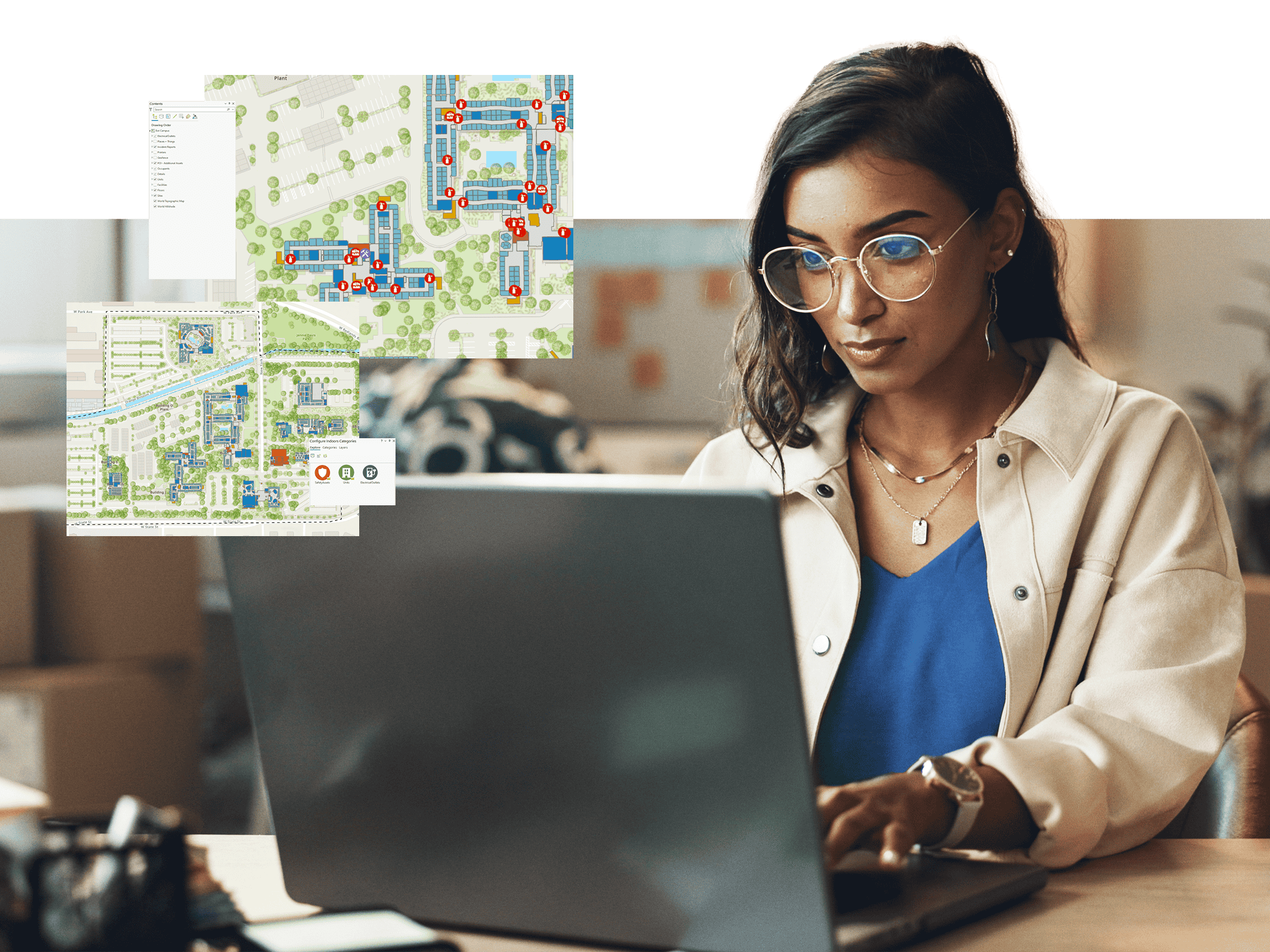
From utilities and airports to campuses and critical infrastructure facilities, organizations are using Indoor GIS to improve operational awareness and make better use of facility information.
Join us at IMGIS 2026 to learn from industry experts, hear customer success stories, and explore how Indoor GIS can support your infrastructure management goals.
Learn more about Indoor GIS.
Article Discussion: