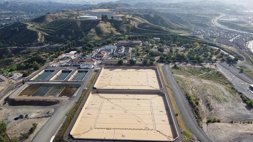
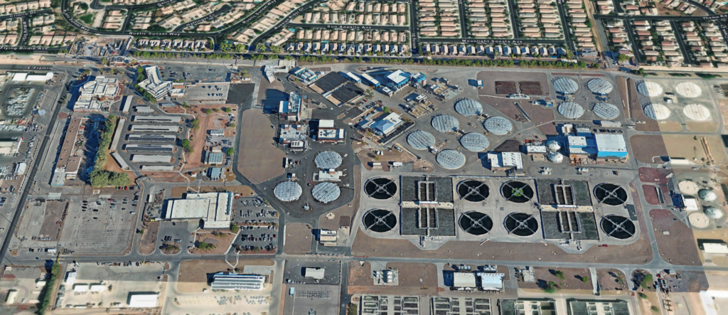
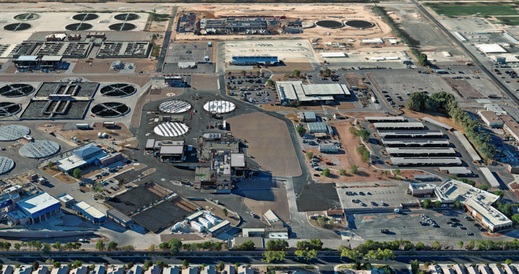
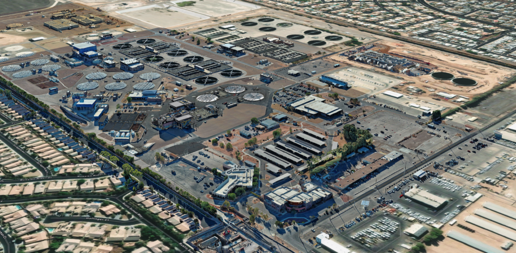
The Clark County Water Reclamation District (CCWRD) is Nevada’s largest wastewater agency, serving more than 260,000 accounts across Southern Nevada. With over 2,400 miles of pipeline and six treatment facilities—including the Flamingo Water Resource Center, which treats and recycles more than 106 million gallons per day—the District plays a critical role in protecting public health and sustaining the region’s water supply.
While CCWRD had long relied on GIS for utility mapping, the organization needed deeper visibility into indoor environments and a way to integrate diverse spatial data sources. By adopting ArcGIS Indoors and expanding its use of Esri’s 3D and imagery tools, CCWRD is building a comprehensive digital twin of its flagship treatment facility—enhancing safety, operational efficiency, and cross-department collaboration.
The Challenge
For years, CCWRD’s indoor information was limited to static AutoCAD floor plans. At the time, Esri’s platform did not yet support indoor mapping, leaving the District without a modern solution to visualize interior assets or support staff navigation within complex treatment facilities.
This lack of indoor visibility created several challenges:
- Limited ability to map and manage safety and security assets
- Difficulty locating employees and workspaces across large facilities
- Inefficient ITS infrastructure management
- Underutilized BIM models from recent expansion projects
- No unified environment to integrate drone imagery, laser scans, and BIM data
With three major plant expansions under construction—and each delivering detailed BIM models—CCWRD recognized an opportunity. Instead of letting these models sit unused, the District sought to integrate them into its GIS ecosystem and build a dynamic digital twin of the Flamingo Water Resource Center.
The Solution
CCWRD implemented a modern, multisource geospatial workflow centered on Esri technology.
ArcGIS Indoors for Interior Mapping and Wayfinding
The District adopted ArcGIS Indoors to map interior spaces, visualize work areas, and support employee location and routing. ArcGIS Indoors now serves as a central tool for ITS staff, technicians, and operations personnel navigating the facility.
The existing floor plans were converted into the ArcGIS Indoors framework. Following the conversion, staff found that significant topology cleanup was required to ensure accuracy and usability. The floor plans were then made floor-aware, enabling users to switch seamlessly between levels within the online viewer.
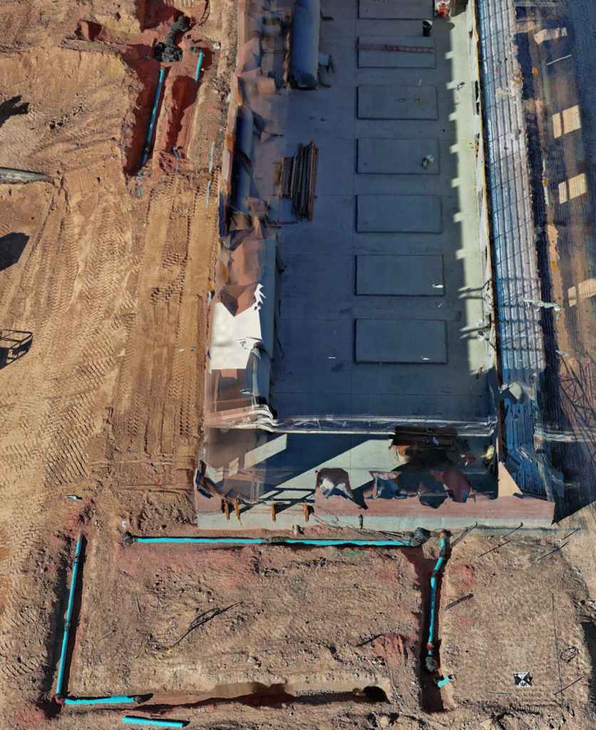
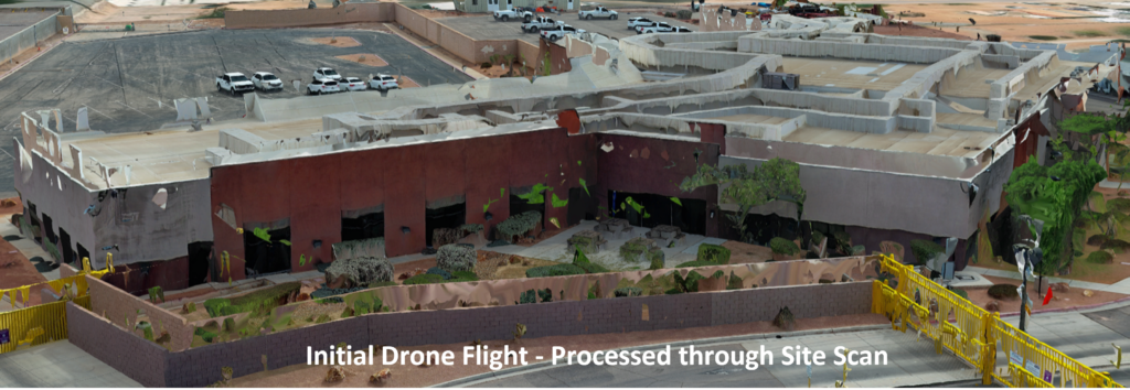
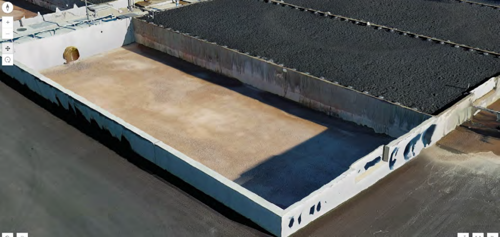
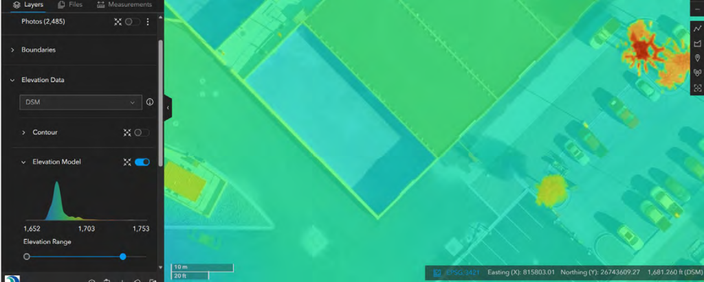
Drone Imagery and Site Scan for ArcGIS
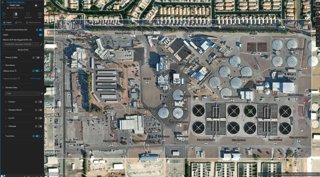
Using Site Scan for ArcGIS, CCWRD processes drone imagery to capture up-to-date site conditions and monitor construction progress across the campus.
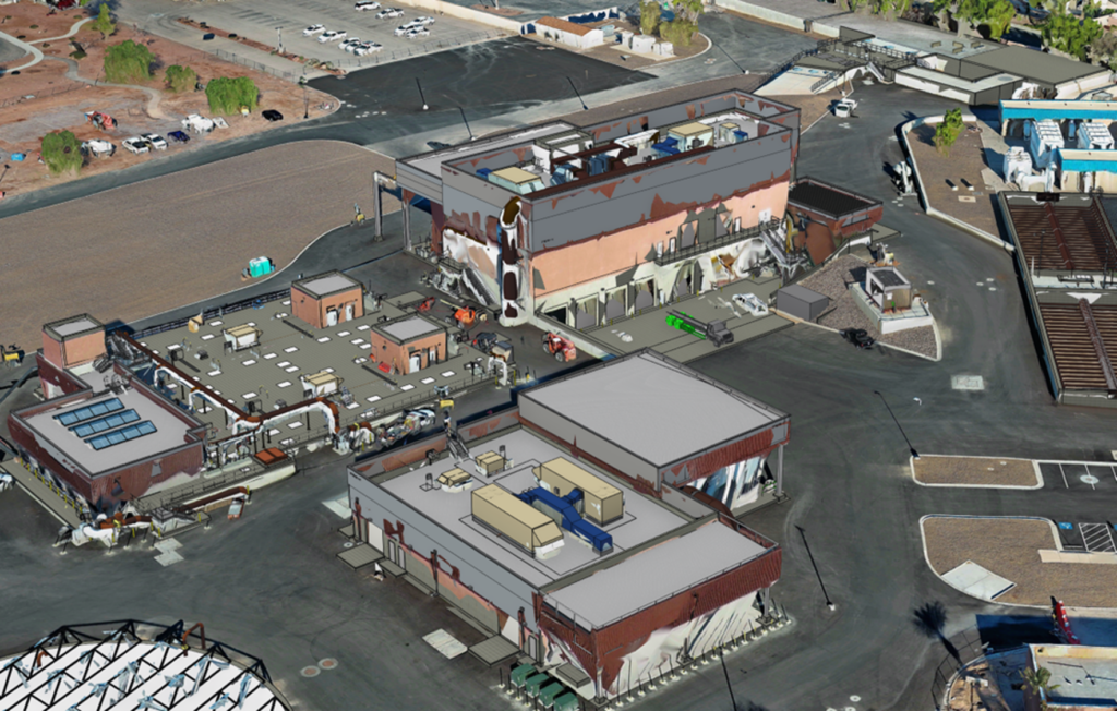
By collecting and processing drone imagery through Site Scan for ArcGIS, CCWRD was able to produce integrated meshes that were shared directly to ArcGIS Online. This provided construction inspectors and project managers with rapid access to up-to-date visualizations of active construction sites.
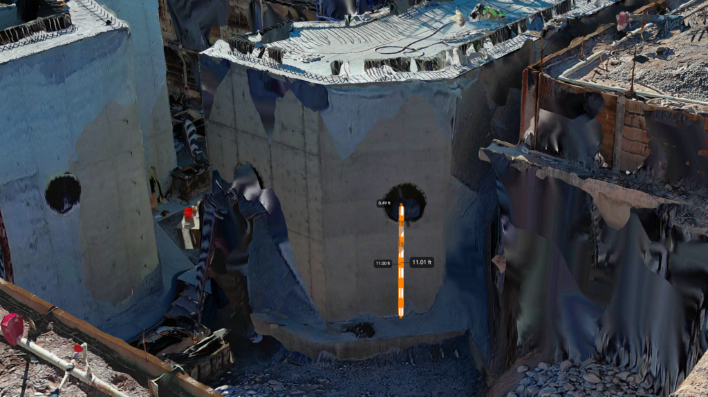
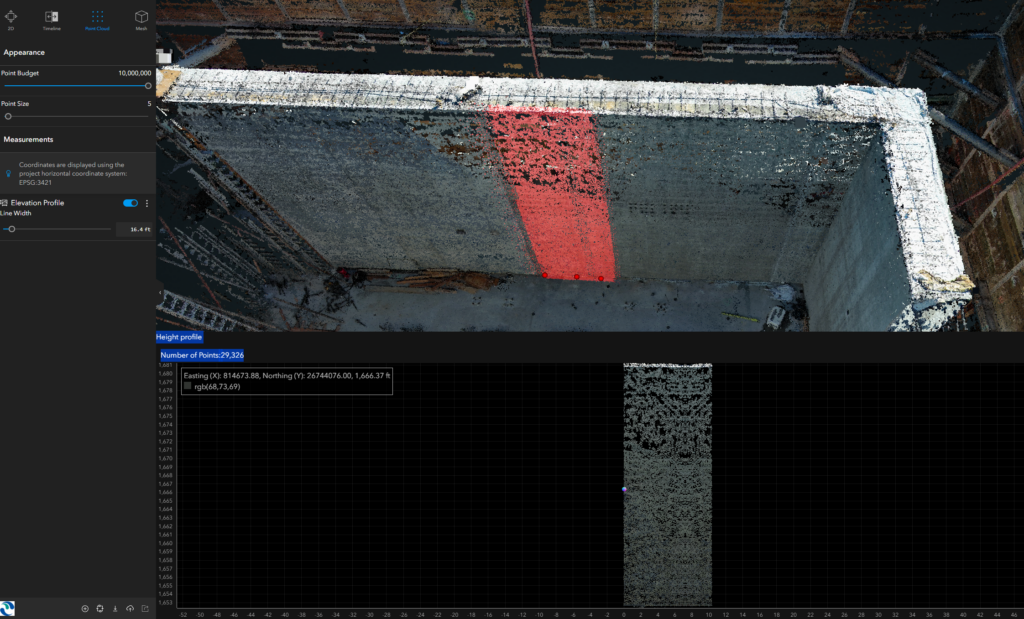
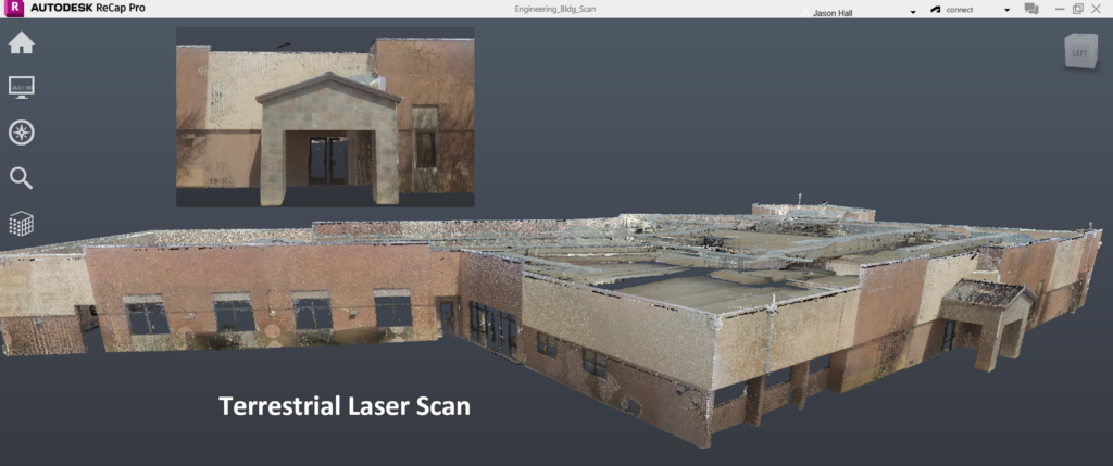
Laser Scanning and Point Cloud Processing
High-resolution terrestrial laser scans are processed using Carlson Point Cloud, Leica Cyclone, and Autodesk ReCap Pro. These datasets provide precise spatial detail for both indoor and outdoor environments.
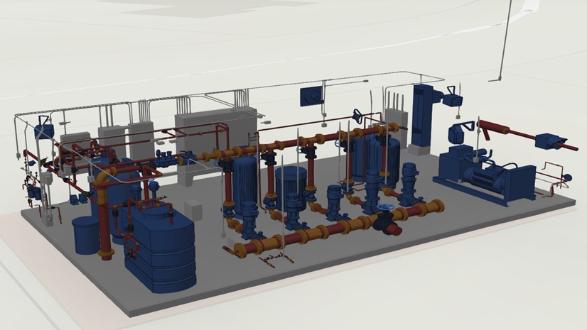
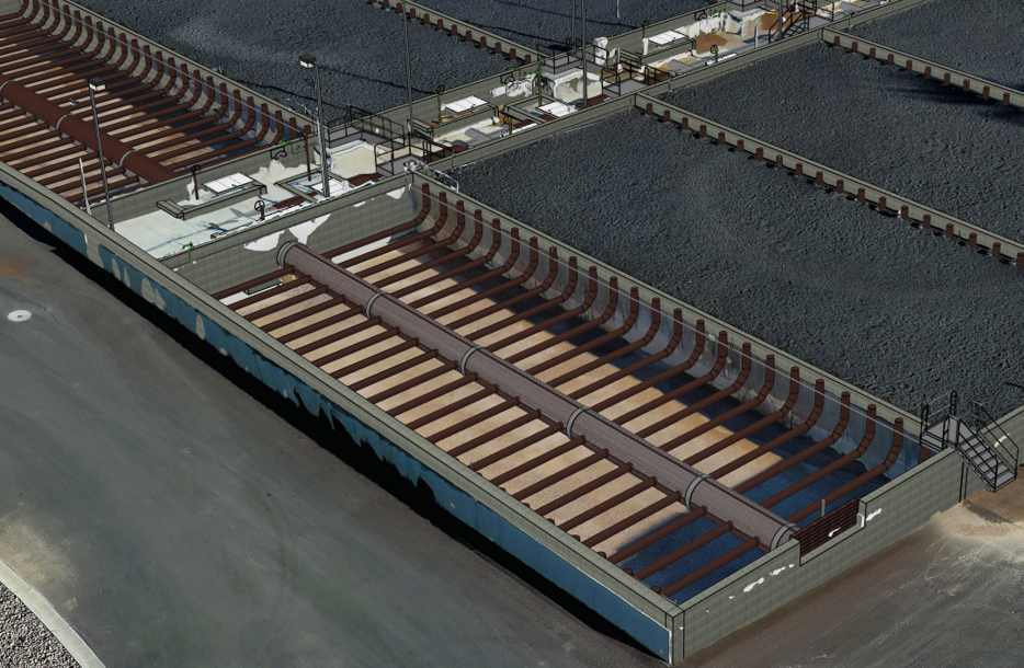
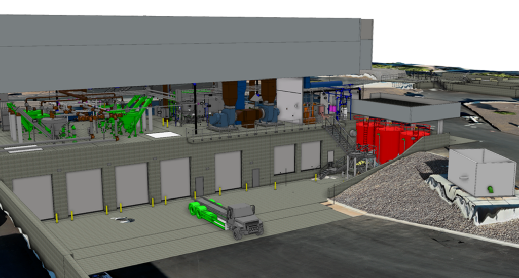
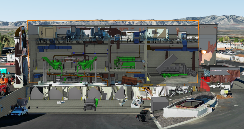
BIM Integration with ArcGIS Pro
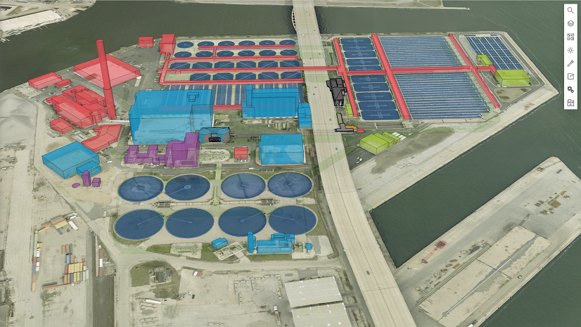
Autodesk Revit models from recent expansion projects are imported directly into ArcGIS Pro and converted into scene layer packages for visualization in ArcGIS Online. This allows BIM data to be viewed, queried, and integrated alongside GIS layers.
Toward a Digital Twin
By combining Indoors, drone imagery, laser scanning, and BIM within the Esri ecosystem, CCWRD is building a comprehensive digital twin of the Flamingo Water Resource Center—creating a unified, interactive representation of the facility.
The future of the built environment lies in the creation of a unified platform that seamlessly integrates drone imagery, BIM models, indoor mapping, and precise elevation data into one cohesive system. By combining aerial perspectives with detailed digital representations of structures, enriched by accurate terrain information and comprehensive indoor layouts, this platform would bridge the gap between the physical and digital worlds. Such integration would empower stakeholders to make better decisions through context-rich visualizations, enhance safety and efficiency in construction and urban planning, and enable predictive analytics for maintenance and sustainability. Ultimately, it represents a transformative step toward smarter, more connected, and more resilient wastewater treatment plants.
The Results
Although the digital twin initiative is ongoing, CCWRD is already seeing significant benefits.
- Improved Staff Navigation and Collaboration—The ITS help desk and service technicians now use ArcGIS Indoors to locate employees and work areas instantly. New staff can quickly understand facility layouts and navigate directly to workspaces using built-in routing.
- Enhanced Safety and Security Awareness—Indoor maps now include AEDs, fire extinguishers, alarms, evacuation routes, and other critical safety features—giving staff immediate access to lifesaving information.
- Stronger IT Infrastructure Management—Wi-Fi access points, network rooms, and (soon) network lines are mapped within Indoors, improving troubleshooting and planning.
- Better Visualization of Construction and Site Conditions—Drone imagery, laser scans, and BIM models allow leadership and operations teams to visualize construction progress and current site conditions in real time.
- Operational Efficiency and Preparedness—Photographic walk-throughs and integrated BIM models help staff assess work environments before arriving on site, improving safety and reducing time spent in the field.
Future Plans
CCWRD is expanding its digital twin initiative with several major enhancements:
- Complete indoor mapping of all facilities, including utilidors, pump rooms, and lift stations
- Full drone-based mapping of the remaining campus
- Development of a comprehensive digital terrain model (DTM) with rapid update capability
- Continued terrestrial laser scanning to refine building facades and improve visual realism
- Adoption of wearable SLAM scanners to efficiently capture hard-to-access interior spaces
These advancements will ensure that CCWRD’s digital twin evolves into a fully integrated operational platform—supporting safety, maintenance, planning, and long-term infrastructure management.
By embracing ArcGIS Indoors and integrating BIM, drone imagery, and laser scanning into its GIS environment, the Clark County Water Reclamation District is transforming how it manages one of the region’s most critical public utilities. The digital twin of the Flamingo Water Resource Center is already improving operational awareness, staff efficiency, and safety—and it lays the foundation for a smarter, more resilient wastewater system for Southern Nevada.
“By integrating ArcGIS Indoors, drone imagery, BIM models, and laser scanning into a single unified environment, we’re giving our teams something we’ve never had before—a precise, living digital picture of our facilities. It marks a major step forward in how we manage and visualize critical infrastructure, and it’s opening the door to a smarter, more connected future.” — Jason Hall, GIS Supervisor, Clark County Water Reclamation District

Stay Connected with Esri’s Water Team
With ArcGIS, utilities can efficiently manage facilities using a reliable system of recording, quickly map assets, visualize data in 2D and 3D, plan maintenance, collaborate across teams, and integrate with other business systems. This approach enables better data-driven decisions, improves operational efficiency, and supports the long-term sustainability of facilities.
Learn more about how ArcGIS solutions enable enhanced facility and vertical asset management.
Subscribe to the Water Industry newsletter “Esri News for Water Utilities and Water Resources“
Follow #EsriWater on social media: X| LinkedIn