The Esri International User Conference (Esri UC), happening July 14-18 in San Diego, California, is a vibrant and bustling event that brings together GIS professionals from around the world. It features a wide array of sessions by Esri staff and customers as well as inspiring keynotes that showcase the latest advancements in geographic information systems.

Filled with a sense of innovation and collaboration, the conference provides a great venue for attendees to network, learn from industry leaders, and explore cutting-edge technology and solutions. This year’s theme, GIS—Integrating Everything, Everywhere, is truly a testament to how GIS empowers organizations to make informed decisions and achieve improved outcomes by connecting everything from everywhere.
Topics in this blog:
- Introduction to Indoor GIS
- Showcase
- Indoor Positioning Live Demos
- Sessions from Indoor GIS Product Team
- Additional Sessions with Indoor GIS Content
- Sessions Presented by Users
- Special Interest Group Meetings
- Indoor Mapping Experience
Introduction
Whether you are a first time or a veteran attendee of the Esri UC, we want to make it easy for you to find everything related to Indoor GIS in one location–this blog post. But first, let’s start with a quick introduction. What is Indoor GIS?
Indoor GIS extends GIS and the geographic approach to indoor space and building management through ArcGIS, a comprehensive system for indoor mapping and positioning for facility operations. Indoor GIS is powered by indoor maps created with ArcGIS Indoors, and indoor positioning could be overlaid through ArcGIS IPS. Indoor GIS is pervasive across the ArcGIS ecosystem of products by providing the ability to
- Enable facilities maintenance activities for mobile workers through ArcGIS Field Maps, ArcGIS QuickCapture, and ArcGIS Survey123
- Configure custom floor-aware experiences using ArcGIS Experience Builder
- Create information visualizations with ArcGIS Dashboards and ArcGIS Knowledge
- Support security operations and mission critical activities by integrating with ArcGIS Mission.
The primary applications or patterns of use for Indoor GIS are asset management, space management, safety and security, and occupant and visitor experience.
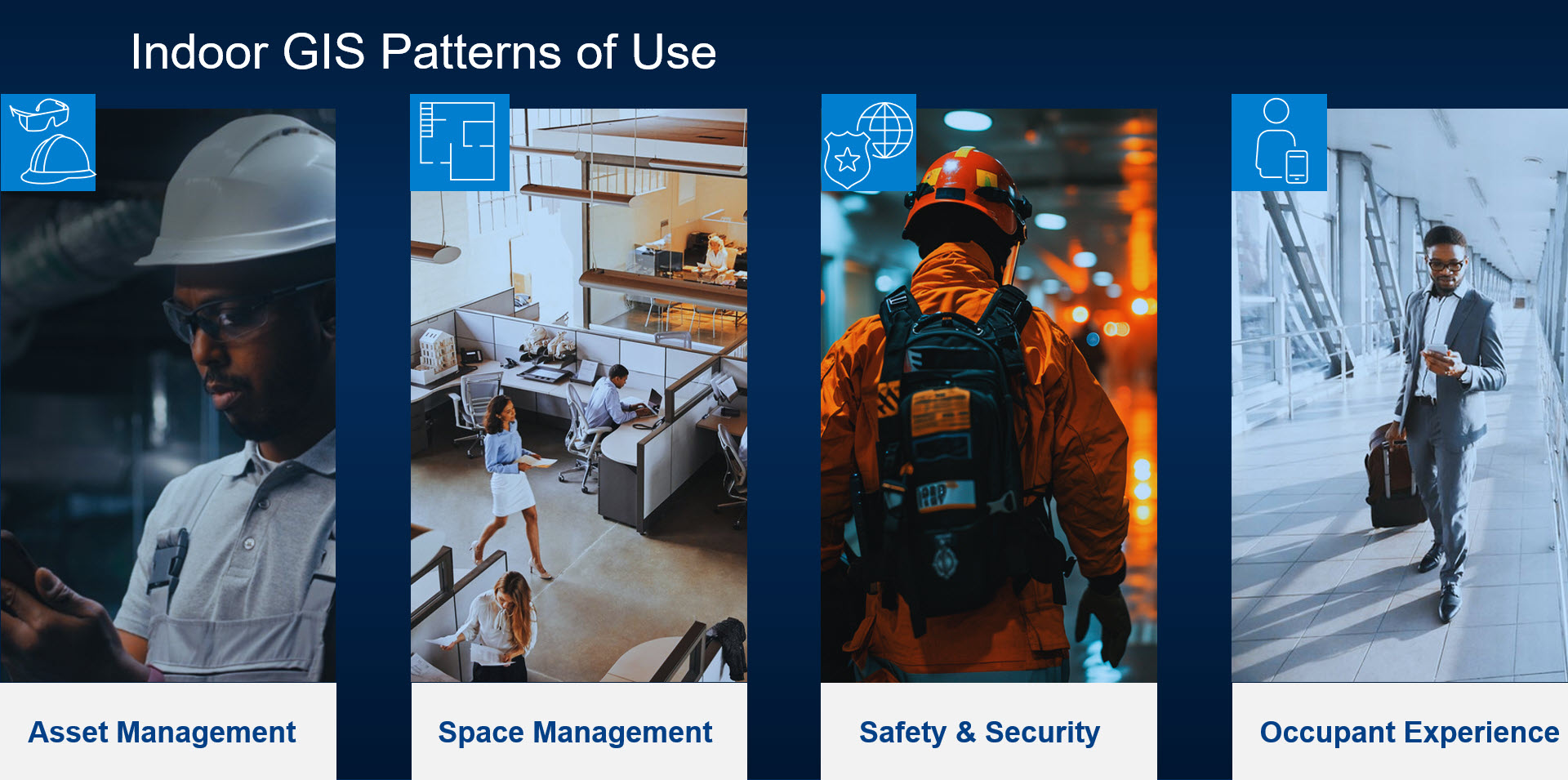
Asset management: By mapping the indoor locations of assets, you can easily find and navigate to them and visualize local conditions of the work environment for mobile workers to carry out inspections and work orders. Recording asset locations also allows organizations to integrate with information with their asset and work order management systems.
Space management: Get a comprehensive overview of facility usage, making it easier to plan and improve the use of indoor spaces. For example, you can consolidate unused space or re-assign it to a different business unit. In addition, you can plan relocations and other scenarios and quickly visualize the impact of these changes.
Safety and security: Incorporating location intelligence is essential for safety and security operations as it empowers emergency dispatchers, first responders, and safety and security personnel with improved situational awareness. Having up-to-date indoor maps of facilities allows them to visualize the locations of people, spaces, safety equipment, as well as exits and evacuation routes.
Occupant and visitor experience: Indoor maps improve interactions between building occupants, visitors, and indoor spaces by enabling wayfinding and turn-by-turn navigation. You can also search for specific people and places, save places for quick reference, reserve workspaces and meeting rooms, and report incidents related to indoor assets. Overlaying indoor positioning on indoor maps allows you to view your real-time location inside buildings.
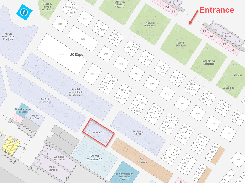
Showcase
Visit us at the Indoor GIS showcase within the Esri expo. Our product experts are available to help you understand how you can benefit from
- ArcGIS Indoors for Mapping
- ArcGIS Indoors for Reality Mapping
- ArcGIS Indoors for Space Planning
- Indoor Facilities Management
- ArcGIS IPS for Indoor Positioning
Expo hours and location
|
Day and Date |
Time | Location |
|
Tuesday, July 15 |
9:00 a.m.–5:00 p.m. |
Halls A/B/C/D |
|
Wednesday, July 16 |
9:00 a.m.–5:00 p.m. |
Halls A/B/C/D |
| Thursday, July 17 | 9:00 a.m.–4:00 p.m. |
Halls A/B/C/D |
Indoor Positioning Live Demos
Did you know that the Hilton Bayfront and Marriott Marquis hotels next to the San Diego Convention Center are equipped with indoor positioning systems enabled by ArcGIS IPS? If you are attending the Esri Safety and Security Summit and/or Esri Education Summit on Saturday, July 12th and Sunday, 13th or if you are attending any sessions on Tuesday, July 15th at either hotel, be sure to visit our booths for live demos that showcase indoor positioning.
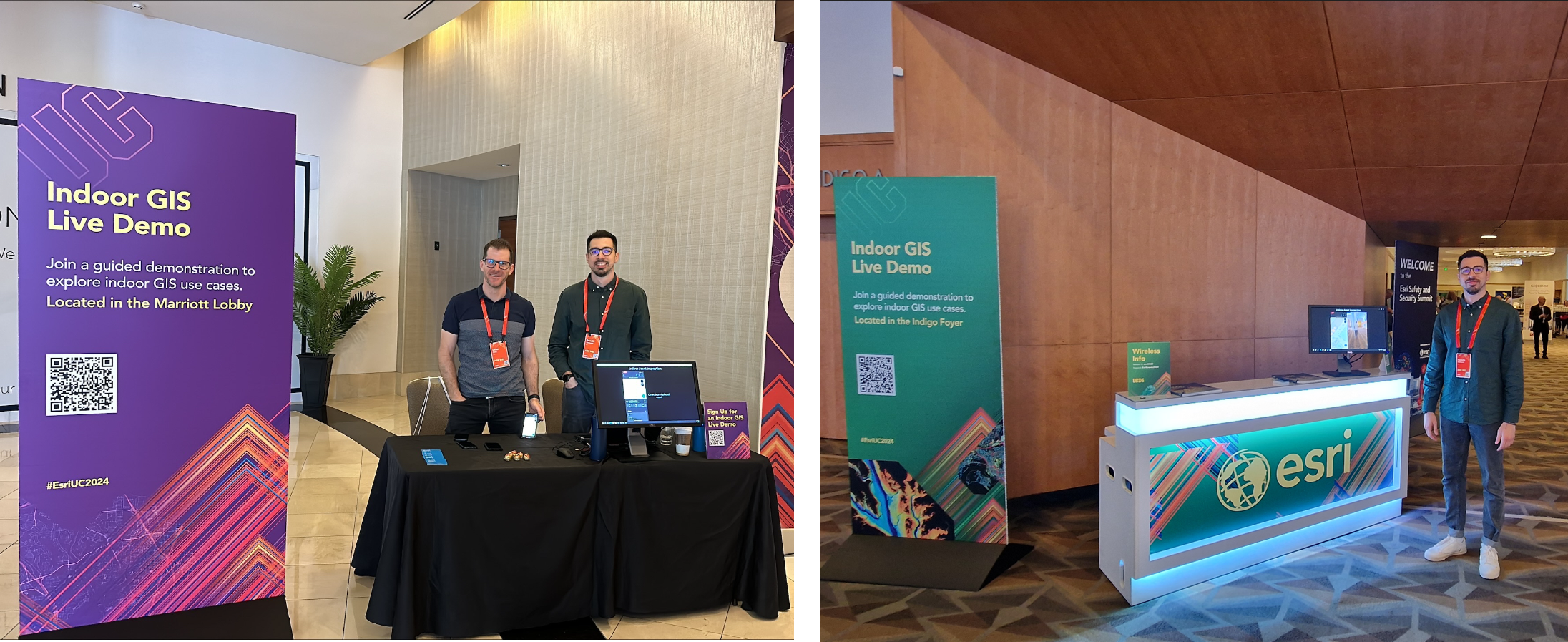
We will show demos related to asset inspections and maintenance, safety and security, and occupant and visitor experience. You’ll see how ArcGIS IPS, ArcGIS Field Maps, ArcGIS Mission, and ArcGIS Indoors come together to bring your GIS indoors.
Demo schedules and locations:
- Marriott Marquis San Diego Marina – North Tower | Grand Ballroom Foyer
- Hilton San Diego Bayfront – Indigo North Foyer
- 9:00 a.m.–5:00 p.m.| Sat, July 12 | Sun, July 13 | Tue, July 15 at both hotels
Interested in a demo? You can reserve a spot today or join us live on one of the days mentioned above.
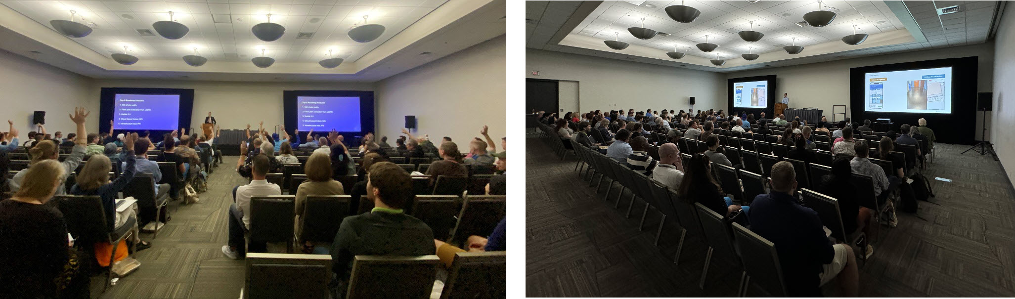
Sessions
Below is the list of Indoor GIS technical workshops, demo theater sessions, special interest group meetings, and user presentations. You can view all these sessions in our custom agenda tool, which is meant to assist you in planning your Esri UC experience. You can also add these sessions to your schedule and mark sessions as favorites directly from the custom agenda.
Sessions Presented by the Indoor GIS Product Teams
Technical Session | Tuesday, July 15 | 8:30 AM – 9:30 AM PDT | Room 1 B | SDCC
And Tuesday, July 15 | 2:30 PM – 3:30 PM PDT | Room 2 | SDCC
Discover the power of indoor mapping with ArcGIS Indoors, an extension to ArcGIS for indoor mapping. This presentation provides an overview of ArcGIS Indoors capabilities and how to create and share floor-aware maps of your building interiors. Gain insight into how to use indoor maps to power Indoors apps for space planning, workspace reservation, indoor navigation, sharing a location, and more, as well as how licensing works.
Indoor GIS: Bringing Reality Capture to Your Indoor GIS
Demo Theater | Tuesday, Jul 15 | 10:00 AM – 10:45 AM PDT | Demo Expo Theater 12 | SDCC
Interested in learning how to use lidar scans inside your facilities? Discover how to create floor-aware indoor maps and import 360-degree photos as a layer to your indoor GIS using ArcGIS Indoors. Speakers share best practices for working with lidar data to produce indoor floor plans and also demonstrate how to build an oriented imagery dataset with a 360-degree photo series.
Indoor GIS SIG: Unleashing the Power of GIS Indoors
Special Interest Group | Tuesday, Jul 15 | 11:30 AM – 12:30 PM PDT | Room 16 A | SDCC
The Indoor Mapping GIS SIG offers a platform to actively engage in discussions surrounding indoor mapping GIS, connecting you with industry professionals who share your enthusiasm for this field. By joining us, you will have the chance to participate in face-to-face interactions, fostering high-quality discussions with like-minded peers. This SIG presents a valuable opportunity to network, exchange ideas, and collaborate with experts in the indoor GIS domain, enhancing your knowledge and expanding your professional connections.
Reservation Required: Note that this Special Interest Group meeting requires a reservation to attend. Please Add to Schedule to reserve your spot or Join Wait List to be added to the queue.
Technical Session | Tuesday, Jul 15 | 1:00 PM – 2:00 PM PDT | Room 16 A | SDCC
Bring the blue dot indoors with ArcGIS IPS, Esri’s indoor positioning product. Learn how ArcGIS IPS lets you locate yourself and others inside a building or facility in real time. Speakers provide a product overview and technology background as well as use cases, trends, and the road map for what’s to come.
Indoor GIS: Floor Plan Editing on the Web
Demo Theater | Wednesday, Jul 16 | 10:00 AM – 10:45 AM PDT | Demo Expo Theater 8 | SDCC
Want to build an indoor GIS and empower your operations or facilities team with editing the floor plan data and do what-if scenario planning? Join us to learn how to use ArcGIS Indoors’ web-based Floor Plan Editor to create, manage, and maintain your indoor maps. With the Indoors Floor Plan Editor, you can edit floor plans from engineering or scanning sources or digitize them by tracing floor plan images. Indoor mapping is now made easy in ArcGIS Online and ArcGIS Enterprise.
Indoor GIS: How to Build Custom Indoor Mapping and Positioning Apps
Demo Theater | Wednesday, Jul 16 | 11:30 AM – 12:15 PM PDT | Demo Expo Theater 11 | SDCC
Learn how to use ArcGIS Experience Builder to develop a low-code or no-code custom app for indoor mapping. Also, discover how to use ArcGIS Maps SDK for Kotlin and ArcGIS Maps SDK for Swift to add indoor mapping and positioning to your native mobile apps for iOS and Android.
Indoor GIS: Mapping Indoor Assets
Demo Theater | Wednesday, Jul 16 | 1:00 PM – 1:45 PM PDT | Demo Expo Theater 11 | SDCC
Want to map the location of your indoor assets? Discover how to use indoor maps created with ArcGIS Indoors in ArcGIS Field Maps to perform field data collection within facilities. Explore how to use 360-degree photos for a photorealistic experience of the local asset conditions using ArcGIS Indoors. Also, speakers demonstrate how ArcGIS IPS is used with ArcGIS Field Maps to equip mobile workers with real-time location information (with the blue dot) and enable them to update asset locations within facilities.
ArcGIS Indoors: Space Planning and Workplace Management
Demo Theater | Wednesday, Jul 16 | 2:30 PM – 3:15 PM PDT | Demo Expo Theater 11 | SDCC
Do you want to help your organization with GIS-based space planning? Join us to learn how ArcGIS Indoors Space Planner streamlines indoor space management for enhanced workspace utilization. Discover how to address key challenges such as business unit space allocation and occupant space assignments. Speakers also demonstrate how to offer a web and native mobile experience to support employees in finding the people, places, assets, and amenities needed and scheduling spaces to work and collaborate when in the office.
Indoor GIS: Taking Data Beyond Indoor Viewer
Expo Spotlight Talk | Thursday, Jul 17 | 10:00 AM – 10:20 AM PDT | Implementation Strategies Expo Theater | SDCC
Maximize the impact of indoor data across your GIS environment. Many users are familiar with ArcGIS Indoors apps, such as Indoor Viewer and Space Planner. This brief presentation explores how to extend the value of your data by seamlessly integrating it into ArcGIS Dashboards, ArcGIS Field Maps, and ArcGIS Experience Builder. Learn how to use indoor data for facility and asset management, maintenance oversight, capacity planning, and more.
Suggested Skills: Experience with indoor GIS.
Additional Sessions that Cover Indoor GIS Content
If you are attending the Esri Safety and Security Summit on July 12th and 13th be sure to add this panel discussion to your agenda.
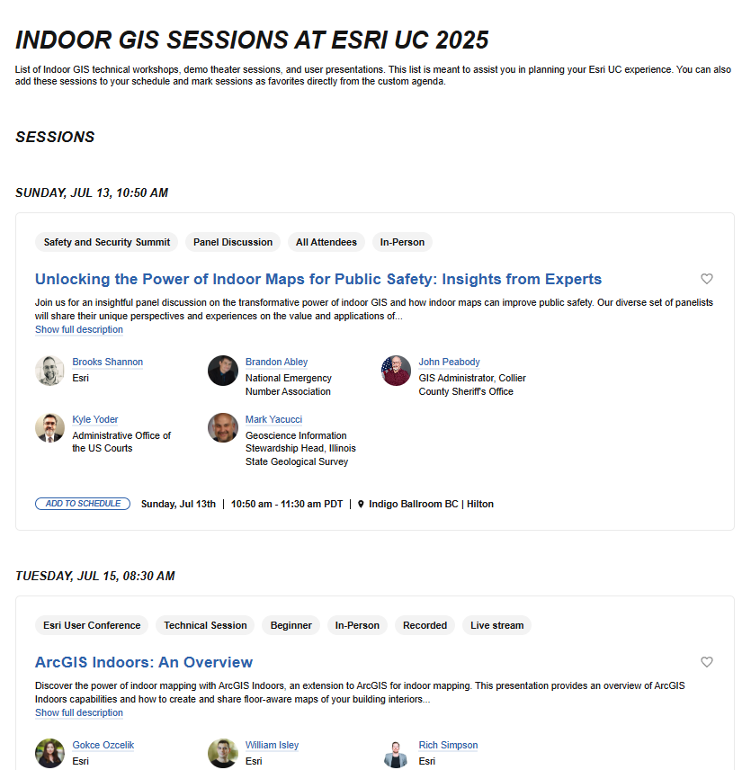
Unlocking the Power of Indoor Maps for Public Safety: Insights from Experts
Panel Discussion | Sunday, July 13 | 10:50 AM – 11:30 AM PDT | Indigo Ballroom BC | Hilton
Join us for an insightful panel discussion on the transformative power of indoor GIS and how indoor maps can improve public safety. Our diverse set of panelists will share their unique perspectives and experiences on the value and applications of indoor maps across a variety of public safety contexts. You will learn how a single indoor map can support multiple public safety use cases, breaking down silos and facilitating interoperability between agencies and systems. Discover the extended value of GIS-based indoor maps and how they can revolutionize emergency preparedness and response.
Technical Session | Tuesday, Jul 15 | 8:30 AM – 9:30 AM PDT | Room 5 A | SDCC
And Tuesday, Jul 15 | 2:30 PM – 3:30 PM PDT | Room 25 B | SDCC
Want to learn more about Esri’s field apps and how they can support your mobile operations? Join us to learn about key features and exciting new developments in the ArcGIS Field Maps, ArcGIS Navigator, ArcGIS Survey123, and ArcGIS QuickCapture mobile apps. Discover how these apps revolutionize field operations by increasing situational awareness and collaboration, both indoors and outdoors, increasing data quality and accuracy, streamlining field processes, and providing efficient navigation.
ArcGIS: How Floor-Aware Indoor Maps Can Improve Public Safety and Response
Demo Theater | Tuesday, Jul 15 | 4:00 PM – 4:45 PM PDT | OPS Center Demo Expo Theater | SDCC
Emergencies can occur anywhere and at any scale. Incidents inside buildings pose unique challenges, especially in large, complex structures or tactical situations. Detailed GIS-based indoor maps are crucial for locating callers and resources. Learn how emergency and first responder systems enhance situational awareness and response. Discover how ArcGIS aids in building, maintaining, sharing, and using 3D maps and floor-aware GIS data to improve emergency communications and protect communities.
User Presentations
Safer Schools with ArcGIS Indoors
Tuesday, Jul 15 | 8:30 AM – 9:30 AM PDT | Pacific Ballroom Salon 26 | Marriott
School safety and security encompass a range of tasks, many of which depend on locational data to move people and resources efficiently during an incident. Learn how ArcGIS Indoors helps schools create plans and manage incident responses.
Presented by: MGT Impact Solutions, LLC
Suggested Skills: Facility managers, School safety staff
More is Less: Increasing Efficiency
Tuesday, Jul 15 | 10:00 AM – 11:00 AM PDT | Pacific Ballroom Salon 26 | Marriott
More information can improve decision-making, leading to savings of resources and time. Learn how integrating weather data with utility and facility data reduces energy consumption and saves money, while adding ArcGIS Indoors Positioning System improves campus navigation and saves time.
Presented by: NV5 Geospatial Inc., Chicago Public Schools, Austin Community College, and Paratum Solutions
Suggested Skills: Facility managers, Operations and maintenance staff
Simplifying and Scaling Space Management
Tuesday, Jul 15th | 2:30 pm – 3:30 pm PDT | Pacific Ballroom Salon 26 | Marriott
Accurate and timely facilities data is critical to the operation of colleges and universities but can be difficult to maintain. Learn how universities use ArcGIS Indoors to integrate facilities data from multiple sources, track changes, and provide dynamic reports to improve space management and decision making.
Presented by: Arizona State University, Baylor University, and Dunaway Associates
Suggested Skills: Facility managers, Space managers
3D & BIM Lead Airports to Indoor GIS
Wednesday, Jul 16 | 8:30 AM – 9:30 AM PDT | Room 29 C | SDCC
Indoor GIS is a game changer for airport operators. Join this session to see how Metropolitan Airports Commission (MAC) is utilizing LiDAR to capture detailed 3D models of indoor spaces, significantly improving workflow efficiency and reducing the time from construction completion to GIS data availability. You’ll also hear how Denver International Airport (DEN) is at the forefront of GIS and BIM integration and is building a digital twin of the entire airport for holistic spatial awareness and asset management.
Presented by: Denver International Airport, HNTB Corp, Metropolitan Airports Commission, and NV5 Geospatial Inc.
Imagery, AI, and Indoors for Facilities Management
Wednesday, Jul 16 | 8:30 AM – 9:30 AM PDT | Room 27 B | SDCC
Join this session on advanced GIS in facilities management. The first presentation explores how 360 imagery and Esri’s ArcGIS Field Maps enhance the creation of floor plans with immersive panoramic imaging. The second presentation introduces a framework for responsible AI principles in geospatial workflows, showcasing real-life projects in public health and education. Attendees will gain valuable insights into promoting ethics, such as inclusivity and transparency in GIS projects, aligning sustainable practices with societal values.
Presented by: Johnson Mirmiran & Thompson Inc, University of Mississippi, and Paratum Solutions
Suggested Skills: Facility Managers, Urban Planners, AI Specialists
Digital Twins and Urban Wins: The Future of City Management
Wednesday, Jul 16 | 1:00 PM – 2:00 PM PDT | Pacific Ballroom Salon 18 | Marriott
Discover how Guam Department of Works are using ArcGIS to enable field crews’ swift deployment and response to a natural disaster. Meanwhile, Altamonte Springs, FL, in partnership with ETM, has developed a dynamic, photo-realistic 3D digital twin of Cranes Roost Park, integrating above-ground reality capture techniques with sub-surface infrastructure data. Learn how these innovations enhance decision-making, operations, and plans for smarter growth.
Presented by: Guam Department of Public Works, WSP, England-Thims & Miller Inc., and City of Altamonte Springs
Suggested Skills: GIS Analyst, Public Works Director, Technician, GIS Manager, City Manager, Asset Manager, Facility Manager, Utility Manager, Planner
School District Space Planning and Campus Scale Asset Management
Wednesday, Jul 16 | 2:30 PM – 3:30 PM PDT | Room 27 B | SDCC
Attendees will discover how to leverage 3D visualization and indoor GIS to improve decision-making and delivering innovative facility planning with GIS. HDR and Oak Ridge National Laboratory will discuss integrating 3D GIS models in ORNL’s Sitewide Master Plan for enhanced transparency and real-time updates. Langan Engineering & Environmental Services will cover the Puyallup School District’s transition from Cartegraph FMS to ArcGIS Indoors, highlighting the benefits of GIS for facility space planning.
Presented by: Brown University, Paratum Solutions
Suggested Skills: Facility manager, Urban Planner, Engineering Consultant, Environmental Consultant, Project Managers
Transforming Facility Operations with ArcGIS
Wednesday, Jul 16 | 2:30 PM – 3:30 PM PDT | Room 29 A | SDCC
NBC Universal utilizes a variety of web and mobile solutions to help them operate on a daily basis, and leverages Esri technology to support all these operations and present a clear and comprehensive view into their operations to leadership. This presentation will showcase how users at every level have adopted Esri technology, case examples of how the technology was integrated to workflows such as roadway management and façade inspections, and goals on their upcoming roadmap to continue to improve their efficiencies and enhanced insight to how their campuses operate.
Presented by: NBC Universal, Langan
Creating Sustainable GIS Programs to Improve 911 and Emergency Response
Thursday, Jul 17 | 8:30 AM – 9:30 AM PDT | Room 26 A | SDCC
Discover lessons learned from GIS professionals on implementing creative workflows and engaging a broad set of stakeholders to keep data accurate, up-to-date and accessible across a wide array of users. Learn how to create sustainable GIS programs that improve 911 and emergency response by establishing innovative, collaborative GIS programs that support public safety.
Presented by: Denco 911, GeoComm, University of North Texas, City of Abilene, and Resource Data Inc.
Suggested Skills: Emergency communications, Public safety
Nonprofits Embracing Tech for Modern Impact
Thursday, Jul 17 | 2:30 PM – 3:30 PM PDT | Pacific Ballroom Salon 25 | Marriott
EarthDay.Org, the Environmental Alliance, and the Henry Ford Museum demonstrate a commitment to innovation, data-driven decision-making, and enhancing stakeholder experiences through spatial analysis and mapping solutions. As one group demonstrates how they have grown GIS adoption throughout their organization, the other unites volunteers and shows their impact at a global level, which demonstrates there are no limits to what a nonprofit can do with GIS.
Presented by: The Henry Ford Museum, Environmental Alliance, Earthday.org, and dymaptic
Suggested Skills: Nonprofit Professionals
Special Interest Group Meetings
Reservation Required: Note that all Special Interest Group meetings require a reservation to attend. Please use Add to Schedule to reserve your spot or Join Wait List to be added to the queue.
Smart Campus Operations SIG: Indoor GIS
Wednesday, Jul 16 | 11:30 AM – 12:30 PM PDT | Room 29 D | SDCC
As indoor GIS evolves across education campus operations, facilities teams are consolidating their asset and space information into a single place, the indoor map. Join our Smart Campus Operations SIG to hear from your peers and learn how they provide easily accessible web and mobile apps for location discovery, asset tracking, wayfinding, room reservations, and space planning using GIS.
Emergency Communications SIG: The Intersection of Indoor Maps, Addressing, and Next Generation 911
Thursday, Jul 17 | 11:30 AM – 12:30 PM PDT | Room 31 B | SDCC
In this SIG, join us to explore how indoor maps, addressing, and Next Generation 911 (NG911) combine to revolutionize emergency response. Panelists will discuss how GIS supports the convergence of these topics, enabling faster, more effective response by increasing situational awareness and enabling interoperability. GIS professionals will share how they use ArcGIS to create indoor maps, manage addresses, and support NG911. This SIG will be of interest to GIS data providers who support public safety, telecommunicators, emergency responders, and security professionals.
Indoor Mapping Experience at Esri UC
Similar to past years, this year’s UC will provide an indoor mapping experience powered by ArcGIS Indoors. This web map is designed to help you familiarize yourself with the conference venue, plan your visit, and get directions once you’re on-site. In addition, the Esri Events mobile app for iOS and Android also can be used navigate to the showcase, sessions, and other points of interest.
Alternatively, there will also be directory kiosks at the conference venue. Attendees can use these to quickly find their destination and can even scan to transfer directions onto their phone by using the map in the Esri Events app.
We hope these details have sparked your interest in Indoor GIS and will serve as a great starting point for your exploration at the conference. We can’t wait to see you next month and dive deeper into the exciting world of Indoor GIS together!


Article Discussion: