The ArcGIS Living Atlas of the World provides foundational elevation layers and tools to support analysis and visualization across the ArcGIS system. These layers are updated quarterly with high‑resolution elevation data from federal agencies, open data sources, and the Community Maps Program. Esri delivers these datasets as ready‑to‑use services that benefit the GIS community and extend the use of elevation data in new and innovative ways.
In this release, World Elevation layers — Terrain and TopoBathy — have been updated with the following high‑resolution digital terrain models (DTMs):
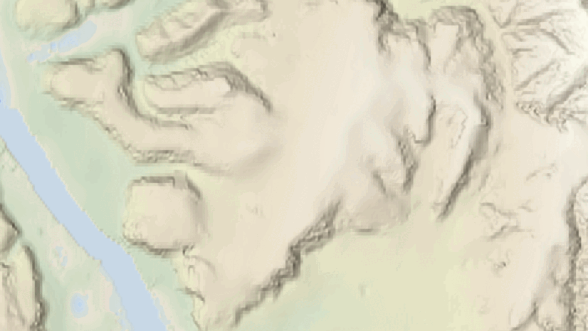
- Swisstopo’s 50‑centimeter lidar‑derived DTMs (swissALTI3D) covering Switzerland and Liechtenstein. This update is based on the latest six‑year lidar survey completed in 2025 and replaces the previous version of the dataset.
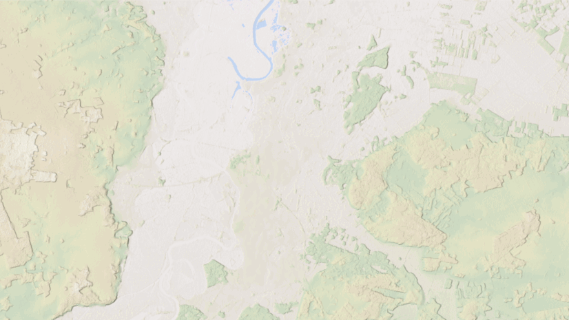
- Land Information New Zealand’s (LINZ) 1‑meter lidar‑derived DTMs add approximately 1,400 square kilometers (~540 square miles) of new coverage for New Zealand, bringing total coverage to approximately 232,550 square kilometers (~89,800 square miles).
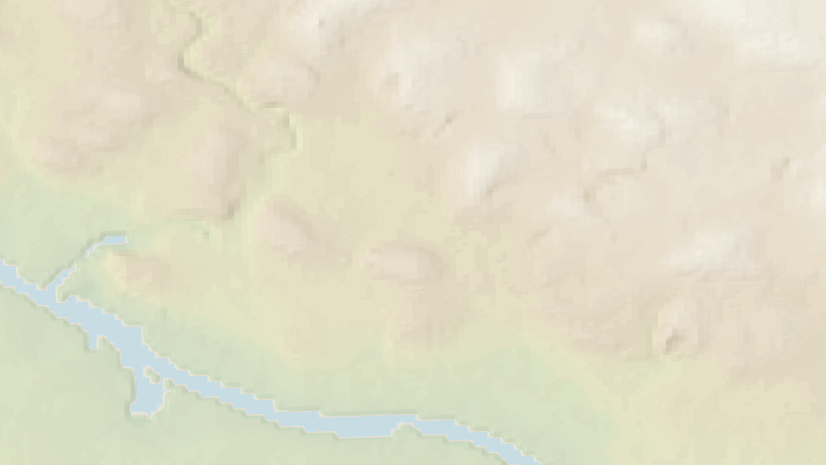
- Expanded coverage of USGS 3DEP 1‑meter lidar‑derived DTMs across the conterminous United States. Approximately 20,000 square kilometers (~7,700 square miles) of new coverage have been added in this release.
- The latest USGS 1/3‑arc‑second (~10 meters) seamless DEM dataset, providing full coverage of the 48 conterminous United States, Alaska, Hawaii, and U.S. territories.
- The latest USGS 1‑arc‑second (~30 meters) seamless DEM dataset for the conterminous United States, Alaska, Hawaii, Canada, and Mexico.
Let’s explore a few examples that highlight the improvements.


These data updates are expected to roll out to the World Elevation tiled services, including Elevation 3D (Terrain3D and TopoBathy3D) and Hillshade (World Hillshade and World Hillshade (Dark)), by the end of the next quarter.
To view the coverage extents of each source comprising World Elevation services, explore the World Elevation Coverage Map.
You can help improve these services by contributing high-resolution elevation data to Living Atlas of the World. To participate and learn more, check out the Esri Community Maps for Elevation program.


Article Discussion: