These activities are great for at-home learning and something any parent, guardian, or teacher can do with their child or student. Some activities can be done totally free! However, some of the best stuff in GIS requires an ArcGIS Online account. First, we recommend you check with your school to check if your child already has a school account so they can save and share their work when school returns. If your learner does not have an account, a parent or guardian can sign up for a free summer-long account at Learn ArcGIS website for access to all the tools you need to become a mappy family.
Ever look around and notice all the different types of trees? Maybe it was on your street, in your favorite park, or in the car driving down the highway. There are thousands of different types of trees (or species) just in North America. We can build maps of all of these trees that help us understand them better.
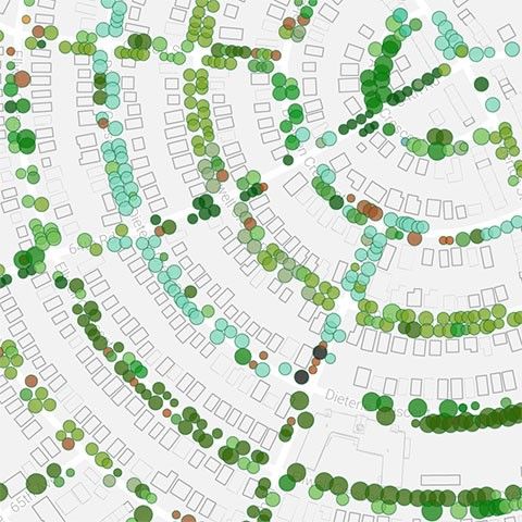
Your city might make a map of neighborhood streets so that they can find areas that need more shade.
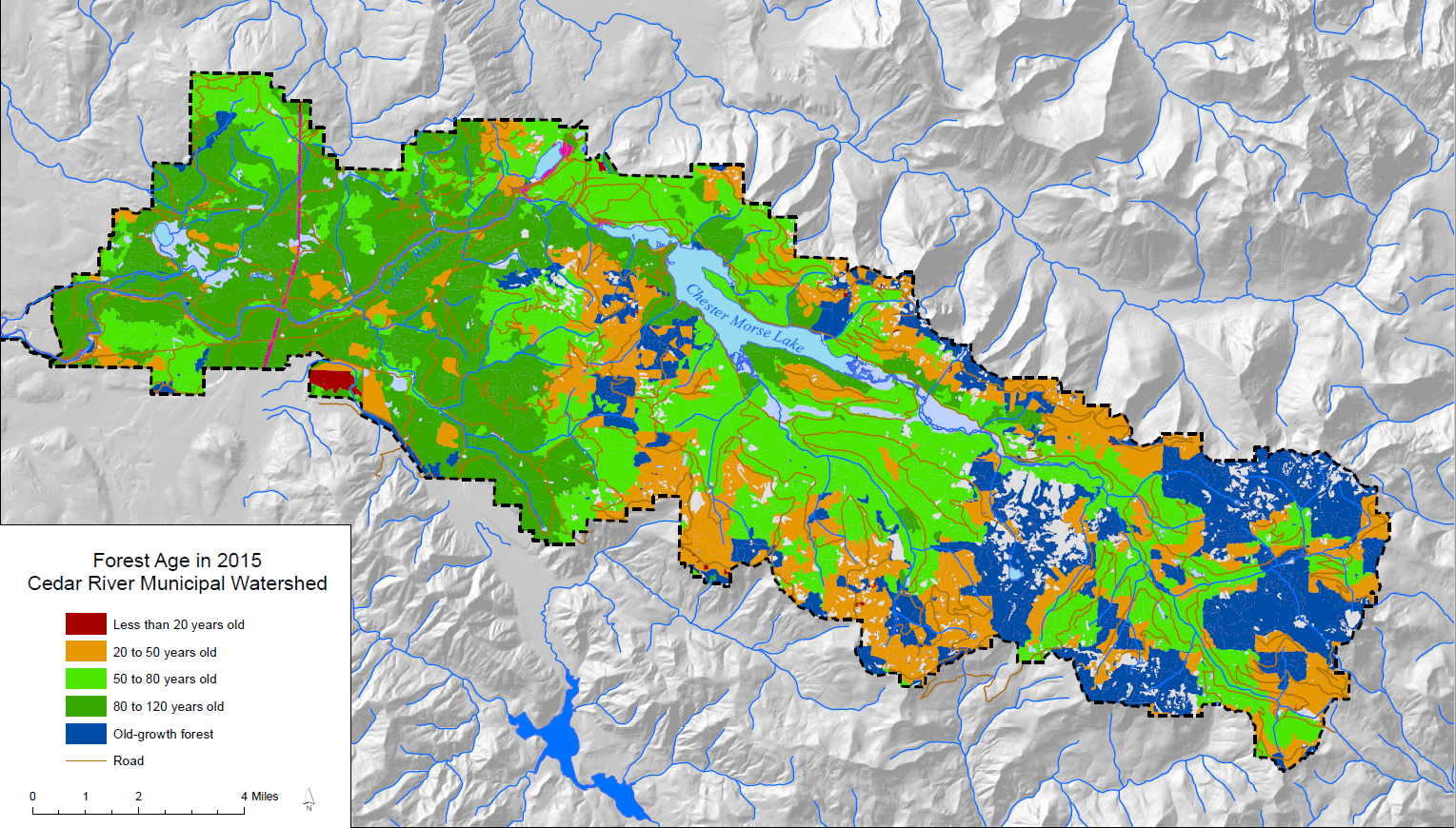
A conservation group might make a map of the age of all of the trees in a forest to make sure that it isn’t over-harvested.
There are so many ways to map trees. Sometimes the best way to start a map is by asking a question, such as “What is the most common tree in every forest in the United States?”
That map looks like this.
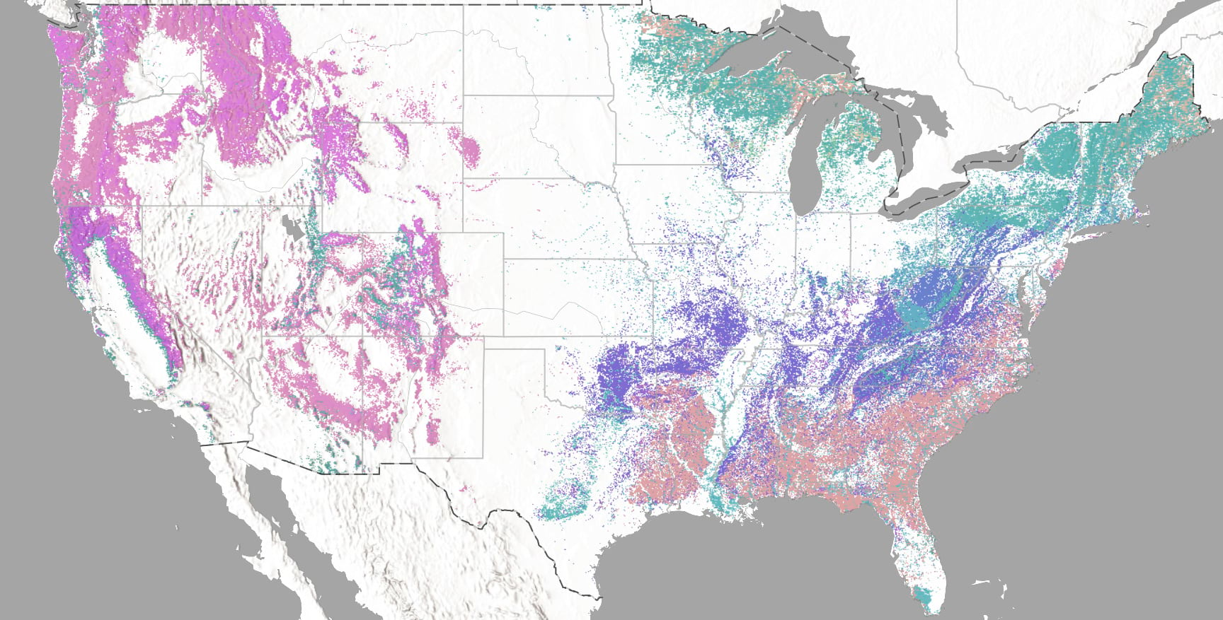
There are 144 different colors on that map, each for a different type of tree. We can also change the map and use colors to tell a different story. I can think of a few, how about you?
- What is the color of the tree leaf or needle?
- What color does the tree turn in the fall?
- How tall does the tree grow?
A more fun map might be, “Where are the best trees to climb?” Let’s think about how we can make this map.
Mapping the Best Trees to Climb
To start, let’s open up the map online. Click here. On the left side, click on Legend and you will see each type of tree and its color on the map.
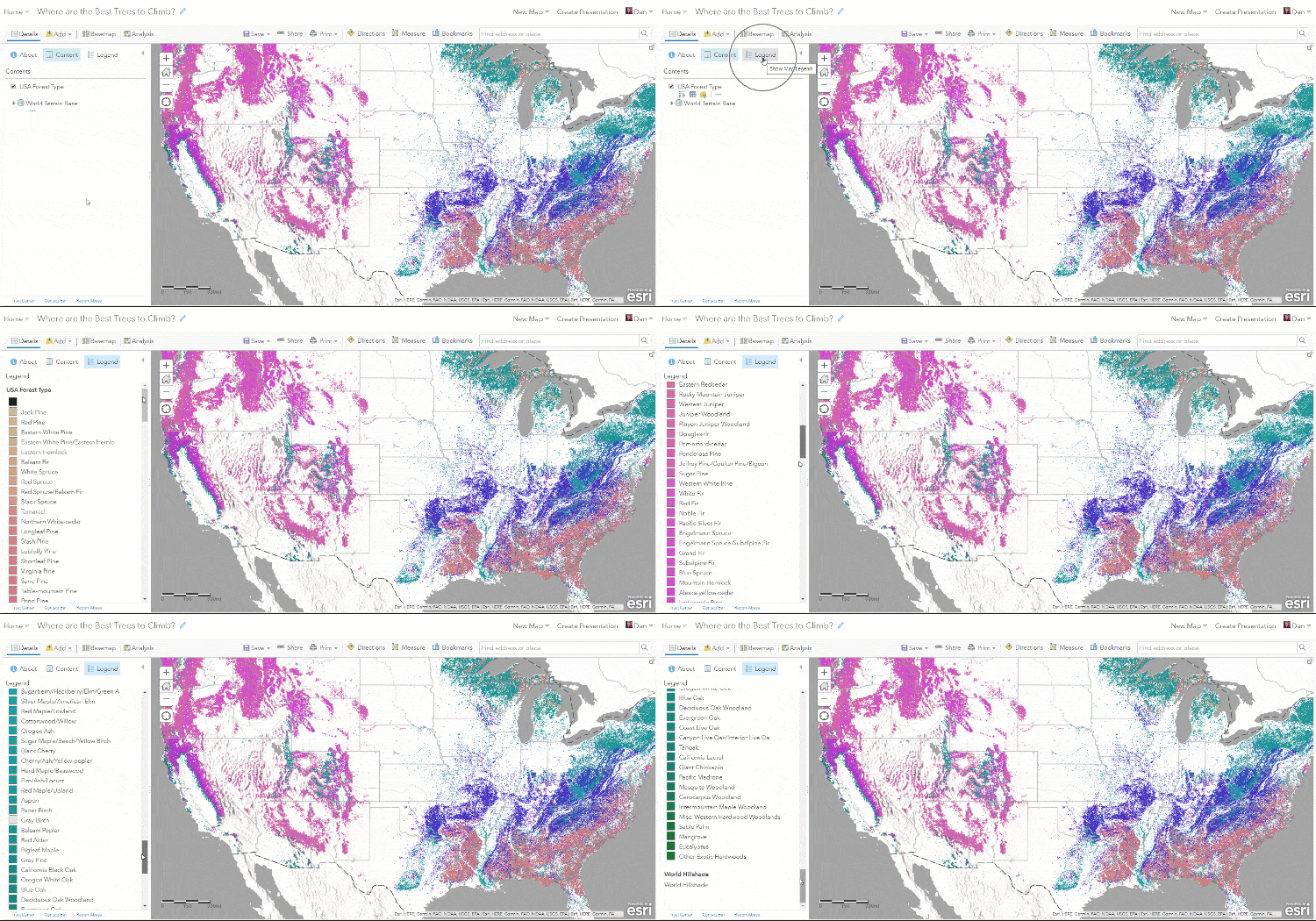
We are going to look up each of the tree types online and give them a climbing grade: Cannot Climb, Bad for Climbing, Good for Climbing, Best for Climbing. Each grade will have a color.
These are grades and colors that I picked. You can pick your own and grade trees however you like.

Each color has a special code name so that the map knows how to show it.
Cannot: 998981
Bad: ff7871
Good: b0ffb8
Best: 71cc56
You can pick your colors and find the code names using this tool. When you find the color you want, copy down the code in the box called HEX.
Changing the Map Colors
Now we are ready to start changing the current map into the climbing map. Here are the steps:
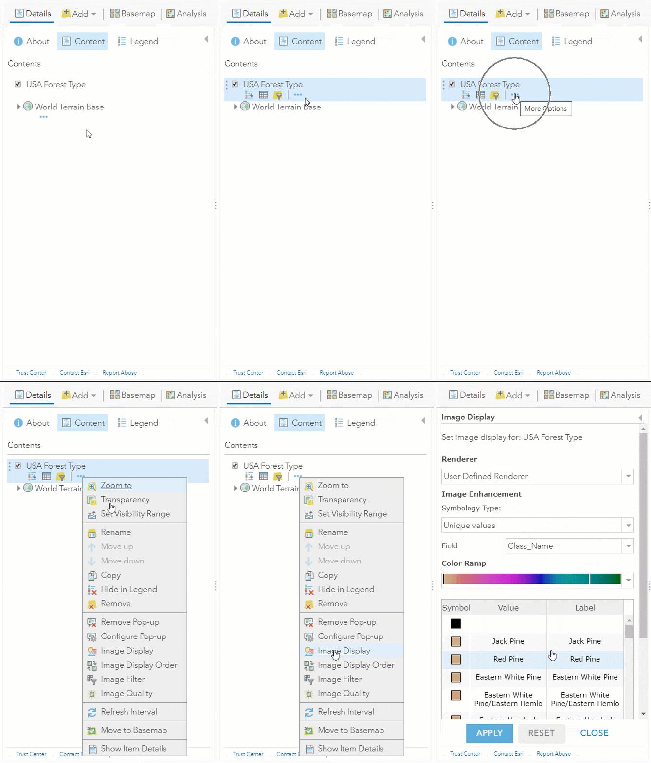
Step 1: Go into Image Display on the USA Forest Type layer
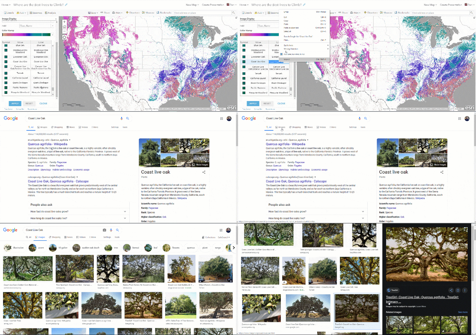
Step 2: Search for each tree by right clicking on the tree name and select “Search Google for” or copy and paste the name into your browser and search for an image. Give the tree a grade. I think the Coast Live Oak is Best for Climbing.
Step 3: Add the color code for the grade into the color box.
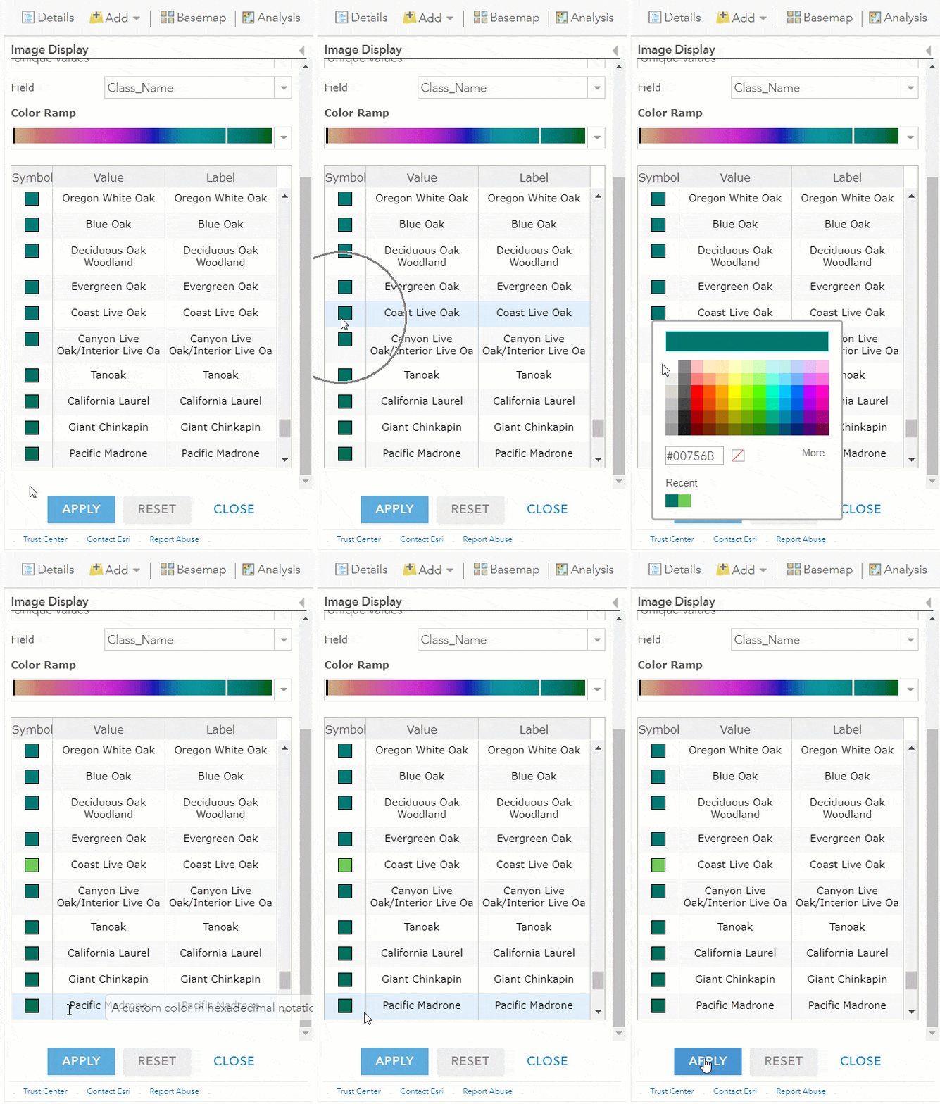
Step 4: Repeat for each tree type.
Once you are done, you have a new map. Be sure to save it and show your friends and family. You can also start over and answer another question about trees and forests. Or start tackling another #TakeYourWorkToKidsDay Challenge!


Article Discussion: