The Wayback in ArcGIS Living Atlas is an application that provides discovery, visualization and utility tools that help explore every release of the World Imagery basemap. World Imagery provides one meter or better satellite and aerial imagery for most of the world’s landmass, and lower resolution satellite imagery worldwide. When and where updates occur, the previous imagery is replaced and is no longer visible in the basemap. The Wayback exists to provide users with access to previous versions of World Imagery. Each layer in the archive represents a version of the entire basemap, as it existed on the date it was published, including the most recent version.

What’s new in Wayback?
- Publish a subset of World Imagery as a hosted tile layer to your ArcGIS Online organization. This functionality supports several use cases, including AI with World Imagery workflows that can be performed end-to-end in a web browser for optimal accessibility.
- Save, share, and revisit Wayback Updates Mode. Publication Status categories have been expanded, and URL serialization preserves the current search state allowing searches for updates to World Imagery to be easily bookmarked, shared, and revisited.
- Manage web map creation from within a dedicated panel which allows users to review and manage versions and map extents before saving content to their ArcGIS Online organization.
These updates require the user to authenticate with their ArcGIS Online organization.
Publish a World Imagery tile layer
From the Explore Mode of the Wayback, select any release, and publish a subset of World Imagery as a tile layer directly to your ArcGIS Online organization. World Imagery tile layers created via the Wayback facilitate ArcGIS Online workflows that can be performed end-to-end in a web browser such as feature extraction with AI and World Imagery.
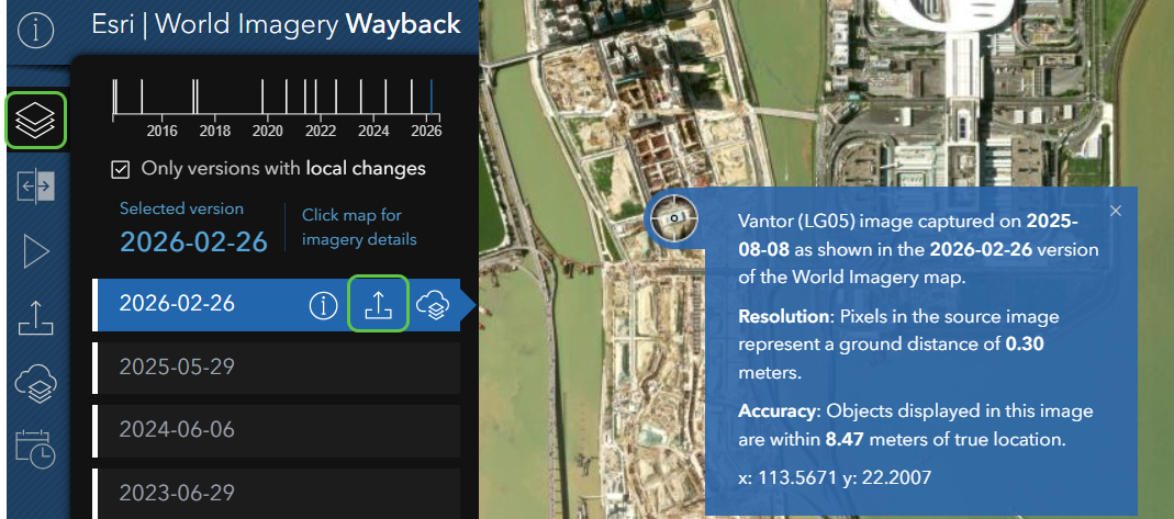
The Explore Mode of the Wayback is accessed by clicking on the layer stack icon from the toolbar on the left-hand side.
Releases of World Imagery are listed by their publication date YYYY-MM-DD. Click on a version to select it and it will be highlighted in blue. Once selected, you can click on the map to see a pop-up with additional information including the imagery provider, capture date and spatial resolution. With a version selected, click on the Export Tile Package icon on the version to activate the Tile Export options.
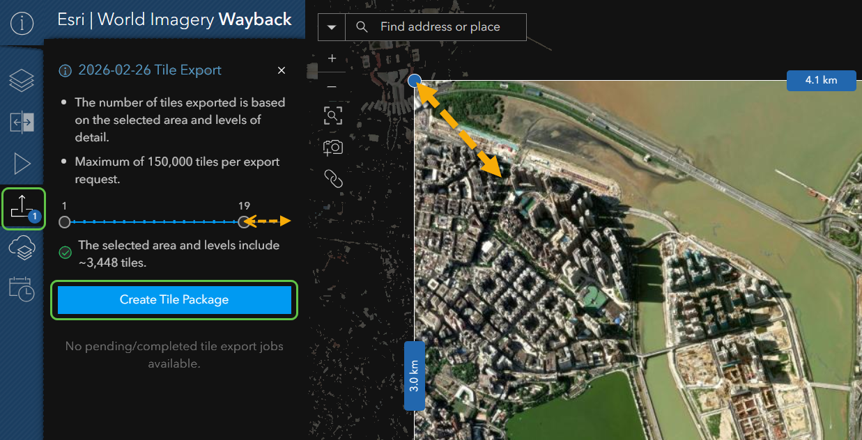
Use the level slider to target the required level of detail. Adjust the extent by dragging the selection window to focus on your area of interest. Limiting the levels or reducing the extent decreases the number of tiles included in the export. Click Create Tile Package to begin the export.
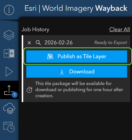
Once the tile package is created, you will be presented with the option to download the tile package for offline use in ArcGIS or select Publish as Tile Layer to publish directly from the Wayback to your ArcGIS Online organization.
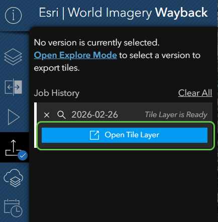
Once a tile layer is published, you will see an option to Open the Tile Layer in ArcGIS Online directly from within the Wayback.
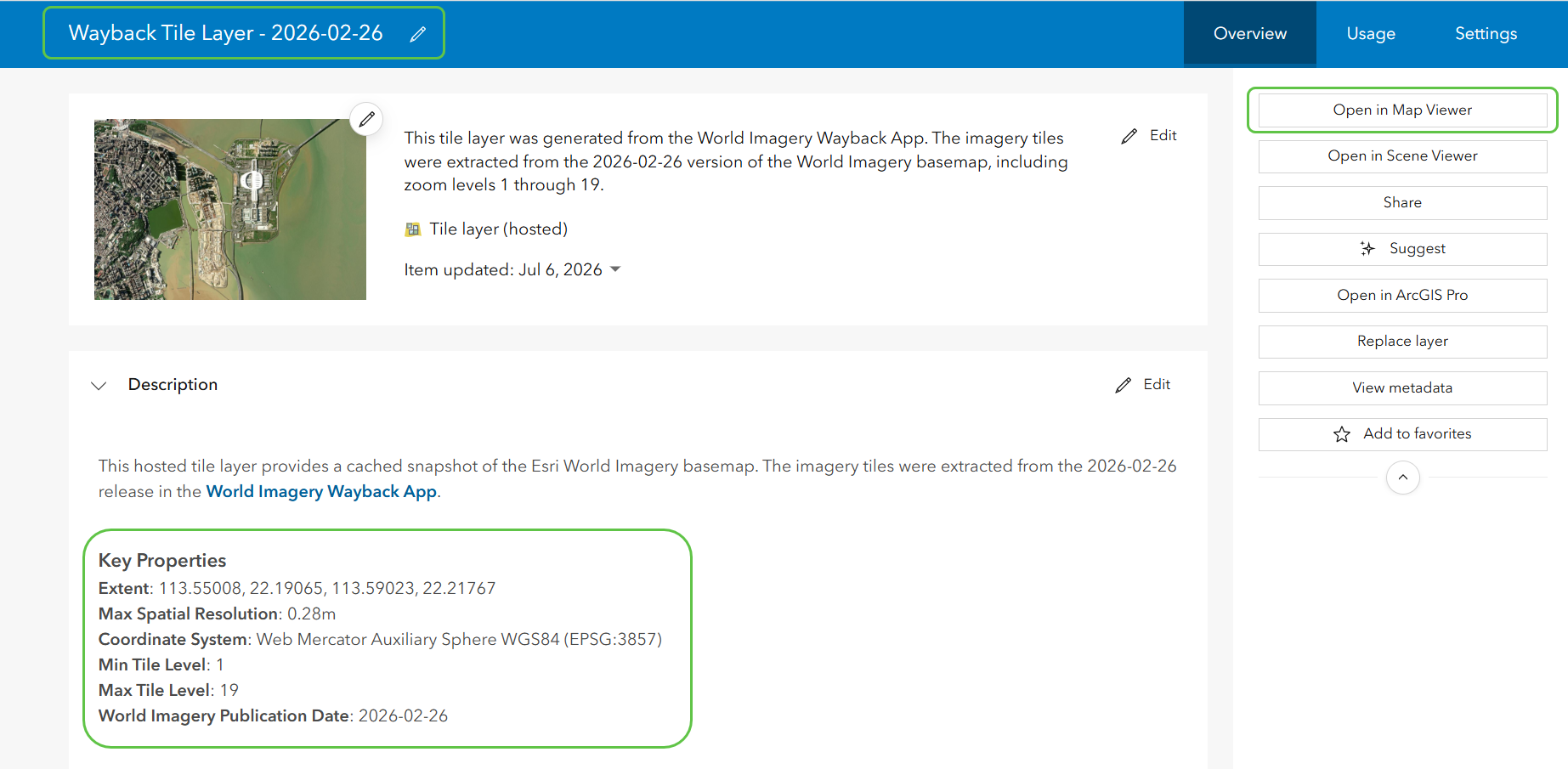
In ArcGIS Online, you can view the item details. View the description to see Key Properties about the extent, spatial resolution and World Imagery publication date of the tile layer. You can rename and update the item details as necessary, and Open in Map Viewer.
Save and Share the Wayback Updates Mode
The Updates Mode in the Wayback allows users to track where, when and what World Imagery updates have been recently published or are pending publication.
Feature enhancements to the Updates Mode provide expanded publication status categories, and search URL serialization that makes it easy to save and share specific search results by capturing all selected search criteria – including imagery category, publication status and geographic region – directly within the URL. This feature lets users save and share searches, reference preconfigured queries, and quickly return to results without re-entering parameters, improving collaboration and efficiency.
The Updates Mode can be accessed from the tool bar on the left-hand side of the Wayback by clicking on the clock and calendar icon.
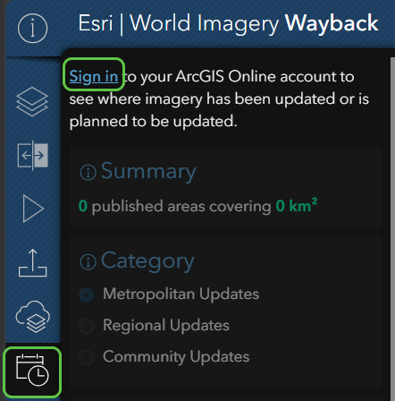
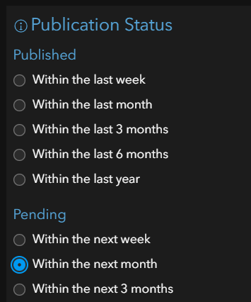
Updates Mode provides several ways to filter and refine the search for updates to World Imagery including Imagery Category, Region, and an expanded Publication Status that offers the following Publication Status options:
To save the current state of the Updates Mode, simply adjust the filters to match your search needs, and then click on the link icon in the map to save the serialized URL link.
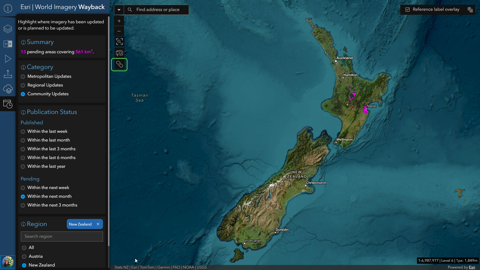
The copied serialized URL for the above search: Community Updates pending for New Zealand within the next month can persist and be shared. The results of the search will change over time, but the search parameters will remain consistent.
Manage web map creation
The Wayback has added a dedicated Create Web Map panel that allows users to review and manage selected versions and map extent prior to web map creation.
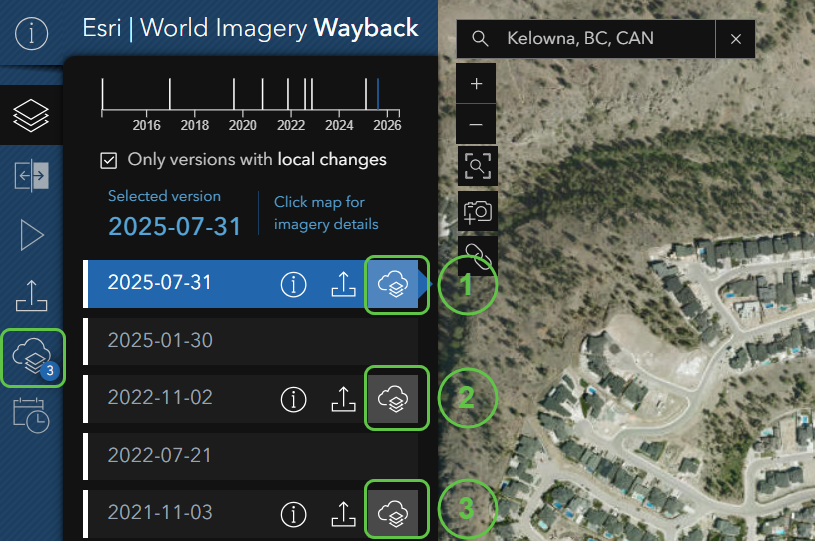
To add a version of World Imagery to the Create Web Map panel, select a YYYY-MM-DD version in Explore Mode, and simply click on the Cloud Layer Stack icon on the release version. In the example below, three versions of World Imagery have been added to the Create Web Map panel.
Once in the dedicated panel, the user can set the extent by modifying the extent of the map with the Wayback, remove World Imagery version layers, and customize Title, Summary and Tags prior to selecting Create a Web Map.
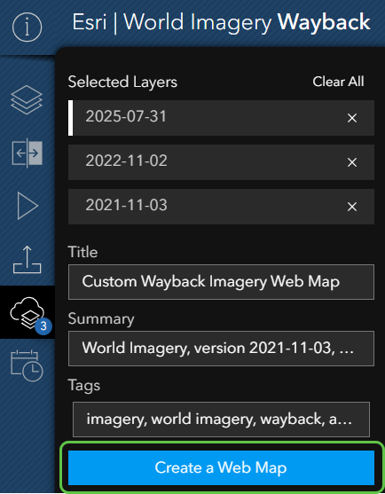
The default Summary will list the YYYY-MM-DD of all selected versions. For the example above, the default summary is:
“World Imagery, version 2021-11-03, 2022-11-02, 2025-07-31. Created using the World Imagery Wayback application, a global digital archive of Esri’s World Imagery map.”
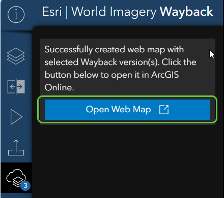
If a version is removed prior to web map creation, the Summary is automatically updated to include only selected versions of World Imagery. Once the web map is published, you can Open Web Map in ArcGIS Online directly from Wayback.
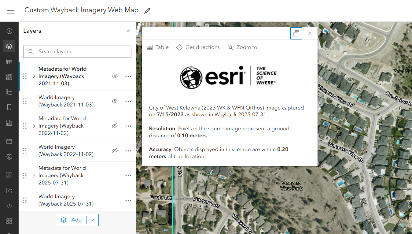
The resulting web map will contain both the World Imagery tile layer and the metadata for each version of World Imagery that was added using the Create Web Map panel in Wayback.
Additional Resources
Explore imagery archives using World Imagery
Wayback More articles on Wayback
Credits
Wayback System Architecture: Dr. Lucian Plesea
Wayback App Development: Jinnan Zhang
Wayback App Design: John Nelson

Article Discussion: