World Imagery is Esri’s flagship imagery basemap, providing high-resolution imagery around the world. From visual context to geospatial AI, World Imagery supports a wide range of workflows and applications providing ArcGIS users with a wealth of information and insights.
Over the past year, the ArcGIS Living Atlas team has been busy making updates and enhancements to World Imagery. As we make updates, the World Imagery Wayback archive continues to grow and we continue to add capabilities to the Wayback app. You can read more about that here.
As of July 2026, we are not only continuing to add value with high resolution aerial imagery through Community Maps, and global high-resolution satellite imagery from Vantor, we are adding two important new data sources and committed refresh with long time Esri partners, Nearmap and Airbus.
Nearmap
Founded in 2007, Nearmap is a global property intelligence company that helps organizations understand and act on the built environment. Nearmap owns the entire intelligence value chain, from high-recency geospatial capture powered by patented camera technology to accurate AI-derived analytics and guaranteed building materials data. This gives insurers, government agencies, and AECO organizations a single, trusted source of truth for property decisions.
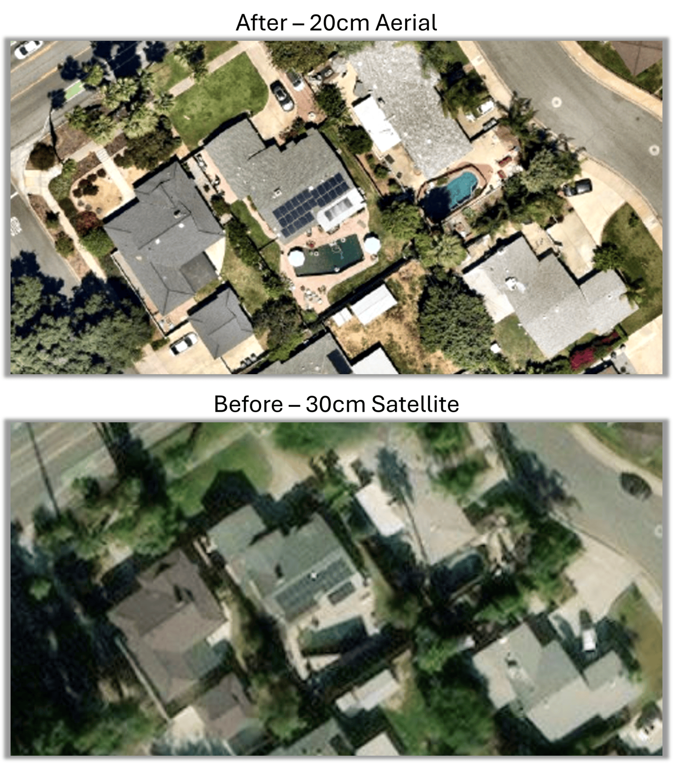
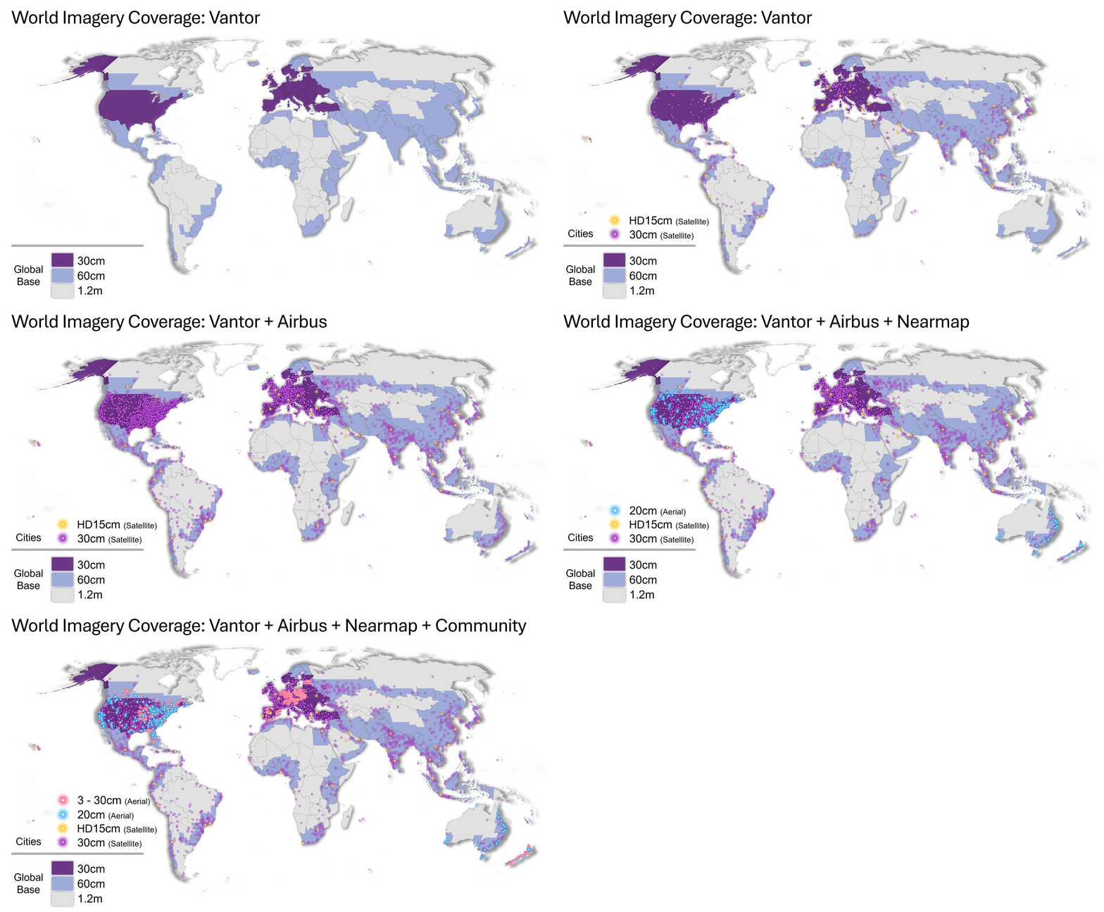
Starting in the second half of 2026, Nearmap 20 cm vertical imagery will be integrated and regularly updated in World Imagery for 200 metropolitan areas across the United States, Canada, Australia, and New Zealand. Nearmap capture spans nearly 90% of the US population and 96.5% of the Australian population.
Airbus
Airbus Defense and Space has been delivering accurate and consistent imagery for more than 35 years, supporting its customers by providing sophisticated geo-information services and turnkey integrated solutions that deliver the right information at the right time and in the right format. These solutions range from data acquisition and processing to advanced analytics and data management, and are designed to strengthen how customers plan and respond to challenges and missions – with greater speed and higher certainty.
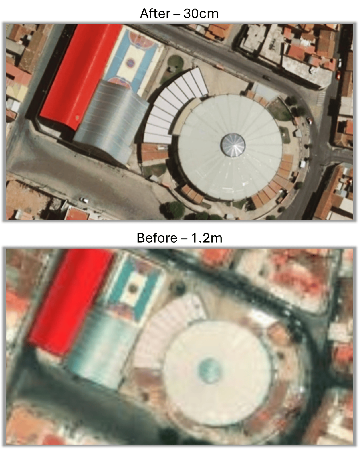
Starting in the second half of 2026, Airbus will begin delivering 2,000 cities around the world. Airbus basemaps are highly accurate, color-consistent and provide nearly cloud-free coverage with minimized haze and seasonal differences between contiguous images. This committed refresh at 30 cm will help provide fresher and more detailed imagery for cities around the world.
Vantor
Vantor brings decades of deep mission understanding and their industry-leading imaging satellite constellation. Vantor’s spatial intelligence system combines software, AI, and highly accurate data to build a living digital twin of Earth—a global-scale, interoperable spatial foundation that can connect sensors across the space, air, and ground domains.
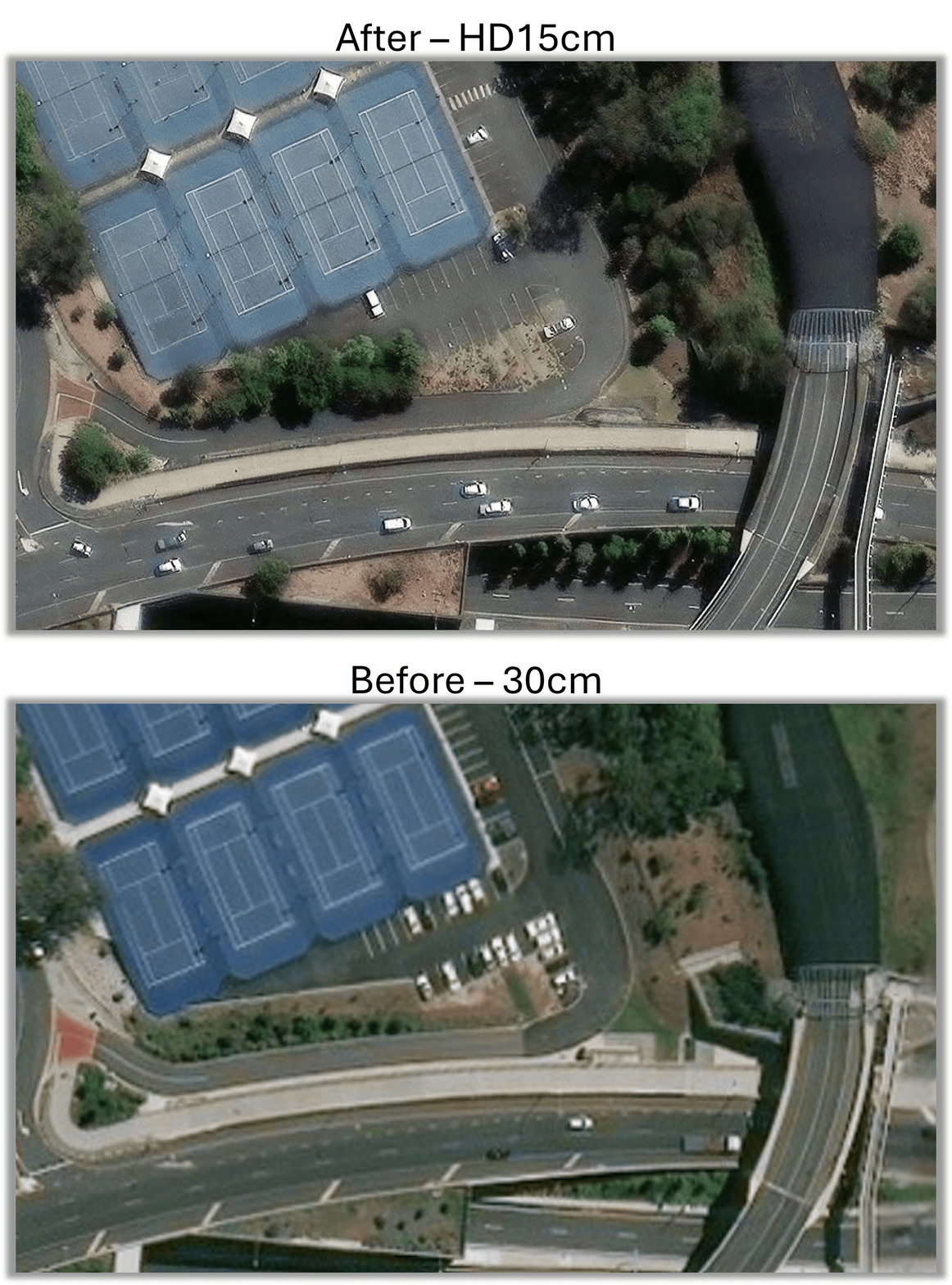
Vantor’s Vivid Mosaic delivers the world’s first 30 cm global basemap, with up to 15 cm resolution in the most dynamic regions. Map, visualize, and detect feature-level changes anywhere on Earth with unmatched clarity and precision.
Vantor imagery continues to provide the global base for World Imagery and committed refresh for 800 cities at 30cm or better. Starting in the second half of 2026, forty major cities and capitals around the world will be upgraded to include HD15 cm imagery.
Community Maps
For over a decade, Esri has maintained a Community Maps Program through which the GIS community has shared their local, authoritative data with Esri to be used in maps and services that we create and provide back to the community. The imagery contributions come from local and national mapping agencies around the world and through Esri Distributors and partnerships.
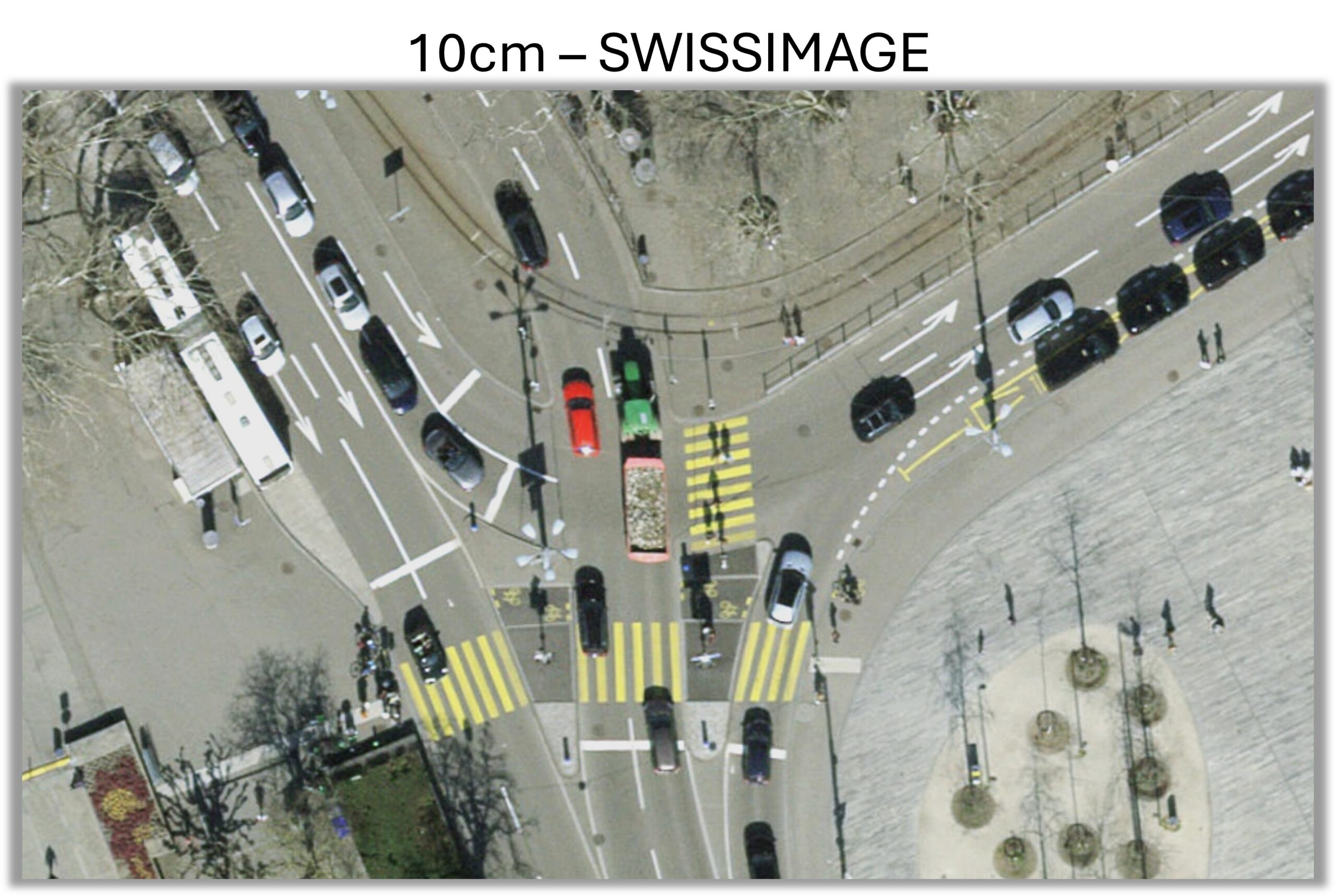
Year over year, this imagery continues to enhance World Imagery with recent, high-resolution aerial imagery ranging from 3 to 30 cm.
Coverage Summary
In summary, here is what the buildout of World Imagery looks like starting in H2 2026 and continuing through 2029.
Related Resources
- Analyzing solar adoption in ArcGIS Online Part1: AI and World Imagery
- Use AI and World Imagery for feature extraction in ArcGIS Pro
- World Imagery Wayback articles
A special shout out to everyone involved:
Esri business management and legal teams
Esri partners Vantor, Nearmap and Airbus
Community Maps, Esri Distributors, and the GIS community
Living Atlas imagery basemap development and production teams

Article Discussion: