The judicial Power of the United States, shall be vested in one supreme Court, and in such inferior Courts as the Congress may from time to time ordain and establish. The Judges, both of the supreme and inferior Courts, shall hold their Offices during good Behaviour, and shall, at stated Times, receive for their Services, a Compensation, which shall not be diminished during their Continuance in Office.
In American life, our courts and rulings made by judges who preside in them impact the public every day. I have been interested in the federal court system since I served on a federal jury in 1994. Sitting, listening, and learning during the trial and watching how the judge interacted with all participants made a real impression on me.

When I would hear news involving a certain court, there was always a missing piece of information, something that I felt would improve what I understood about a case or ruling. I would read about the U.S. Court of Appeals for the Ninth Circuit or maybe learn about something in the Western District of New York. The missing piece was an actual location of the court or a judge. Often, I did not know anything about the judge. Where would the ruling impact someone? A connection grows stronger when we understand where an event is happening.
Active Federal Judges layer is updated daily
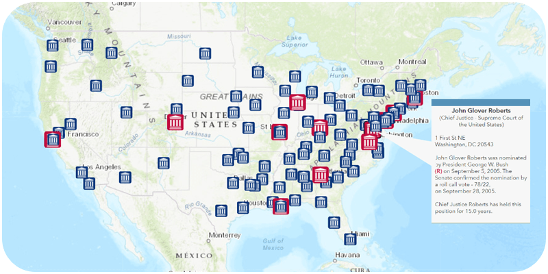
The Active Article III Federal Judges feature layer makes that connection. It provides details about all active judges serving at the federal Supreme Court, appellate courts, district courts, and the Court of International Trade. It also provides insight into an area where two independent branches of the U.S. government (Executive and Legislative) directly affect the other (Judicial).
The source data on the judges is available from the Federal Judicial Center’s (FJC) Biographical Directory of Article III Federal Judges. The FJC is the education and research agency for the federal courts. Once the FJC updates the source data, processing takes place on a copy of it and the feature layer updates. This is a daily process.

There is plenty of information about each judge that details their nomination and approval process.

What is in there and why is it important?
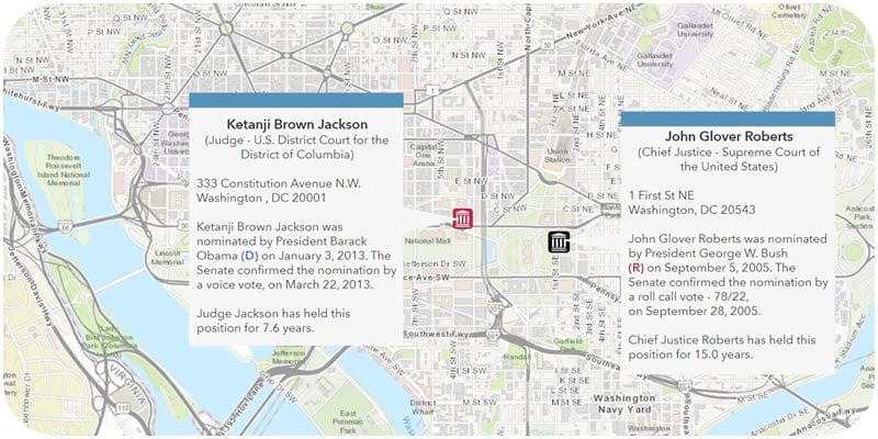
The president, as the leader of the Executive Branch, begins the process by nominating a person deemed worthy of the seat that is available. The U.S. Senate provides advice and consent on the nomination. In this portrayal, the layer shares information about the title of the judge, the individual court, the location of the court, the name and political party of the president, the nomination date, the type of Senate confirmation vote, the result of the vote, the confirmation date and the length of service by each judge in their current position.
Why is this information important? Landmark cases shape our history. Brown v. Board of Education (separate schools are not equal), Miranda v. Arizona (police must inform suspects of their rights before questioning), and other high-profile rulings fundamentally altered activities long established in our country. Those types of decisions and thousands that are less well-known are made by judges listed in this dataset. To learn more about the source data and other available datasets, visit the FJC.
Use and configure the layer to support your work
This dataset contains information for all Article III federal judges (more than 4,400). The default filter shows only those who are active. Deceased judges or those who are now in Senior status are available for inclusion in a different portrayal. Revise the filter in use for this feature layer. This includes judges in courts that no longer exist. Information about John Jay (first Chief Justice of the Supreme Court), Thurgood Marshall (chief attorney in Brown v. Board of Education and later Supreme Court Associate Justice), Ruth Bader Ginsburg, and many others are available. Combine this layer with others in a web map to provide greater context. For example, add U.S. District Courts. Now you see boundaries for a set of courts. There are many ways to explore this data. Check it out in ArcGIS Living Atlas.


Article Discussion: