Your organization can contribute its local, authoritative content to the Community Maps Program, which is a part of the ArcGIS Living Atlas of the World. Your data is integrated with data from other providers and published and hosted by Esri as part of ArcGIS Online reference and thematic basemap layers.
New Communities and Updates
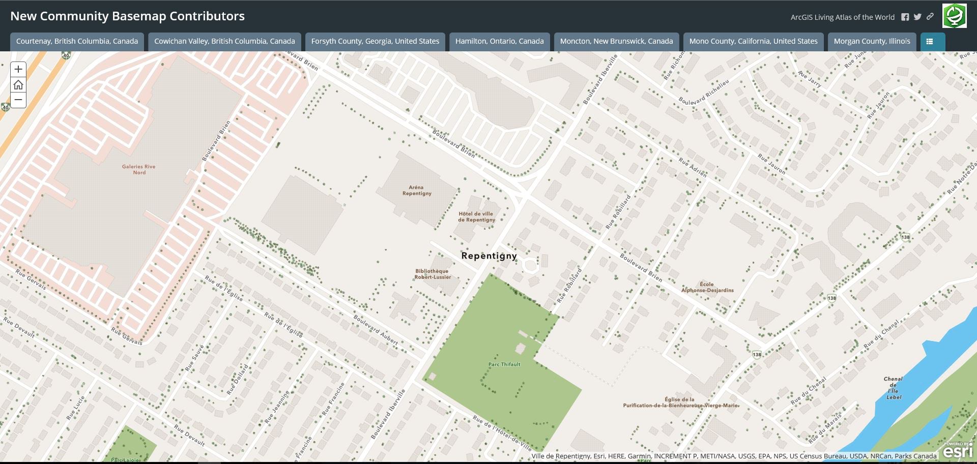
The Community Maps Team is off to a busy start this year. Since January we have published new and updated basemap and imagery content for 146 communities! These new and updated communities include countries, counties, cities, campuses, and provinces throughout Canada, Europe and the United States. In addition to these updates, our expert Living Atlas cartographers have created a new basemap style we call the ‘Community’ style.
This new basemap style provides a customized world basemap that is uniquely symbolized. It is optimized to display special areas of interest. These special areas of interest include landscaping features such as grass, trees, and rock and sports amenities like tennis courts, football and baseball field lines, and more. This vector tile layer is built using the same data sources used for the World Topographic Map and other Esri basemaps. This new style brings large-scale map features to life as illustrated in the example below. Click on the image for an interactive map.
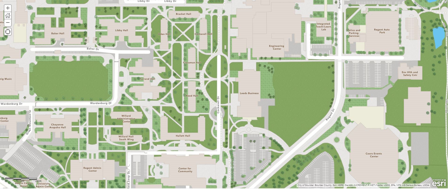
Let’s have a look at our new communities rendered with the new Community style. by clicking on the image below.
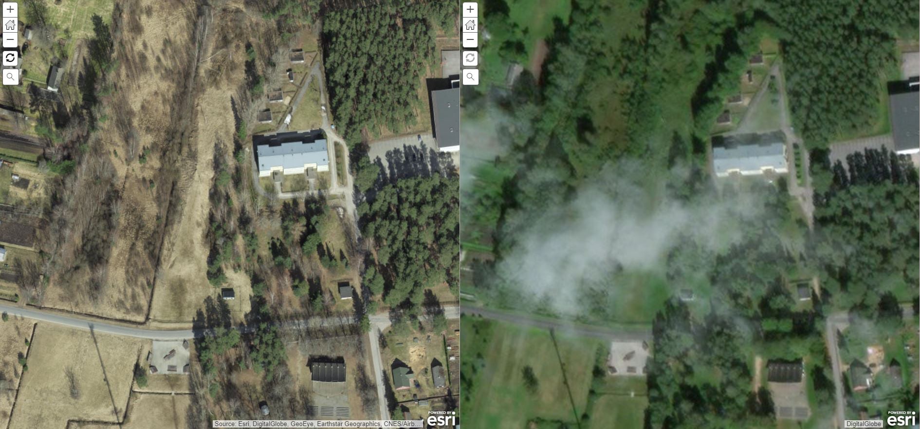
The high-resolution imagery being shared to the Living Atlas through the Community Maps Program continues to add significant value to imagery service users worldwide. A few examples contributed by the Estonia Land Board can be viewed below, just click on the images for a larger view.
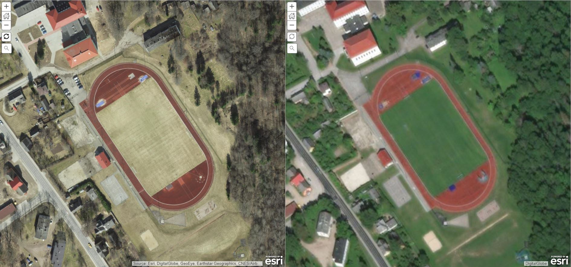
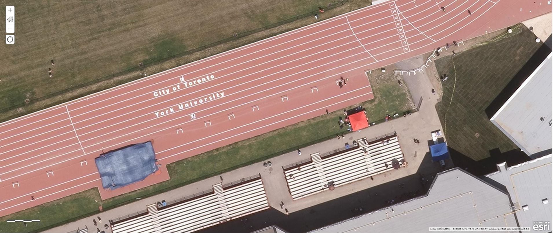
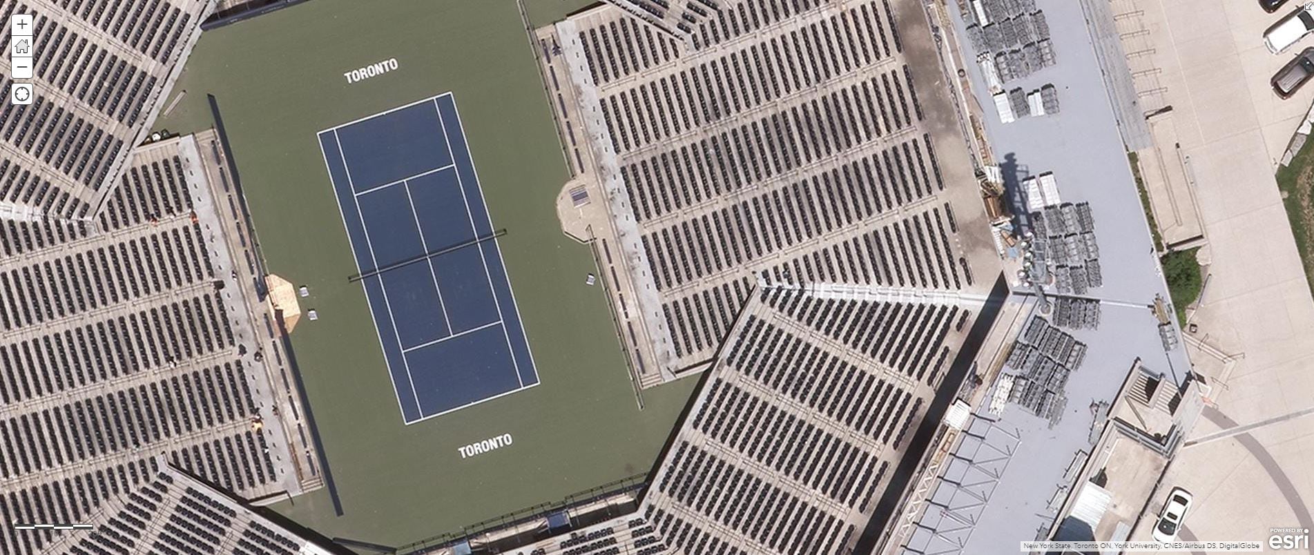
Areas surrounding York University in Toronto, Canada have been updated with imagery taken just 4 months ago with a resolution of 0.1 meters. Click on the images below to explore an interactive map.
How do I contribute?
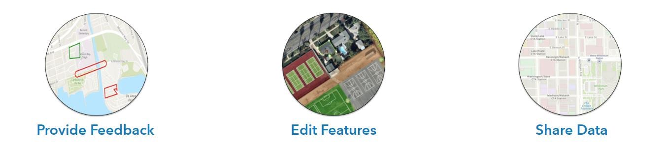
It’s easy! The Community Maps Program works with authoritative GIS data contributors to build the ArcGIS Living Atlas of the World consisting of reference and thematic maps covering a wide variety of topics. Community Maps Program contributors participate by sharing data to one or more of these communities. If you are wondering how to best share your local geographic knowledge, start by clicking the image below to better understand how your organization can participate.

Commenting is not enabled for this article.