ArcGIS Mission allows mission members to operate in the field through use of the ArcGIS Mission Responder app. Mission Responder users are highly mobile, able to operate in a wide variety of environments and participate in mission-critical workflows, such as gathering information, communicating with each other, and fulfilling tasks assigned to them by Mission Managers.

As Mission Responder users move through different areas, they may experience different levels of connectivity or change networks as they move. To allow users to make the most of their tools, ArcGIS Mission Responder can operate in one of four connection statuses.

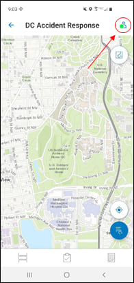
Connected, Active: This status is most commonly seen when a user is on the mission map. It indicates that a user has made a connection to the server and is visible on the map to other mission members. The Connected, Active status can be thought of as the default operational status for most missions.

Connected, Inactive: This status is visible when a user enters the Mission Overview, prior to entering the mission map. It indicates that a user has made a connection to the portal but is not sending tracks, and therefore not visible on the map yet.

Connected, Peer-to-peer (P2P): This status only appears when a user is disconnected from the ArcGIS Mission Server but remains connected to other Responder users via a local-area-network (LAN). The P2P status will likely only be seen in missions which have been prepared for it, which means that it will be a deliberate action on the part of the user to switch to a network configured for it. In P2P, users have access to all the tools they have when connected, and can still communicate with other Mission Responder users. However, while in P2P, the data being generated is stored locally on the device until a connection to the server is reestablished, when it is forwarded to the ArcGIS Mission Server.

Disconnected: This status indicates that a user has lost connection to the Mission Server and is not connected to other users by LAN. Operating while disconnected can occur if a user loses connection to their cellular network after, for example, entering a tunnel or other underground facility. While disconnected, users can still operate inside the mission independently, but cannot communicate with other mission members. All information generated while disconnected is stored locally and forwarded after a connection to the Mission Server is reestablished.
The Mission Responder app will automatically detect changes in network or connection and switch to the most appropriate connection status, although it should be understood that this can be dependent on device settings and capabilities. Under ideal circumstances, these transitions will occur instantly and cleanly, but users should be prepared for some degree of lag while the device searches for the most appropriate connection.
When a Mission Responder user reconnects to the Mission Server, all the data they created while disconnected (including location tracks) goes through a forwarding and deconfliction process, and their app is synced with the mission.

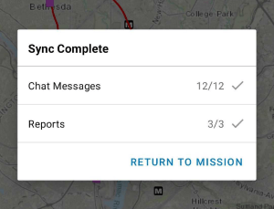
Once the reconnection sync process is complete, users are notified of how many messages, reports, and tasks they forwarded, and whether there were any sync conflicts. After that, they can continue working in the mission.
To learn more about ArcGIS Mission, sign-up for product announcements (latest release updates and product news), or contact an Esri Sales Representative, visit go.esri.com/arcgismission.


Article Discussion: