ArcGIS Mission is interconnecting managers and responders and enabling analysts, mobile teams, and executives to quickly establish command and control. Use ArcGIS Mission to streamline your operations, manage your teams and tactical resources when working on planned events, or needing to quickly pivot to deal with unplanned circumstances. I am excited to share a preview of some new and enhanced features in ArcGIS Mission that users can look forward to this fall, including:
Adding portal users to a mission by easily using existing portal groups or by uploading a CSV (command separated values) of existing portal usernames.

Utilizing your Mission Responder device’s QR code reader to connect to your mission. The codes can be copied, printed, or otherwise distributed using tools inside of a mission.

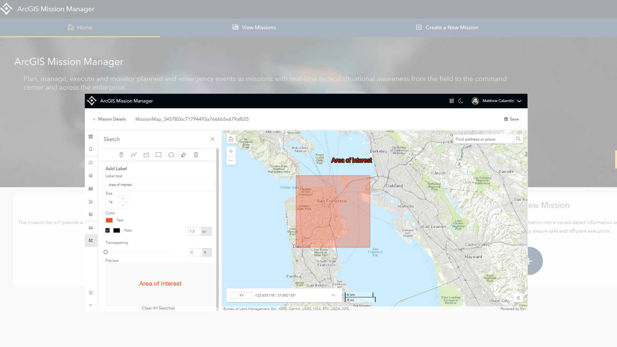
Enhancing Mission map creation and editing to account for the dynamic evolution of a mission with more focused tools streamlined for ease of use.
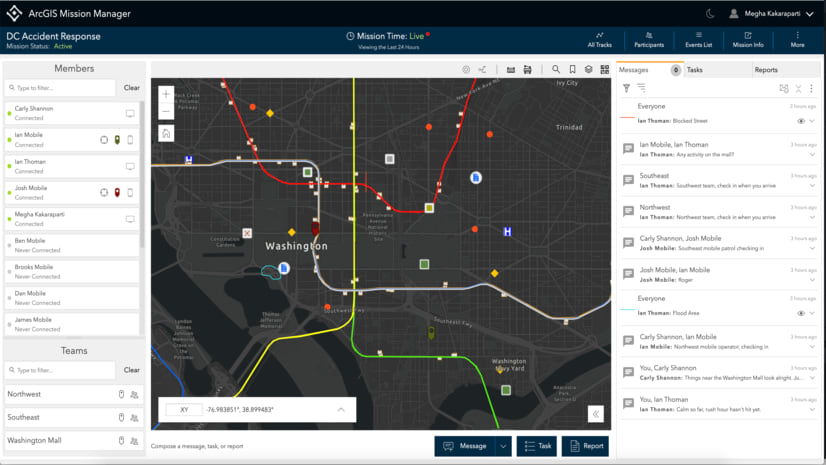
Accurately seeing who is readily available for communication at any given time, as mission member presence has been enhanced to use Avatars and focus on providing more information, more frequently.
Chatting with text that includes a sketch (formerly a geomessage) or attachments, all contained within the chat threads. These feeds are now easier to visualize and keep track of in the Mission Responder app.

Building sensor reports, a customizable report form built-in to Mission Manager, but triggered by Mission Responder users through the use of a connected hardware device allowing unique map actions and notification responses, tailored to the mission.

Organizations looking to manage their operations and respond more efficiently are still challenged with coordinating activities among a dispersed workforce. All while ensuring that everyone remains in contact, regardless of the environment. Our team is progressively working toward streamlining mission operations and providing users with one tool that leverages ArcGIS to make it a seamless process.
Your input is valuable, connect with us on the Esri Community to share your ideas, feedback, and comments, and look out for the upcoming release!

Article Discussion: