Summer is over, kids are back in school, another UC has come and gone. As you catch up on what’s new in ArcGIS Online, one update worth putting on your radar is beta support for annotation and dimension layers. Introduced this summer, initial support for these new layer types lets you bring carefully authored annotation and dimension layers from your enterprise data into web maps. In this article, we’ll explore how you can get started, what you can do with them today, and what’s coming next.
New layer types
Annotation
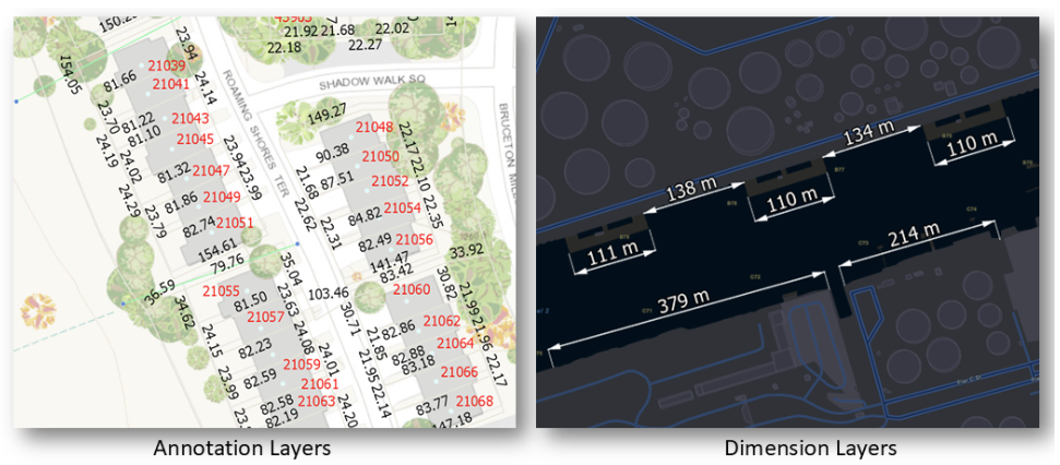
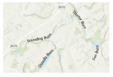
Annotation feature layers contain text that has been carefully placed and formatted to fit its surroundings. Unlike dynamic labels, annotation can be individually positioned, rotated, stretched, stacked, enlarged, or reduced to achieve a specific cartographic result. Think of it as labeling, but with way more control.
Dimension
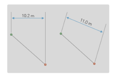
Dimension feature layers illustrate measurements on the map – think the length of a building, the offset from the curb, or the distance between two valves. They help provide important spatial context without requiring users to perform measurements themselves.
How they are created
You can create annotation and dimension feature classes in ArcGIS Pro, then publish them to ArcGIS Server as a non-hosted feature service, or include them as part of a web map. At the time of writing, support for these layer types in web maps is available only for registered data stored in an enterprise geodatabase.

What’s included in beta support
Initial beta support is for adding and displaying feature-linked and standard annotation (but not leader lines) and dimension layers, and saving them in your 2D web maps. This was introduced with the June 2026 update of ArcGIS Online, and in the Maps SDK for JavaScript version 5.1. It means you can add these layers to your web maps in both Online and the SDK, save the maps, and your annotation and dimension layers will display in downstream apps like Dashboards, Experience Builder, or Web Editor.
Enterprise users can look forward to similar support in ArcGIS Enterprise 12.2, due out later this fall.
Exploring Beta Support in Map Viewer
Next we’ll explore how you can get started with these new layer types in Map Viewer.
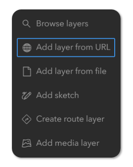
First, add a feature service containing annotation or dimension layers to the map using the service URL. Once added, the layers draw on the map alongside your other layers.
Fine-tune their appearance
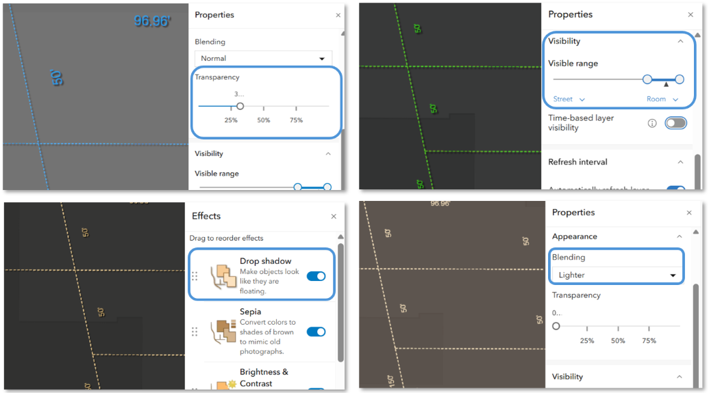
Next, select the parent layer in the Layers pane, then you can adjust any of the following properties to change the appearance of the layers to better suit your map:
- Add transparency to layers to help mesh them more naturally with the rest of your map, while keeping important information visible.
- Set the visible range so the layers only draw at the appropriate scales.
- Apply effects such as drop shadow, hue rotate, or adjust properties like saturation, brightness, or contrast.
- Try blend modes such as Multiply, Overlay, or Screen to create visual effects that complement your basemap.
When you’re happy with your changes, you can save and share the map.
Considerations
Feature-Linked Annotation: Keeping Strings Up-to-Date
When you update a feature that has annotation (feature-linked annotation), the annotation string updates automatically to reflect changes to the feature’s attributes. This ensures your map’s text stays in sync with your data. You may need to refresh the map, or set an appropriate refresh interval on the layer, in order to see the changes on the map.
Limitations
Initial support is for displaying basic standard and feature-linked annotation, and dimension layers, which you can then save in the web map. We’re working to add broader support for more complex rendering in the future.These are some current limitations to be aware of with the beta release:
- Displaying annotation and dimension layers is supported only for Enterprise services
- Leader lines are not shown
- Pop-ups are not supported
- Saving as an item is not supported
Looking ahead
This initial support is just the first step. Future enhancements will focus on expanded rendering support, additional workflows for adding and saving layers, honoring text formatting tags, and richer interaction capabilities like using pop-ups and editing.
Wrap up
Initial beta support for annotation and dimension feature layers lets you bring important cartographic and measurement information to the web. We’re excited to introduce this first phase of support and look forward to expanding these capabilities down the road. Please test them out, keep an eye out for future updates, and share your comments and feedback with us over on Esri Community.



Commenting is not enabled for this article.