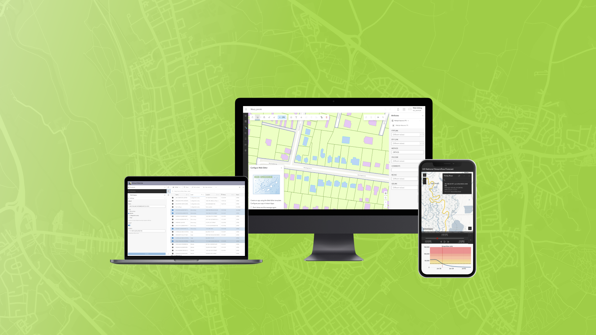
The June 2025 ArcGIS Online update introduces new features and key updates throughout the site. The same applies for ArcGIS Instant Apps, as we have rolled out several updates and new features to our existing apps, further improved choosing and managing your apps on the Instant Apps home page, and addressed various bugs and enhancements to help stabilize and improve your experience across the site. See the highlights below.
New app template: Web Editor (beta)
Streamline data maintenance workflows using the new Web Editor (beta) template. Create apps that prioritize editing data by offering app users a complete suite of tools and capabilities to create, modify, remove, and maintain data from any editable feature layer. Perform advanced geometry edits such as editing vertices, splitting, merging, moving, and reshaping features. Several key app capabilities include batch editing support, snapping to features and using a reference grid, support for editing forms, feature and attribute selection tools, and using a directional pad for precise map navigation.
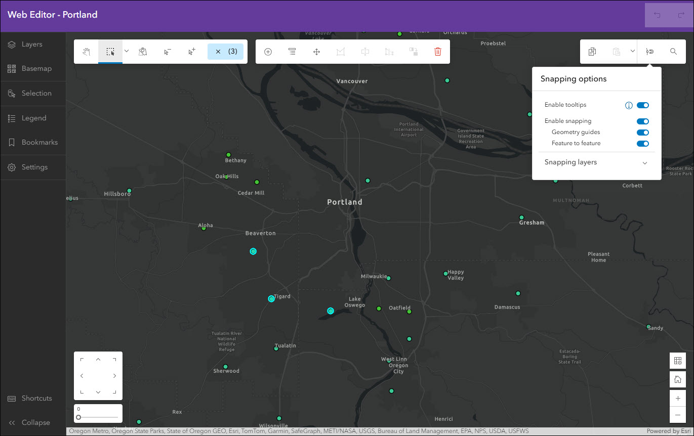
This template requires a web map that has at least one editable feature layer. Since editing data involves important access considerations, you must have a Creator, Professional, or Professional Plus user type and Data Editor, User, Publisher, Facilitator, Administrator, or another custom role with Edit privileges. An app created with Web Editor (beta) cannot be accessed anonymously, meaning that your audience must access it using an ArcGIS Online account meeting the above-mentioned criteria.
Create a new app using Web Editor (beta) from anywhere you are comfortable creating apps with Instant Apps. Additionally, new apps using the Web Editor (beta) template can be created from inside of ArcGIS Web Editor by using the Create app button in the left side panel.
For a further introduction and more details, please check out our Introducing Web Editor (beta) Template blog.
Manager updates
Review and edit data from multiple maps and layers using the Manager app template. For example, review problems and feedback with new public transit stations that were collected using crowdsourcing. Use the app configuration to choose each map used in the project that you want included for review. A browser in the configuration lets you search and find any map you have access to so that there’s no need to rely on having everything contained inside a single group.
We’re excited to announce that batch attribute editing support has been added. Select multiple features at once from the table or map and use the Edit multiple button available in the app to begin. Set values for various fields in the editing window and then click Update to apply these attribute edits in batch to all currently selected features.
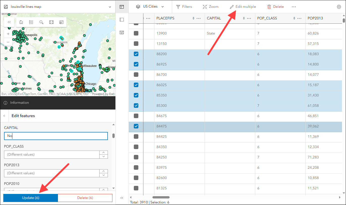
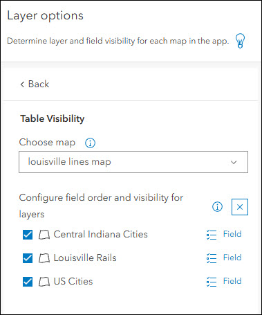
We’ve also updated the configuration to support toggling layer visibility on or off. If you want to hide any layers from any map, reorder them, or configure how the fields and sort orders will display in the tables, use the settings on the Interactivity > Layer options tab.
For a further overview of editing data in Manager and within Instant Apps in general, please check out our Editing in ArcGIS Instant Apps blog.
Sidebar updates
Sidebar offers a range of tools for exploring, understanding, and managing data. Like the Manager template, Sidebar also supports batch attribute editing. Use the editing panel to select multiple features from the map and apply attribute edits in batch. Choices to select features include Select by rectangle or Select by lasso. Note that batch editing can only be performed on a single layer, so keep this in mind when selecting features in maps that have multiple layers.
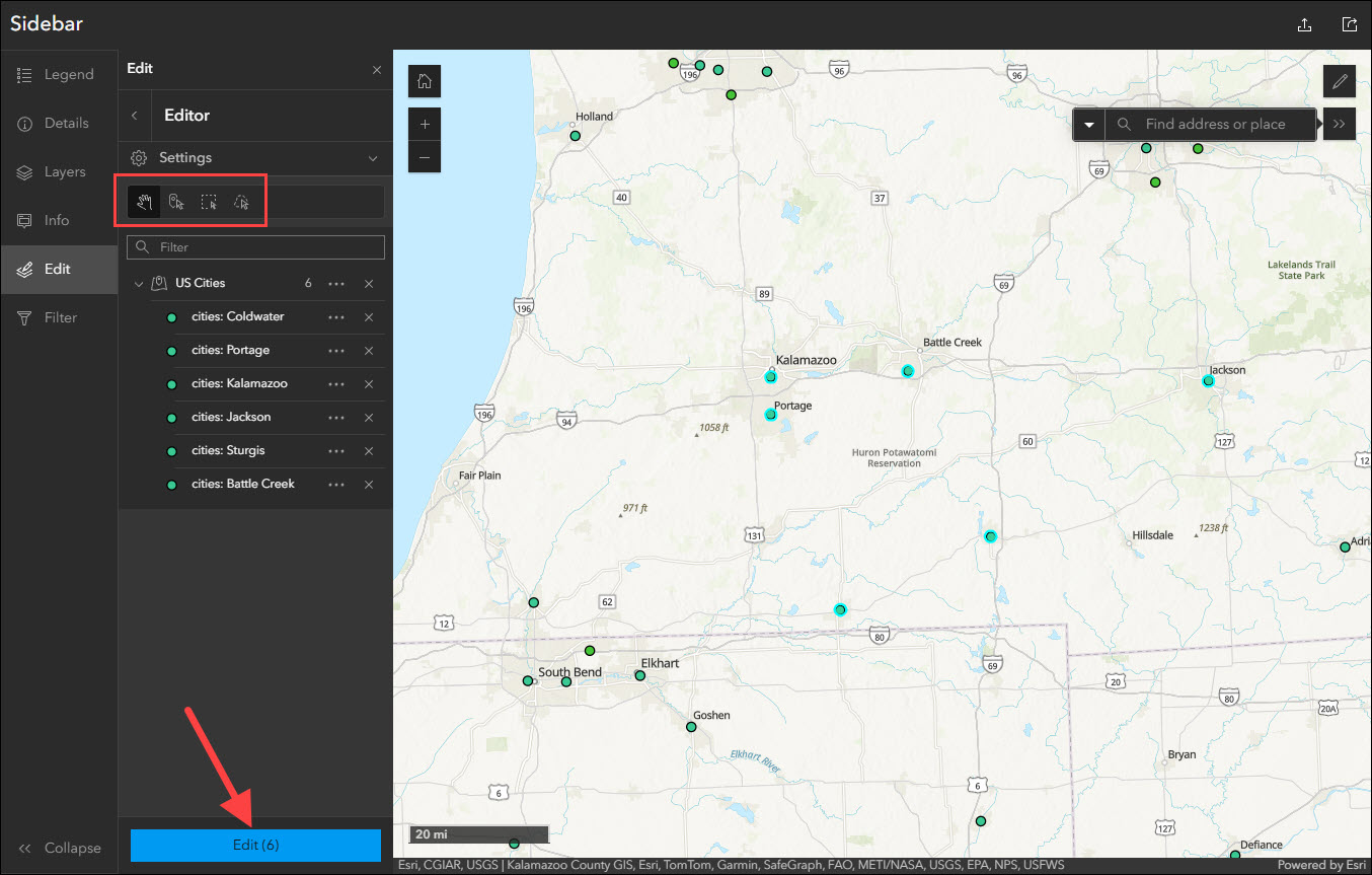
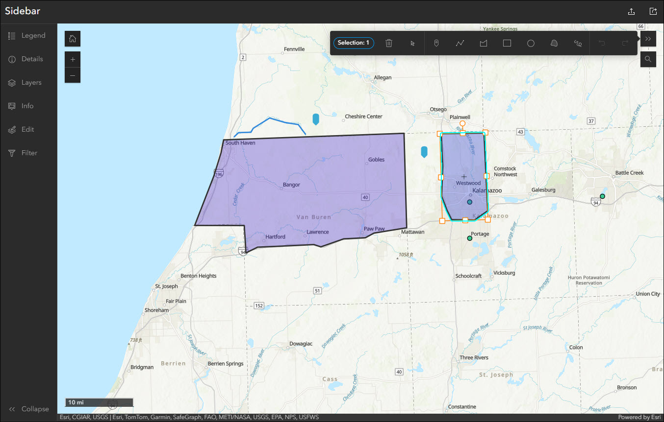
Also included in Sidebar with this update is support for sketch tools. Sketch tools are used to draw graphics in the map and can be points, lines, or polygons. Optionally, choose which colors to be used for each geometry type that is drawn. Note that sketch layers are included in the map when using the Export tool to PDF, PNG, or JPG.
For a further overview of editing data in Sidebar and within Instant Apps in general, please check out our Editing in ArcGIS Instant Apps blog.
Basic and Media Map updates
The functionalities of Basic and Media Map have been combined into a single template, now called Basic (Media Map). There is no loss of functionality between either template and all settings such as the swipe tool are available to configure in Basic (Media Map). Apps created using the original Media Map template will continue to be configurable and can easily be accessed on the My Apps tab of the Instant Apps home page inside the Basic (Media Map) filter in the side panel.
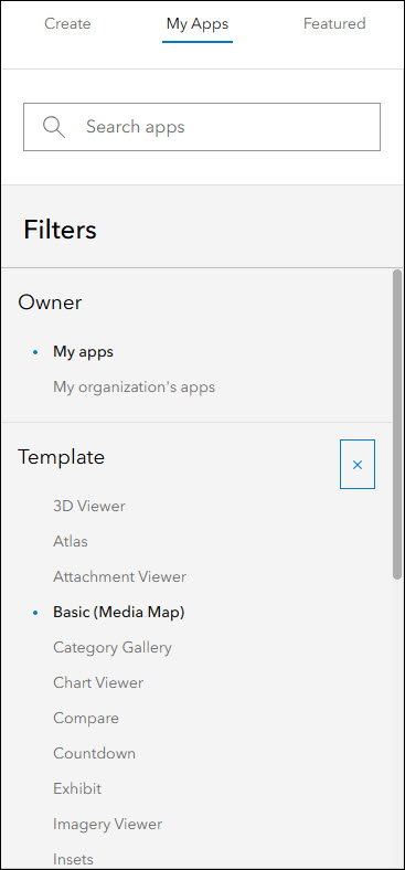
To create new apps moving forward, use Basic (Media Map) found on the Create tab of the Instant Apps home page.
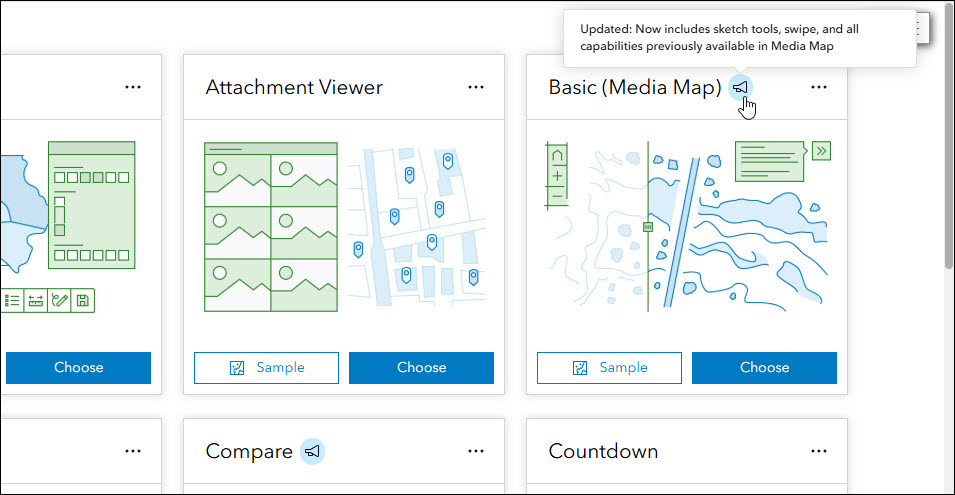
Further, the Basic (Media Map) template now includes support for sketch tools and creating sketch features in the app. Find this new setting on the Interactivity > Modify tab of the app configuration.
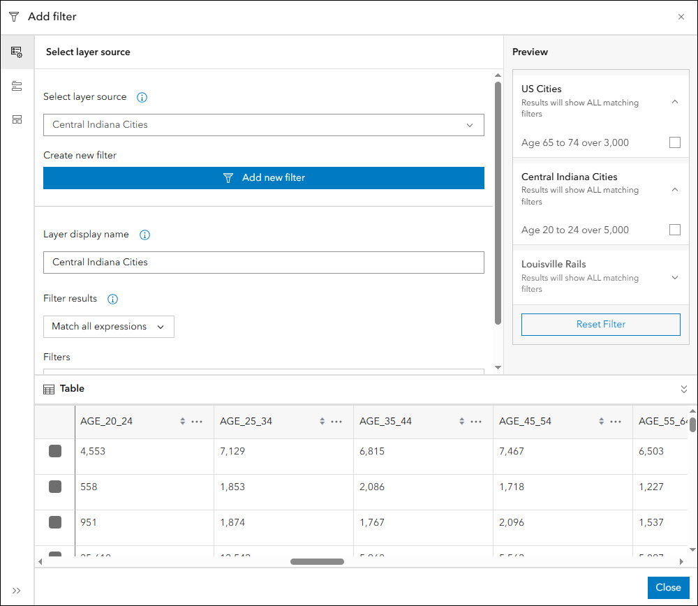
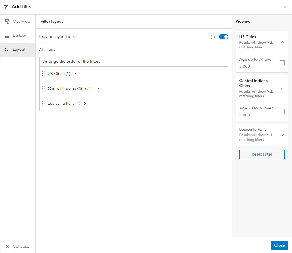
Attribute filter configuration updates
The attribute filter feature is included in most Instant Apps templates and lets app authors configure the way that data in the app is displayed. Set up predefined filters or configure user input filters that prompt app viewers to choose how they want to filter the data they are seeing.
With this update we have given the attribute filter configuration experience a new look and interface. Since configuring a filter contains a large amount of settings, the entire experience has been moved out into its own take-over window directly in the configuration instead of contained within the panel. This makes it easier to see what filters you are setting up and even get an automatic preview of how they are going to look in the app before saving. We’ve also added the ability to view the attribute table to use as reference during the process. Functionally, all options and settings within the attribute filter configuration are the same, but creating useful filters in your apps has been made more simple.
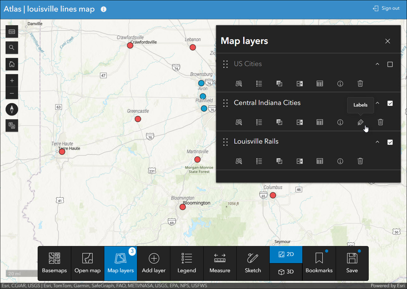
Atlas updates
Atlas provides viewers with tools to explore maps and layers with light weight mapping and data exploration capabilities. Viewers can open a map and add individual layers to it. They can utilize measurement tools, generate an elevation profile, toggle the view between 2D and 3D, use a swipe tool and adjust transparency on layers, and view data as a table.
When viewing layers that have labels enabled, Atlas now offers the ability to toggle the labels on and off within the Map layers panel. If labels are detected for a layer, a Labels icon will appear next to that layer that controls the labels with a single click.
Compare updates
Visualize data at one or more locations using multiple maps and scenes with side-by-side or stacked layouts in the new Compare app template. Choose between two comparison modes to compare multiple maps at the same location or compare multiple locations of the same map. This template supports up to 4 maps, scenes, or a combination of both. We have several useful enhancements with this update:
- Layer list – The Layer list tool has been added to Multiple maps mode. Enable the Layer list to add the tool to each map or location you have in your layout and use it to toggle the visibility of layers in the map. Optionally, choose between Eyeball or Checkbox as the layer visibility icon from the app configuration.
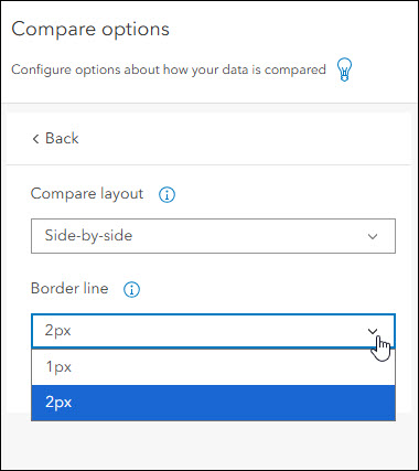
- Border line – A new setting has been added that increases the thickness of the border that separates maps or locations. Find the “Border line” setting on the Interactivity > Compare options panel of the app configuration and choose between 1px (default) and 2px. This subtle change can enhance the look of app layouts where the division between maps can blend together.
- Toolbar theming – When the app header is disabled in Compare (About > App details), a toolbar displays on the right side of the app to display tools that are universal such as Synchronize maps, Share, Export, etc. We’ve updated the app’s theming settings to apply the same theme choice to this right-side toolbar that is applied to the app header. Therefore, if you set a specific color for the header in the Theme & Layout > Theme settings, this color will still apply to the toolbar that replaces it whenever disabled.
Reporter updates
View and submit issues or observations in an area using the Reporter app template. This app lets users create a report that displays on the map. They can also view existing reports and use basic map exploration tools to navigate the map.
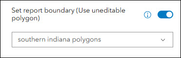
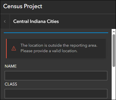
App authors can now set a boundary for reports to limit where they can be created. This means that app users must capture their report within this boundary or they will be presented with a warning message. Find the “Set report boundary” setting on the Reporter > Panel options tab of the app configuration. This setting uses an uneditable polygon layer from the map to establish the boundary to be used. Choose the desired uneditable polygon layer from the drop-down. When an app viewer attempts to make a report outside of the boundary of the feature(s) from this layer, a warning message will appear stating this information to them.
We’ve also enhanced the authoring of custom panel text for reports by adding in rich text editors to the app configuration. On the Reporter > Panel text tab of the configuration, use the Edit buttons to open and customize panel text in the rich text editors.
To see all of the new details about Reporter, take a look at our What’s New in Reporter (June 2025) blog.
And for a further overview of editing data in Reporter and within Instant Apps in general, please check out our Editing in ArcGIS Instant Apps blog.
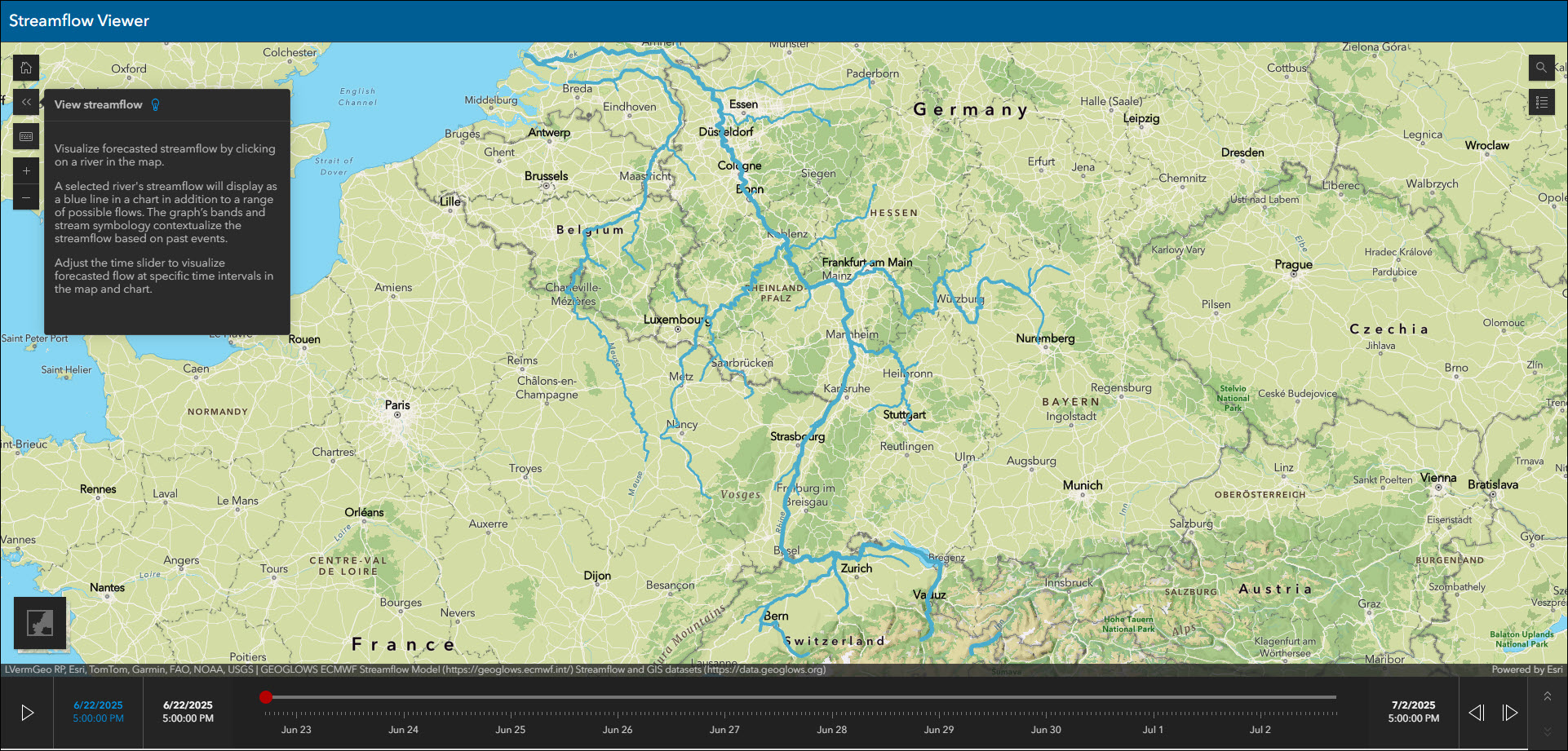
Streamflow Viewer updates
Interact with streamflow forecast data through a chart and time slider using the new Streamflow Viewer template. This app includes two different 10-day river forecast services, the GEOGLOWS Streamflow forecast service for global coverage from the European Centre for Medium-range Weather Forecasting (ECMWF), and the United States National Water Model service for US coverage from the National Weather Service.
Choose to filter the stream layer in your app using preset filters. For both forecast services (Global and United States), choose to filter by stream order. The stream order value measures the relative size of streams where the higher the value, the larger the stream. Use the preset filter on the Streamflow Viewer tab of the app configuration to choose a stream order value from the drop-down and streams of equal value or more will show in the map.
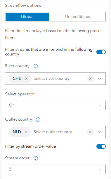
For the Global forecast service only, you can also filter streams by country that they are in or that they end in. Use the preset filter to choose the country where the stream is located and which country the stream outlet is in. Further, set the and/or operator setting.
Note that both of these new filter options are currently only available in the app configuration for the app author to define. App viewers will not see or be able to interact with the filters on their end.
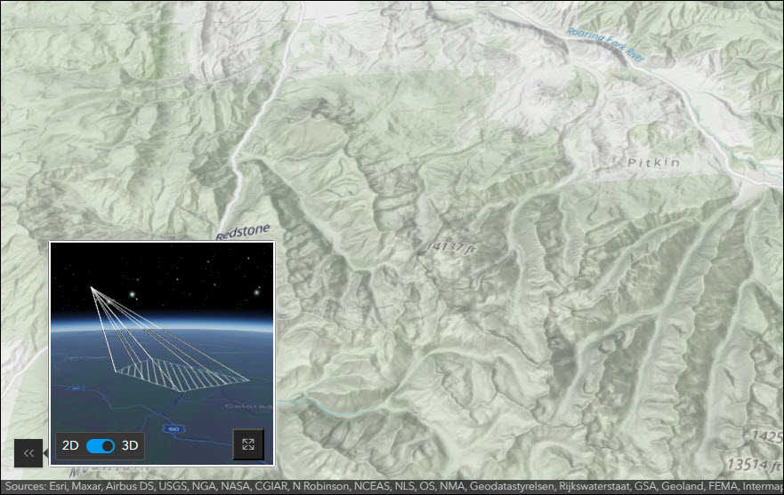
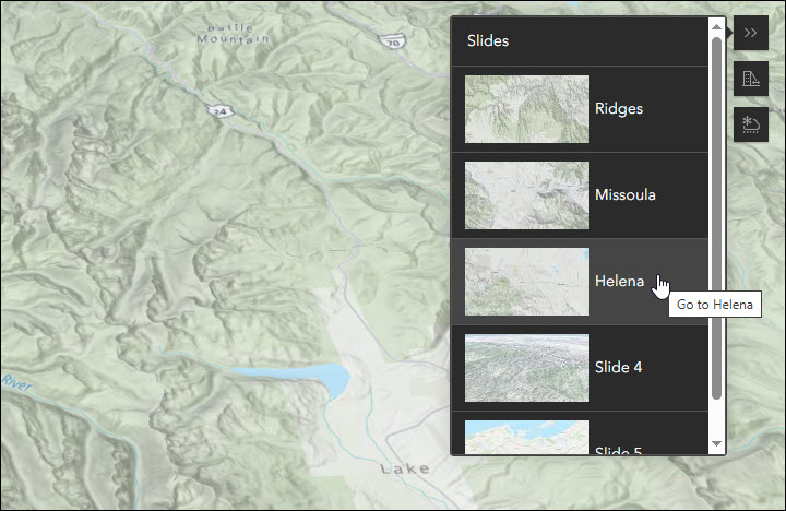
3D Viewer updates
Present a 3D scene with a variety of exploration tools using 3D Viewer. We’ve updated the Locator map widget with an enhanced experience and new feature. When enabled from the Interactivity > Locator map area of the app configuration, you can now toggle between 2D and 3D views to be used while navigating. This allows for a more detailed reference of the view you are seeing in the main frame scene. The color of the view icon and prism can be configured to any color so that you can best match it with the locator map basemap of your choice, both of which are settings found in the same configuration panel.
We’ve also enhanced the Slides widget to make it easier and quicker to navigate the scene’s extent to the chosen slide. To transport immediately to the extent of the chosen slide, double-click on the slide in the slide list instead of single-click. This is useful for app viewers when navigating between slides that are a very far distance across the earth.
Nearby and Zone Lookup updates
Both Nearby and Zone Lookup have several new capabilities to announce. Take a look at our Updates to Nearby and Zone Lookup in the June 2025 Release blog to find out all the details about the new map click search, showing results based on a user’s location, new filter builder, and URL parameter support for embedding apps.
Deprecation Notice for ArcGIS Configurable Apps
As of the June 2023 update of ArcGIS Online, a deprecation notice has been issued for ArcGIS Configurable Apps. Deprecation does not impact the availability, functionality, and Product Lifecycle Support phase of ArcGIS Configurable Apps.
ArcGIS Configurable Apps continues to be available until it is officially retired, but will not receive new features or other enhancements. Before retirement, users are still able to create apps using ArcGIS Configurable Apps templates and existing apps will continue to work.
Retirement of Configurable Apps is expected to happen in the Q1 2026 release. Please take a look at our detailed announcement blog: ArcGIS Configurable Apps Roadmap for Retirement.
More information
For more information please reference our documentation page where you can find details about getting started with creating and sharing ArcGIS Instant Apps.

Article Discussion: