The June 2026 ArcGIS Online update includes some significant enhancements to the Sketch Experience in Map Viewer. Curve support has been expanded to include a variety of different curve types as well as the ability to switch between curved and straight-line segments while drawing lines or polygons. Additionally, the style section was updated with some useful symbol locking improvements, and users can now choose to enable labels indicating length of each segment while drawing.
More curve options and drawing toolbar updates
In June 2025 a tool for drawing basic curved lines was added to Map Viewer. This allowed you to draw a quick, single segment, curved line and style it as you wanted. With this release, support has been added for a variety of different curve types for drawing both lines and polygons.
With so many new drawing tools added, we had to change the basic design of the drawing toolbar to fit them all in. You will notice that the button for the single Curved Line drawing tool is missing, but if you click on the regular Draw a Polyline tool, a new toolbar opens with various options including: line segment (straight line or freehand), bezier curve segment, tangent curve segment, arc segment, and endpoint arc segment.
Start drawing a line with one of these tools and then choose another while drawing to switch effortlessly between segment types.
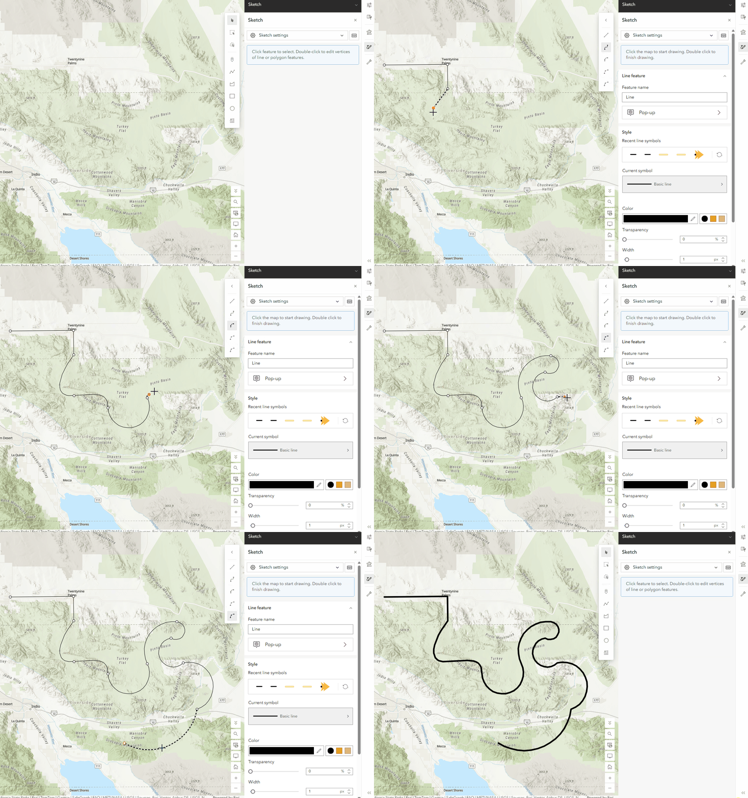
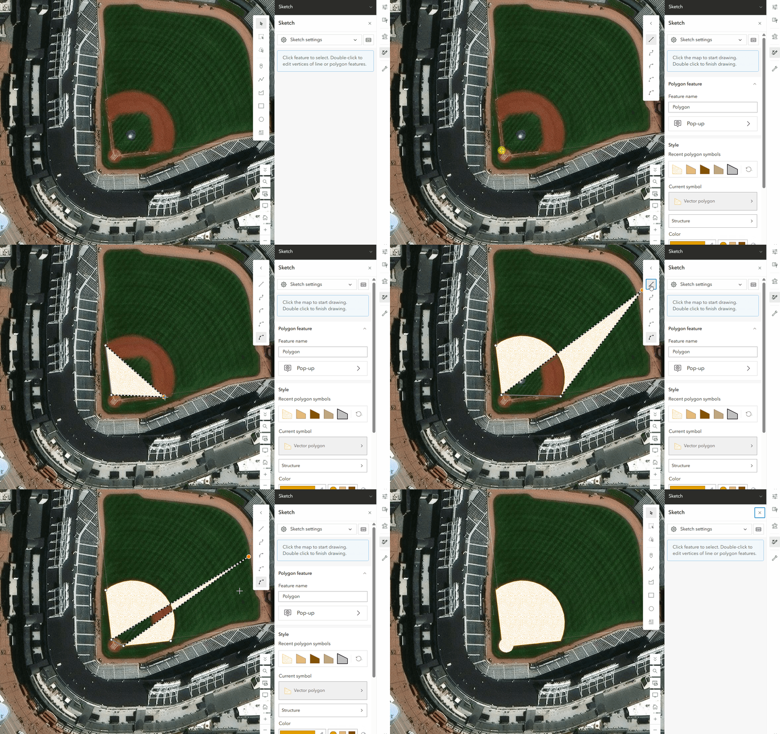
As before, all the various line styling options are available for these curves, so you can change colors, add offsets, place arrows, and more. These same enhancements also show up for the Polygon tool. Click on the Draw a Polygon tool and you will see the same options for segments as you do with lines. Switch between any segment type while drawing your polygons!
Symbol Styling Enhancements
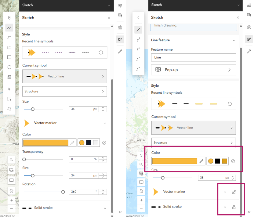
With this release there were some small updates to the Styling section in sketch as well. There is now top level color application that can be applied to all unlocked symbol layers in a vector symbol. This allows for more control over how different parts of a symbol are styled.
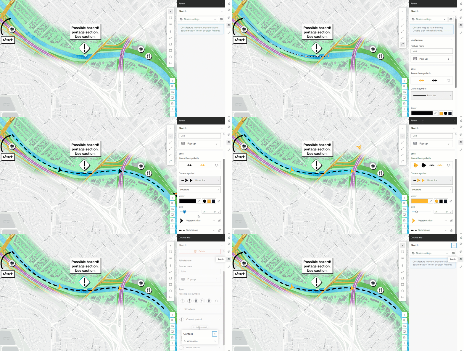
You can now control if a symbol layer is locked or unlocked and any top-level color changes will be applied to only the unlocked layers. For example – in the image below notice how for the arrow line symbol, the arrow is unlocked while the line is locked. When the color was changed to orange for that symbol, it was only applied to the arrow. This can improve efficiency when quickly restyling symbols with lots of symbol layers. See the example in the next section for a full demonstration. You will also notice that individual symbol layers are now collapsed by default, reducing confusion when you may just want to quickly change the overall color or size of a symbol.
These updates can also be found in the Styles / Smart Mapping section of Map Viewer for other layer types, keeping the experience consistent across the app.
Segment labels while drawing
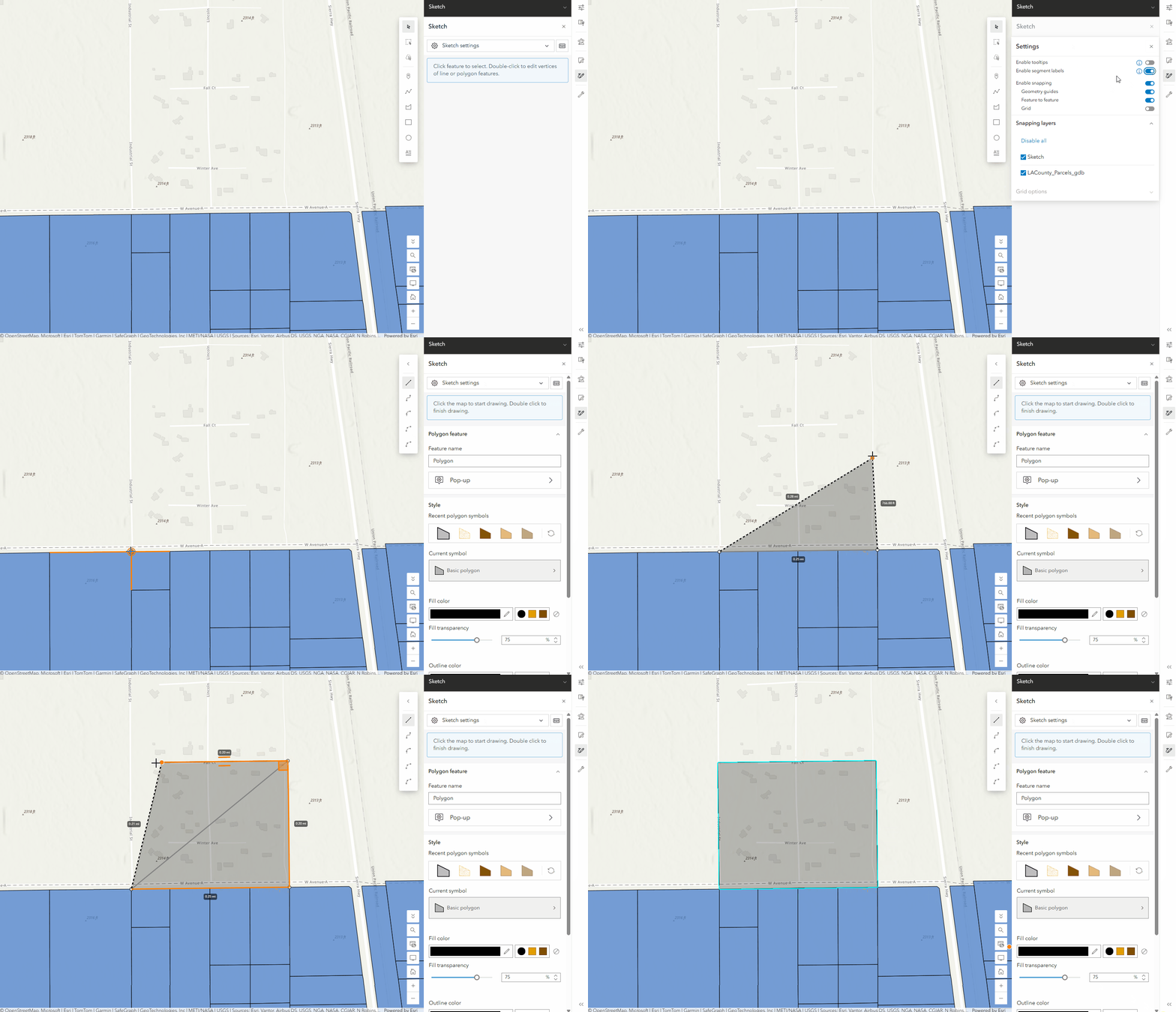
Finally, the Sketch settings now include the option to Enable segment labels while drawing. When this is enabled, you will see labels indicating the length of each segment, giving you more control over your sketches. This is supported while drawing both lines and polygons.
Bringing it all together
The example below illustrates how these new sketch enhancements can be combined with other Map Viewer capabilities to bring your ideas to life. This map combines layer blending, effects, and sketch to create a unique basemap that focusses on the area of interest for a kayaking race. The new curve drawing tools were used to illustrate the route and color locking was applied to the arrow symbols. The additional route details are also all sketch features, including the animated warning symbol (another recent enhancement!).
We look forward to seeing your creations as we continue to add new functionality in Sketch. Remember to take advantage of time based-layer visibility on Sketch layers as well!

Article Discussion: