Approximate Read Time: 6 min
You can use the Append tool in ArcGIS Pro to load data from one or multiple input datasets into an existing target dataset.
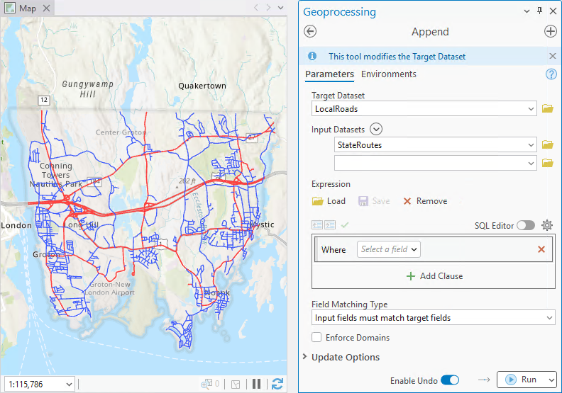
Combining multiple datasets into one may sound simple, but sometimes the input and target dataset attribute fields are different. For example, one dataset may have more fields than the other, or fields have different names or types. In this case, you may need to use field mapping to reconcile those differences.

Field mapping can be as simple as matching fields between datasets, or more complex involving Actions to determine how multiple source fields get combined to a single target field. Actions can include statistical operations like finding the sum, mean, or max value, or text operations like concatenating or slicing field values.
Note: In other tools (like Merge and Spatial Join), field mapping also includes changing other field properties like names, alias, field order, as well as adding and removing output fields.
Field mapping with Append
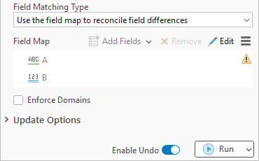
In the Append tool, you can activate the field map parameter by specifying Use the field map to reconcile field differences as the Field Matching Type.
The field map automatically maps fields with the same name. But in previous releases, it may not be immediately obvious how to map the unmatched fields (indicated with a warning).
Field mapping with Append (Pro 3.7)
In ArcGIS Pro 3.7, the field map parameter in the Append tool dialog box is updated to support more field mapping capabilities.
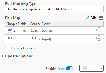
The updated field map displays the target fields and source fields in two columns. Each source field includes the name of the input dataset it came from in parentheses, which is especially useful when you have more than one input. Using the drop-down, you can map source fields from the Input Datasets to target fields from the Target Dataset directly on the tool dialog box.
Steps: How to map attribute fields using Append
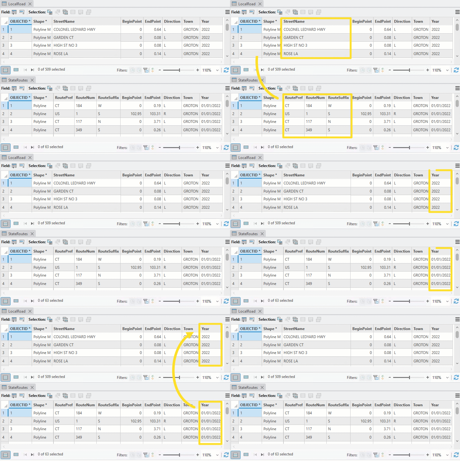
Below are the attribute tables for a LocalRoads and StateRoutes dataset.
Notice how the fields differ between the two datasets? The StateRoutes dataset has three fields for the road name, and the year field is formatted differently in each dataset.
Using the Append tool, specify the following parameters to load the line features from the StateRoutes dataset to the LocalRoads dataset:
- Target Dataset:
LocalRoads - Input Datasets:
SateRoutes - Field Matching Type:
Use the field map to reconcile field differences
This activates the field map parameter, where two target fields have a warning: StreetName and Year.
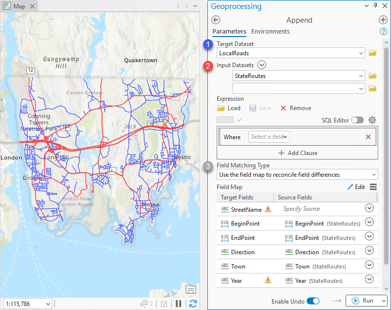
The StreetName field has a warning because there’s no matching field with the same name in the StateRoutes dataset. To map source fields to the StreetName field:
- Click the first drop-down under the Source Fields
- Check the RoutePref, RouteNum and RouteSuffix field boxes in the menu.
- Set the Action to
Concatenate, and use a dash (–) as the delimiter.
This step is necessary to combine multiple source fields into one target field. If the default action (First) is used, only the first listed field would get written to StreetName. - Click OK to add three source fields to the StreetName target field.
- The route prefix should appear first, so drag RoutePref above RouteNum.

The Year target field is already matched. So, why does it have a warning?
Hover the Year field’s warning: The field length is shorter than the source fields. This message appears on text fields when the target field length is shorter than the source field length. In this example, the Year target field length is 4 whereas the source field length is 10. Attempting to load values that do not fit into a target field can cause a big problem when running Append!
Follow the steps below to reconcile the field length difference:
- Right-click the Year source field > Click Edit text slicing.
- In the Slice Text dialog box, specify the text position to start at 6 and end at 9, then click Add.
The year information in the source field starts at the 7th character, where the first character has index of 0.
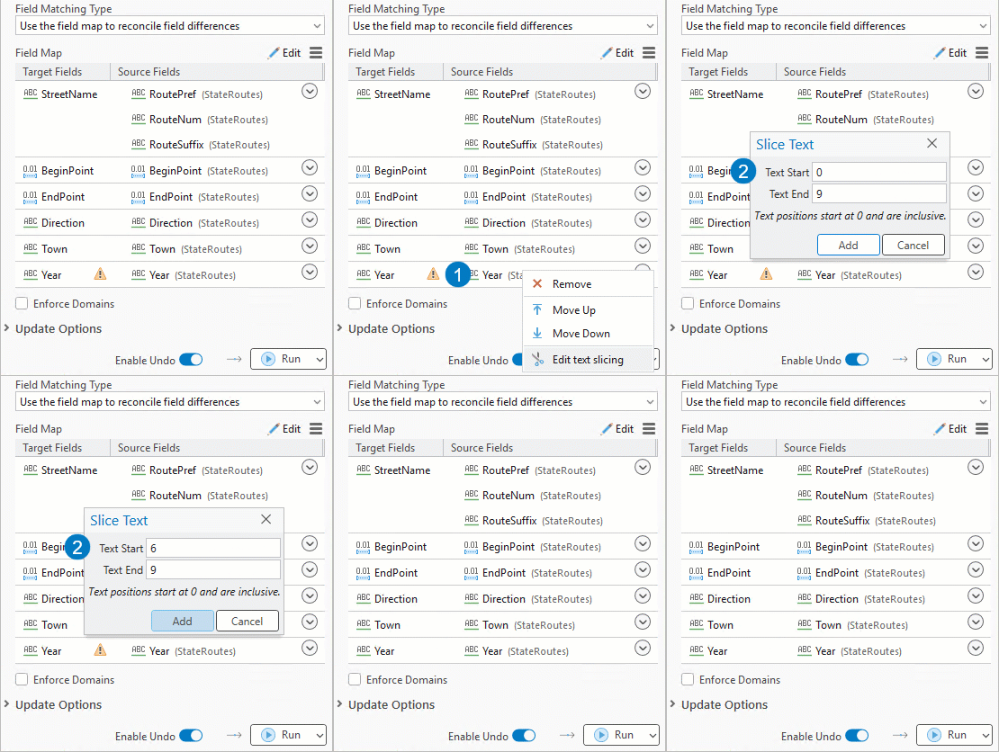
Now that all field differences have been reconciled, run the Append tool.
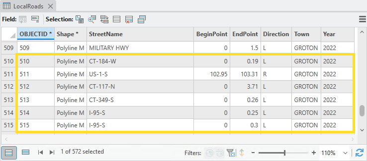
Result: The target dataset, LocalRoads, should update from 509 to 572 total line-features.
Summary
In ArcGIS Pro 3.7, the Append tool has an updated field map. You can now view all target and source fields at a glance and perform field matching directly on the tool dialog box.
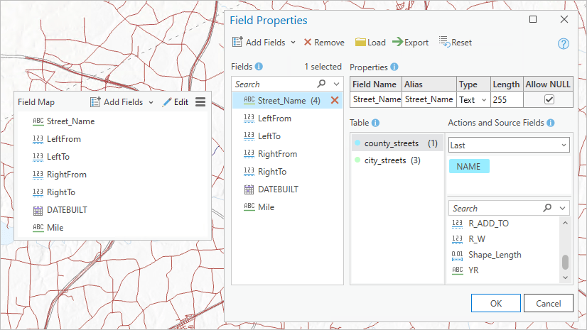
If you need a larger view of all your fields, click the Edit button to open the Field Properties window. That way, you can view many target fields at once and perform all your field mapping tasks in one place.

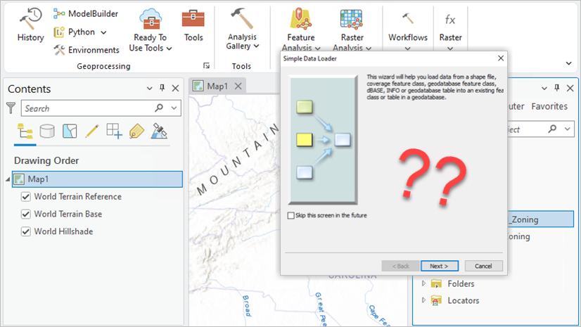
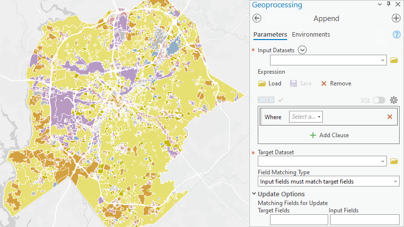
Now the geoprocessing panel takes 2 inches more width. Really a sad decision. Unpratical. Bad UX.
The geoprocessing pane and all panes in Pro can be resized to make the UI components effective for your specific projects and use cases. Panes that are docked by default to the side of the app have a narrow portrait orientation that works well for many forms. Some controls can benefit from a little more horizontal width, particularly a control like the Field Map for selecting fields side-by-side from multiple sources and target. You can continue using the field map as it was used previously with a narrow width, and open the full Field Properties window for times when you need more screen “real estate” to complete your field mapping in Append and other tools. Some refinements and improvements for the Field Properties window are being designed and planned for the near term.