As part of the ArcGIS Pro 2.9 release, the geodatabase team has enhanced how you manage geodatabase functionality for your datasets. You will notice that when you right-click a dataset in the Catalog pane, instead of seeing the manage pull-right context menu full of options that you are used to, there is now a single Manage option.
Clicking this launches the properties page with a new Manage tab on it.
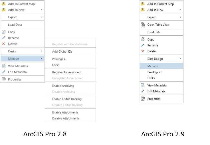
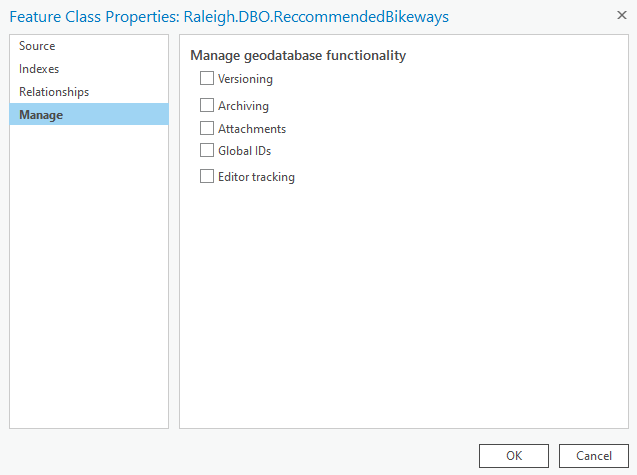
This new page acts as a one-stop shop for enabling and disabling geodatabase functionality. Instead of going back to the right-click context menu over and over to enable capabilities, just open the Manage page, select the ones you need, and click OK.
Here are some of our favorite workflows that highlight the new Manage:
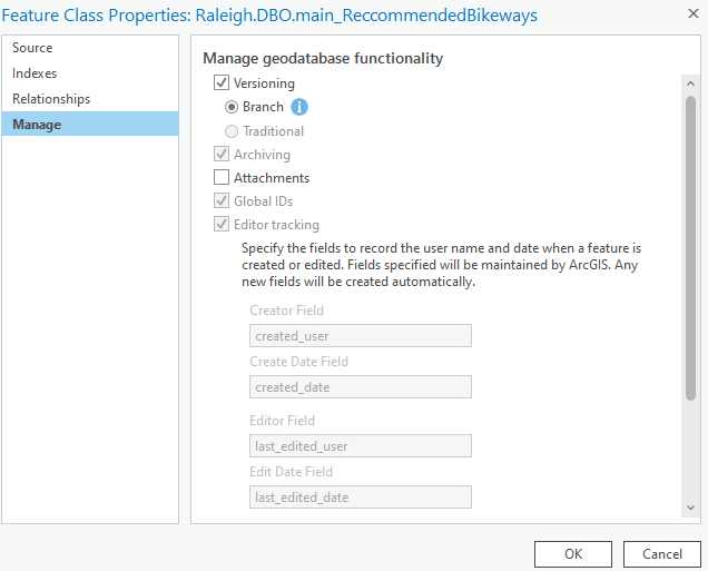
Enabling Branch Versioning in one click
Within the new manage page, you can now register as branch versioned in one step. When the versioning box is checked, the default versioning type of Branch is set and all of the required conditions for Branch versioning are automatically enabled (archiving, global ids, editor tracking, and swizzling your geodatabase connection to/from Branch). Clicking OK in this dialog will go through the steps and provide visual indicator in the dialog for each specific step that is being executed. This change is a massive boost to productivity and reduces the chance for user error.
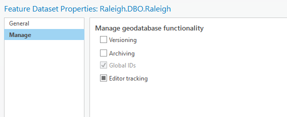
Feature Datasets with contents in a mixed state can be now indicated
Prior to this release, it was not possible to indicate the mixed state of the feature classes in a feature dataset by reviewing the feature dataset properties. This can occur when adding a new feature class to an existing feature dataset with geodatabase functionality already enabled. The improved Manage page, allows you to identify such states through the mixed-state checkboxes.
You can click on the check box for the specific geodatabase functionality to enable. You’ll see the mixed or indeterminate state icon symbol change to a check mark.
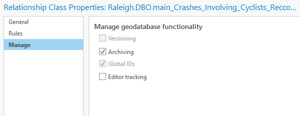
Attributed relationships can be managed
When an attributed relationship is created, an intermediate relationship class table is also created to map the associations between the origin and the destination objects. With this release, you can now manage all geodatabase functionalities for the intermediate table with attributed relationships.
Curious to see how it all works together? Look at the video below.
If you find this exciting, be sure to watch the What’s New in ArcGIS Pro 2.9 video to catch all the new capabilities, performance, and productivity enhancements.
As we continue to improve the software each release, we look forward to reading your feedback on the Esri Ideas page.
Our users who had early access to these new features loved this new addition and we hope you will too!
Photo by Jess Bailey on Unsplash


Commenting is not enabled for this article.