The release of ArcGIS Pro 3.8 for ArcGIS Aviation Charting and ArcGIS Aviation Airports includes enhanced tools to further support your airport, charting, data management, migration, and design needs. This blog article contains more information about these updates.
ArcGIS Aviation Charting
Importing and exporting AIXM data
The Import AIXM 5.1 Message and Export AIXM 5.1 Message tools have been updated to provide additional information about Aeronautical Information Exchange Model messages for improved data exchange and interoperability, including the ability to interpret null fields. This helps provide more information to understand and troubleshoot during any exchange of AIXM data. For example, null fields in AIXM messages can now be interpreted along with any associated nilreason values. These fields can also be set to null in the associated charting features when importing or updating AIXM data.
Manage Airspace
New airspace categories were added to the Manage Airspace add-in, including Special Use Airspace, Class, and Other. Dynamic updates now occur in the form when you select a category, ensuring that the required airspace data management attributes are displayed.
Product data files updates
Rather than building every part of a workflow from scratch, the ArcGIS Aviation product files provide a standardized foundation for working with ArcGIS Pro and the ArcGIS Aviation extensions. They include preconfigured databases, cartographic templates, applications, and services designed to help you apply consistent business rules and produce authoritative content for maps, analysis, and sharing across your organization. With this release, the ArcGIS Aviation Charting product data files include the following updates:
ICAO (SID and STAR) and Enroute templates
The Standard Instrument Departure (SID), Standard Terminal Arrival Route (STAR), and Enroute chart templates were updated with enhanced logic for chart-specific symbology. You can use these chart templates to reduce the number of manual configuration steps for setting up new charts and maps, such as the selection of relevant layers, and the configuration of symbology for those layers. With these templates, you can simply provide a data source and begin customizing the chart to your needs.
Learn more about downloading and using the Aviation product files
ArcGIS Aviation Airports
Airports data model schema
Updates were made to the ArcGIS Airports data model schema to address the performance and reliability of tools when working with airports data. The Import FAA 18B Shapefiles tool now has enhanced reliability when run with the ArcGIS Airports data model.
Aviation North arrow
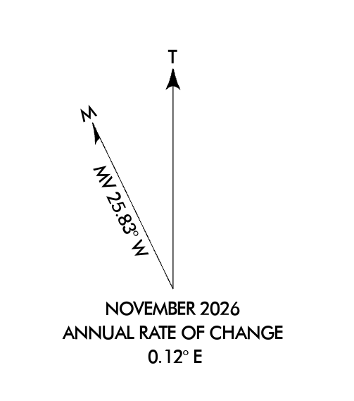
The Aviation North arrows are now available to users with the ArcGIS Aviation Airports license, allowing you to use the North arrow from the Aviation Charting assets without also needing an ArcGIS Aviation Charting license.
Product data files updates
The Airports product data files include the following updates:
Font support enhancements for airport sign workflows
The Airports product data files have been updated to improve font support for airport sign workflows, including expanded support for special characters, including periods (.) and commas (,). You can now more effectively create and manage accurate and standards-compliant airport signage.
Reach out to us at aero@esri.com if you have questions about these new capabilities.
For further information, please visit the ArcGIS Pro page or the What’s New documentation and post your questions in the ArcGIS Aviation board in Esri Community.



Article Discussion: