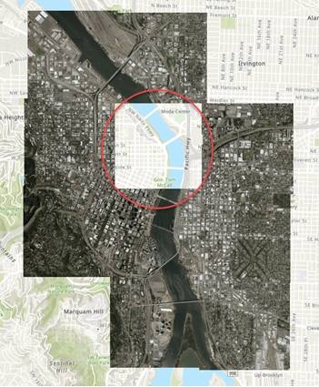
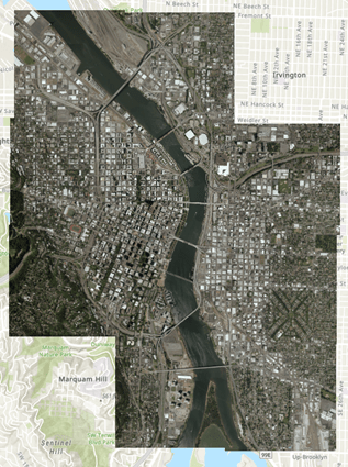
Did you create a mosaic dataset only to find that one of the mosaic dataset items is not in the correct location? Now in ArcGIS Pro 2.5, you can geoference a mosaic dataset item. Therefore you can geo-position your misplaced raster within your mosaic dataset. This means you can georeference your image without having to reload the data.
In this case, the mosaic dataset of the Willamette River appears to be missing an image. But upon further inspection, all the items were loaded into the mosaic dataset. However, one of the items seems to be in an incorrect location.

Steps to get your mosaic dataset item in the right place
To georeference a mosaic dataset item, there are three main tasks:
1) Select the mosaic dataset item
2) Georeference the mosaic dataset
3) Update the mosaic dataset
Now that your mosaic dataset has been georeferenced and updated, you can use this mosaic dataset in any of your projects.

NOTE: The source has not been updated (only the mosaic dataset). If you need your source to be updated, you can export your georeferenced item and replace the source. To replace the source, overwrite the source imagery with your newly exported raster.

Article Discussion: