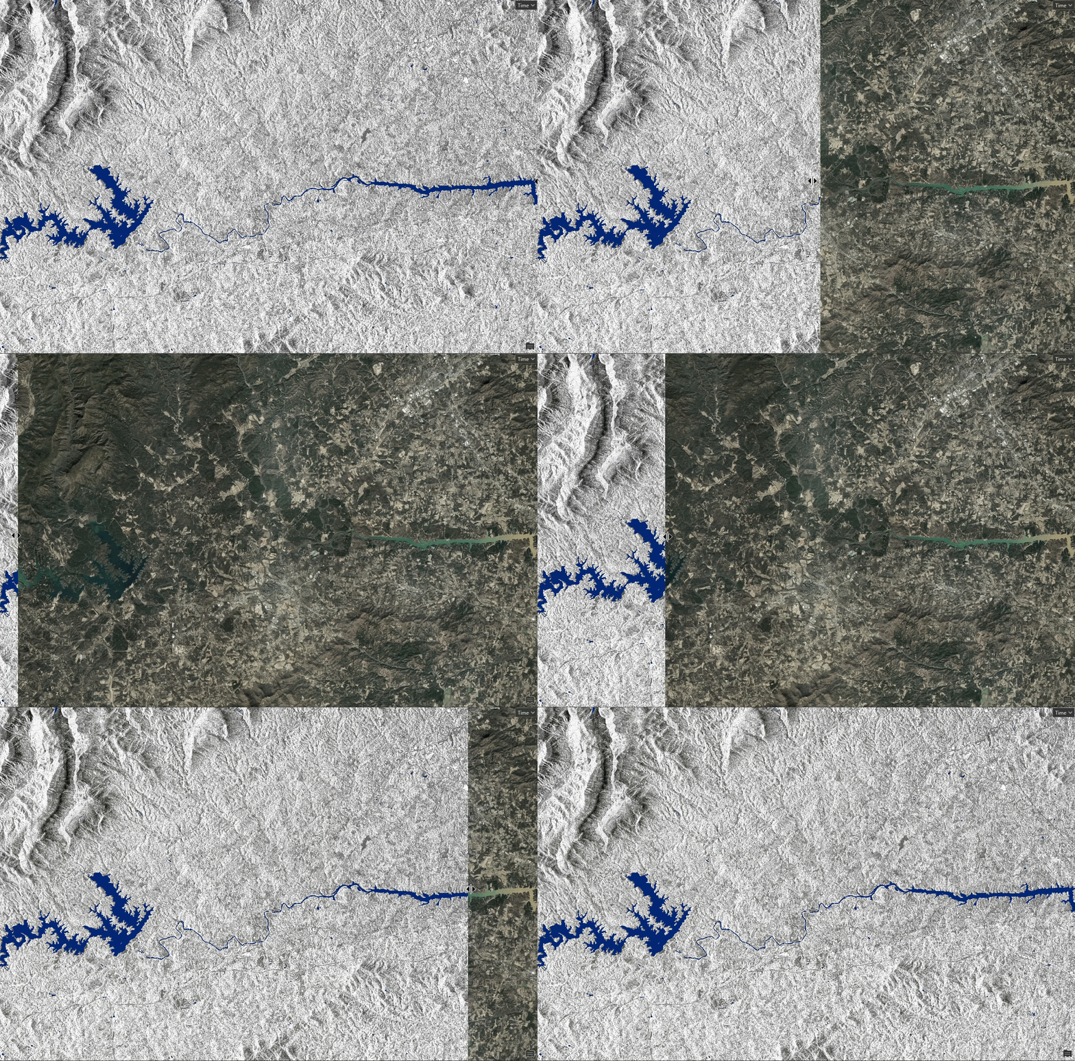
Did you know Esri offers pretrained deep learning models that you can use to leverage specific imagery tasks? These ready-to-use models have well-defined workflows that alleviate the monotonous task of labeling and training data so you can shift your focus to the analysis results. Although they have been available since 2020, Esri has recently released a series of pretrained deep learning models that work specifically with SAR data, such as ship detection, water body extraction, and oil spill detection.
Why has Esri released SAR pretrained deep learning models?
SAR is an important radar tool to use because it provides a consistent view of the properties and shape of the earth’s surface. Unlike optical imagery, it doesn’t matter if it’s a cloudy day (or night) with SAR. Regardless of the climatic condition, you can revisit and collect data over a particular area without worrying about environmental factors.
What makes this exciting is that it opens many doors for a variety of analysis capabilities, especially detecting or modeling change in a particular landscape. With SAR, you can monitor a flooding river during an extreme weather event (which is bound to have a lot of cloud cover) or perhaps a volcanic eruption with copious amounts of smoke and ash.
In fact, Esri has actually performed this for the 2019 flood event in the Midwestern and Southern United States, which was aptly named “the Great Floods” because of its impact on the 14 million people that lived in the affected area. This is just one example where creating a Sentinel-1 SAR analysis-ready product can be accomplished through a series of geoprocessing tools in the SAR toolset. What is even more exciting is that the SAR data can be processed and written out to a dataset that could form the basis for future analysis and interpretation.

Using SAR data in ArcGIS
There is an array of options and capabilities that you can leverage in an ArcGIS environment to process and analyze your SAR data, ranging from raster product support and raster functions to deep learning.
Process your data using raster products and functions
Because of its versatility, Esri has extended SAR support into several raster products designed to make the process of adding imagery from specific sensors more intuitive. Raster products are an efficient way for ArcGIS to render sensor data based on the corresponding metadata provided. Esri currently supports Sentinel-1, RADARSAT Constellation Mission, and ICEYE GRD products.
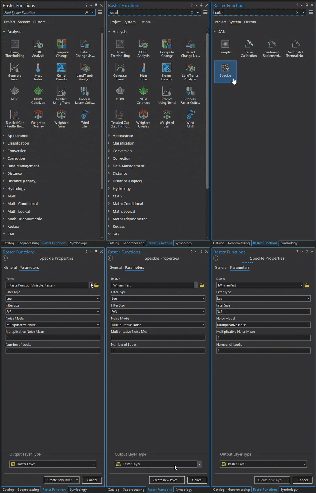
Many of the tools have been wrapped into raster functions as well. These apply calculations directly against the original data as the raster is displayed, so only visible pixels are processed. This allows for quick experimentation of parameters in ArcGIS Pro given that no intermediate data is written to disk.
In addition, you can create color composite images on disk using a geoprocessing workflow or process SAR data in-memory with additional raster functions. This lets you harness the polarization characteristics of the platform to create three-band raster datasets for the ArcGIS analysis environment.

Analyze your data with deep learning
Currently, Esri offers three SAR pretrained models, which are available in ArcGIS Living Atlas of the World. All three models focus on object detection and pixel classification; however, it will be important to provide mechanisms to perform coherent change detection and feature extraction/detection moving forward. Each SAR pretrained model makes use of freely available Sentinel-1 ground range detected (GRD) data.
Here is a quick summary of each SAR model we currently offer.
Ship Detection
Whether your goal is to track illegal fishing vessels or monitor a cargo ship fleet through a tumultuous storm, the Ship Detection (SAR) pretrained model can save you the tedious task of detecting ships manually—with Sentinel-1 SAR data. This model can be used with any geography, but depending on your software type, you will need one of the following license requirements:
- ArcGIS Image Analyst extension (for ArcGIS Pro)
- ArcGIS Image Server (for ArcGIS Enterprise)
- ArcGIS Image (for ArcGIS Online)
And if you have the ArcGIS Image Analyst extension for ArcGIS Pro, there’s also a custom project template that you can leverage for a simpler workflow. Steps for using this custom template can be found here.
Water Body Extraction
Much like the SAR-specific pretrained model for ship detection, the Water Body Extraction (SAR) pretrained model saves time by automating tasks that are inherently useful for SAR data. In this case, it extracts bodies of water from Sentinel-1 SAR imagery as a raster—with water and non-water classes in your designated area of interest (AOI). This model is ideal for Sentinel-1C band VH band raster data for the United States, but similar to the ship detection model, you will need specific licensing requirements based on your software type. These license requirements are as follows:
- ArcGIS Image Analyst extension (for ArcGIS Pro)
- ArcGIS Image Server (for ArcGIS Enterprise)
- ArcGIS Image (for ArcGIS Online)
Steps for using the Water Body Extraction (SAR) pretrained model can be found here.
Oil Spill Detection
By now, you’ve probably gathered that these pretrained models are here to save time and effort. There’s just one more pretrained model developed specifically for SAR data that’s yet to be discussed in this blog: the Oil Spill Detection (SAR) pretrained model. It’s inherently difficult to detect oil spills in our world’s oceans but also inherently important to be able to do so because of the detrimental effect oil spills have on the ecosystem. Using SAR data, you can implement this deep learning model to detect potential oil spills as a feature layer in ArcGIS. This model can be used globally and works best with Sentinel-1 VV band raster data.
The license requirements for this model are as follows:
- ArcGIS Image Analyst and ArcGIS 3D Analyst extensions (for ArcGIS Pro)
- ArcGIS Image Server with raster analytics configured (for ArcGIS Enterprise)
- ArcGIS Image (for ArcGIS Online)
Steps for using the Oil Spill Detection (SAR) pretrained model can be found here.
A look into the future
The future of SAR is full of possibilities, especially as more data becomes easily available. As SAR support increases, the ability to analyze data in a variety of ways will continue to grow. Going forward, the goal is to provide industry-specific workflows that can be directly leveraged within ArcGIS. Ultimately, supporting specific workflows with targeted pretrained deep learning models will help ease adoption.
Additionally, although we currently support Sentinel-1, RADARSAT Constellation Mission, and ICEYE GRD data products, extended format support is forthcoming. Increasing the list of natively supported sensors is important with the hopes of abstracting away the complexity associated with using SAR data.
Here’s a TLDR; on the benefits & drivers of SAR
- SAR imaging is not limited by weather or time of day requirements, making it ideal for monitoring changes in a particular area and performing analysis
- Users can leverage freely downloadable Sentinel 1 data and then use the output for analysis in ArcGIS
- Esri currently has three main pretrained deep learning models for SAR data—Ship Detection (SAR), Water Body Extraction (SAR), and Oil Spill Detection (SAR)
- The SAR landscape is changing, which will provide numerous forthcoming options, dependent upon the use case (For example: future sensor support will include Capella and RADARSAT-2)


Article Discussion: