I find loads of inspiration in the David Rumsey Map Collection. Most of the time I feel a looming sense of inadequacy at the art and information inherent I find in so many of the examples, many of them over 100 years old and wrought with tools far removed from my kit.
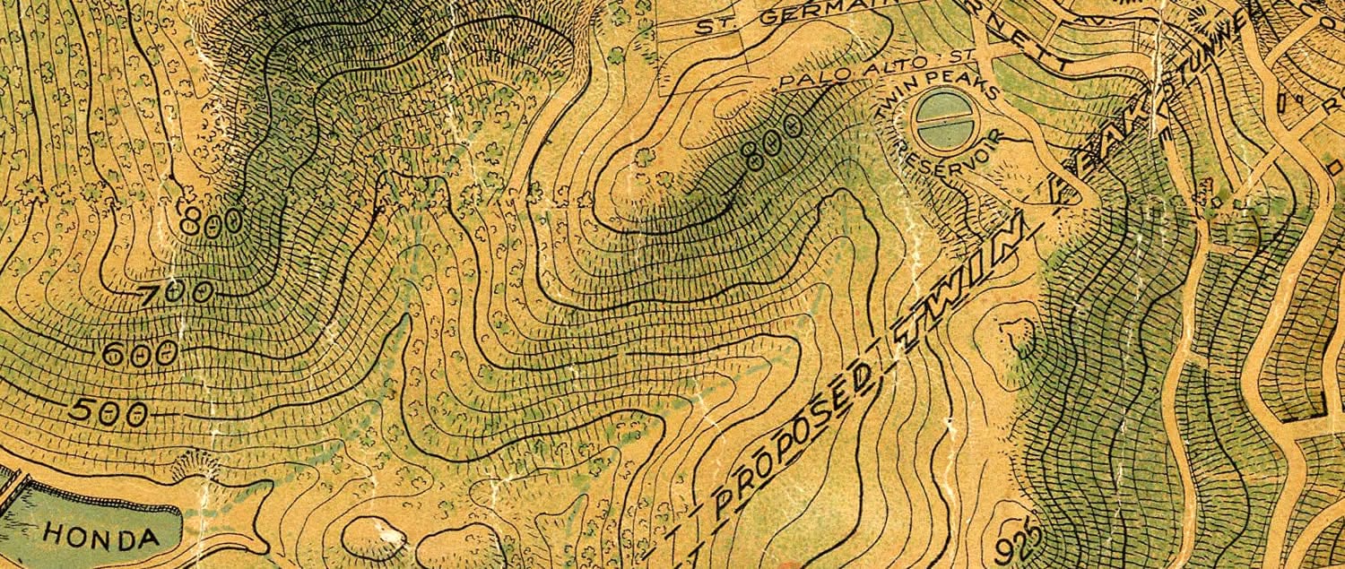
I think the “Chevalier” map of San Francisco, created by August Chevalier in 1911, is especially lovely. In particular, I like how Chevalier uses hachures only on hillshade sides of slopes.
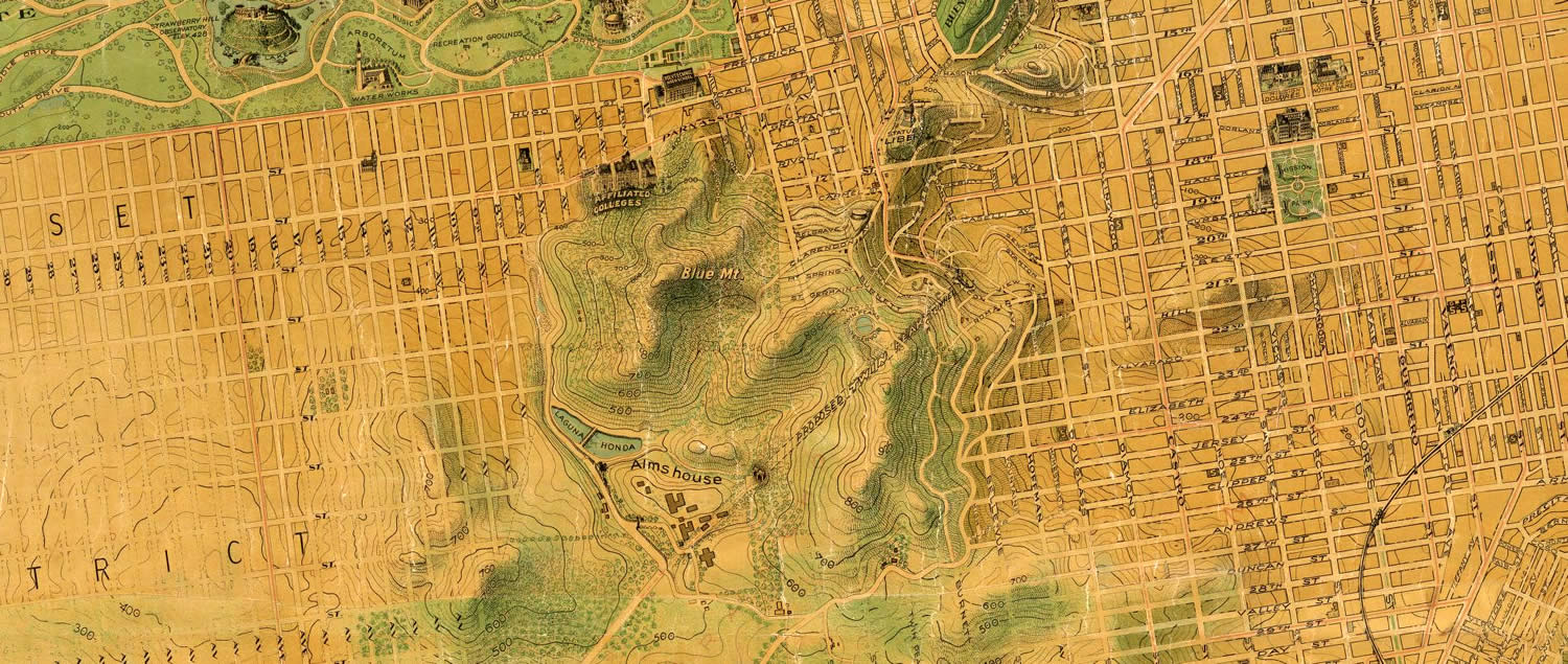
Glorious.
I also have benefited greatly from the perspective of David Pye’s Nature and Art of Workmanship. The main theme is the difference between the workmanship of risk and the workmanship of certainty.
The workmanship of risk relates to fully free-form creation, like whittling a stick with a knife. Full freedom but little expectation of rapid and consistent reproduce-ability. The workmanship of certainty has to do with using tools, templates, jigs, that guarantee precision and reproduce-ability, but at the cost of limited creative expression on the part of the maker.
Map makers these days might consider themselves positioned further toward the workmanship of certainty end of the spectrum. Our tools are precise and powerful and templatized, but sometimes we might feel like the fuller sense of freedom of hand-drawing maps is out of reach. I feel it too, which is why I like to think of ways to blur that distinction by pulling some freedoms of the workmanship of risk into the fast and capable environment of the workmanship of certainty. Smoosh them together.
So I was pondering Chevalier’s artistic hand-etched method of hachured hillshading (and those cool caterpillar hills of yore) and longing to do something similar in ArcGIS. Then I hit on an idea!
Here is the process…
- Grab a Digital Elevation Model (DEM).
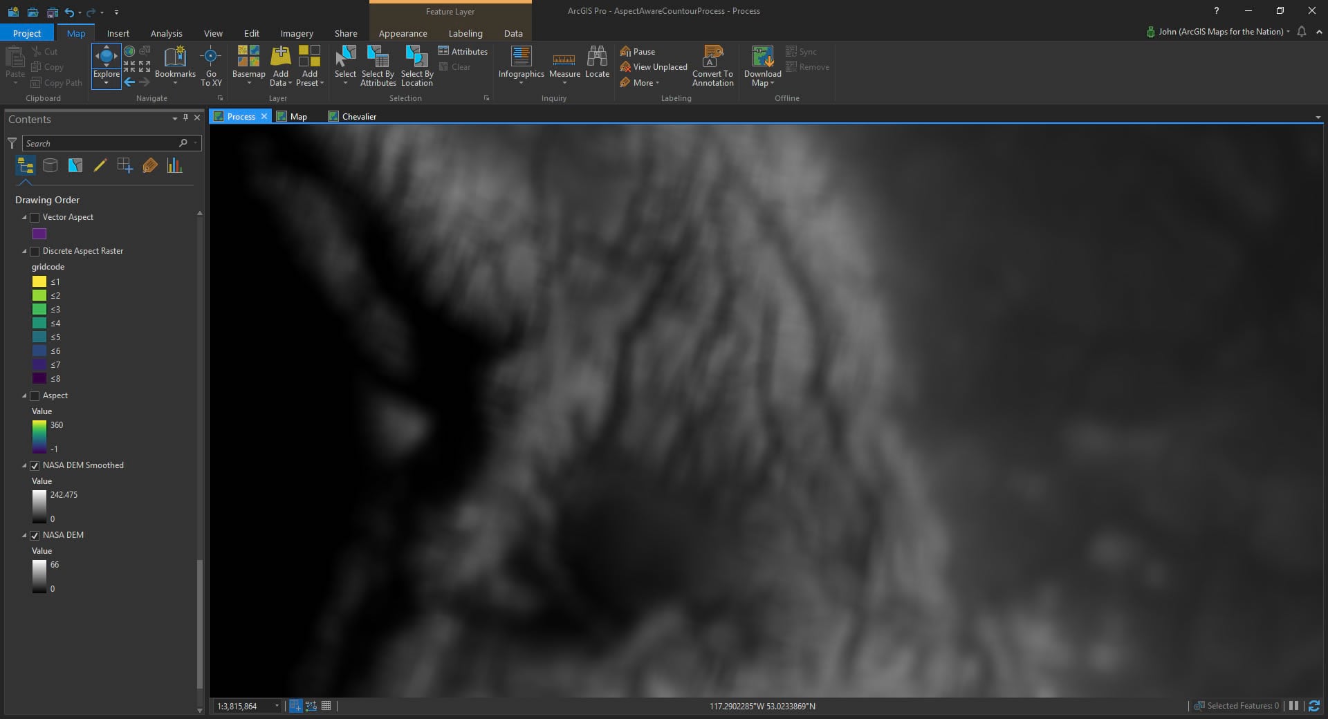
- Smooth it to taste, to get smoother curvier versions of what comes next.
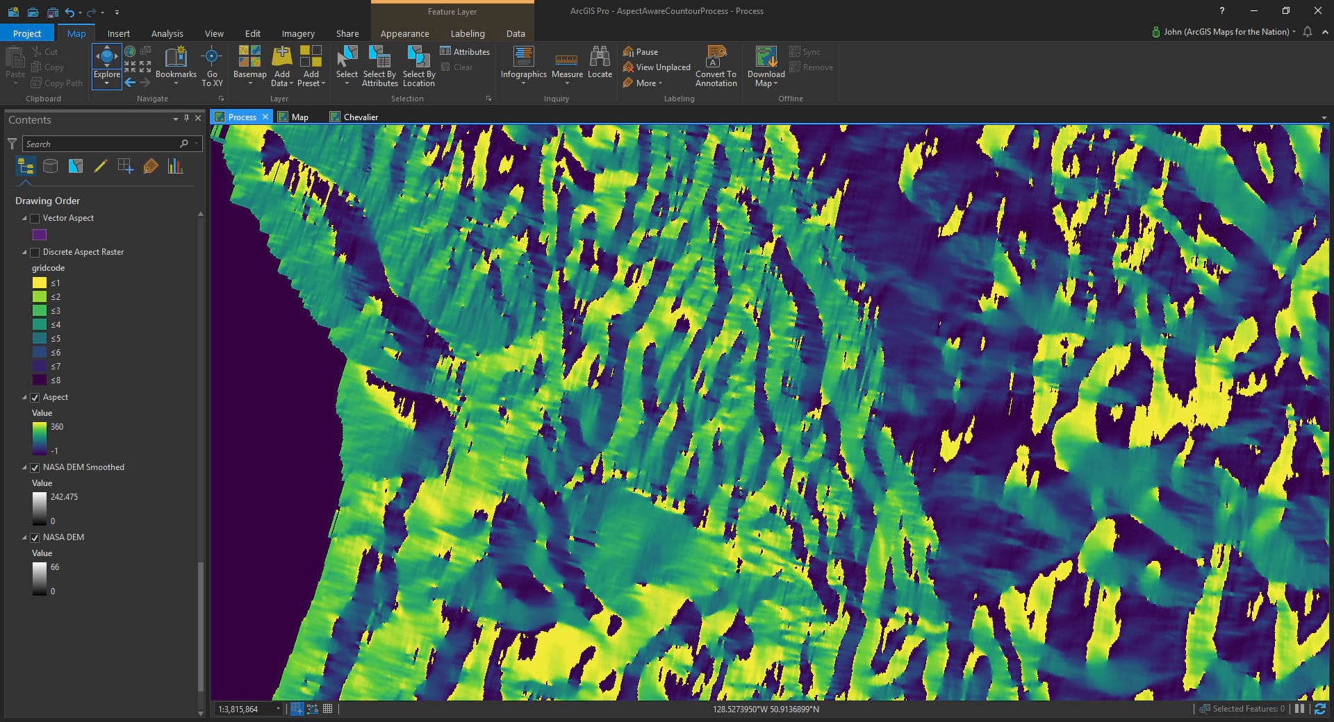
- Generate and Aspect layer.
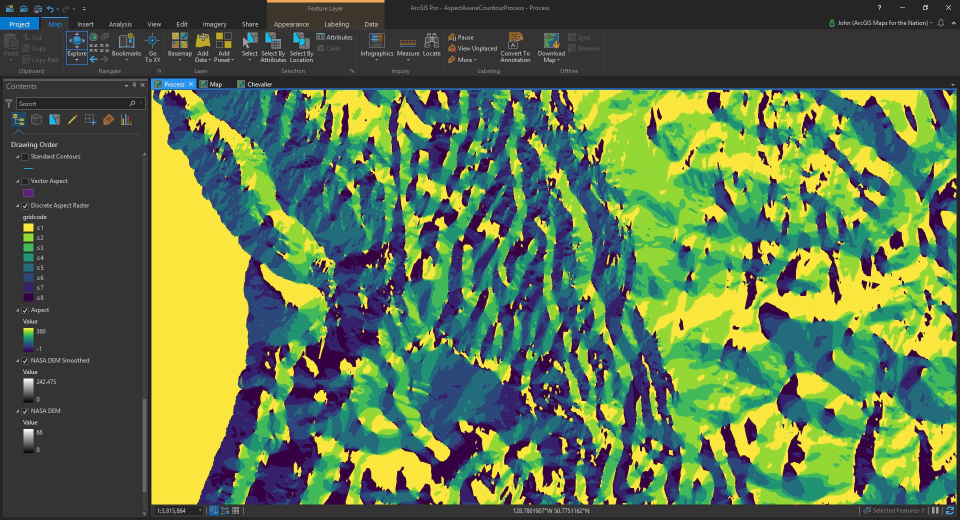
- Reclass the aspect layer into eight or so discrete ranges.
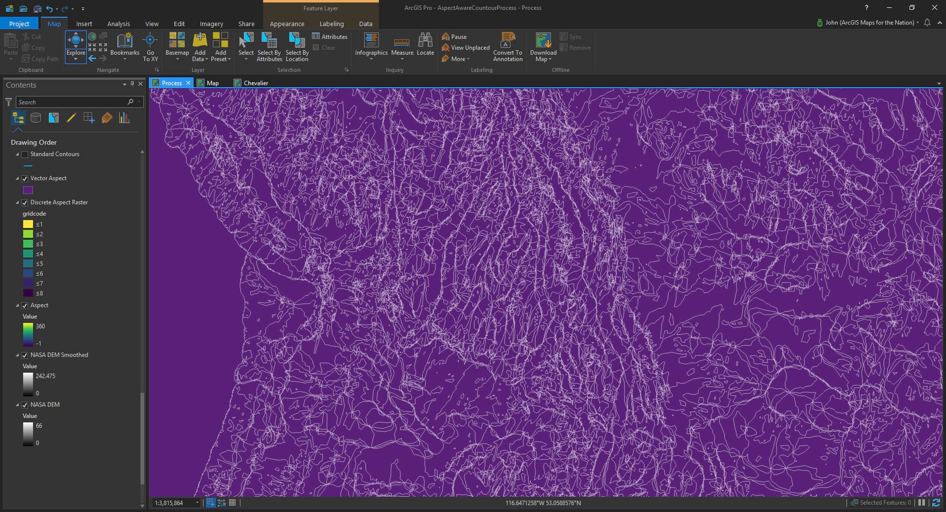
- Convert discrete aspect layer to vector.
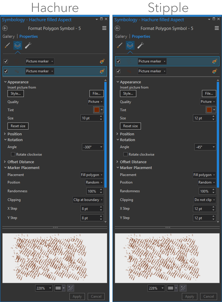
- Apply a hachure marker fill to the vectors, angled and scaled by the aspect orientation.
Ok ok, here are some visuals…
Good old DEM:
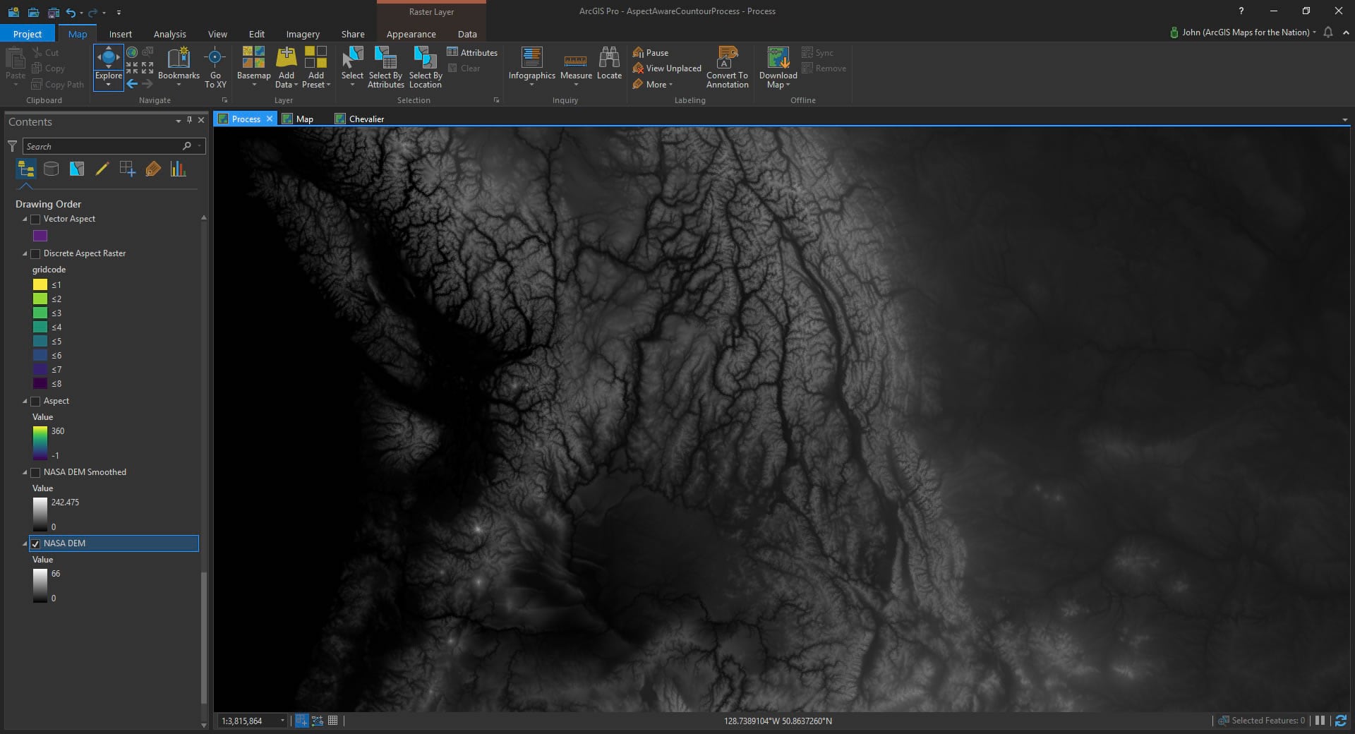
Smoothed to taste (use the Focal Statistics spatial analyst tool to blur the image):
Aspect layer creation (imagery > raster functions > surface > aspect):
Reclassed to discrete bands of orientation (spatial analyst reclassify tool):
Convert to vector (raster to polygon tool):
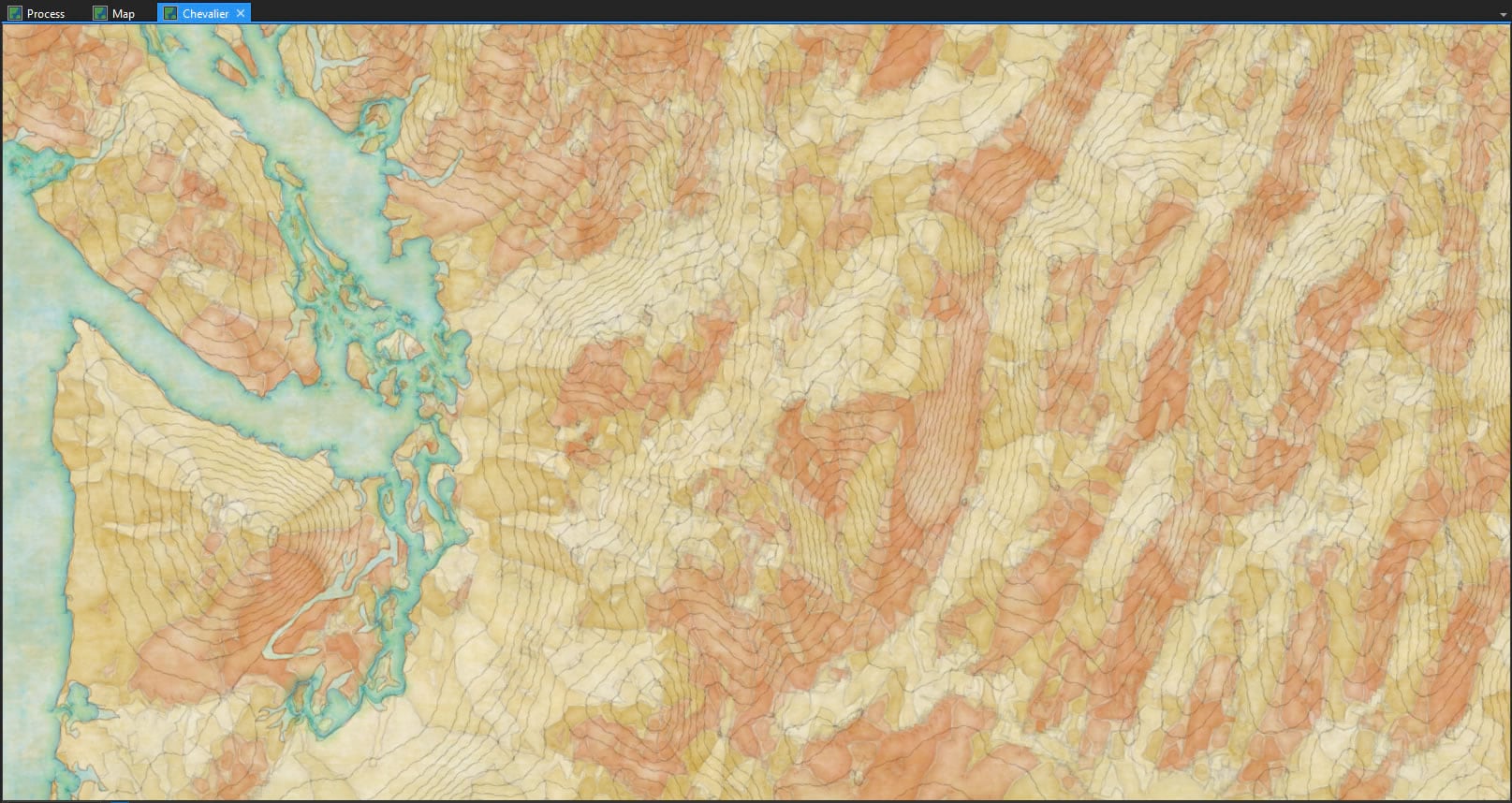
Now all sorts of magical styling can happen.
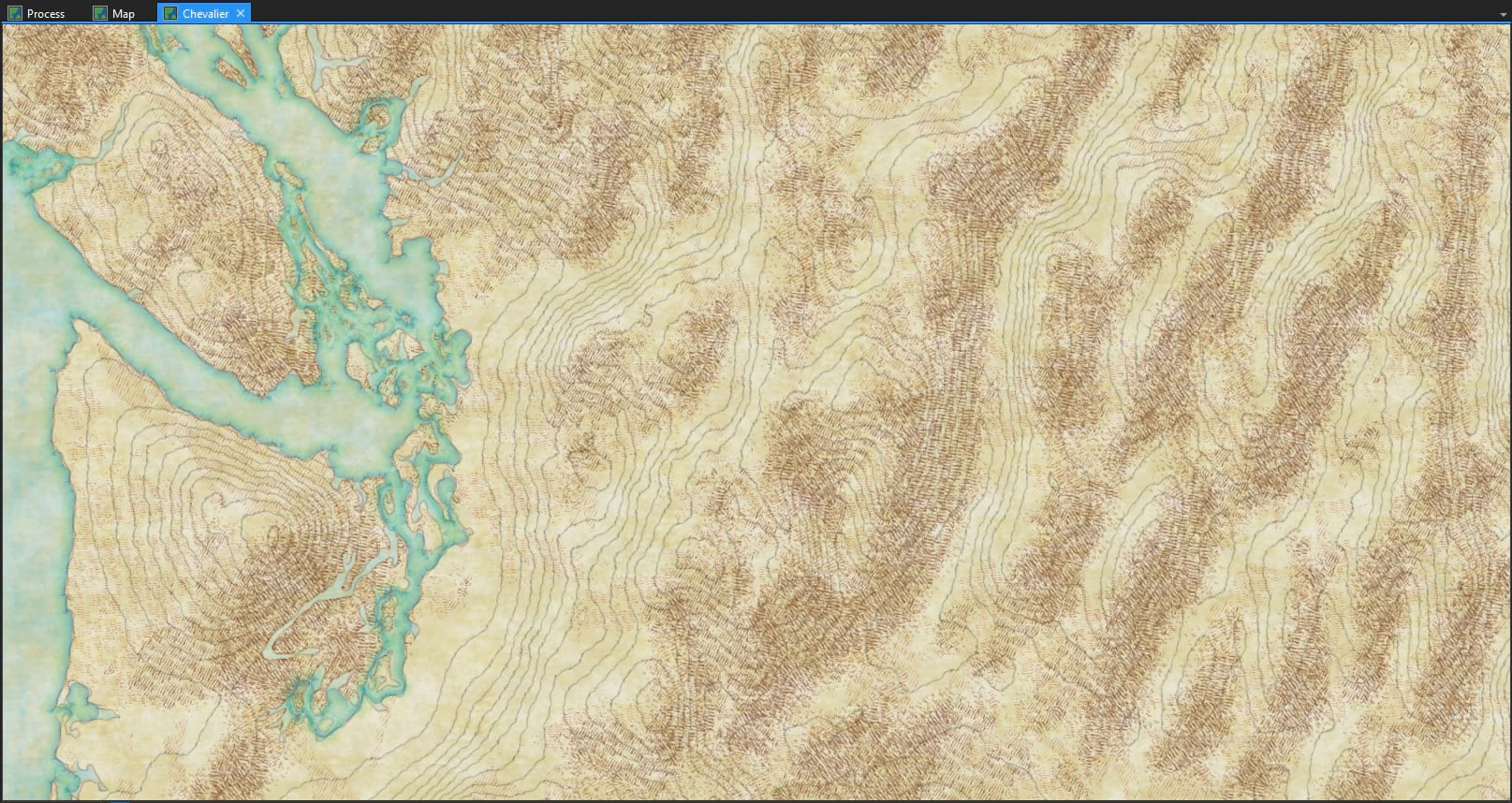
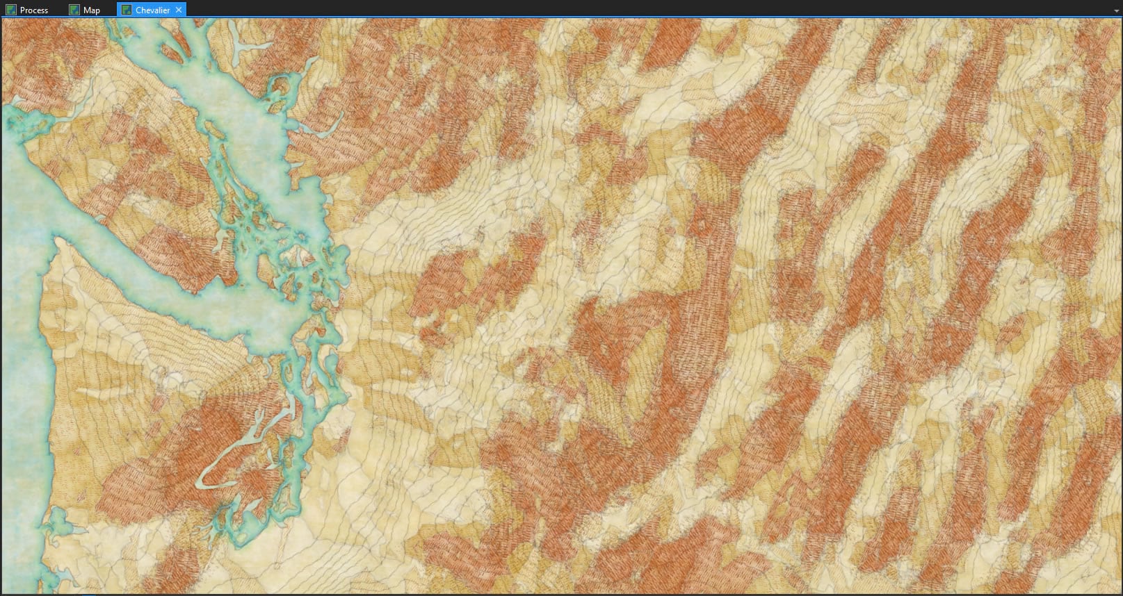
Here is a map of some contours made using a combination of the hachures style and watercolor style…
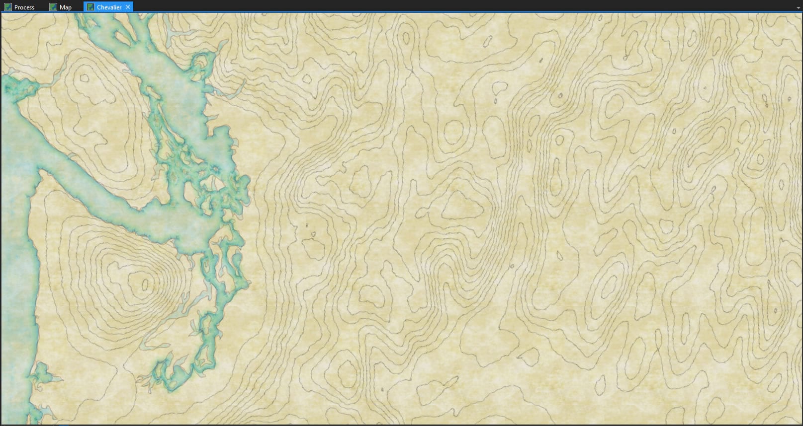
Now, if I open up the symbology of the aspect polygons I just cranked out, I can use these images to create hachured fills of the aspect polygons, angling the hachure image to fit the general orientation of the aspect.
Which looks a bit like Chevalier’s shade! We did it!
Mega fun, right? The workmanship of certainty looks a bit like the freewheeling workmanship of risk!
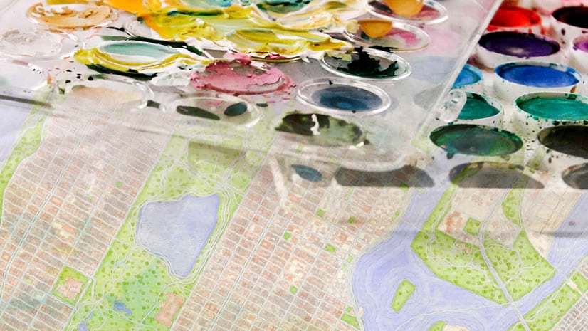
By the way, if you have the watercolor style installed, you could give the aspect polygons darker paint in the shadowy areas. Why not?
You may be asking yourself, what if we lived in a world where you could shade hills using watercolor AND Chevalier hachures?
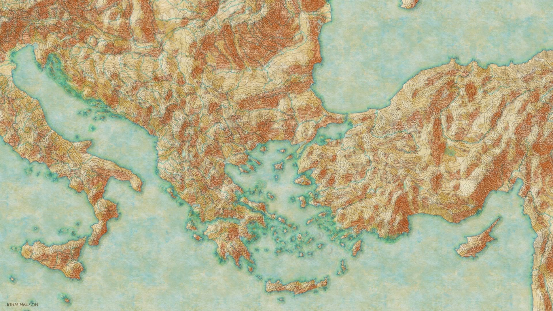
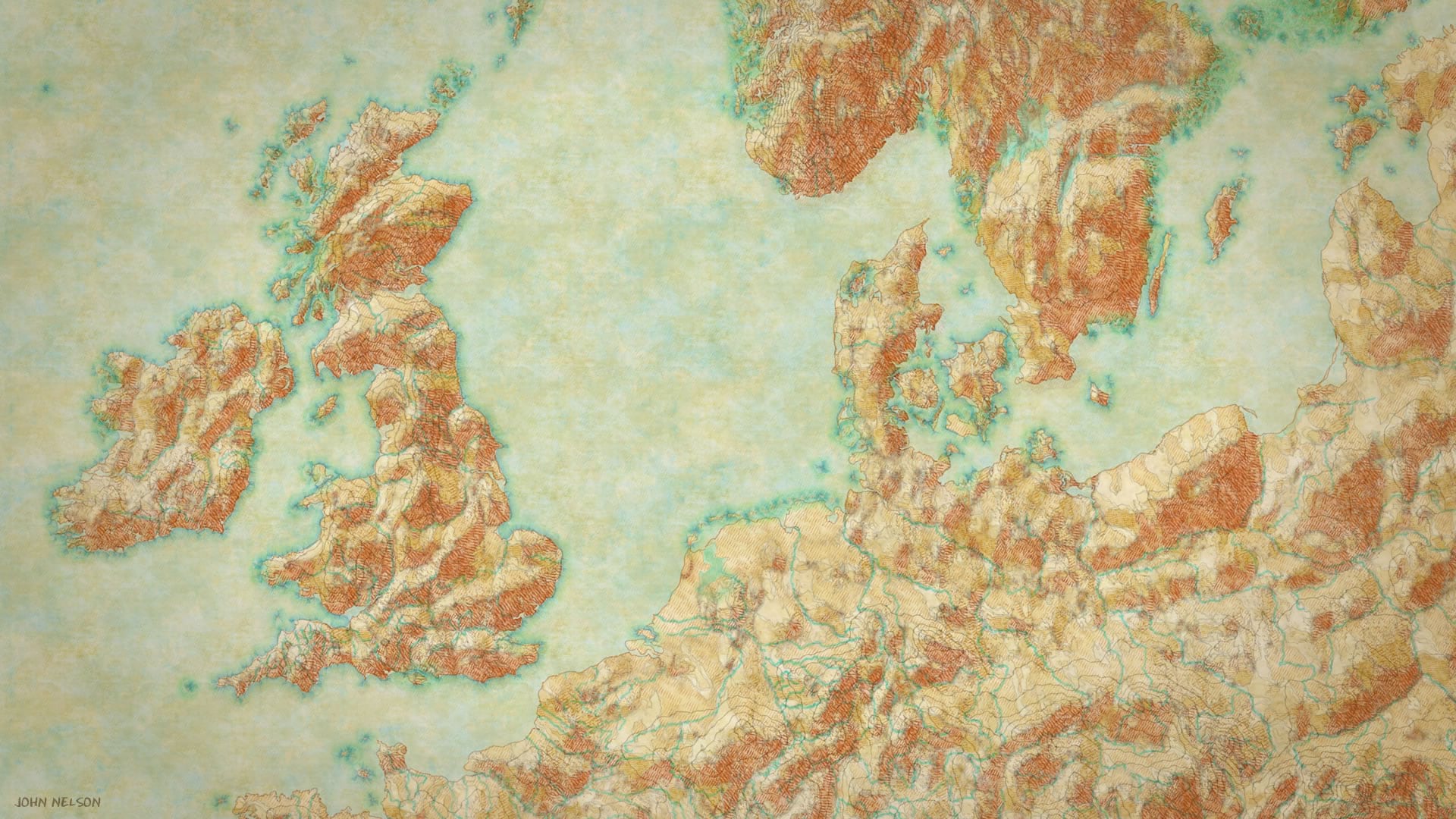
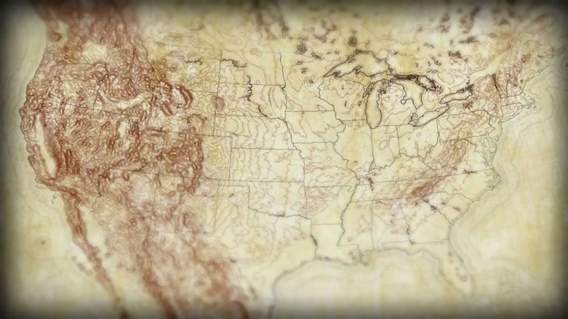
And, for posterity, here are some more examples of other places. This method is too much fun and you will try it. It is your destiny.
Obviously I’ll start with the Greatest Lakes…
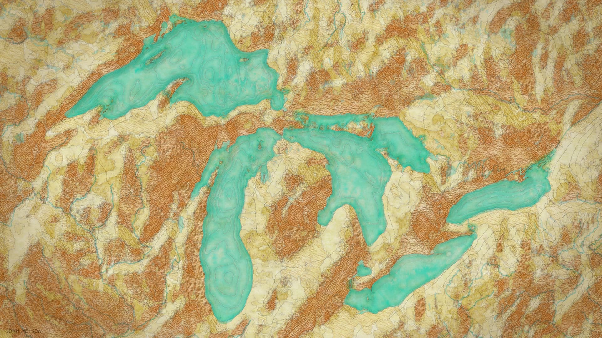
Ahhh. The workmanship of risk and the workmanship of certainty blend just a bit more now. I smile and throw a wink to August Chevalier across the decades. Thanks for the amazing work, AC, inspiring punk cartographers one hundred years on.
Happy Hacky Hillshading! John
P.S. Did you ever wonder what would happen if you cookie-cut the contour lines by the aspect polygons? All sorts of fun happens, that’s what. I’ll follow up with a bunch of examples but right now it’s way past quitting time on a Friday! But who am I kidding, pretending that making maps is work? Who’s got it better than us?

Commenting is not enabled for this article.