ArcGIS Pro 2.2, Esri’s flagship 64-bit desktop GIS, has been released and is available. Now is the perfect time to migrate to ArcGIS Pro.
ArcGIS Pro 2.2 is the largest update to ArcGIS Pro yet and brings a slew of new features and functionality. It adds and improves your highly requested workflows, features new innovations that take advantage of ArcGIS Pro’s unique 3D and 64-bit environment, and connects your desktop more tightly with the rest of the ArcGIS platform.
Slice Tool
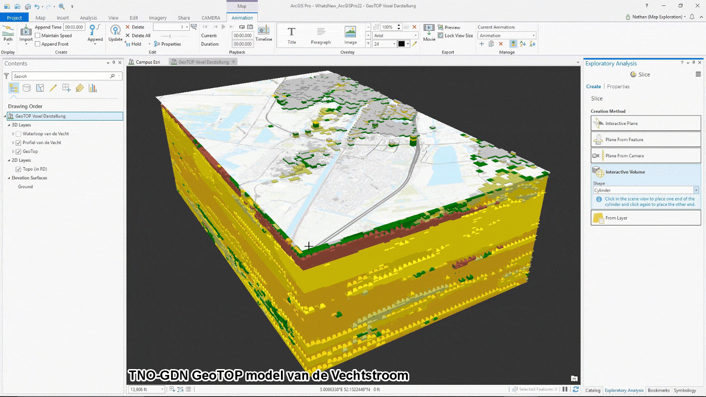
Explore content hidden behind or within other content with the new interactive 3D exploration tool, Slice. You can slice through content in your scenes using planes or volumetric shapes. Slice is included among the other Interactive Analysis tools in the 3D Exploratory Analysis tools introduced in ArcGIS Pro 2.1.
Full Motion Video (FMV)
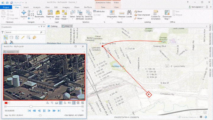
Play and analyze full-motion video (FMV) data that is geospatially enabled with the ArcGIS Image Analyst extension. Enable the projection and display of the video frame footprint and sensor position on the map while the video plays. You can also collect features in the video player and visualize them on the map, or collect features in the map and see them displayed in the video player.
New Styles
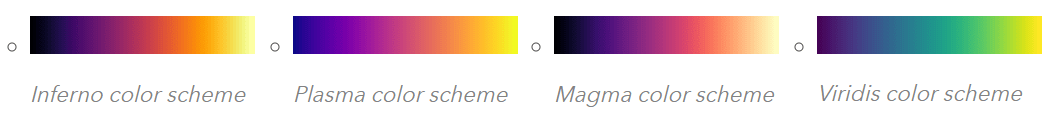
Inferno, Magma, Plasma, and Viridis scientific color schemes are now included in the ArcGIS Colors system style. These color schemes are particularly useful with imagery, LAS symbology, unclassed, and graduated colors symbology. They are also effective for grey scale environments and color-blind users.
Additional Innovations and Updates
ArcGIS Pro 2.2 is a big release. Here are some more new features:
- Support for reading Autodesk® Revit™ files enabling access to architectural model data inside ArcGIS.
- Stream layers: a new layer type that displays real-time streaming data.
- Apply photographic textures when interactively editing 3D objects.
- Pause drawing of a map or scene and still interact with it. While paused, you can navigate, add layers, or change the symbology; the state of the map will not refresh until paused drawing is turned off.
- Clip a measured grid to only show coordinates within its UTM zone boundary. This is especially useful when mapping areas that cross UTM boundaries.
- 50 new geoprocessing tools and batch geoprocessing to automate the running of a tool multiple times using many input datasets or different parameter settings.
Get the full details and watch video from the ArcGIS Pro developers on what’s new in ArcGIS Pro 2.2.

Commenting is not enabled for this article.