ArcGIS Pro 2.1, the next release of Esri’s flagship 64-bit desktop GIS application, is only a few months away. ArcGIS Pro 2.1 continues Esri’s mission to provide new and user-requested functionality, the latest innovations for working with 2D and 3D spatial data, tools for performing advanced analytics, and enhanced support across the ArcGIS platform.
Here are some of the new features you can test out in the ArcGIS 2.1 Beta 1:
Add Dynamic and Interactive Tables to Layouts

ArcGIS Pro 2.0 brought dynamic charts to your layouts. ArcGIS Pro 2.1 extends that functionality to dynamic tables. You can now add all sorts of tables to your layouts, including Excel spreadsheets and attribute tables from map layers s. You can turn fields on and off, reorder the fields, and change everything about the display of the table, including backgrounds, borders, and headings. With attribute tables, you can automatically filter your data to only show visible features; as the map view changes, the table changes dynamically to only show the features in the current extent.
Connect to SAP HANA Geodatabases
Furthering the collaboration of Esri and SAP, ArcGIS Pro 2.1 will support SAP HANA as an enterprise geodatabase. SAP HANA geodatabases will support advanced platform capabilities with the newer service-based editing model. This allows the use of enterprise geodatabase functionality such as subtypes and domains, relationship classes, attachments, editor tracking, the utility network, and more.
Add Branches to ModelBuilder
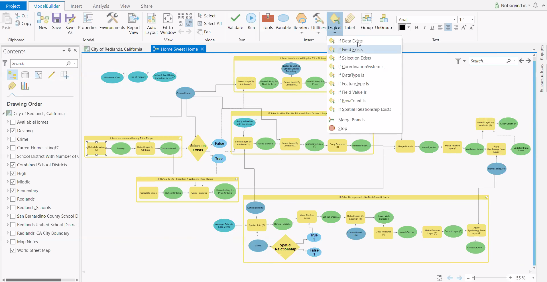
In ArcGIS Pro 2.1, ModelBuilder include a set of 9 logical tools that support the creation of if-then-else branching logic in your models that test conditional statements to determine how a model should proceed. This allows models to account for multiple options, choices, and alternatives.
You don’t have to wait until the final release to try out all the new features of ArcGIS Pro 2.1. Sign up for the ArcGIS Pro 2.1 Beta 1 today and get access weeks before anyone else.


Article Discussion: