ArcGIS Solutions helps you make the most of your GIS by providing purpose-driven, industry-specific configurations of ArcGIS.
Emergencies are becoming more frequent and intense, increasing their impact on your community. When an emergency occurs, you need timely, accurate information to help your community recover quickly. A slow damage assessment process or inaccurate information can impede your recovery efforts.
Conducting initial damage assessments in the field is often time-consuming and resource intensive. You may rely on windshield surveys, field reports, and other on-site methods that can be slowed by limited access and unsafe conditions. The new Virtual Damage Reporting solution helps your staff use GeoAI models and post-disaster imagery captured by satellites, aircraft, or drones to quickly quantify and review damage classifications from a safe location. This approach speeds up your early damage estimates and helps you understand where resources are needed and whether additional assistance may be required.
Here’s how the Virtual Damage Reporting solution helps streamline damage reporting.
Quickly identify the extent of the damage
As an emergency management agency, you need timely and accurate information about damage in your community to determine where resources are needed.
Perform deep learning assessments
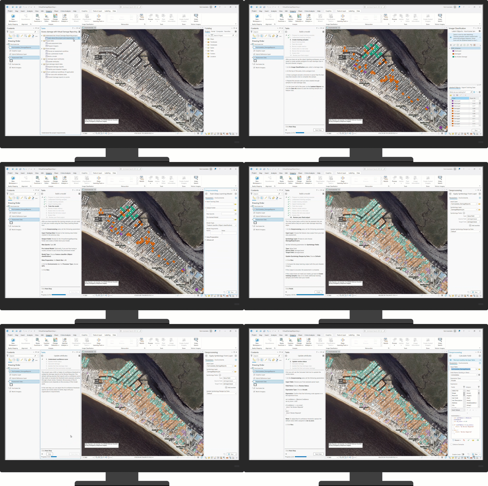
As a GIS analyst, you can use the ArcGIS Pro project included with the Virtual Damage Reporting solution to identify damaged and destroyed structures across impacted communities and generate actionable insights that support recovery efforts. A series of tasks guides you through adding post-disaster aerial imagery and parcel data to the project, then using either a pre-trained GeoAI model or a model you create for the specific incident to assess the damage.
You can then use the AI confidence score for each feature to identify which reports require manual review. After you update the review status, you can further enrich the data with estimated value loss by combining parcel property values with damage classifications, ultimately transforming damaged and destroyed classifications into an early picture of potential loss for your community.
Validate damage reports
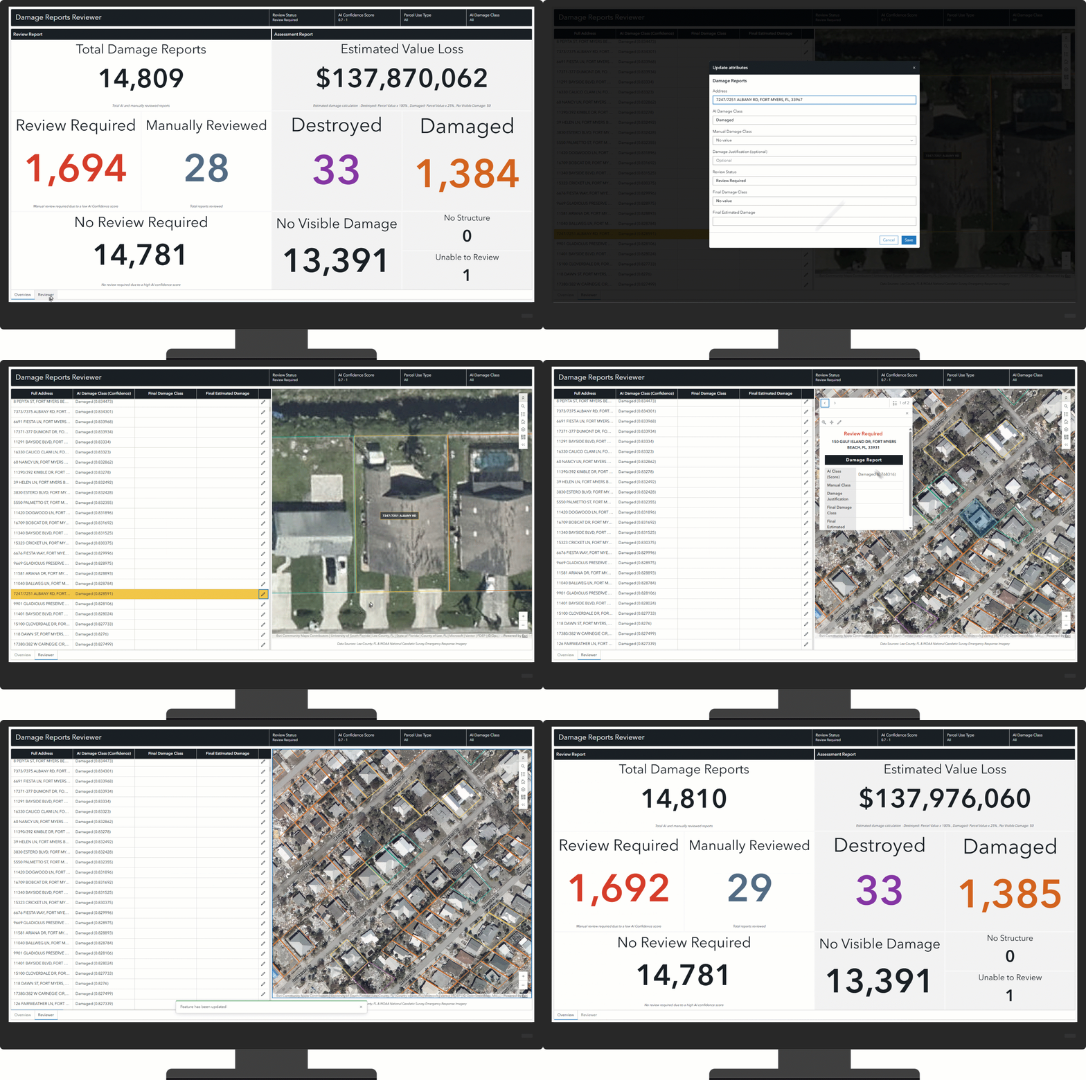
After the analysis is complete, as a damage assessment coordinator, you can use the Damage Reports Reviewer dashboard to view analysis results and manually validate or update damage reports using a prefiltered list sorted by AI confidence score. By prioritizing lower-confidence locations, you can focus your time where human validation adds the most value.
Share essential information with decision makers
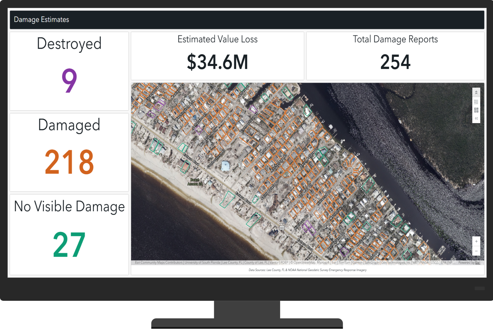
After damage reports are finalized, as an emergency manager, you can use the Damage Estimates dashboard to assess the number of damaged and destroyed structures and the estimated property loss. The results help you quickly identify the most impacted areas and determine where resources or assistance may be needed.
With faster access to reliable damage estimates, agencies can better direct resources and begin recovery efforts sooner.
Learn more
- Learn how to deploy, configure, and use the solution.
- View a demo video.
- Learn more about ArcGIS Solutions.


Article Discussion: