ArcGIS Solutions helps you make the most of your GIS by providing purpose-driven, industry-specific configurations of ArcGIS.
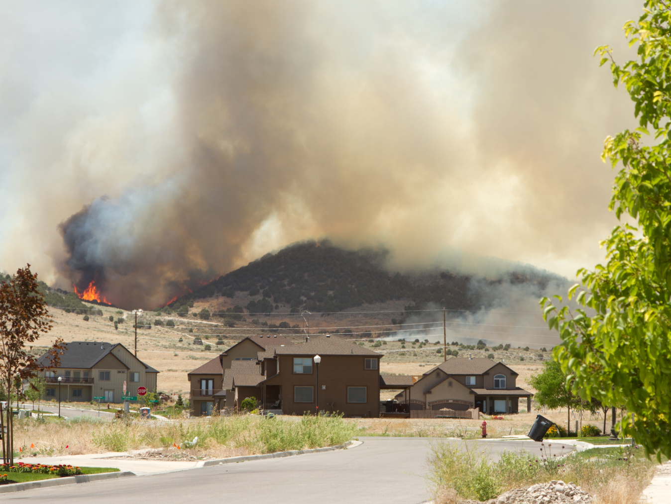
Wildfires are a formidable natural hazard that can be difficult to prevent and challenging to control. With the rising incidence and intensity of wildfires, along with more homes and neighborhoods being built in the Wildland-Urban Interface (WUI)—the area where wildlands meet urban development—it’s clear that communities can’t afford to wait until smoke is in the air to take action.
To get ahead of the risk, many communities develop a formal wildfire risk assessment and identify effective mitigation strategies. That often means creating a Community Wildfire Protection Plan (CWPP), designed to reduce wildfire risks and enhance the safety of residents, properties, and natural resources. These plans rely on maps and spatial analysis to understand risk and guide targeted mitigation efforts. In short: good data and good planning can make all the difference when a community is threatened by wildfire.
If your community is seeking proactive measures to plan against wildfires, the Wildfire Protection Planning solution may be just what you’re looking for. The solution was designed to help emergency management and fire agencies analyze historical wildfire patterns, evaluate their effects on structures, and prioritize mitigation efforts that minimize wildfire impacts and safeguard people and property.
Analyze wildfire history and risk
The Wildfire Protection Planning solution includes an ArcGIS Pro project that your GIS analysts can use to assess wildfire risk, understand the impact on structures, and identify defensible space to help firefighters plan mitigation efforts. The project includes a series of tasks that walk analysts through a historical wildfire analysis, visualization and understanding of structures at risk within the WUI, and an analysis of defensible space around structures that uses ArcGIS Deep Learning models.
To get started, your GIS analyst adds local data for community boundaries, high-resolution imagery, building footprints including an optional deep learning model to detect buildings from imagery, WUI zone boundaries, and historical wildfire starts. A spatiotemporal analysis of historical wildfire incidents helps inform risk patterns, including a cluster density analysis for wildfire starts, which can identify hotspots and inform mitigation areas for early prevention of new fires.

Understanding risk by identifying structures within wildlands, ember zones, and ignition zones brings actionable insight into areas that are part of the WUI. A task group in the Wildfire Protection Planning project identifies and classifies structures in the zones of the WUI within the area of interest.
Defensible space is the buffer between a structure and the surrounding area, and adequate defensible space acts as a barrier to slow or halt the progress of fires that could destroy property. Many jurisdictions have rules or guidelines on how much vegetation should be within a certain distance of buildings or structures, often classed in 5-foot, 30-foot, and 100-foot zones for reducing burnable material and vegetation. Through a series of tasks utilizing ArcGIS Deep Learning models, you will determine which structures have the most tree canopy within defensible space for your area of interest. The result is a symbolized layer classifying structures with the most tree canopy that helps prioritize your outreach efforts.

Assess and plan mitigation
Wildfire Mitigation Planner is an ArcGIS Experience Builder app that firefighters can use to prioritize wildfire mitigation areas, communicate the effectiveness of mitigation activities, and enhance planning efforts. The app helps firefighters assess wildfire protection planning factors and understand analysis results, plan wildfire mitigation activities, and export maps for use in digital or print formats.

Firefighters can first visualize factors like wildfire history, the Wildland-Urban Interface (WUI), risk indices, and localized vegetation and defensible space analysis, which produces targeted, evidence-based insights. After identifying the most at-risk areas, firefighters can easily edit the map to plan wildfire mitigation activities. An ArcGIS Business Analyst infographic included with the solution analyzes your area of interest or mitigation area with insights about structures and demographics relevant to wildfire protection planning.
Firefighters can use the app to export maps that support a Community Wildfire Protection Plan (CWPP) or a Hazard Mitigation Plan that includes location information, wildfire history, WUI boundaries, and analytical results. You can also share these maps with stakeholders or community members.
Learn more
For more information about the Wildfire Protection Planning solution, check out the following resources:
- Learn how to deploy, configure, and use the solution.
- Watch the demo video.
- Learn more about ArcGIS Solutions.
- Chat with us on Esri Community.


Article Discussion: