The 2025 ArcGIS StoryMaps Competition is now closed. Visit the competition website on February 10, 2026, to meet the competition finalists and cast a vote for your favorite story.
This year, Esri’s ArcGIS StoryMaps and Living Atlas teams are cohosting the 2025 ArcGIS StoryMaps Competition to share best practices and innovation in storytelling, cartography, and data visualization—and to help you elevate the challenges that mean the most to you.
Who can participate? What are the competition categories? What makes a winning story? Get the competition basics from John Nelson—your guest judge and ArcGIS Living Atlas mapping wizard.
Read on for more competition details and resources to get started.
- What are the competition categories?
- Who can participate?
- What is ArcGIS Living Atlas of the World?
- What makes a winning story?
- Who are the guest judges this year?
- What’s the best place to start?

What are the competition categories?
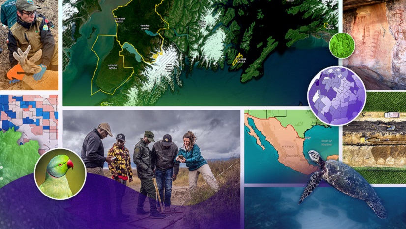
From lunch programs to green cities to biodiversity, individuals and organizations worldwide tell place-based stories about local communities, challenges, and innovative solutions—with common threads across our people, the infrastructure we build, and the impacts on the natural world and environment.
What’s your passion, your area of expertise?
Whatever your story, the three 2025 ArcGIS StoryMaps Competition categories offer an open space for ideas big and small—and all voices.

CATEGORY 1. People
Understand socio-economic patterns.
How many households live within fifteen minutes of a grocery store? What percentage of families own versus rent? How does broadband access vary by geographic location? Explore topics—like housing, health, and public safety—that affect your community. Read sample stories.
CATEGORY 2. Environment
Explore the natural world .
From the ocean floor to the stars, the natural resources around us can be preserved, protected, and better understood by using a geographic approach. With GIS tools and information, you can compare change over time for important trends; map real-time topics like wildfires, storms, and drought; or present your conservation cause through beautiful imagery and data visualization. Read sample stories.
CATEGORY 3. Infrastructure
Visualize the connection between built resources and needs.
Map infrastructure — the critical building blocks of our everyday lives. Our communities rely daily on the planning, designing, and building of community resources like transit systems, bike paths, and broadband connections. Tell a story about the powerful ways that infrastructure impacts our lives. Read sample stories.
And within each category, there’s a professional and a student track for young professionals with innovative ideas, different skill levels, and unique talents. To qualify as a student, you must be 18 years or older and a degree-seeking student at a two or four-year institution of higher education.
Who can participate?
College students, educators, and librarians. Researchers and communication professionals. Cartographers and GIS professionals.
This global competition is for you—newbies and experts alike.
There are just a few details to know up front:
- You must be at least 18 years old.
- You can submit one story or collection built with ArcGIS StoryMaps—either new or existing content.
- The story or collection must include ArcGIS Living Atlas content.
- You can build the story as an individual or group.
So grab a colleague, classmates, or chart your own path—and get started on your story.
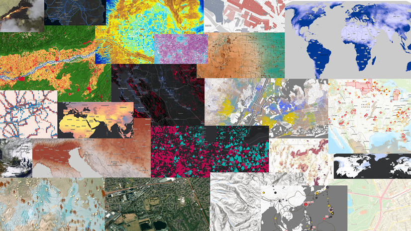
What is ArcGIS Living Atlas of the World?
Why create stories with ArcGIS Living Atlas content? What does that content include? Who can use it?
ArcGIS Living Atlas is the world’s foremost collection of geospatial content from the GIS community. It includes maps, apps, layers, and tools built directly into the map-making process—across ArcGIS and available to you.
In just a few clicks, you can add authoritative, pre-processed, and pre-configured datasets directly into your own maps. You can even use pre-designed ready-to-use maps and simply customize them for your needs and click save. Making impactful, stunning maps has never been easier. —Lisa Berry, cartographer, Living Atlas evangelist, and racecar driver
Whether you’re new to GIS or a geospatial leader, Living Atlas has content to match your topic, industry, and skill set. Add authoritative, ready-to-use content to your competition story in just a few clicks. Get started with this short demo.
Ready to dig a little deeper into Living Atlas layers, maps, apps, and tools? Bookmark these resources:
What makes a winning story?
The creativity, thoughtfulness, and attention to detail in each of these projects are inspiring, and underscore the impact that attentive, data-driven storytelling can have on our communities. —2024 guest judge from Old Dominion University
In February 2026, the ArcGIS StoryMaps and Living Atlas teams will announce the competition finalists—up to fifteen in each of the three categories.
From the finalists, the 2025 ArcGIS StoryMaps Competition judges will select a winner and student winner in each category based on the following criteria:
- Overall design, impact, and originality
- Innovative use of GIS, Living Atlas content, and the ArcGIS StoryMaps product
- How well the story or collection meets the competition category theme
In April 2026, we will announce those competition category winners along with three special award winners.
Community Choice Award
Esri will encourage the public to select their favorite 2025 ArcGIS StoryMaps Competition submission from among the finalists. The one submission that receives the most votes will be named the winner.
Storytelling with Maps Innovation Award
Esri’s StoryMaps team will select one winner of the Storytelling with Maps Innovation Award from among the competition finalists. The winner will demonstrate excellence and creativity in integrating GIS products (such as dashboards, web apps, web maps, surveys, etc.) with ArcGIS StoryMaps.
Living Atlas Innovation Award
Esri’s Living Atlas team will present one winner of the Living Atlas Innovation Award, recognizing exceptional use of Esri technology. The winning story will showcase the latest mapping and analytical capabilities in ArcGIS, demonstrating how innovative tools and techniques can elevate storytelling and spatial insight.
Read interviews with prior competition winners to get a behind-the-scenes look at their storytelling processes and valuable advice for becoming a Storyteller of the Year.
Who are the guest judges this year?
We’re amazed each year by the diverse talent and collective skill of our guest judging panels. And this year is no exception.
Meet the judges for the 2025 ArcGIS StoryMaps Competition—all talented storytellers and geospatial experts.
- Karina Amalbert, Geospatial Project Manager for Latinos in Heritage Conservation
- Véronique Couttee, Founder of Geospatial Equity Tech (GET) and Afritech
- John Nelson, Cartographer and UX Designer for Esri’s ArcGIS Living Atlas of the World
- Maryam Rabiee, Director of SDGs Today, a part of the UN Sustainable Development Solutions Network
- Stephanie Smith, GIS Director for the Grand Canyon Trust
Read their bios in our 2025 ArcGIS StoryMaps Competition announcement story.
Coming soon! Join a “Meet the Judges” webinar where our experts will share their experiences and advice for creating your stories, maps, and more. Follow @ArcGISStoryMaps X for webinar details and other competition resources.
What’s the best place to start?
Your home base for the 2025 ArcGIS StoryMaps Competition is the official website. It’s a starting point for understanding the competition rules and requirements, and it’s the ending point for submitting your story or collection to the competition.
But we recommend the companion competition hub for building your submission. It includes the latest competition news, category-based stories and Living Atlas content, and how-to information.
While it has a little something for everyone, we built the hub content with the beginner in mind—or for someone who needs a good fresher. Discover the resources that we’ve curated just for you.

Are you a Storyteller of the Year?
Visit the 2025 ArcGIS StoryMaps Competition website to get started.
We can’t wait to see what you create.


Commenting is not enabled for this article.