The December 2021 release of Oriented Imagery is here, just in time for the new year! We’ve added support for publishing tools in ArcGIS Pro 2.9, enhanced documentation for setting up cloud storage and automating publication workflows, new enhancements for exploiting video in the Oriented Imagery viewer, and more.
What is Oriented Imagery?
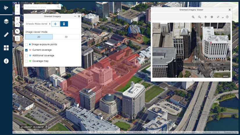
Oriented Imagery is an ArcGIS-wide solution for managing, exploring, and visualizing imagery taken from any angle, including drone imagery, street-side imagery, 360 images, panoramas, video, and more. It includes an Oriented Imagery add-in for ArcGIS Pro to visualize and exploit your imagery, Oriented Imagery Management Tools to manage and publish oriented imagery catalogs (the input for Oriented Imagery), an Experience Builder widget you can use to create and share custom Oriented Imagery apps, and the Oriented Imagery API (which manages the Oriented Imagery viewer across all the clients). Learn more about Oriented Imagery.
New in December 2021
We’ve added new enhancements and improvements across the Oriented Imagery components—here are some key highlights.
Enhancements for managing and visualizing video
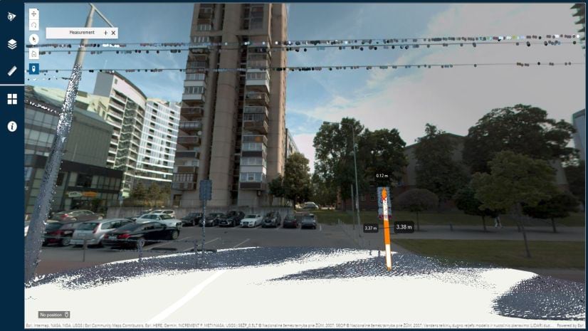
With Oriented Imagery, you can play a video in the Oriented Imagery viewer as you watch the video footprint update dynamically on the map. Now, when you pause a video in the Oriented Imagery viewer, you’ll have the option to view feature layers overlayed in the viewer, plus the ability to add or update editable features, just like you would in a static image.
We’ve also added support for additional fields in the Geospatial Video oriented imagery type—find more details in the documentation installed with the Oriented Imagery Management Tools (installed by default at C:/Image_Mgmt_Workflows/OrientedImagery/Documentation/ OrientedImageryCatalogManagement_UserGuide.pdf).
New documentation for cloud storage and automation
To help ensure user success, the documentation installed with the Oriented Imagery Management Tools now also includes information on proper configuration when setting up cloud storage in Amazon Web Services, including sample bucket policies to help control access and guidance for setting the S3 CORS policy for web applications that are loaded in one domain for interacting with resources in different domains.
We’ve also added new documentation to help you automate the creation and management of oriented imagery catalogs using Python or MDCS, including sample scripts.

Improved user experience for the ArcGIS Pro add-in
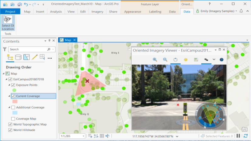
3D frustums are now shown in 3D scenes instead of polygons, making the desktop user experience more like the web. The Oriented Imagery add-in for ArcGIS Pro now supports a dark theme, making it easier to use Oriented Imagery regardless of how you configure ArcGIS Pro.

You can also add feature layers to the oriented imagery catalog group layer to view and edit features in the Oriented Imagery viewer.
Better support for oriented imagery catalogs created with ArcGIS QuickCapture
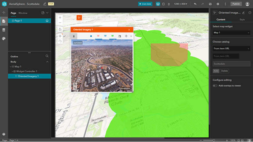
Both the Oriented Imagery widget for ArcGIS Experience Builder and the add-in for ArcGIS Pro now fully support oriented imagery catalogs created using ArcGIS QuickCapture.
Additional quality improvements
The Oriented Imagery Management Tools now support ArcGIS Pro 2.9. Additionally, permissions set on a published oriented imagery catalog are now maintained when the catalog is republished or updated.
In the ArcGIS Pro add-in, we’ve enhanced error handling and reporting.
In the Oriented Imagery API (which controls the Oriented Imagery viewer), we’ve fixed some previously identified issues:
- Features overlayed in the viewer are now displayed along the ground, improving interpretability.
- In superimpose mode, image cube face lines are blended more seamlessly.
- Large images will successfully display in the viewer.
- TIF images are now read in image space.
- If the World Elevation service is provided as the oriented imagery catalog’s DEM source, correct Z values will be computed.
- Errors handled by the Oriented Imagery API now display appropriate error messages based on the HTTP status code.
Try the latest release of Oriented Imagery
To try the latest release of Oriented Imagery, download the Oriented Imagery add-in for ArcGIS Pro and the Oriented Imagery Management Tools from ArcGIS Online, or use ArcGIS Experience Builder to build an app using the Oriented Imagery widget. If you’re completely new to Oriented Imagery, review our gallery of sample Oriented Imagery apps to see the solution in action, and check out the Oriented Imagery workflow for more resources.


Article Discussion: