We are back with our Esri Experts blog series! In todays blog we will explore what goes into building the world’s most trusted basemaps. Seth Sarakaitis, Product Engineering Lead for Community Maps at Esri shares how his team blends commercial, open, and community-contributed data to create authoritative maps that power countless applications. Learn how local expertise, innovative workflows, and a passion for accuracy drive Esri’s commitment to delivering reliable, up-to-date location services for users everywhere. Let’s dive in.
1.Could you please introduce yourself and explain your role at Esri? When did you join the team, and how has your role evolved over time?
I’m Seth Sarakaitis, and I lead the team that manages Esri’s basemap data. I’ve been with Esri for over 18 years, spending most of that time in the ArcGIS Living Atlas team. I started out as a Project Manager in Professional Services, which gave me a solid foundation in project management—skills I still use every day. Now, my team focuses on the data side of basemaps, pulling information from a mix of sources: commercial vendors, open data platforms, and even contributions from the ArcGIS user community.

2. Esri is known for delivering world-class services, including the integration of multiple data sources and a rigorous vetting process for authoritative data. In your opinion, what sets Esri’s data products and location services apart from those offered by other companies?
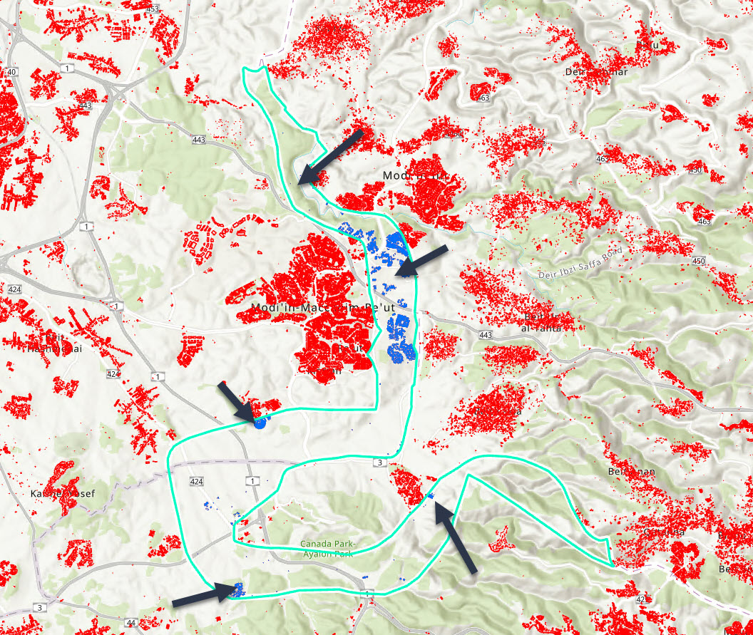
The data used to create Esri’s basemaps comes from three primary sources: approximately 40% commercially licensed data, 40% contributions from the ArcGIS Community, and 20% from open data where commercial or community sources are unavailable. The community contributions are especially valuable. These organizations—cities, counties, and other local entities—use ArcGIS tools to create and maintain assets within their own regions. Because they live and work in these communities, they are often the first to know about changes such as new developments or street name updates. This local expertise ensures timely and accurate data. Esri’s Community Maps Program leverages these trusted human resources—GIS professionals who care deeply about their communities—alongside open data initiatives, creating a unique and highly effective methodology for building authoritative basemaps.
3. Your products are regularly updated. How do you and your team manage the influx of new data and ensure its integration into the services?
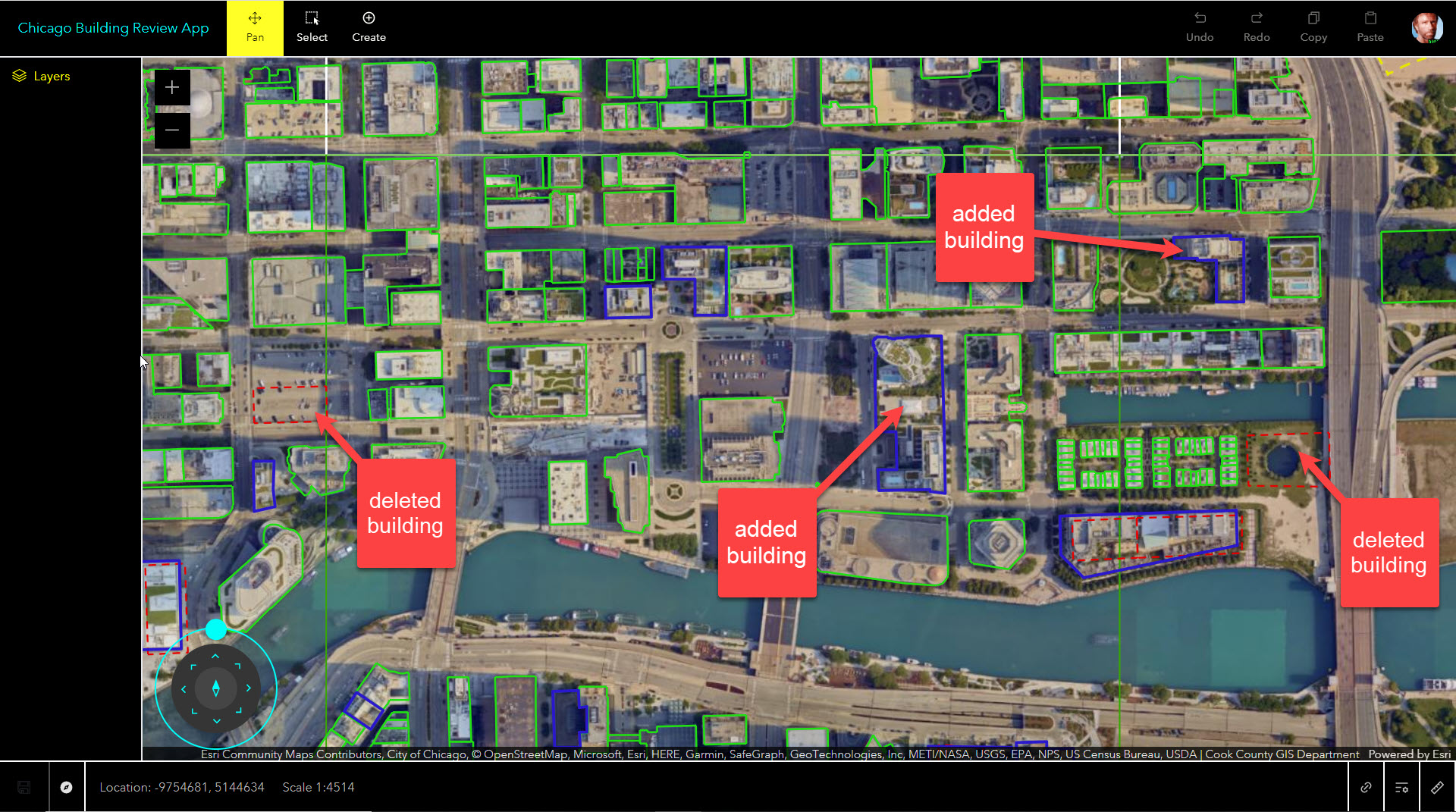
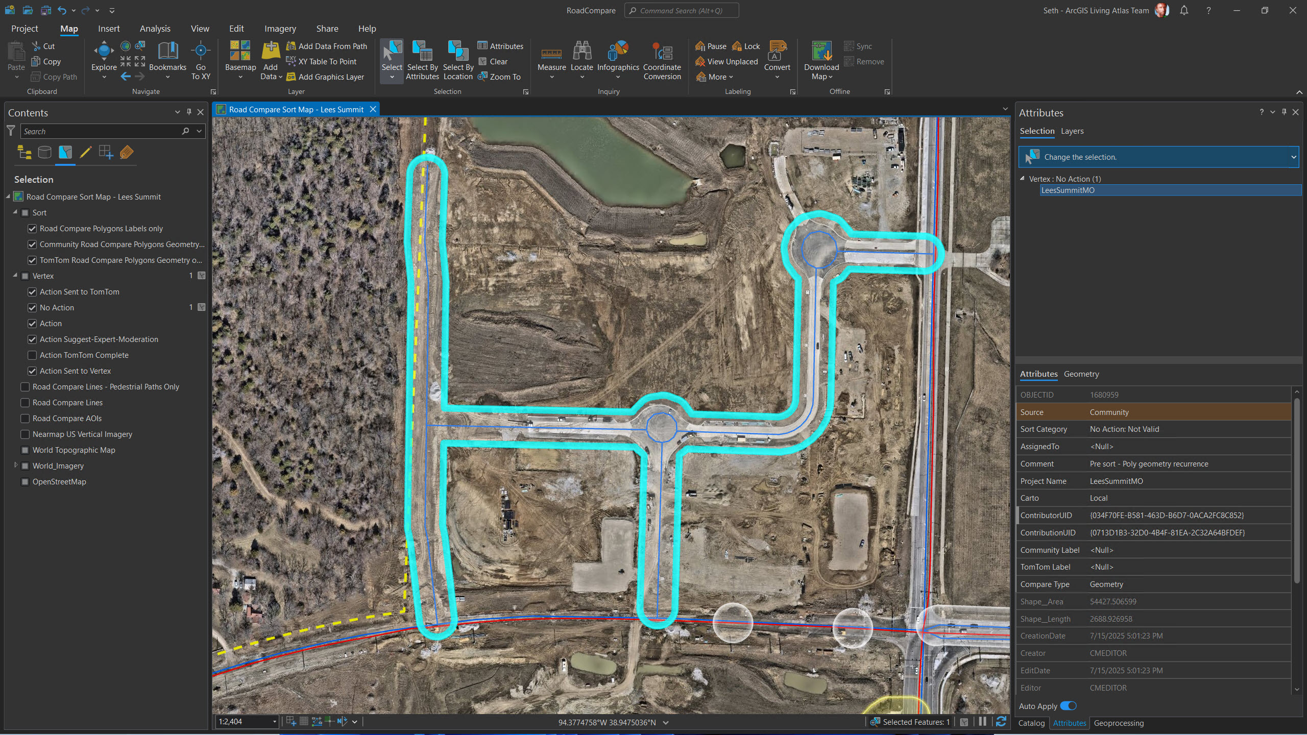
Our Community Maps team runs almost like a startup inside Esri. We’re not just building maps—we’re ArcGIS users ourselves, so we know what it takes to make them great. Every day, we work with Esri’s own tools, from ArcGIS Pro on the desktop to Enterprise Portal and ArcGIS Online, to process and refine contributed data. To keep things organized, we rely on ArcGIS Workflow Manager, which creates a work order for every data delivery. That means nothing slips through the cracks and every update is handled with care.
While parts of our process are automated, we always add a human touch. Our team reviews each contribution to make sure it makes sense and fits the cartographic style of our basemaps. The goal? Constant improvement—better coverage, fresher data, and more detail. When we achieve that, our basemaps become even more useful, empowering users to do more with their maps in any application.
4. When developing these products, what is the most significant challenge you encounter, and how do you overcome it?
Managing the growing volume of data deliveries is always a challenge. I often joke that I can’t reach my office door because of the mountain of data waiting for me each day! Over the years, our program has evolved significantly, driven by contributor feedback and requests. One of the most impactful changes has been accepting data as services in ArcGIS—either hosted in ArcGIS Online or on local systems. This approach transforms data delivery into a subscription-like model rather than a reactive process. Contributors build and maintain these services, and Esri pulls updates up to twice a year. Many contributors now provide updates regularly without additional effort, which keeps our basemaps fresh and accurate.
What’s next? The possibilities are endless. With rapidly advancing technology and enthusiastic customers, we’re excited to explore new ideas and innovations together.
5. How do you ensure the accuracy of the data products and location services you create?
Keeping our maps accurate is all about listening to our users. We’ve made it easier than ever for people to share feedback by using an ArcGIS Instant App, where they can quickly point out errors they see. And the details they provide are incredible—sometimes we get photos of street signs or official documents for a new park, straight from the community. These contributions aren’t just helpful; they’re essential for making sure maps reflect real-world changes. On top of that, we work closely with our data vendors, who are just as invested in quality as we are. When feedback comes in, we can trace it back to the source and make sure it gets fixed fast, so everyone benefits from the most accurate maps possible.
6. Throughout your experience working with global data, what has been the most surprising discovery you’ve made?
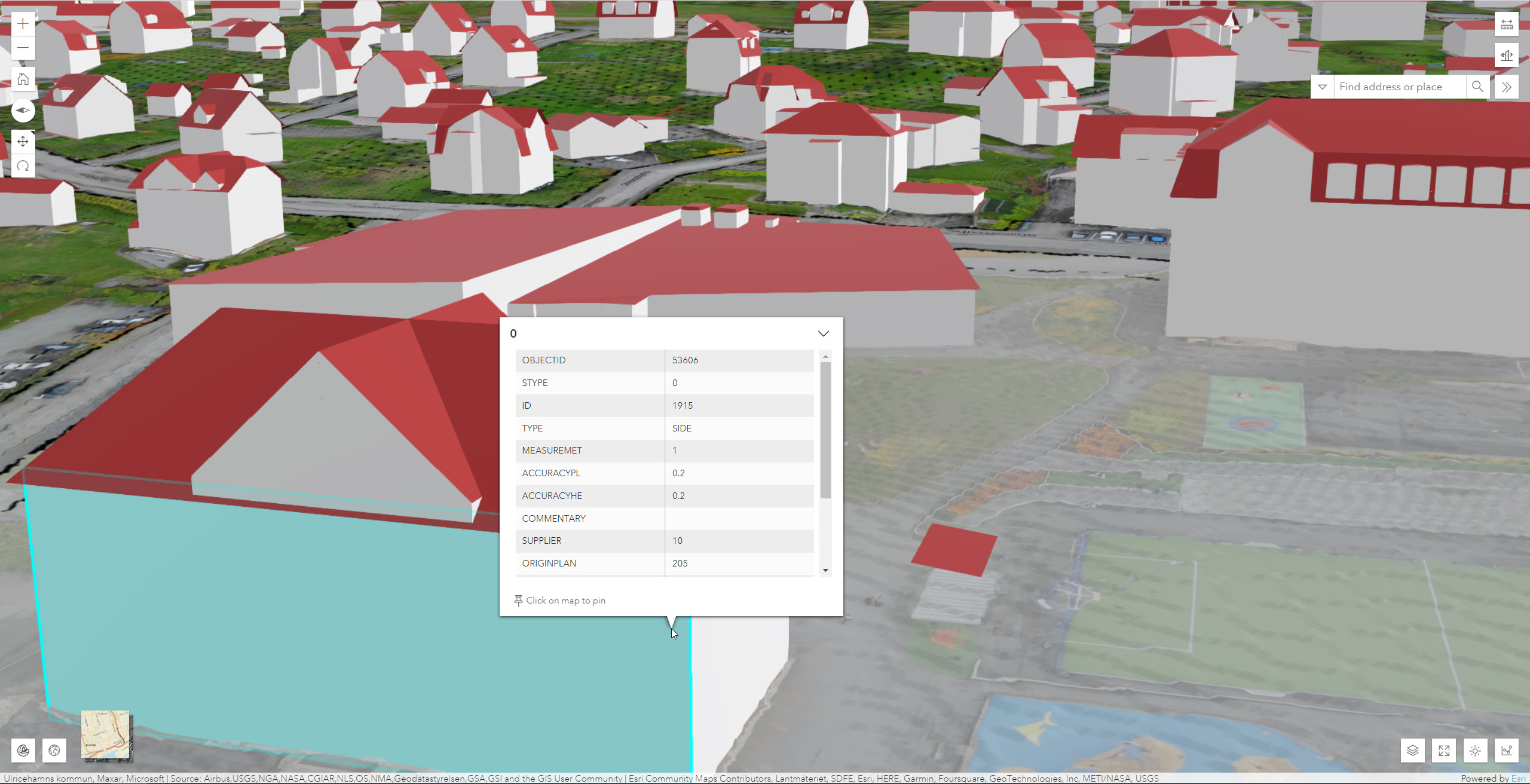
Even though Earth is finite, I feel like I’m always discovering new places! Sure, it’s a big planet, but every time I dive into a map, something new catches my eye. Honestly, if you told my younger self that looking at maps every day would be the thing that excites me most, I wouldn’t have believed you. What really blows my mind is the level of detail some places have achieved in their data. Entire countries have been mapped down to the scale of a campus—every street, every pathway, every little nook and cranny captured with incredible precision. It’s amazing to see that kind of dedication to detail.
7. What motivates you and your team to continuously strive for excellence in your work?
We’re always on the hunt for those standout datasets that make a basemap truly shine—the kind that turns a good map into something we can’t wait to share. It’s amazing to see how contributors start with a simple, base-level map and then ask, “How can we make this better?” That’s where the fun begins. We suggest adding details like building names or categories for different footprint types. Sometimes, we help create tree datasets so parks feel alive and unique.
And then there are the power users who dive in with the Community Maps Editor App, adding incredible large-scale details—think sidewalks, sports fields, and more—to schools and parks. These projects are some of our favorites because they show what’s possible when creativity meets data.
To spark ideas, we even create web map bookmarks so new contributors can browse and get inspired. Because here’s the truth: when customers build great basemaps, they unlock the ability to create better maps and apps—and that means better services for their communities.
8. Can you share any updates or improvements that you and your team are currently working on or planning to make in the near future to enhance the quality and functionality of your data and location services?
Esri’s Community Maps program is always growing and finding new ways to connect with communities. Recently, we launched a Road Closures community, building on the success of our Basemap and Imagery communities. We’re also slowly deploying a special Road Centerline community to improve all styles of basemaps as well as Routing and Directions services. And we’re not stopping there—imagine theme-based communities focused on things like recreation trails or other specialized layers that make maps even more useful and engaging. We’ve also been talking with customers about adding 3D features, like buildings and trees, to bring 3D scenes to life. These ideas could come together as curated collections from authoritative sources, giving users richer, more dynamic mapping experiences. The possibilities are endless, and we’re excited to keep pushing the boundaries of what’s possible.
As technology evolves and the demand for precise, dynamic mapping grows, Esri’s Community Maps team continues to push boundaries—empowering users, embracing community feedback, and exploring new ways to enhance data quality and functionality. Seth’s insights reveal a future where collaboration and creativity fuel even richer mapping experiences, ensuring that Esri’s basemaps remain at the forefront of innovation for years to come.
Visit our website to learn more about ArcGIS Data products and capabilities.


Commenting is not enabled for this article.