The water industry faces many challenges. Loss of intellectual knowledge is happening at alarming rates as industry professionals retire. Aging infrastructure is resulting in main breaks, leakages, and asset failures. Urban growth continues to drive demand for already stressed water resources. Increasing regulatory requirements often result in more work and require costly investments. In addition to these challenges, the water industry must be resilient to the impacts of climate change. Extreme heat and cold, longer droughts, and more frequent flooding are impacting water quality and threatening water security.
Impacts of Climate Change
Over the last 10 years, floods have caused more than $400 billion in damage and almost 60,000 casualties worldwide. Four billion people worldwide experience severe water scarcity for at least one month every year. Approximately two billion people worldwide consume water that is contaminated. It’s estimated that by 2030, demand for water will exceed supply by 40 percent.
The impacts of climate change are resulting in not enough water, too much water, and dirty water. This is what I call the trio of tricky problems.
How Does Climate Change Contribute to Not Enough Water?
Climate change intensifies water scarcity by escalating temperatures, altering precipitation patterns, and increasing evaporation. This results in reduced freshwater availability and increased drought frequency and severity.
- In early 2024, a prolonged dry spell in southern Africa threatened food security for millions. – Numerous regions in southern Africa faced the most severe midseason drought in over a century. Changes in rainfall patterns caused inadequate precipitation and elevated temperatures in multiple countries, leading to crop failures and livestock losses. Conversely, these shifting patterns triggered intense rainfall and sudden floods in other areas of the region.
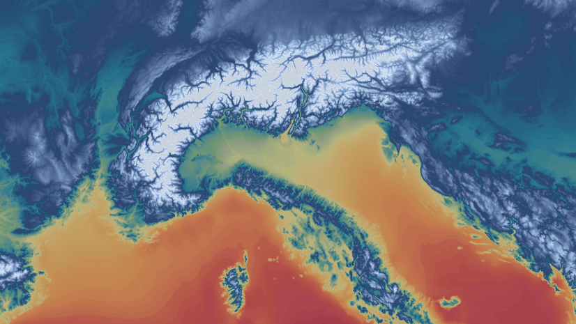
- In the fall of 2024, drought in the United States reached record levels. – A combination of hot and dry conditions across the country created record-breaking drought coverage. At the time, 45.3 percent of the Lower 48 states were in drought, and 73.2 percent of the Lower 48 was abnormally dry or in drought. Drought was present in every state except Alaska and Kentucky.
 Right: In the fall of 2024, drought was present in every state except Alaska and Kentucky. NDMC Map by NOAA Climate.gov")
How Does Climate Change Contribute to Too Much Water?
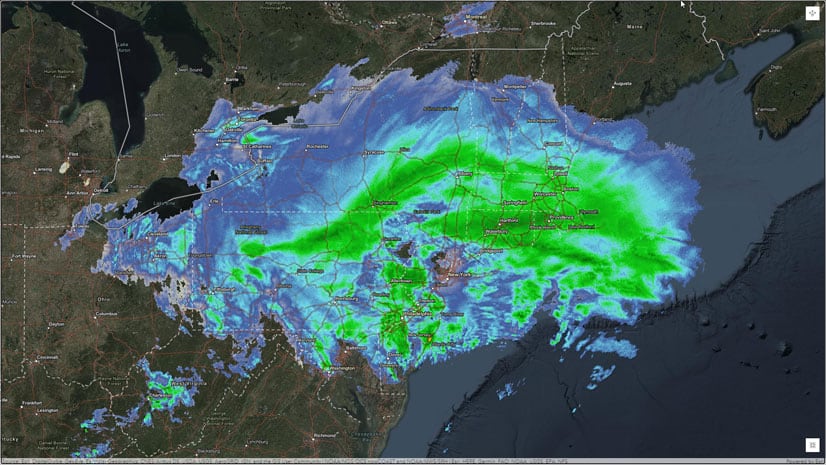
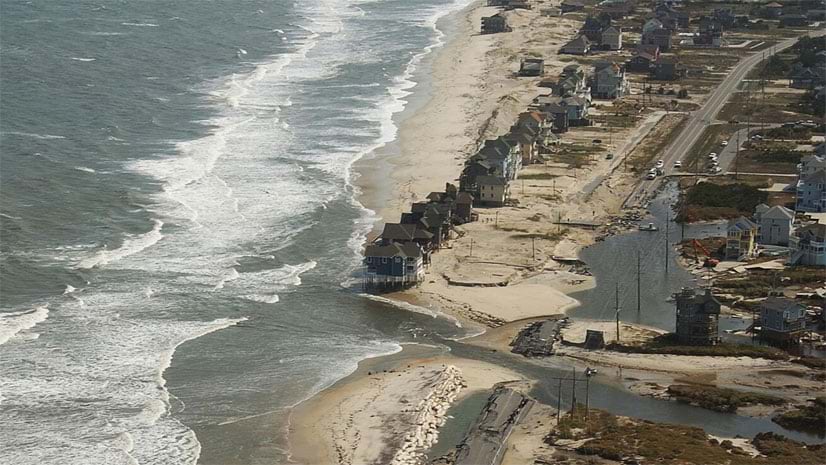
Climate change increases the risk of flooding in a number of ways. Increasing temperatures result in warm air that can hold more water than cooler air can. This is creating longer rainy seasons and shorter, intense bursts of rain that lead to flash flooding. Glaciers and ice sheets are melting at faster rates, adding freshwater to the oceans and increasing the volume of water. As our oceans warm, water expands, causing sea levels to rise. This amplifies storm surges and increases the risk of coastal flooding.
- In January 2024, San Diego, California, experienced historic flooding. – The city was struck by more than a month’s worth of rain in just six hours, destroying homes, flooding neighborhoods, and requiring hundreds of water rescues. More than half of the households in the city were displaced. State and federal officials estimated the cost of damage to public infrastructure at approximately $31 million.
- In May 2024, Brazil experienced heavy rains that led to elevated river levels and inundated numerous municipalities. – More than 90 percent of Rio Grande do Sul’s 497 municipalities were impacted, with 418 declaring a state of emergency or disaster. The storms caused extreme flooding in the greater Porto Alegre area, impacting 2.3 million people. Entire districts were washed off the map. As the waters retreated, sanitary conditions deteriorated, leaving behind contaminated mud and extensive debris.
- Hawaii is continuously vulnerable to coastal flooding, with 70 percent of its beaches under threat and 66,000 individuals at risk. – As sea levels rise, island residents face more than coastal flooding. Rising seawater reverses the flow from storm drains, leading to the formation of contaminated pools of brackish water. Due to the hydrological connection between groundwater and the ocean, groundwater flooding is happening further and further inland.

How Does Climate Change Contribute to Polluted Water?
Climate change threatens the quality of source water by amplifying the runoff of pollutants and sediment; reducing water availability from drought and saltwater intrusion; and adversely affecting overall efforts to maintain water quality.
- In communities where stormwater and sewage are combined in a single pipe system, intense storms have the potential to overwhelm the infrastructure. This can result in untreated sewage and contaminated stormwater being discharged into nearby water bodies such as streams, rivers, and the ocean.
- Elevated temperatures can contribute to the formation of harmful algal blooms. These blooms occur when algae that produce toxins experience rapid growth in a body of water. These toxins can be harmful to humans and animals. In addition, decomposing algal blooms consume large amounts of dissolved oxygen in the water, diminishing oxygen supply and often resulting in severe consequences for the ecosystem.
- Climate change significantly influences erosion processes, which encompass the breakdown, transport, and redistribution of soil particles by natural elements such as wind, water, and gravity. Erosion is intensified by the heightened frequency of storms and the rise in sea levels. This exacerbation introduces sediment, nutrients, and pollutants into water bodies, resulting in turbidity, eutrophication, and habitat degradation.

Improving Resiliency with Digital Solutions
Climate change is impacting our global community. It is a complex issue that is not easily solved. When addressing water industry challenges such as aging infrastructure, rising demand, and stricter regulatory standards, we must consider the heightened risks of floods, droughts, and pollution.
This is driving water, wastewater, and stormwater utilities to digitally transform. Utilities need solutions that will help them optimize efficiency across teams, manage systems holistically, and make data-driven decisions. By doing this, they will accomplish more with the resources available to them and be better prepared to mitigate the impacts of climate change.
Digital technologies offer unlimited potential to transform the world’s water systems, helping utilities become more resilient, innovative, and efficient, and in turn helping them build a stronger and more economically viable foundation for the future.
The International Water Association reports that digital solutions have a positive impact on reducing operational expenditures, increasing capital efficiency, improving the customer experience, enhancing the efficiency of the utility workforce, and even improving how people view their utility providers.

Digital Transformation in the Water Industry
Digital transformation happens when utilities implement technology-based solutions that help them do their job better. How utilities transform varies.
Many small and rural systems digitally transform by moving from paper maps, forms, and spreadsheets to web maps and field apps. This significant transformation improves efficiency and enables data-driven decision making. Easy access to data and analytics reveal trends and patterns that support strategic planning and organizational objectives.
Utilities that have a digital foundation already in place are continuing to transform by integrating business systems and breaking down data silos. They digitally transform how data is stored, accessed, and analyzed. Utilities are building fully connected, real-time systems that support digital twins, creating a real-world look into what will impact sustainability goals.
One thing that most utilities have in common is that they are digitally transforming with the help of GIS-based solutions.
GIS and the Geographic Approach
Solving the trio of tricky problems starts with us, the water industry. The work we do and the knowledge we hold are crucial. ArcGIS is a powerful platform that is helping the water industry collect, visualize, analyze, and share data, turning it into information. It is helping us make decisions that will improve resiliency and sustainability.
GIS applications are the foundation for understanding and action. They are an important part of the work utilities are doing. Applications democratize data by making it easy to access.
- Mobile applications enable data collection and provide information to remote staff, making it easier for them to complete their work.
- Web apps empower understanding. They help us share information in ways that engage stakeholders and support data-driven decisions.
- Desktop applications provide powerful tools and capabilities, including advanced mapping analytics, 3D visualization, and real-world network models.
GIS further democratizes data by integrating critical business systems, enabling utilities to manage more holistically. It breaks down data silos and makes information easily available.
Our industry needs to do things differently—we need to do better. I believe that we are taking steps in the right direction. Utilities, communities, and even global organizations are working to create partnerships, build solutions, and increase understanding.
Tackling Climate Change with GIS — Not Enough Water
The increasing need for water has led to conditions where both surface water and groundwater are insufficient to meet rising demand. This has resulted in the depletion of shallow aquifers, plus research into accessing deeper ones that cannot be replenished within our lifetime. In the process, we threaten not only our own health, peace, and well-being but also the health of ecosystems and wildlife.
In response to overuse of our water resources, National Geographic Society and Utrecht University have created the World Water Map. This map helps us understand where and why water gaps arise, how climate change might aggravate them, and even how they might be managed. It shares global data, visualizing water scarcity around the world.

The image above illustrates groundwater extraction projects in India and provides insights into the impact of over-pumping aquifers. India is the leading country in terms of groundwater pumping, using water primarily for irrigation purposes. In the dry northwestern regions of Punjab and Haryana, water-intensive crops like rice and wheat have become predominant, relying heavily on well water for irrigation. Consequently, the water table is declining at a rate of up to three meters annually.
Organizations like National Geographic, Utrecht University, and others are working hard to collect data, analyze, and visualize it to better understand how water is being used and how best to make change that supports future water security.
Tackling Climate Change with GIS — Too Much Water
Geohazards Risk Mapping Initiative promotes a sustainable environment through the development and dissemination of geohazard maps using advanced geospatial technology and artificial intelligence. They work to foster local solutions through the development of flood risk geospatial solutions.
Volunteers in Nigeria created a real-time flood reporting tool, interactive flood maps, web applications, and a comprehensive flood event database. This work is helping to refine flood prediction analyses and foster community engagement. It helps communities in Nigeria prepare for and respond to recurring flooding events.

The mission of the Geohazards Risk Mapping Initiative is to have a positive impact not just in Nigeria but across Africa. Hard work is going into identifying areas susceptible to geohazards, producing prediction maps at local scales, and sharing information and resources with disaster and emergency management institutions, government ministries, NGOs, community leaders and environmental response stakeholders.
Tackling Climate Change with GIS — Dirty Water
Urbanization contributes to increased levels of pollutants in our nation’s water bodies. This is largely a result of dense residential and commercial development dominated by impervious surfaces. A typical city block generates five times more polluted runoff than a woodland area of the same size, increasing the risk of water quality degradation.
In addition to the challenge of working in highly urbanized areas, utilities in Southern California are experiencing increased intensity of rainfall. Large amounts of rainfall in shorter periods of time leads to more stormwater rainfall and can overwhelm stormwater systems. Increased runoff from extreme storms can result in pollutants contaminating our water sources.

The City of Carlsbad, CA is managing and sharing information about treatment-control best practices and has inspired public partnerships for pollution prevention. The city has reduced the cost of its inspection and verification program by 44 percent, increased the number of verification submittals by 24 percent, and reduced the time to complete and submit verifications by 75 percent.
Leveraging ArcGIS Technology
GIS technology empowers water utilities to proactively address the challenges of climate change by enhancing risk assessment, resource management, infrastructure resilience, emergency response, and stakeholder engagement. By leveraging spatial data and analysis tools, utilities can build more resilient and sustainable water systems in the face of a changing climate.
- Risk Assessment and Planning: Utilities use ArcGIS to assess risks such as extreme weather events, sea-level rise, and changing storm patterns. By mapping vulnerable areas and assets, utilities can develop effective adaptation and mitigation strategies.
- Resource Management: Managing water resources becomes more efficient when using GIS technology to monitor source water, distribution networks, and demand. By analyzing spatial data, utilities can optimize water allocation, reduce leakage, and ensure sustainable water management practices.
- Infrastructure Resilience: Maps and spatial intelligence help utilities to quickly identify critical infrastructure that is vulnerable to climate change impacts. By mapping infrastructure assets and their condition, utilities can prioritize maintenance and investments to enhance resilience against extreme weather events.
- Emergency Response: GIS technology facilitates real-time monitoring of water systems, enabling utilities to respond strategically to emergencies such as floods, droughts, or asset failures. By visualizing data on a map, utilities can coordinate emergency response efforts more effectively.
- Stakeholder Engagement: Engaging with stakeholders, including policymakers, communities, and other agencies involved in water management is essential to achieve resilience and sustainability goals. By sharing spatial information through interactive maps and visualizations, utilities can foster collaboration and communication on climate change adaptation strategies.
This blog showcases diverse applications of technology in collecting, presenting, and sharing information. We are confronting the Trio of Tricky Problems using modern solutions that help us to digitally transform and enhance our understanding, resulting in a more effective approach to tackling climate change.

A very insightful article, Christa—thank you for breaking down the trio of tricky problems so clearly. Recent cloud bursts in Pakistan and their widespread destruction are a stark reminder of how urgent it is to adapt and strengthen our water infrastructure.