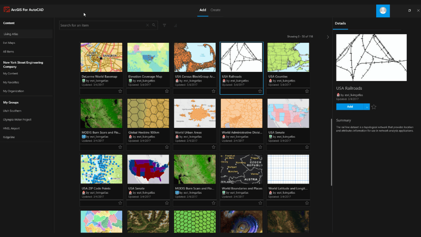
Overview
ArcGIS for AutoCAD weaves GIS into CAD workflows. Participation in GIS processes is two-way, empowering civil engineers and CAD technicians to collaborate with GIS professionals while consuming, creating, and sharing centralized project data. As a plug-in to Autodesk AutoCAD® and Civil 3D®, ArcGIS for AutoCAD leverages feature services for working with feature layers, maps, and imagery in desktop design applications. This enables CAD professionals to enrich and contextualize drawing geometry with spatial information, leading to more informed design decisions.
The 430 release of ArcGIS for AutoCAD brings new features and enhancements that strengthen collaborations between CAD and GIS teams. For example, newly added support for branch versioning enables multiple CAD editors to work simultaneously on web feature layers while GIS professionals track changes through time. This release also includes an extension that aids indoor GIS workflows and smooths preparation of CAD floorplan content for later consumption in ArcGIS Pro.
Release Highlights
Key features included in version 430 of ArcGIS for AutoCAD are highlighted below. Access the release notes to find detailed documentation on the new features and other helpful product resources.
Branch versioning
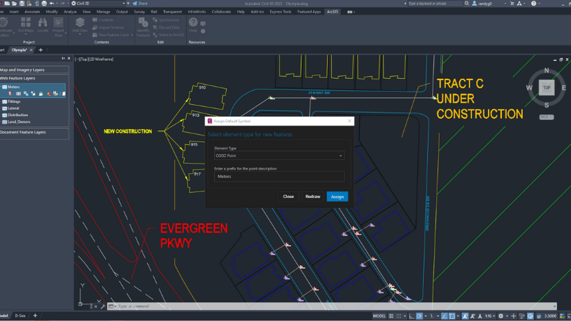
A significant enhancement in this release includes added support for branch versioning on web feature layers with supporting user interface changes, AutoLISP routines, and commands. This enhancement allows GIS professionals and administrators to adhere to common patterns across the stages of branch versioning workflows. CAD professionals working with web feature layers assigned a branch version can view layer data, modify editable layers, and synchronize changes in the usual way from within their CAD environment. They can further use the branch versioning feature set in ArcGIS for AutoCAD to:
- Create new branch versions of web feature layers. For web feature layers that support branch versioning, assign a branch name, provide a description, set access permissions, and change to the new version.
- Change between branch versions of web feature layers. Select a web feature layer that supports branch versioning, see the currently assigned branch version and related information, and select from a drop-down of other available branch versions.
Interactively access branch versioning functionality from the context menu of a selected web feature layer within the Esri Contents pane or build out customizations through provided AutoLISP tools.
Extension for indoors workflows: ArcGIS Indoors for AutoCAD
ArcGIS Indoors transforms CAD data into indoor maps for space management and wayfinding. The ArcGIS Indoors for AutoCAD extension helps prepare CAD floor plan drawings for use in ArcGIS Indoors workflows. Perform quality control workflows and analyze CAD data issues such as unclosed shape entities, self-intersecting polylines, and mislabeling. Addressing these issues from within the CAD environment saves time on post-import quality control in ArcGIS Pro. It also reduces unnecessary rework during building remodeling projects. The extension is installed automatically when you install ArcGIS for AutoCAD version 430. Check out this blog to learn more and keep on the lookout for a training seminar in January 2024.
AutoLISP functions for datum transformations
When an Esri coordinate system definition is assigned to a drawing, layers subsequently added through feature services will be properly positioned to that assigned coordinate system regardless of the coordinate system of the source data. For those who are automating customized CAD workflows using AutoLISP, datum transformation functions were added to make transformations explicit. Namely, three new functions are available in the ArcGIS for AutoCAD API:
- esri_coordsys_DatumTransformations_set: sets the transformation from a coordinate system to another coordinate system and the transformation step(s), all based on specified WKIDs.
- esri_coordsys_DatumTransformations_remove: removes a datum transformation, with specified WKIDs for the “from” and “to” coordinate systems.
- esri_coordsys_DatumTransformations: returns all the datum transformation definitions in the drawing
Ask our ArcGIS experts
Reach out to us with questions and suggest ways to make ArcGIS for AutoCAD even better. Visit the Esri Community to post questions and participate in product discussions. Help us drive new capabilities and enhancements to future releases by posting your product ideas for consideration.


Article Discussion: