The ArcGIS Open Data team has been working hard and deployed a minor update this week to help make it easier on you to change the world you live in with glorious Open Data. We call this a minor update as the UX for providers and consumers is unchanged, but what we did add are some improvements you’ve been asking for around understanding your data.
Included in this update:
Projection Magic
Previously all shapefile downloads regardless of original projection were provided in WGS84, but now your data will be provided in the original projection they were shared as. If you are confused on Projections, give this gem a read!
*Web Mercator will still convert to WGS84 for interoperability purposes
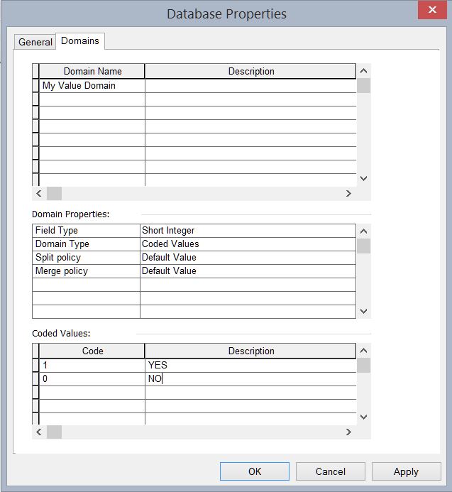
Coded Value Domain Support Lands
Yes, Coded Value Domains which are a property of the Geodatabase will now be honored in Open Data. This means if you have a domain that displays a YES/NO but stores a 1/0 in the table, we will filter the data on the displayed values and even write them to the CSV, SHP, KML, GeoJSON format for ease of use by consumers. (New to Coded Value Domains, learn how to create one!)
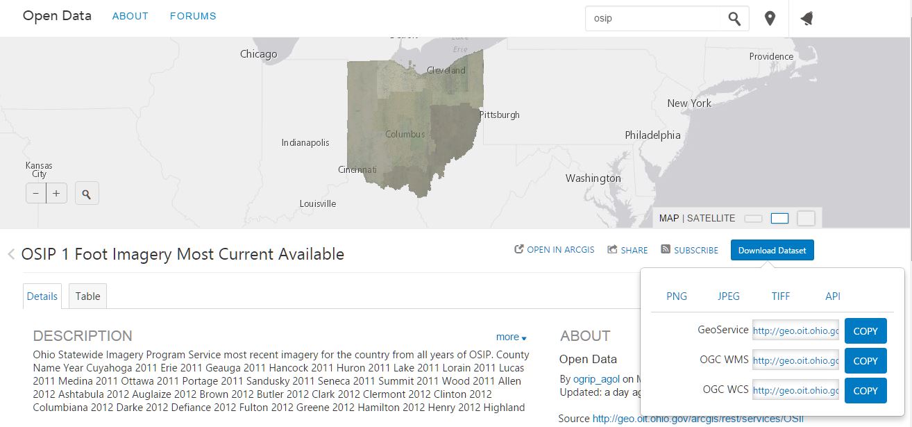
OGC Service Support
For providers taking advantage of the last update and sharing Image Services as Open Data, we will now show the API links to your data for WMS and WCS if enabled on the server. This provides great interoperability to open clients that support these specifications.
Shoo Fly
As always we’re crushing any pesky bugs reported to the team via Support or GeoNet!


Article Discussion: