On October 12th Esri officially announced a partnership with Waze, the free, crowdsourced traffic and navigation app powered by drivers. This partnership means that we are further providing templates and tools to allow governments to quickly work with Waze and build out an app to infrastructure system. Through the Waze Connected Citizens Program, a free, two-way data exchange program, municipalities can share data they already manage in ArcGIS as Open Data into the application, such as Road Closures, Government Buildings, Parking Lots, Points of Interest, Snow Plow Locations and more, which puts your data into the dashboard of more than 65 million monthly active users globally. The amazing thing about this, is that Waze is not just here to vacuum up government data, they provide a free, real time feed of data back to Connected Citizen Program Partners. The anonymized data is provided to partners to understand where Wazers are reporting issues and detecting traffic jams, so that our local governments can respond to these events in a variety of ways to improve driver safety as well as keep our roads flowing.
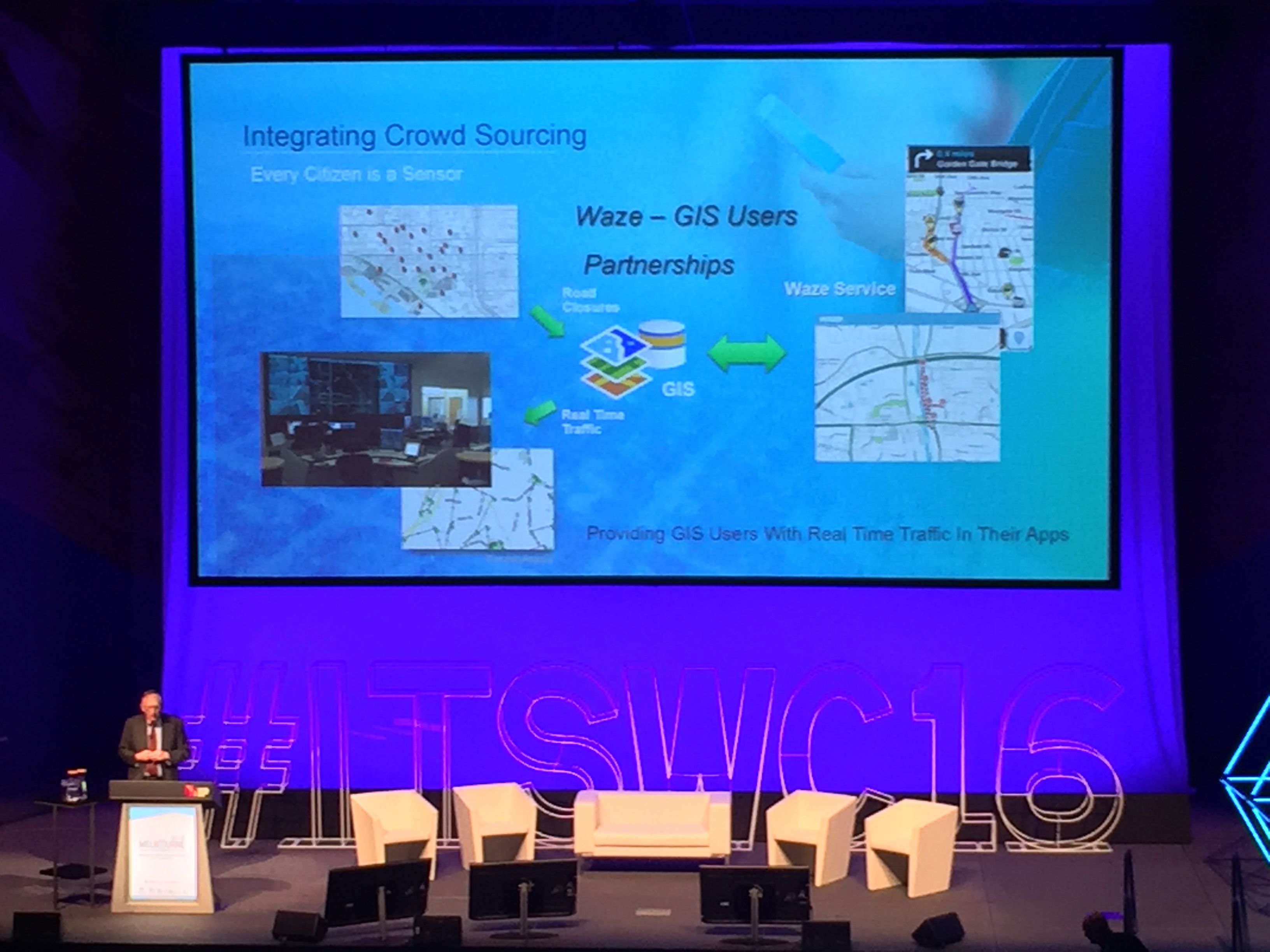
If you are not a partner in the Connected Citizens Program, you can signup today! As a member of the Program, you will share your real-time and advanced road closure as well as construction data with them. To do this, you can leverage the Feature Templates hosted in ArcGIS Online, or the Road Closures feature class of the Local Government Information Model. These templates are formatted in the schema required by Waze, to quickly add your road closures and construction data to the app. Once you’ve created a service with this data in ArcGIS Online or Server, you can provide the URL to your data feed in order to complete your CCP registration.
Once you have been accepted into the Connected Citizens Program, you will be provided with a live feed of Waze data specific to your region. This feed of data can be integrated into ArcGIS, by leveraging the GeoEvent Server and the Waze Connector. A feature service will be configured to add the Waze Alerts to your existing maps, and you can take it a step further by setting up different events to trigger actions based on the different Waze alerts and jam data. You can visit the GeoEvent Team’s blog post for more information about the Waze Connector and to see examples of it in action or to ask questions in the forums.
Joining the Connected Citizens Program is more than just a data exchange, it is a joining a community of over 100 governments who share ideas, data, analysis, and projects they are working on. Become a member today, and share your amazing work with governments around the globe! Please visit this link for more information on Esri, Waze, and You.


Article Discussion: