Since our release of the NEW Open Data Sites into beta just before the 2016 User Conference, the open data team has been very busy adding more functionality you have requested into the new sites. Let’s take a quick look at some of the amazing new things we’ve put out there for you over the past few months.
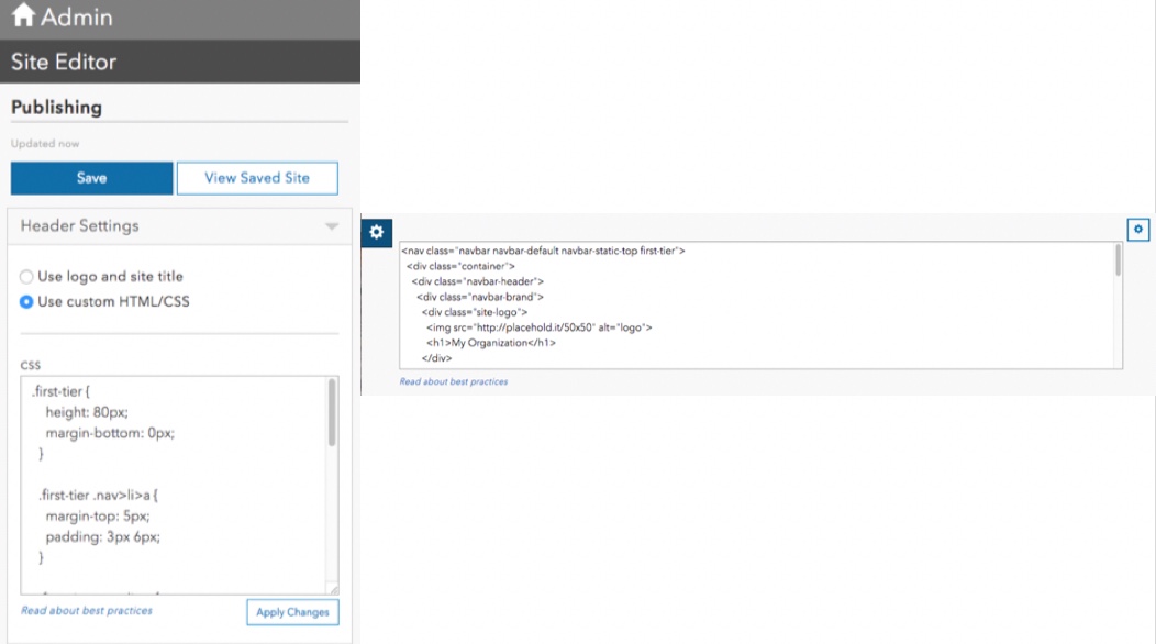
Custom Header and Footer
In the new site builder we have re-introduced how to add your own custom header and footer. As you can see in the screenshot below there is an option to put in your own custom HTML and CSS to create a site that builds off your organizations main branding on the web. By limiting the code you enter specific to these two sections, we can still allow for the body of the application to leverage the What You See Is What You Get (WYSIWYG) experience to allow administrators, instead of developers, to control updates to the page anytime they need.
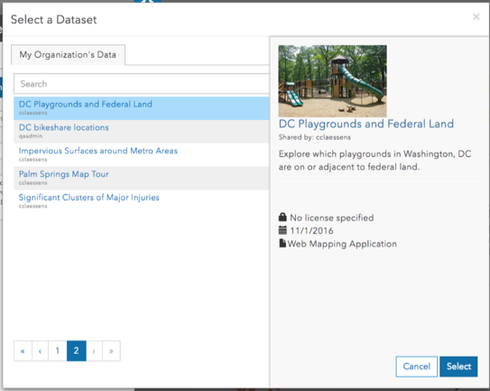
Dataset Card
The new page building experience consists of using cards organized by Rows. We have now added a Dataset Card which you can drop into your rows to highlight noteworthy datasets. The content of this card such as the title, thumbnail, and description is driven directly from your Online Item!
Custom Category Card
We have also added a new set of category icons that you can use to help the public browse for data. In addition to this you can now add your own icons by referencing their URL. These Icons can be hosted on your web server or hosted in ArcGIS Online, and all you need is the URL to your image when configuring this card.
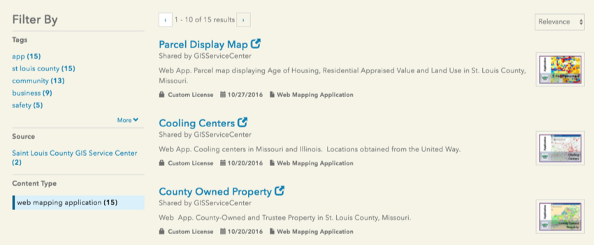
Search Facet for Web Mapping Applications
The new sites also support the indexing and searching for web applications you shared into an Open Data group. These applications are often linked off your home page, but are also good to be discovered through organic search in an effort to help the public explore the data with your web application as their lens of insight.
Google Analytics Update
Perhaps the most underrated features of the releases are the improvements we made with Google Analytics. When applied on the new sites, you will now see the dataset by Name instead of ItemID in your Analytics Dashboard and reports. This will allow for better usage reporting and analytics on your Open Data!
Introducing the iframe Card
You asked for it and we delivered! You can now customize the home page even further by leveraging the iframe card and loading in your web content. This flexible feature allows you to bring in parts of other web pages you maintain or to integrate functionality from other applications!
Smart Mapping + Charts = Favorites
While you are exploring the data by interactively charting variables of interest, you will also notice that any geospatial data on the map will also be rendered with the smart mapping capabilities of the ArcGIS platform. Theses smart maps help provide additional insight into data, and can be saved by logging in and choosing to Favorite the dataset!
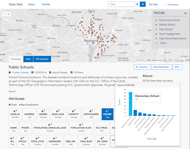
Charting has also made a comeback and to improve the usability of the charts, public users can now click an attribute card on the dataset page to quickly view a chart of the data. Charts have also been improved to work with large datasets hosted in ArcGIS Online.
Create a story map
Sign in is now supported on default and custom domains on your open data site. This will allow members of your Online Organization to save views of the data, and also allow citizens to create public accounts in ArcGIS with their Facebook or Google accounts. These public accounts are unlimited to your citizens to create, and are not members of your organization or count against named users. Once logged in you and your constituents will notice that you can do more than favorite datasets, because you can now launch into Story Maps! Take your time to filter and smart map your data, then choose the Open in Story Maps option to share your story about your dataset of interest.
Future of Open Data Sites
We are so excited about the final release of the new sites and we know that you are too! In mid November we will be taking off the beta label, and will disable the ability to create the older version of sites that required your web developer skills to get started. You will still be able to update these older sites until June 2017, and we know that your transition into the next generation of open data will be exciting with you in complete control of your pages.
Stay tuned to the ArcGIS blogs for more announcements about Open Data!

Article Discussion: