
The Developer’s Lounge series continues with a new edition. In this interview, Developer Advocate Courtney Yatteau shares her unconventional path into the world of development and explains why she believes it is essential to meet developers where they are through support for open-source libraries.
Esri has long been committed to building an inclusive and interoperable geospatial ecosystem where developers can work with the tools they already know and trust, making support for open-source libraries a natural extension of this vision.
During the interview, Courtney shed light on why Esri champions this approach and offered a detailed overview of open-source libraries, along with practical steps for getting started.
"Supporting open-source libraries is part of respecting the tools, workflows, and preferences developers already have." - Courtney Yatteau
1. Hello, Courtney! What’s the story behind your first line of code, and how did it get you to this moment?
My path into development was not especially traditional. Before working in tech, I was a math teacher, and along the way I started teaching computer science concepts too. Early on, I was building lessons around tools like calculators and later teaching AP Computer Science, so I got comfortable learning technology as I taught it. During virtual teaching in 2020, I had a little more time to explore web development seriously, and that is when things really clicked. I signed up for an online course, started learning HTML, CSS, JavaScript, and React, and fell in love with the visual and creative side of building for the web.
One of my first web projects was a fun Pokémon app that pulled in API data and displayed it like a little Pokédex. That project reminded me how much I enjoy making information visual, interactive, and easier to understand. Eventually, that led me to developer relations, which ended up being a perfect mix of teaching, building, and helping other developers discover what is possible with technology. Today, I’m a Developer Advocate at Esri, where I create demos and talks, engage with the developer community, and help translate what our engineers are building into things developers can use and get excited about.
2. Why do you think developers enjoy using open-source libraries?
I think developers enjoy open-source libraries because they give people flexibility and familiarity. Developers want to use tools that fit the way they already like to work, and open-source libraries often make that easier. They also make it simpler to experiment, learn by doing, and build something without feeling locked into one particular path.
From my perspective, they are also appealing because they make it easier to meet developers where they are. A lot of developers already know or want to learn libraries like Leaflet or MapLibre, so open source becomes a very natural entry point. It lets them focus on building something useful first, then layer in more advanced capabilities as they grow.
3. For a developer who hasn’t used one, which would you say is the easiest open-source library to get started with?
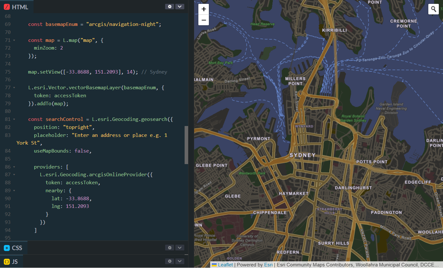
I would probably point a newer developer to Leaflet first, especially if they want something approachable and easy to get running quickly. It has a lower barrier to entry, and it is a great way to start understanding web mapping concepts without feeling overwhelmed.
That is one reason I’ve liked creating content with Esri Leaflet too. It is a nice bridge for developers who want to work with a familiar open-source library while also connecting to ArcGIS services and data. If someone wants to get a map on the screen, style a few layers, and start experimenting, that is a very friendly place to begin.

4. Why does Esri care about supporting and maintaining open-source libraries?
Developers do not all work the same way, and they should not have to. Supporting open-source libraries is part of respecting the tools, workflows, and preferences developers already have. If someone wants to build with an open-source library and still take advantage of ArcGIS services, that should be possible. This also ties into Esri’s broader Open Vision. ArcGIS is built to work with the tools developers already use, including open standards, APIs, data formats, and open-source libraries. That means developers can bring ArcGIS services into their existing workflows instead of feeling like they have to start from scratch
From my point of view as a developer advocate, it comes down to making ArcGIS more accessible. Supporting open-source libraries helps more developers discover how location technology can fit naturally into the kinds of apps they are already building. It lowers the barrier and opens the door to more creativity.
5. What can developers do with ArcGIS and open-source libraries?
They can build all kinds of real, useful applications. That could be a map-based search experience, a local discovery app, a data visualization experience, a location-aware dashboard, or something more playful and experimental. The open-source library handles the map experience developers are comfortable with, while ArcGIS can provide things like basemaps, geocoding, routing, hosted data, and other location services.
That combination is especially useful because it lets developers work in a way that feels natural to them while still tapping into strong mapping and geospatial capabilities behind the scenes. It gives them room to build lightweight apps or much richer experiences depending on what they need.
6. Can you provide an example or use case of an open-source mapping application that a developer can build by also utilizing ArcGIS location services and hosted data?
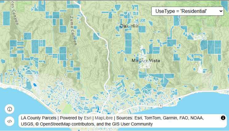
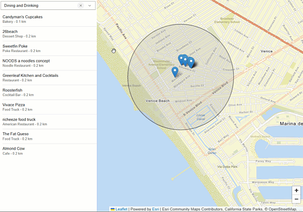
One example could be a neighborhood explorer or local guide app. A developer could use a library like Leaflet or MapLibre for the front-end map experience, then use ArcGIS location services for things like geocoding and place search, and ArcGIS hosted data for custom points of interest, routes, or layers.
You could imagine an app that helps people explore restaurants, coffee shops, parks, or event locations in a city, while also layering in your own hosted data for recommendations, categories, or custom content. That kind of app is practical, easy to understand, and a great example of how open source and ArcGIS can work together really well.
7. Next steps for developers looking to get started with ArcGIS supported open-source libraries…
My advice would be to start simple. Pick one library, get a basic map working, and then add one meaningful capability at a time. Maybe that is geocoding, maybe it is hosted data, maybe it is a location search or some styled points on the map. You do not need to build a huge app right away to learn a lot.
I also think it helps to build something fun or personally interesting. That is often how the best learning happens. A lot of my own work starts with visual demos or small ideas that are easy to understand, then grows from there. Start with something manageable, experiment, and let that first small app teach you what you want to try next.
8. Is there anything else about open-source libraries or your work at Esri that you’d like to share with our audience?
One thing I would add is that a lot of my work is really about helping developers feel like these tools are approachable. My background in teaching still shapes the way I build talks, demos, and content. I try to explain things in a clear way, use analogies and real-world connections, and give people ideas they can build on for themselves.
I also genuinely enjoy the creative side of this work. I love building demos, speaking at events, and creating content around things like Esri Leaflet and AI-powered mapping. For me, one of the best parts of developer advocacy is when someone sees one of those ideas and then builds something even cooler with it.
To learn more about open-source libraries and ArcGIS, take a look at the following resources:
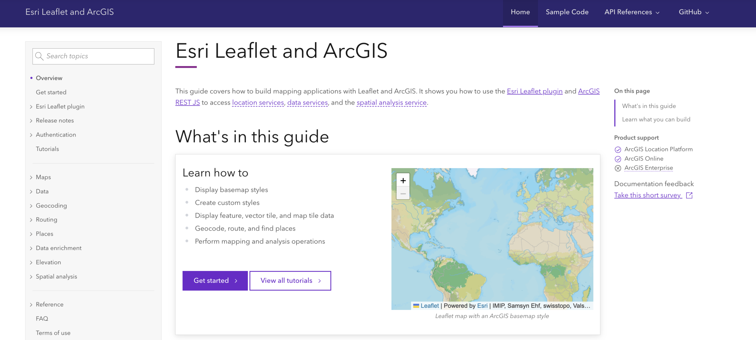
- Esri Leaflet and ArcGIS: For developers who want a simple Leaflet starting point with ArcGIS services.
- MapLibre GL JS and ArcGIS: For developers who want modern WebGL maps with ArcGIS services.
- MapLibre ArcGIS plugin overview: To learn more about the Esri supported plugin and how it works with ArcGIS basemap styles, feature services, and vector tile services.
- ArcGIS REST JS: For developers who want to understand how to call ArcGIS services from JavaScript without being tied to one map-rendering library.
- ArcGIS REST APIs documentation: A great resource for all things location services, content/data services, analysis services, and ArcGIS core services.
Connect with Courtney and stay updated on the latest events and hands-on demos that help developers get started.
Additional Resources and Apps by Courtney
- A Developer’s Guide to Open Source Web Mapping Libraries, Carolina Code Conference repo: Includes demos for Leaflet, Esri Leaflet, MapLibre GL JS, MapLibre + ArcGIS, OpenLayers, and OpenLayers + ArcGIS.
- A Developer’s Guide to Open Source Web Mapping Libraries, RVAJS 2025 repo: A talk focused on open-source mapping libraries and Esri integrations.
- AI-Powered Gamification for the Web repo: A creative example that shows broader demo-building work with AI, gamification, and location-aware apps.
- Courtney’s GitHub profile: Useful as the catch-all place for sample apps and demos.
Look out for more interviews in our Developer’s Lounge series!

Don’t forget to subscribe to the Esri Developer Newsletter to discover more developer offerings and updates.


Article Discussion: