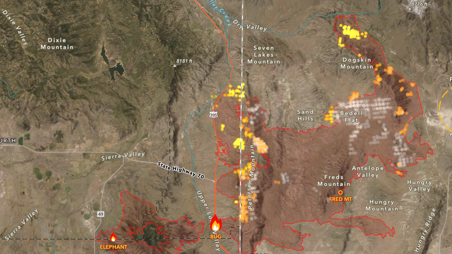
Wildfires rage in communities around the world, yet many of them don’t garner enough public visibility or attention. This year alone, over 48,000 fires have been reported in the US, collectively burning more than 6.5 million acres of land.
In the face of natural disasters or any other kind of crisis, many are curious about the role technology plays in improving response efforts. Developers have a key role to play when it comes to rescue operations – saving lives should be a collective mission, with individuals across different roles in society lending a hand to causes that affect all of our communities, health, and the broader world. With access to the right tools and technologies, organizations that are at the forefront of rescue efforts can work smarter and faster.
As a developer building applications for your organization, exploring solutions that empower your teams to save lives is essential. One such solution is the ArcGIS Elevation service – a location service that provides elevation and terrain information with context. With the Elevation service, developers can find the elevation for one or more locations. The service provides height details for both terrestrial (land-based) and bathymetric (water-based) locations.
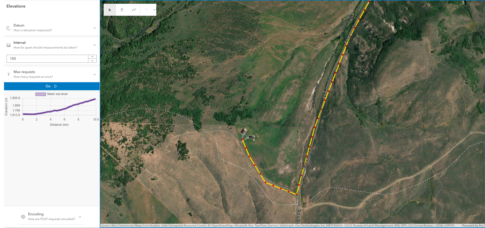
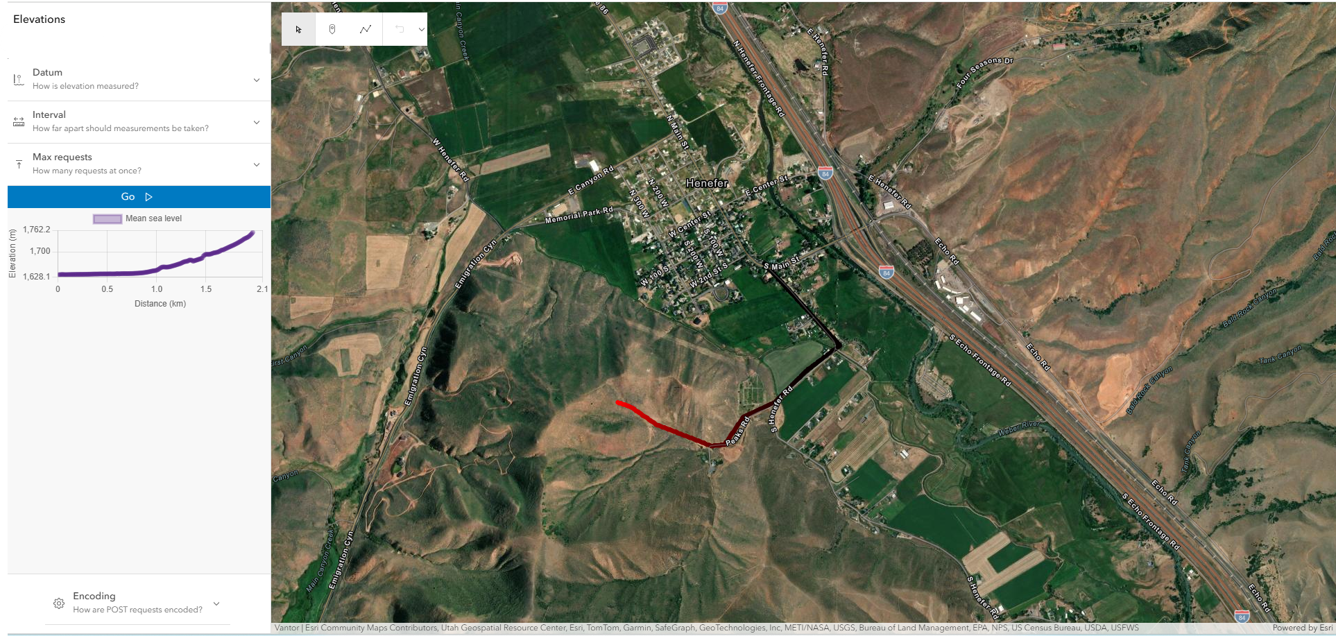
So, if you’re building any kind of application that requires the end-user to examine the height of a terrain, measure the elevation along a route, or find the depth of a body of water, integrating the Elevation service can greatly enhance their work.
Historically, wildfires have significantly impacted forested and mountainous areas with unpredictable landscapes. Regions affected by wildfires often contain some of the roughest terrain, with high peaks and steep slopes. Additionally, homes in surrounding communities, especially in Western US states, are sometimes built on hillsides or hilltops. Understanding elevation profiles and variations in such regions is critical for fire-containment processes and rescue path planning. The Elevation service is designed to support this by helping its users determine point elevation for a single point or multiple points at the same time.
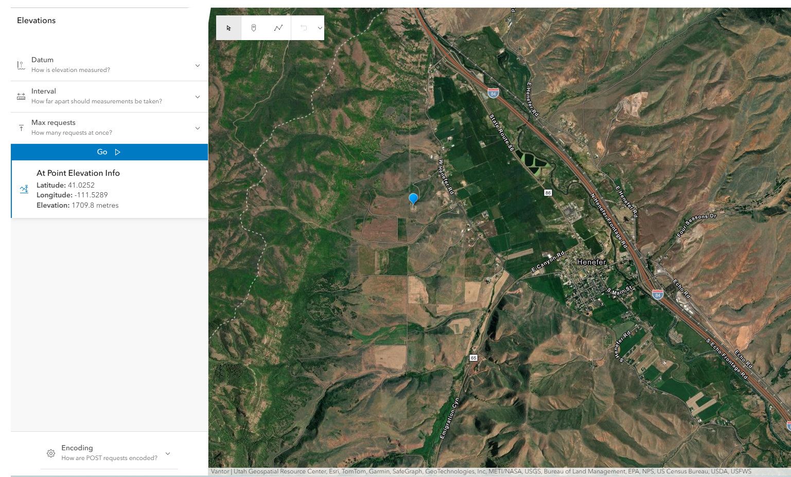
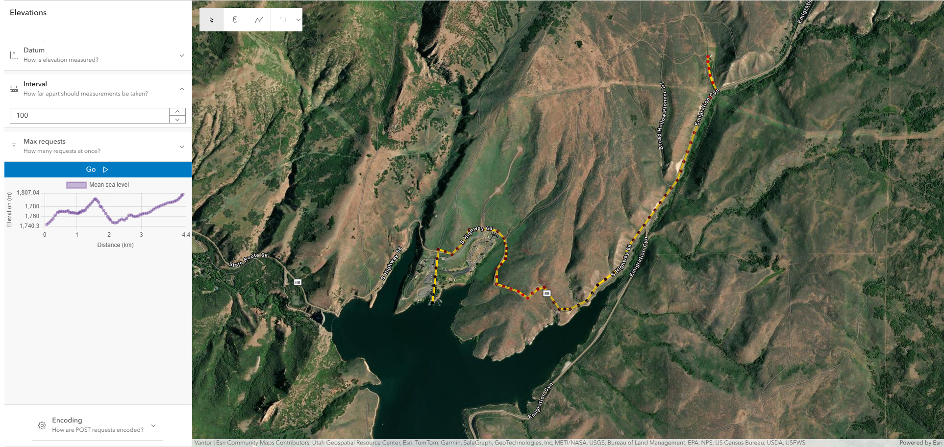
Point elevation provides an understanding of the vertical distance (height) of a single location on the Earth’s surface. Integrating the Elevation service into your application can support end-users in not only visualizing the elevation of any location on a map, but also in making comparisons about the height of different regions or how a terrain changes across a route, especially in instances where they need to map a flight path to distribute fire retardants, analyze patterns to determine fire spread, or strategize on effective methods to protect hilltop homes.
During rescue missions, elevation information displayed on a map gives dispatchers critical context about a caller’s exact location. In hilltop and hillside communities, pinpointing that location is not always straightforward: Is the caller on a specific slope? Which level of their multi-story hillside home are they on? How far above or below the nearest road are they?
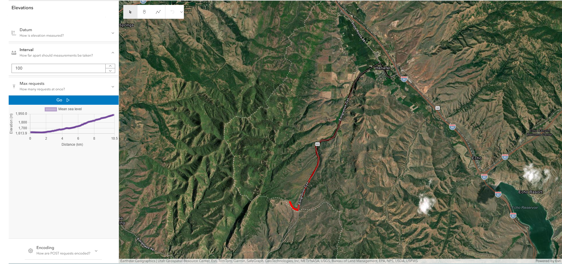
Added complexities include how much faster fire travels uphill, and the fact that every section of a hillside sits at a different elevation. In some instances, two homes on the same street may face very different levels of immediate danger. Having accurate elevation and terrain information through the ArcGIS Elevation service could make all the difference for a timely rescue.
You can’t think about elevation without first understanding the characteristics of a place as a whole. Emergency management in crisis situations requires a full picture of the surroundings of residents within a community. In instances where dispatchers are sending ambulances to the scene of a wildfire, it’s helpful to know the places that surround the perimeter of the fire. Is there a school or community center that can be used as a shelter for residents? What’s the closest hospital that may not be directly impacted by the fire? Where can resources be distributed for affected victims?
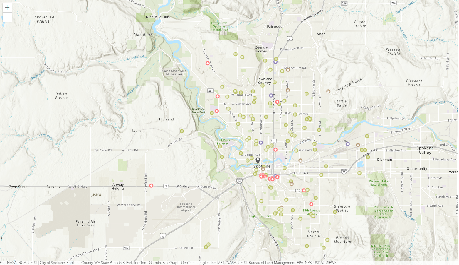
Another location service, the ArcGIS Places service, helps in answering some of these questions. The Places service enables developers to integrate place–finding capabilities into their applications. End users of solutions built with the service can search for places near a location or within an area. Additionally, it supports getting valuable information about a place, such as the name, category, address, or contact information associated with it. Categories and place icons are helpful for place–classification and ease of identification during the app–building process and for end users as well.
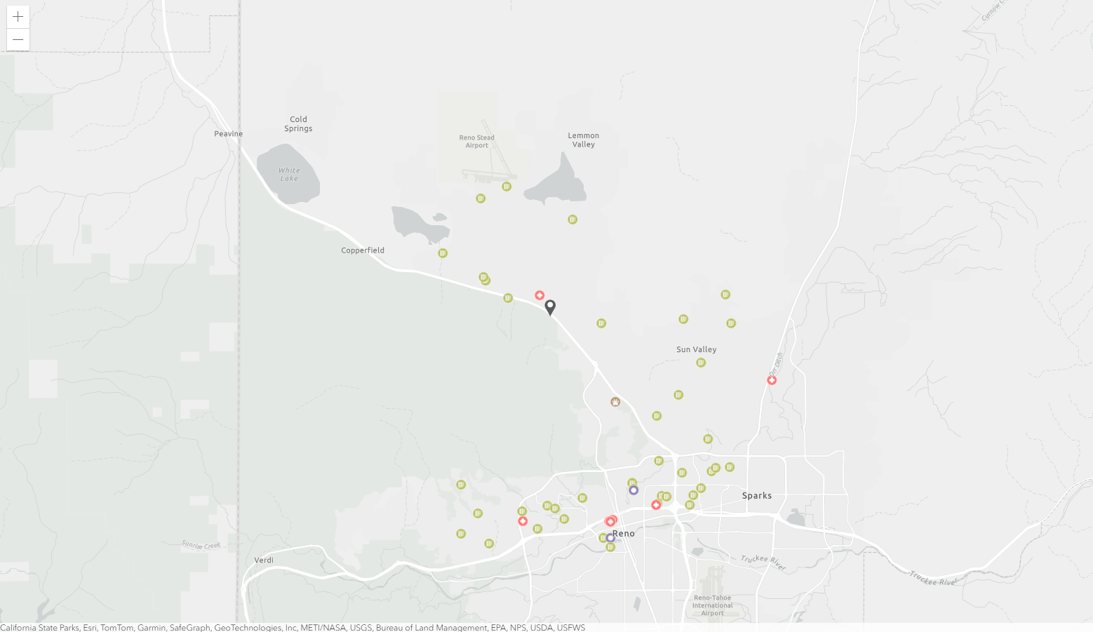
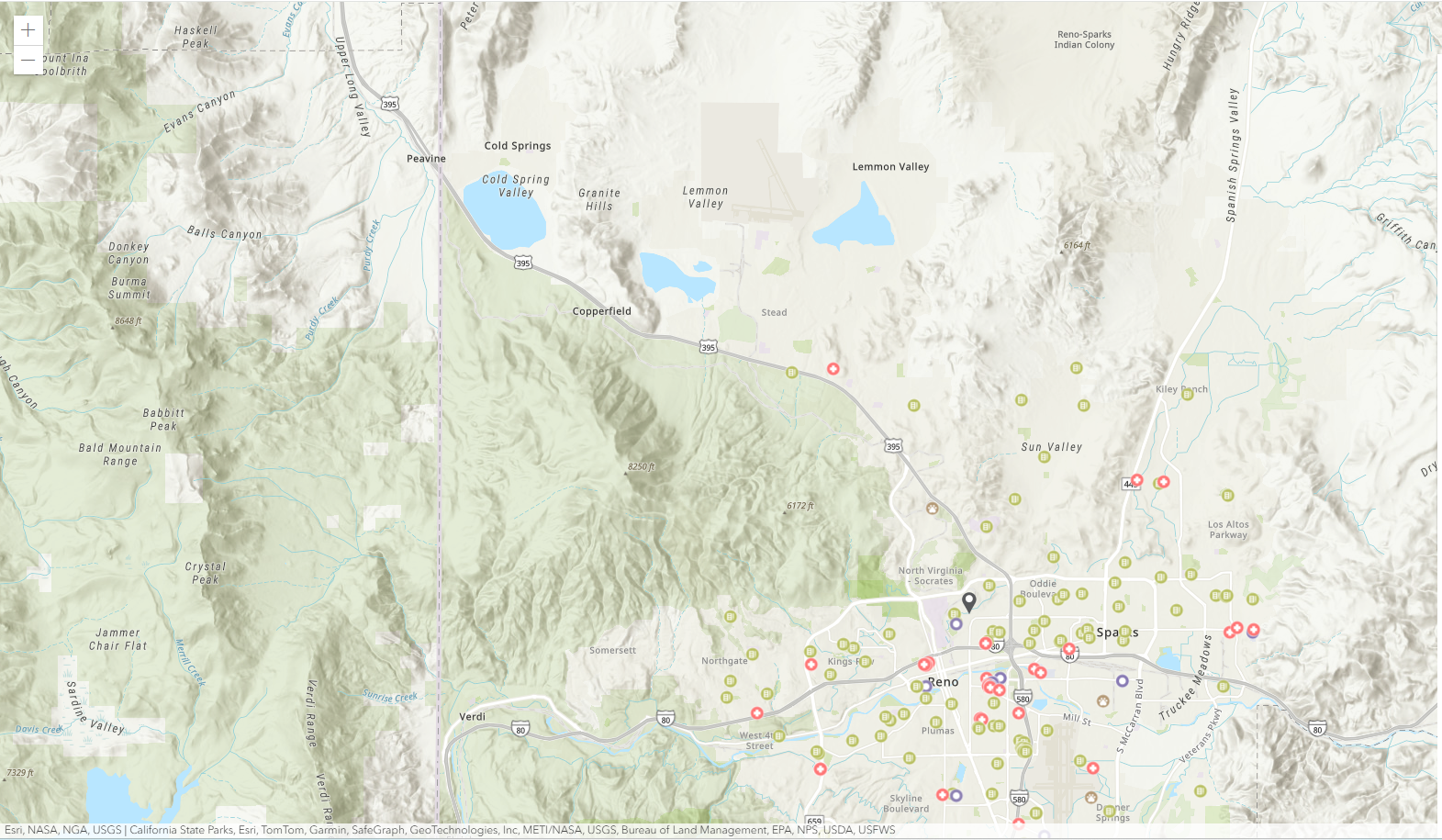
If you’re building a solution that enables a crisis-management organization to disseminate information about a crisis to help individuals in a location know where to find the best places to seek shelter, the Places service is useful for finding and displaying points of interest on a map, along with the specific categories and icons, and also highlighting place attributes.
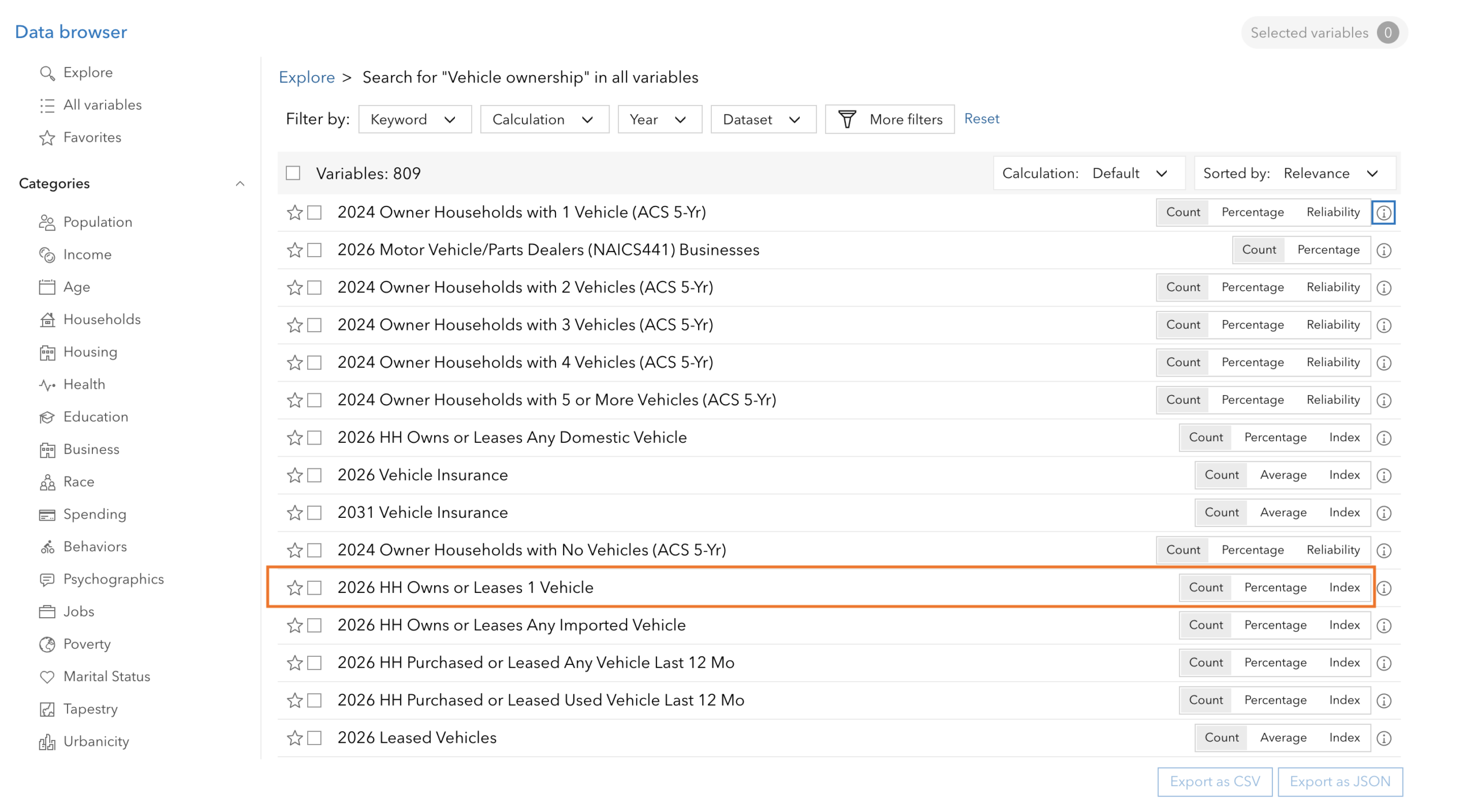
To better understand the demographic makeup of individuals within an area and help end users of solutions answer questions such as “Are there seniors in assisted living facilities living within a 2-mile radius of the fire?” or “What percentage of the affected population own vehicles needed for evacuation?”, developers would need the ArcGIS GeoEnrichment service.

Demographic insights provided by the service are important for those dispatching ambulances to the scene of the crisis, for example. Having this level of information about locations can help first responders anticipate how care would be given at the site. Developers performing data enrichment through the GeoEnrichment service can search for global and local data across thousands of variables such as age, population, households, and more using the Analysis Variable Finder.
The details matter, and richer data provides room for better analysis and optimized rescue efforts.
Building applications that improve how responders work is a meaningful contribution that extends far beyond a computer screen. Don’t underestimate the reach of your development work – keep developing for good.
For developers looking to use the three ArcGIS Location Services referenced above, an ArcGIS Location Platform account is a great starting point, as it provides easy access to all of these services. For additional details on building an application with these services, please refer to the documentation guide.
Don’t forget to subscribe to the Esri Developer Newsletter and follow Esri Developers on LinkedIn to discover more developer offerings and updates.




Article Discussion: