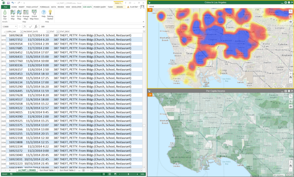
Do you find yourself limited with the monitor real estate when scrolling through your spreadsheet data and interacting with maps? Are you trying to overlay your map in Excel with your organization’s GIS data in different coordinate systems? Do you have a cluttered data visualization when you map datasets from multiple tables?
The 3.0 version answers all these questions and makes it even easier to map your Excel data and work with maps in many new ways. For example, you can add multiple maps to your spreadsheet and compare them side by side, change the coordinate system for your maps to match with your organization’s preferred projection system, float the maps outside the Excel window and to other monitors, and much more. To download Esri Maps for Office and learn more, visit http://doc.arcgis.com/en/maps-for-office/.
With Esri Maps for Office 3.0, you can:
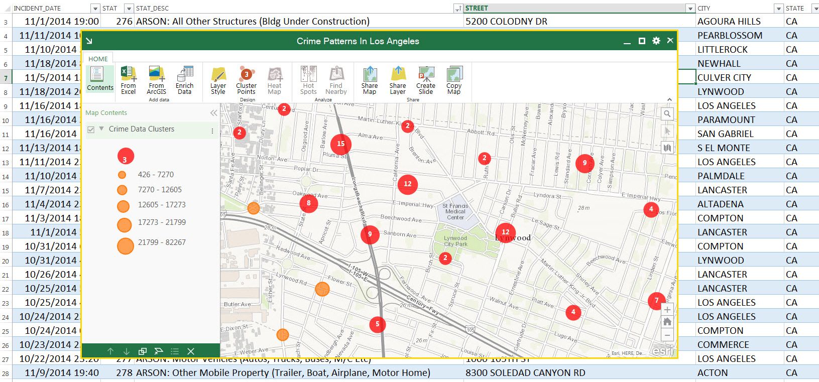
- Visualize your Excel data more clearly by inserting more than one map in your spreadsheet. You can create multiple maps for different tables you have in spreadsheets.
- Compare maps side by side or drag them out to other monitors without cluttering your Excel window.
- Work with the mapped data easily by finding the tools in the map window.
- Leverage the new search tool to find locations quickly.
- Create beautiful maps without needing to be a GIS expert. See how your map will look before mapping the data. Map styles are recommended according to the data you are mapping so you get the best visual insights.
- Use the coordinate system of your choice and easily overlay other GIS datasets that are in your local coordinate system.
- Add custom location types using line features.
- Get started quickly and easily with the new ‘Getting started’ guide.
In the coming weeks I’ll walk through these features in more detail, so keep an eye on blogs.esri.com for updates. You can start experiencing an improved way of mapping in Excel with Esri Maps for Office 3.0 right now. Get it here.


Article Discussion: