During the January 2017 ArcGIS Solutions Release 7 new Solution Products were added to ArcGIS, 19 Solution Products were updated and 4 moved to the Mature Lifecycle Phase.
New Solution Products
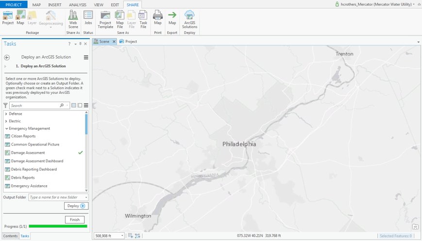
ArcGIS Solutions Deployment Tool enables users to deploy ArcGIS Solutions to an ArcGIS Online subscription or Portal for ArcGIS using ArcGIS Pro. Includes tasks to assist with configuration and data loading.
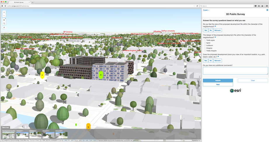
3D Public Survey uses 3D scenes and configurable forms to solicit input from the public.
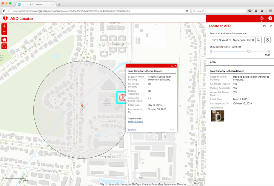
AED Locator helps the public locate automated external defibrillators (AEDs).
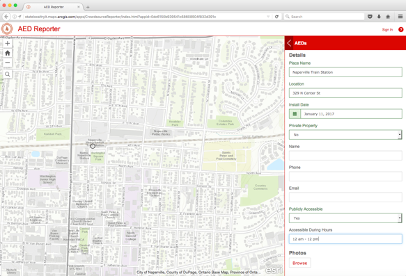
AED Reporter enables the public to submit the location of AEDs in their community.
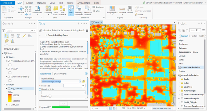
Calculate Solar Radiation helps assess the potential for solar power installation on building roofs. Calculates solar radiation maps and visualizes results in a 3D scene.
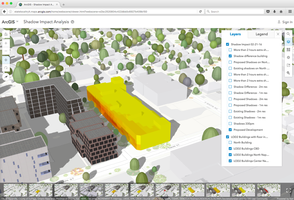
Shadow Impact Analysis assist with evaluating shadow impacts from existing and proposed buildings. Creates building shadows and shares results in a 3D scene.
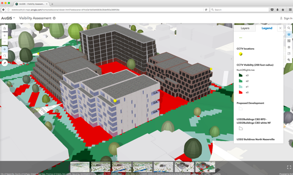
Visibility Assessment helps understand what is currently visible from where and potential future visibility impacts within a community.
Updated Solution Products
AED Inventory has an enhanced AED feature layer.
ArcGIS Online for Environment and Natural Resources and ArcGIS Online for State Government received new sample thumbnails.
ArcGIS Online for Emergency Management updated icons for Open Data groups and has a new thumbnail template.
Backhaul Optimization added script to locate asset resulting in improved backhaul processing performance. Output route and assets are now related. Added additional parameters.
Citizen Problem Reporter now includes individual feature layers for each problem type. Traffic Safety Problems were removed, use Vision Zero instead. Vector Control Problems were removed, use Mosquito Service Request instead.
Community Addresses and Community Parcels resolved dataset locking error
Environment Analysis improved Impact Report tool error handling.
Events Calendar, Event Locator, Park Locator , Shelter Locator, Water Access Locator and Wildlife Management Area Locator improved search results with an updated geocoding service and fixed pop-up bugs.
Restaurant Inspection added an Operations Dashboard configuration for restaurant inspection monitoring.
Road Maintenance Agreements now uses Web AppBuilder for ArcGIS.
Visualize Proposed Developments renamed from Proposed Developments.
Water Quality Inspections added a Survey123 for ArcGIS configuration to support field collection of water quality information.
Product Lifecycle Changes
Executive Dashboard moved to the Mature Lifecycle Phase.
Previous version of Live Work Locate (ArcGIS for State Government) moved to the Mature Lifecycle Phase. Functionality replaced by a new version of Live Work Locate (ArcGIS for State Government) that utilizes Web AppBuilder for ArcGIS.
Site Selector (ArcGIS for State Government) moved to the Mature Lifecycle Phase.
Tax Parcel Viewer (JavaScript) moved to the Mature Lifecycle Phase. Functionality replaced by Tax Parcel Viewer (Web AppBuilder).


Article Discussion: