ArcGIS Field Maps is a powerful, versatile, mobile app solution used to complete a variety of field workflows. ArcGIS Field Maps brings maps to life on smartphones and tablets. It enhances the situational awareness of your field workforce, streamlines field data collection workflows, and integrates directly in your existing enterprise systems.
First released in November of 2020, ArcGIS Field Maps is 4 years old! We’ve experienced remarkable growth in the use of Field Maps and want to express our gratitude to our incredible community for your support and valuable feedback. The November update is our third and last major release of 2024. For details on previous updates this year, please read our what’s new blog articles for June and February.
What’s new for November
Our November 2024 release includes new ways to get started using Field Maps Designer, additional options for controlling offline use of a map, as well as stability and performance enhancements to both the iOS and Android mobile apps. Please reference our What’s New documentation topic for additional information.
Get started using templates
Field Maps Designer allows you to configure the maps mobile workers use. Designer can also be used to create new maps and web feature layers. Starting from scratch, you can design a new map, with feature layers, their attributes, forms, and templates for data capture.
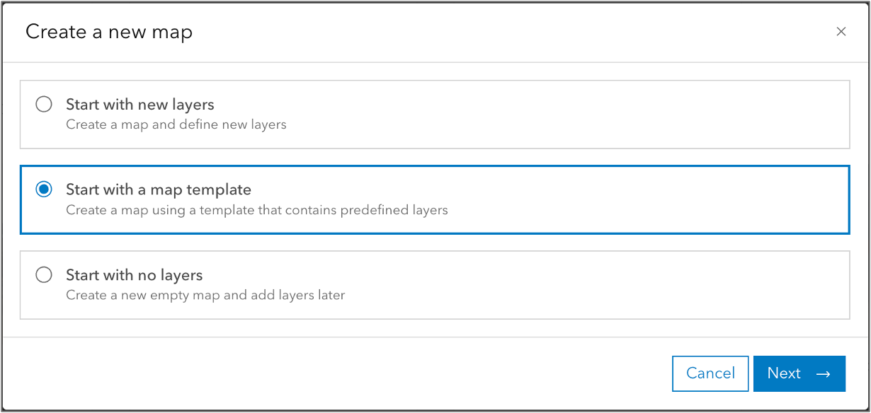
But why start from scratch? Now you can get started using map templates. When you create a new map, choose to start with a map template.

Map templates include predefined layers that are prepared with forms that include logic and calculated expressions, ready-to-use pop-ups, and simple symbology. Once created, you can easily customize the map and layers to fit your needs.
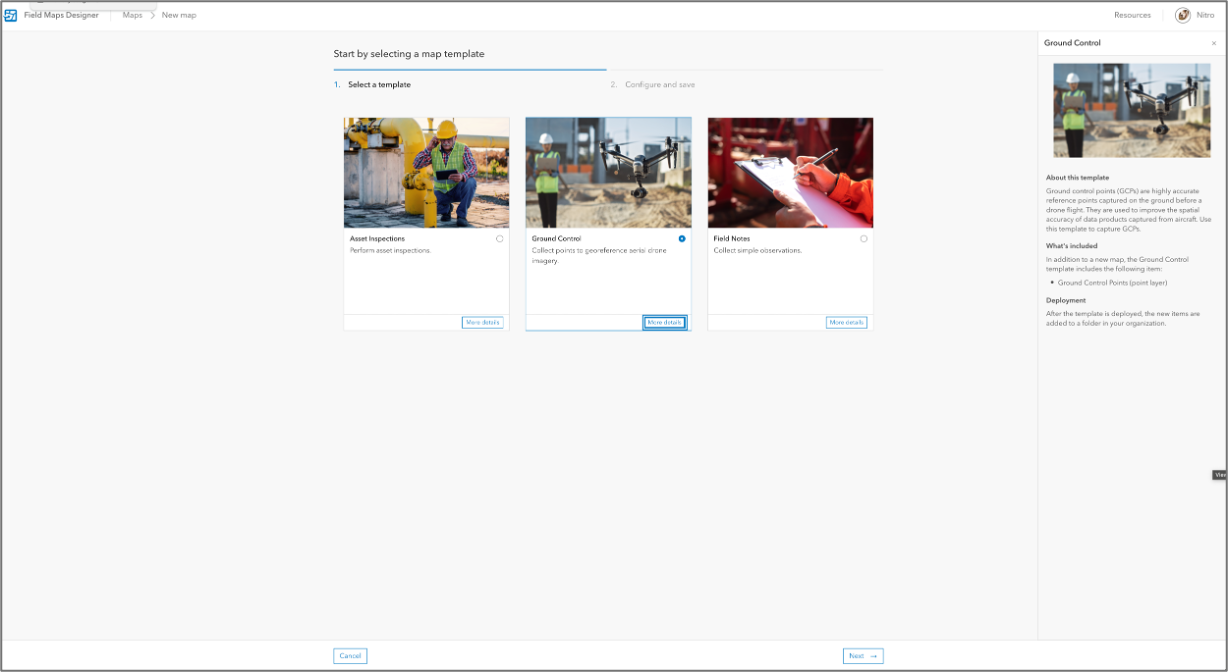
This initial release includes the following templates:
- Ground Control
- Field Notes
- Asset Inspections
Reading the details of each template, you can quickly understand it’s purpose. Once selected, simply provide a name for the new map and Designer will create it for you and open it so you configure it, create offline areas, and/or share it.

This is our introduction to map templates. We plan to add additional templates, and in a future update, we will let you select your own maps as map templates.
NOTE: ArcGIS Solutions includes a collection of industry-specific configurations of ArcGIS. You can use the ArcGIS Solutions app to deploy offerings that include Field Maps configurations.
New offline settings
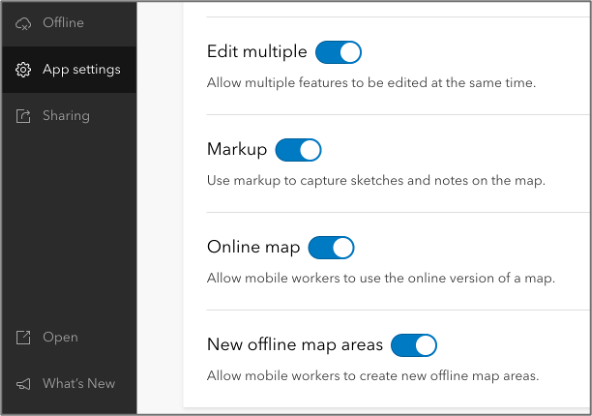
Field Maps includes additional options for controlling offline use of a specific map through two new settings found in the App Settings tab in Field Maps Designer:
- New offline map areas – when disabled, this setting will prevent mobile workers from adding offline areas for the map within the mobile app. To ensure your mobile workforce use the offline map areas created for them, disable the creation of offline map areas.
- Online maps – when disabled, this setting will prevent mobile workers from using the online version of a map. It will require mobile workers have an offline map area downloaded to their device before they can open and work with the map. To ensure your mobile workforce is ready for offline map use, disable the use of online maps.
These settings are enabled by default and can only be defined when authoring the map; mobile workers cannot override them. To modify these settings in Field Maps Designer, click the App Settings tab, expand the Map group, and use the toggle next to Online maps and New offline map areas to disable settings.

In addition to the enhancements mentioned above, we’ve included several performance and stability improvements to Field Maps Designer as well as Field Maps mobile app for iOS and Android. Mobile updates include fixes for the GetUser “Failed to Calculate” issue and “User isn’t able to sign-in” issue reported on Esri Community.
To view a list of all improvements, read the What’s New section of our documentation website.
What’s coming in 2025
Looking forward, 2025 is going to be an exciting year. We’ve been busy working on some exciting new enhancements to Field Maps that include:
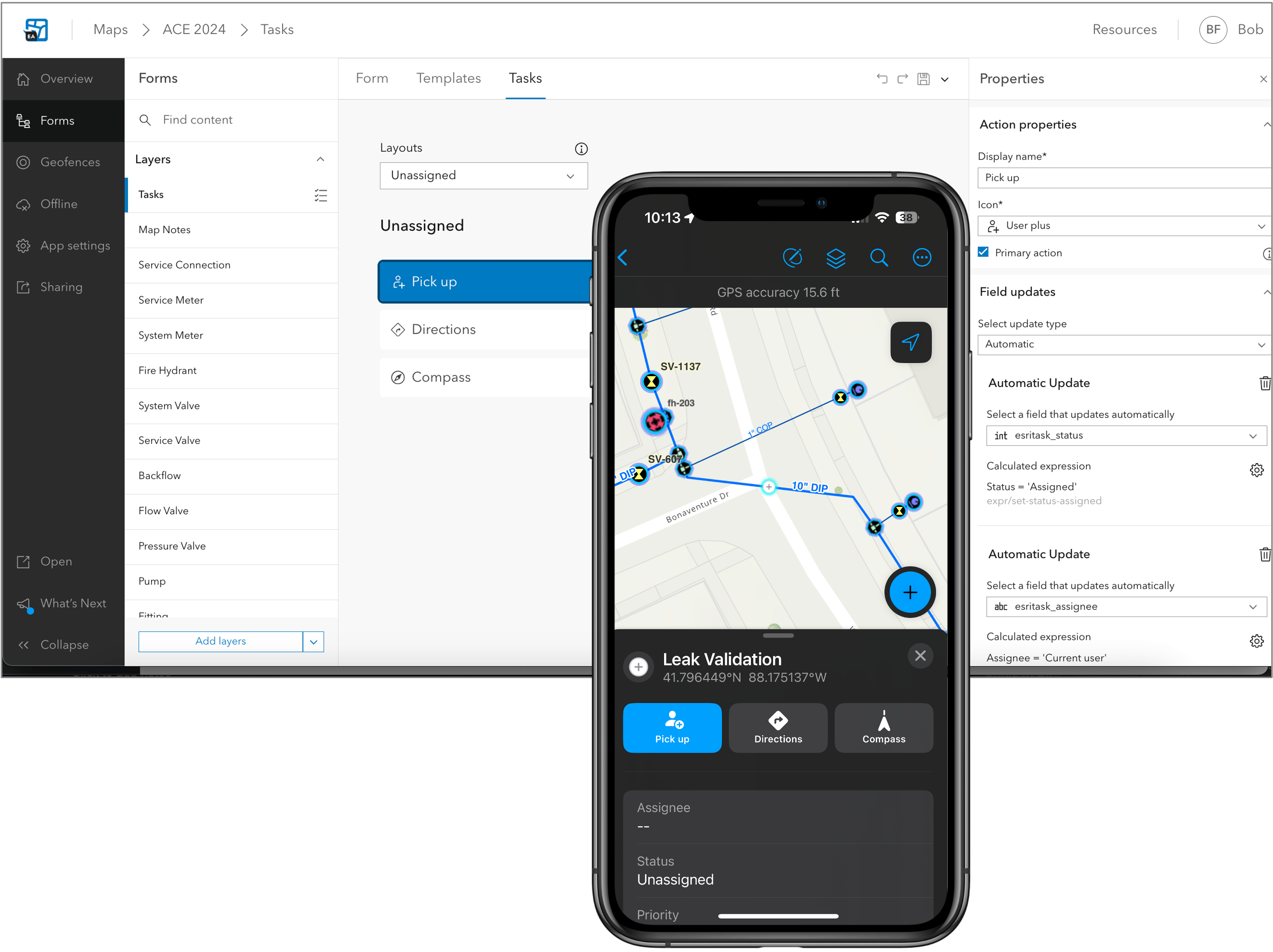
- Plan and coordinate field work using tasks.
- View and trace utility networks offline.
- Editing support for subtype group layers, enhancements to the Indoor editing experience.
- Forms support within the Edit Multiple tool.
- Improved experience for related records including support for Related pop-up elements.
- Geofence location-alerts that update with edits to the underlying feature layer.
- New and improved personal markup experience.
- New collaboration experience for Apple devices.
- Much more…

We’d love to have you join our public beta. Click on the following link and join the Early Adopter Community opportunity with your Esri global account.
If you have questions about ArcGIS Field Maps, please check out our Esri Community page. If you would like to connect with and learn from your fellow users, please join our LinkedIn group.

So, in AGOL using the template ‘always’ does a Ground Control map no matter which template you select.
How do you make it create a Field Notes or Asset Inspections map?