ArcGIS Field Maps is a powerful and versatile mobile app solution used to complete a variety of field workflows. Leveraging the power of a map, Field Maps enhances situational awareness, enables simple and advanced capture capabilities, and can record and share where mobile workers have gone, all within a single location-aware mobile app.
This is our first major release of 2024 and we’re excited for what the year will bring! Our updates match the cadence of ArcGIS Online releases, so look for 2 more big updates coming this year.
Let’s take a look at what’s new in our February 2024 release.
Info form element
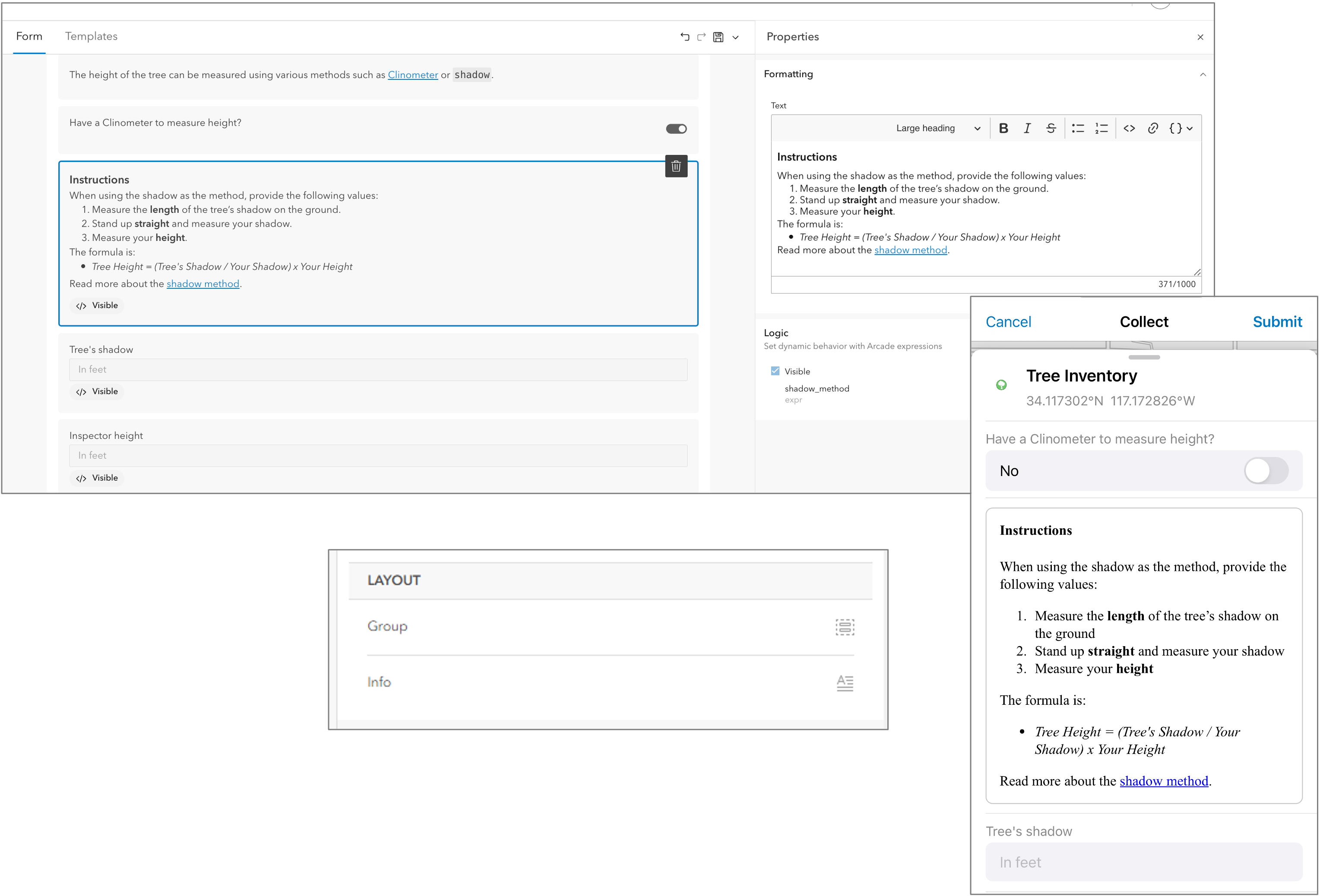
Now you can add info elements to provide supplemental information and/or needed instruction when editing forms. Content in an info element is formatted in markdown, and you can include dynamic information drawn from fields and expressions in the form.
Using Field Maps Designer, you can drag an Info element onto the form and provide read-only information using the Text editor.
With the Info element, you can:
- Format text in a variety of ways, such as with headings, bold, italics, and code font, bulleted and numbered lists.
- Link text to external sources.
- Add a visibility expression to conditionally show or hide the info element.
You can include as many Info elements on your form as you like, but each element must not exceed 1,000 characters. HTML content is not supported.
Read the Add read-only information documentation topic or this blog article published March 4th.
Preparing maps for offline use
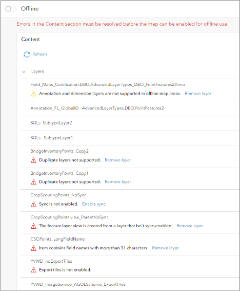
When preparing a web map for download, it’s important to ensure your data meets the data requirements for offline use. The Content section of the Offline tab in Field Maps Designer will inspect map layers and present error messages where layers do not meet data requirements.
In this update, we’ve improved offline checks by:
- Highlighting errors per layer.
- Offer to remove layers from the map as well as access their item details.
- Check image services to ensure they support export tiles.
- Check feature layer views to ensure their parent layer supports sync.
- Check that multiple layers do not reference the same feature layer sublayer.
- Flag subtype group layers and image service layers.
- Provide warning messages for annotation and dimension layers.
Read our topic titled Enable content for offline use for details and we recommend reading the Enabling layers and maps for offline use in the ArcGIS Online documentation as well.
Creating new hosted layers
In 2023, we added new capabilities that make it easier to create and configure new maps, layers, and form elements in Field Maps Designer. With the February update, we’ve included advanced settings so you can choose a coordinate system other than the organization’s default basemap. We’ve also added the ability to enable m-values in support of linear referencing capabilities as well as additional capabilities to manage your layer content..
Choose a coordinate system
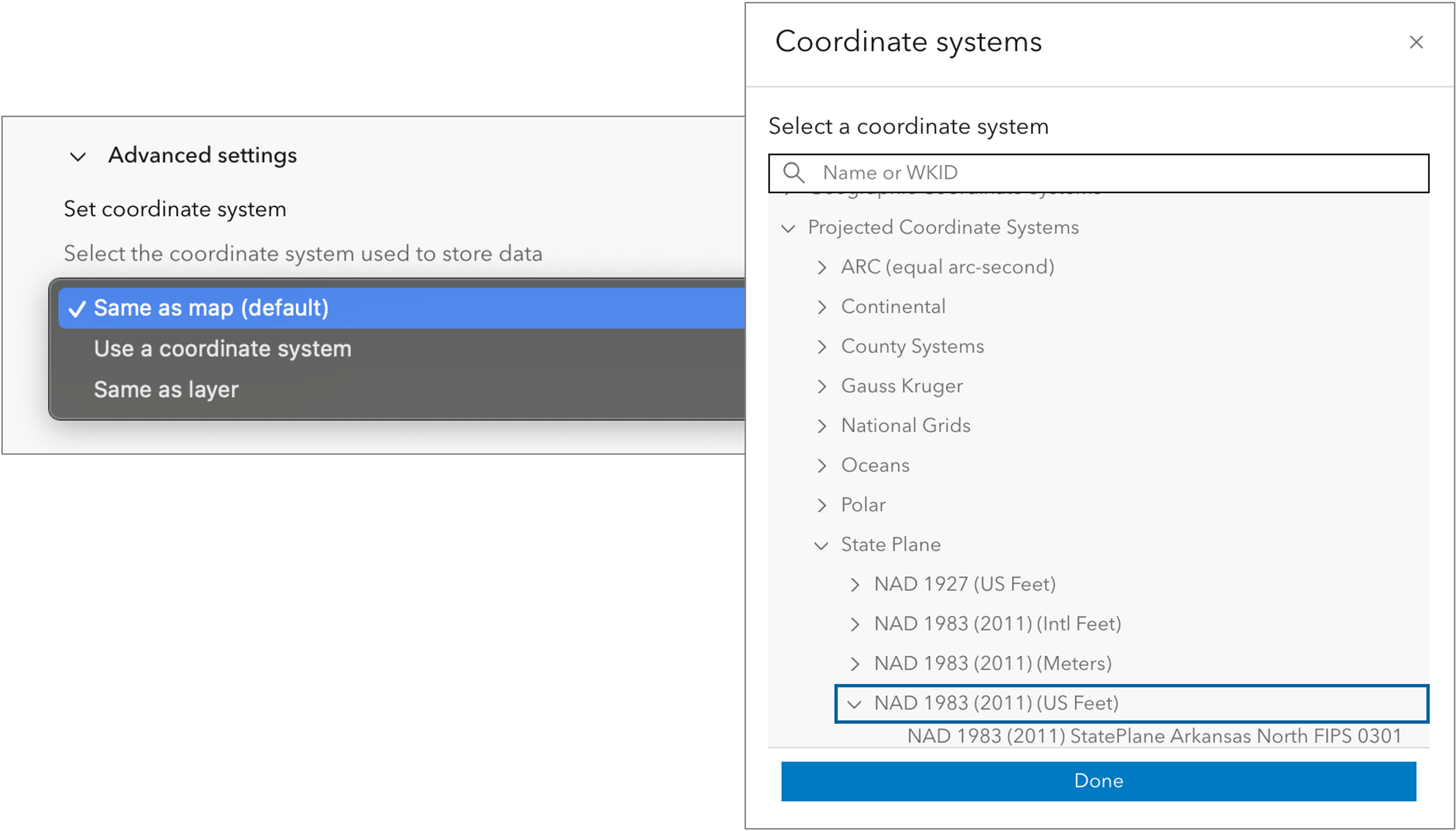
When creating new layers for new and existing maps in Field Maps Designer, you can now choose a coordinate system. This is important for high-accuracy data collection projects where you need to store captured features in a local, projected coordinate system.
From the advanced settings section of the new layers dialog, click “Use a coordinate system”, browse, and select from a list of coordinate systems.
Enable m-values
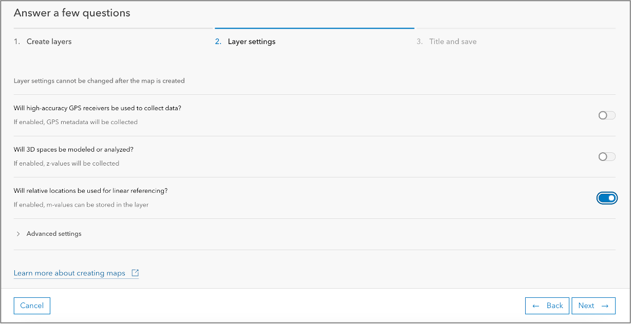
In 2022, Field Maps added support for finding measurements along linear features. Now, we’re adding support in Field Maps Designer to enable m-values on new layers. Choosing to support relative locations will enable m-values for point, line, and area layer types.
Managing layer content
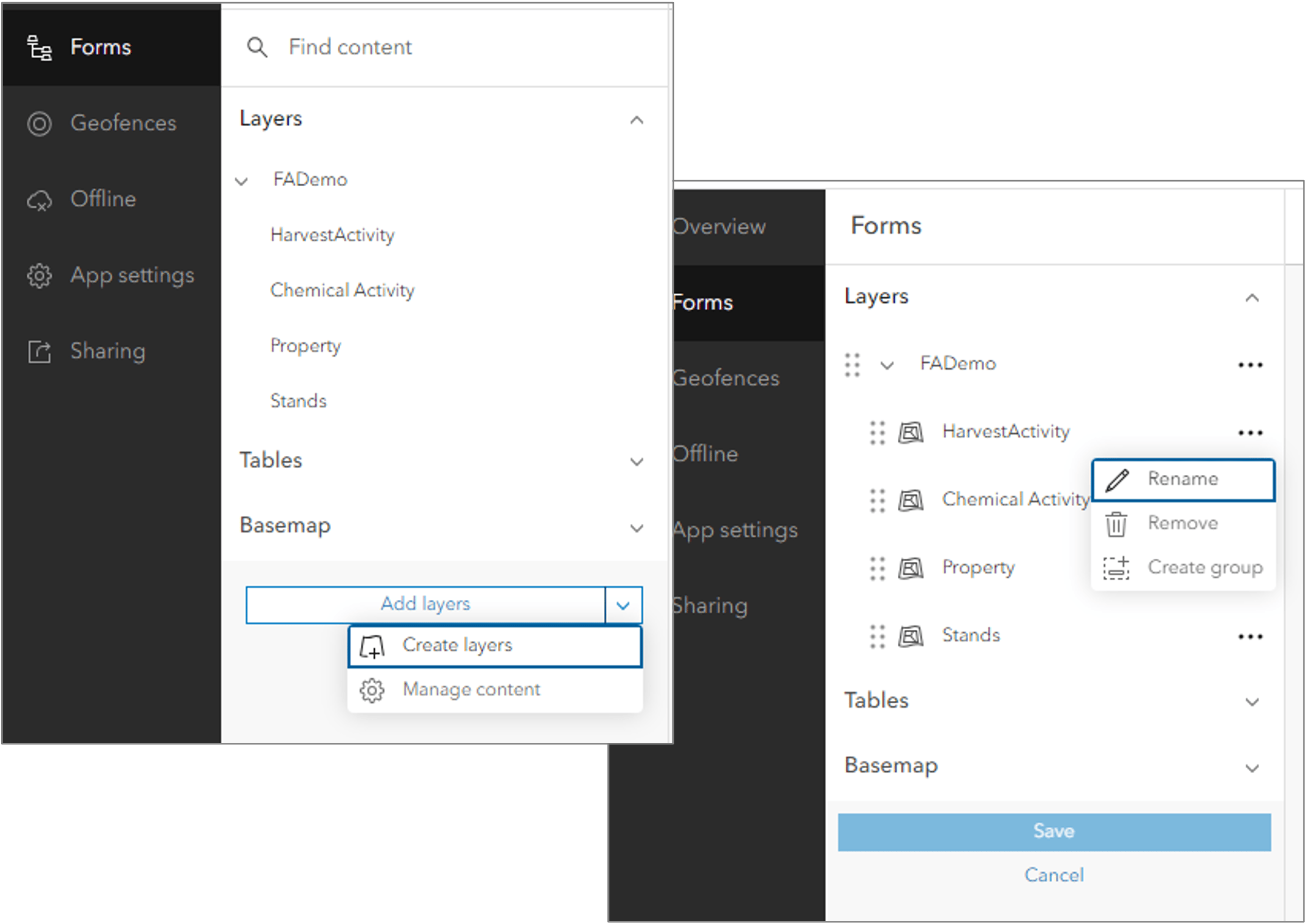
Maps can have many layers and tables. Clicking Manage content from the Add Layers dropdown, you can drag and drop layers and tables to re-order them, remove layers, create new group layers, and rename map layers and tables. When in the managed content experience, layers will display an icon representing their geometry type to help you make decisions when changing layer order.
Manage lists
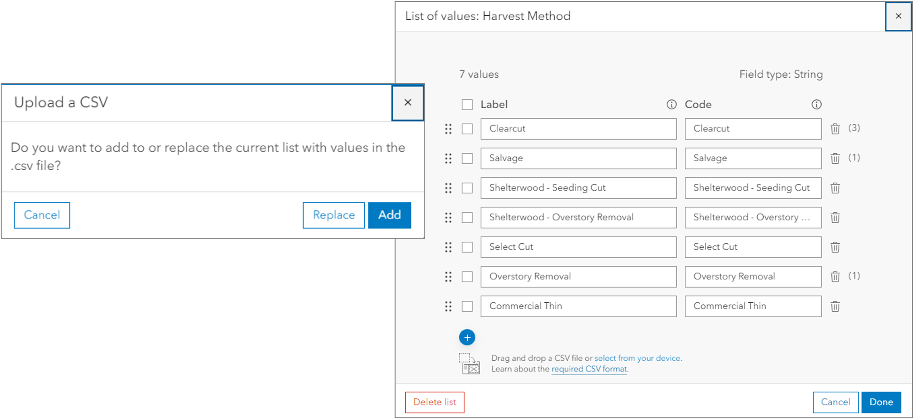
The February update includes additional support for managing lists in forms. With existing lists, you can use a CSV file to either add or replace the list of valid values. In addition, the list of values will show frequency counts on list items.
Disable Markup tool
Bringing ArcGIS Explorer and ArcGIS Collector together into one app means that the markup capability is available to all maps and users. However, not all users want markup capabilities.
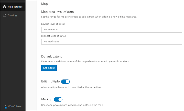
With this update, you can disable or enable use of the markup tool from the App settings tab in Field Maps Designer. If existing markup is stored on the device, you can turn markup layers on or off even if the Markup tool is disabled.
Dynamic cumulative length
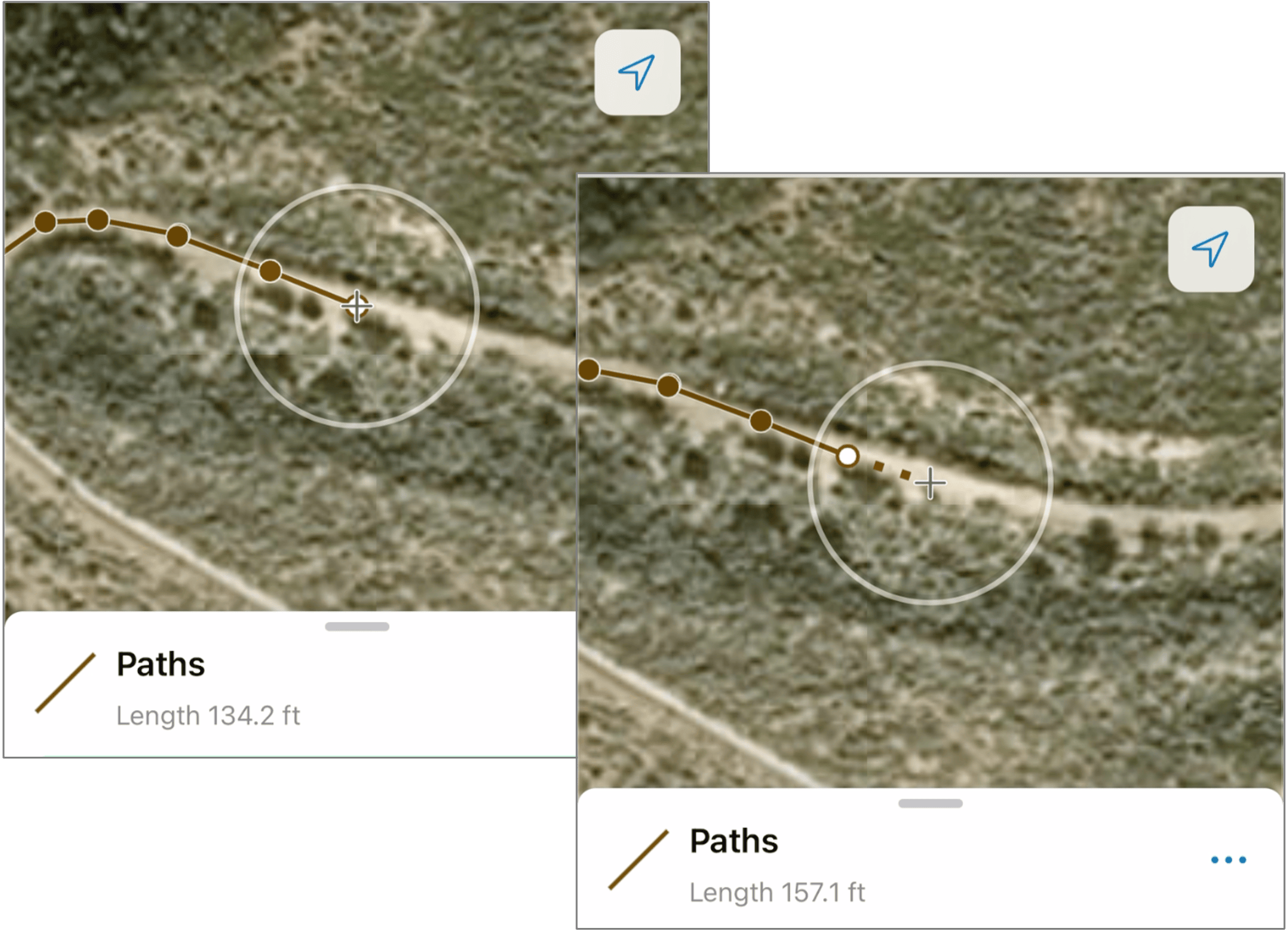
When collecting linear features, the cumulative length of segments captured are displayed while collecting the geometry. The measurement value now includes the length of proposed geometry (distance from the last vertex captured to the target location).
What’s coming next
All of the capabilities mentioned above, along with our updates from late 2023 will be available in ArcGIS Enterprise 11.3, shipping later this spring.
Following these updates, we are continuing to further ArcGIS Field Maps with exciting new capabilities coming this summer and in late 2024. As we approach each release, there will be several beta and tech preview opportunities where you can test capabilities ahead of their general availability.
We greatly appreciate your feedback and ideas. If you are looking for new capabilities in ArcGIS Field Maps, please post your ideas to the Esri Community Ideas site. Here you can also upvote ideas and comment on those posted by others.
Thank you for your continued support!


Article Discussion: