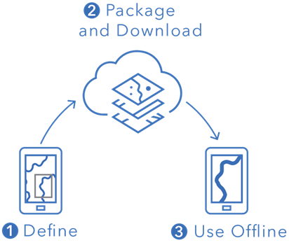
When using a mobile device, there are few things more frustrating than losing internet connection, being in an area without Wi-Fi, or experiencing slow network speeds. Thankfully, ArcGIS Field Maps provides a few different options for taking maps offline, so your work is never interrupted due to a loss of connection. This means you can take your maps anywhere, be that in rural areas, a wildlife preserve, or even that spot in town notorious for slow internet speeds.
You can prepare maps for offline use by creating map areas or by creating mobile map packages (MMPKs), and you can check the offline status of maps and layers using the Field Maps web app.
Create map areas
Map areas allow you to package your data, basemaps, and attachments for download. Once map areas are downloaded to your mobile device, you can use them to view assets and collect data offline, just as you would in a connected environment. There are two ways to create map areas: ahead of time using the Field Maps web app, and on demand using the Field Maps mobile app.
Create map areas in the web app
If you know where mobile workers will be during the day, create map areas they can download ahead of time using the Field Maps web app.

Once you create a map area, it’s packaged and available for download in the Field Maps mobile app for anyone the map is shared with. See Create and manage map areas to learn more.
Create map areas in the mobile app
If mobile workers have unplanned or unique offline work they need to do, they can create and download a map area directly on their device using the Field Maps mobile app.

Once they’re done working for the day, mobile workers can sync their data updates and remove the map area from their device if it’s no longer relevant. Learn more about downloading map areas in Field Maps in the video below:
Create a mobile map package (MMPK)
MMPKs allow you to take data or advanced symbology offline. They are created and shared using ArcGIS Pro and can be downloaded or sideloaded (copied) onto mobile devices. Sideloading maps is helpful for large file sizes because it eliminates the time required for download. MMPKs are read-only and do not support data collection. To learn more about MMPKs, see Create an MMPK for download and watch the following video:
Configure offline settings
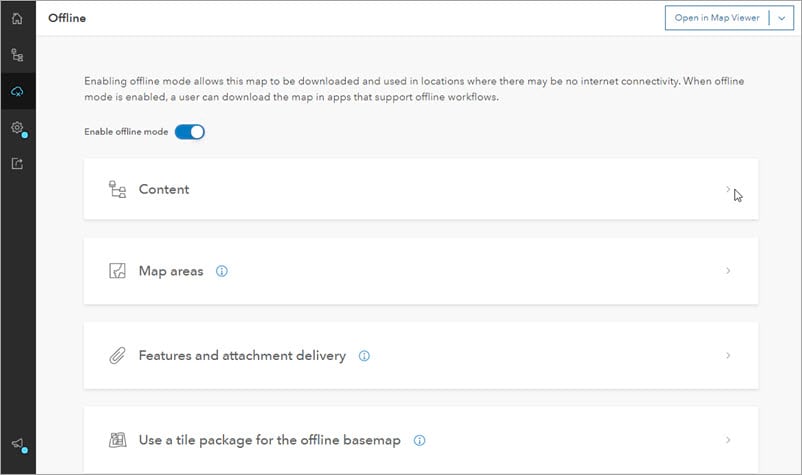
The Offline page of the Field Maps web app allows you to configure additional offline settings and check the offline status of your map and layers.

From this page, you can enable offline mode, enable layers for sync, create map areas (as mentioned earlier), adjust feature and attachment delivery settings, and set an on-device tile package to use as the offline basemap. To learn more about the offline settings in the Field Maps web app, see Configure the map to work offline.
Additional resources
For guided instructions on how to take web maps offline with Field Maps, see Take Your Web Maps Offline in Field Maps (PDF).
For a more detailed overview of taking web maps and MMPKs offline with Field Maps, see the Taking Your Maps Offline 2021 Dev Summit Presentation.


Many thanks for this blog! I’ve observed that when an offline area is created either ahead of time, or on-demand, that there appears to be no way of opting to operate in ‘online mode’. The user is forced to make use of the existing offline areas, or to create a new offline area. I’ve checked over the documentation in the Additional Resources PDF, the closet thing I could see to a confirmation of this was: “Once map areas are created as part of your map, mobile workers cannot use the map without downloading a new map area”. However, I wasn’t… Read more »
Hi Simon – thank you for your comment! As of now, there is no way to use a map in ‘online mode’ once map areas are created, however there are plans to address this in a future release. In the meantime, the best way to get around this is by duplicating your map and adding an ‘online’ or ‘offline’ suffix to the map title. Configure the ‘offline’ version for offline use, and leave the other one as online only. That way you have both an online and offline version of the map that can be accessed in Field Maps. The… Read more »
I too have just discovered this, seems a little silly, when is this to be released?